Severe Storms Return to OK

Our next storm system is approaching the region and should trigger scattered severe storms across the E half of the Plains. Here is the broad overview which will be fine tuned/adjusted by the Storm Prediction Center tomorrow. The threat is for Wednesday afternoon/night.
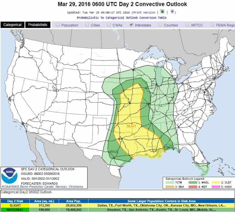
Storm Prediction Center Severe Weather Outlook for Wednesday.

There is only one computer model (out of many) that indicates severe storms will develop roughly along I-35, which includes the greater OKC metro area. The rest of the models show the best indicies well to the east. In those outcomes, the most likely location for severe storms would be from Tulsa SSW to Ardmore and points east from there. However they’re not very bullish on development NOR sustainment. The biggest threat will be very large hail and damaging wind. There is a low threat for an isolated tornado or two with any supercell storm that forms, but the tornado indicies are very low as well. This is what the models say today and we’re just now in the 36 hour window. They will be better at focusing in on these mesoscale specifics once you get within 24 hours of the event. So by tomorrow morning we’ll know the exact areas to watch for.
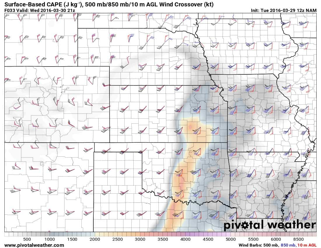
NAM computer model location of highest CAPE (instability) values overlaid with sheer vectors.

Buy or Sell today with Results That Move You!
So, have a plan in place to deal with severe storms should they develop in your area.


