Severe Storms Return Today

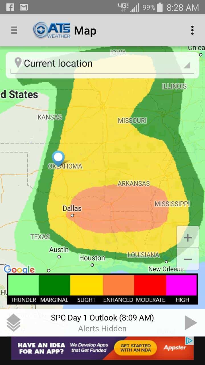
A large region of the country will be affected by severe storms later today and tonight. Parts of Oklahoma is included in that.
However, the majority of the computer model data indicates too much of a SW wind aloft and mixing down to the surface out ahead of a forming dryline circulation. This typically scours out the low level moisture and prevents storms from forming when they otherwise would have. However, one thing that can happen, is there is enough instability to overcome this limitation and elevated storms erupt. Those could then produce some rather large hail, but no tornadoes.

Buy or Sell today with Results That Move You!
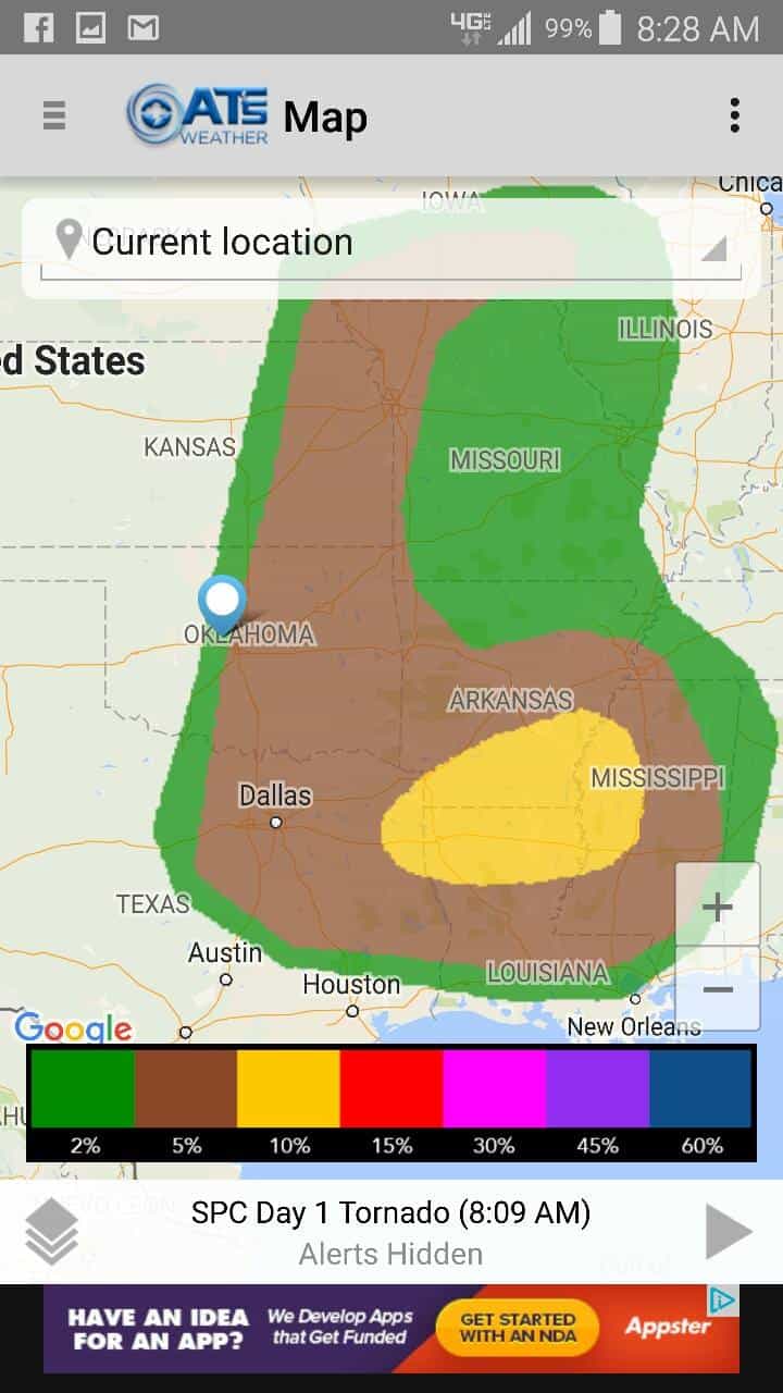
So across C OK, specifically the I-35 corridor, the dryline will get close but should halt about 50 miles west late this afternoon. This places OKC in the threat zone for storm formation. However, at the same time, surface winds are not forecasted to be convergent along the dryline boundary, more southwesterly out ahead of it. This helps to limit storm formation. This also limits the required low level directional wind shear needed to produce tornadoes. All a good thing of course. As the storms (however many that do form, assuming they do) move east of I-35, they will encounter better moisture and better low level wind fields, so a low tornado threat will be present, especially closer to dark. After which, storms should gradually weaken. So the most likely corridor for tornadoes in OK would be roughly from a line near Tulsa SSW to Ardmore and points east until a little after dark.
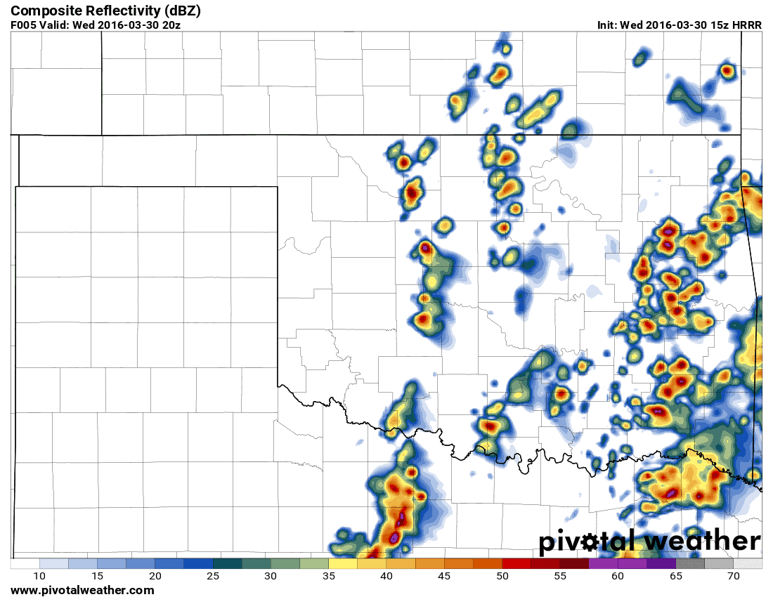
Until then a few rounds of showers and mostly non-severe storms (any severe ones will be for small to medium size hail) will develop and move through the E half of OK until early afternoon. Then if the wave of supercells develop, it would be closer to 4pm on the west side of the OKC metro. The map below shows the hi-res computer model predicting storms developing at 3pm in this location, elevated in nature.
Buy or Sell today with Results That Move You!
So if you live along or east of I-35 today, keep my weather app by your side. It will alert you if storms will be affecting you directly, and will give you additional time to seek shelter.


