Quick Forecast Update

So this week is here and as stated earlier, expect several days of showers and storms. A few start tomorrow late afternoon/evening as a cold front moves through.
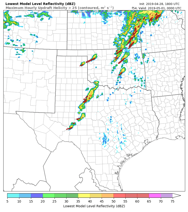
The Monday evening storms will be elevated along the I-40 corridor producing some hail. Additional storms will move into NW OK overnight and move east during the morning on Tuesday.
That sets up Tuesday. Model parameters are loaded for supercell storms capable of producing tornadoes. The image below is one example of how things could play out. We’re just now getting into the 48 hour window on this event so I’ll have more about it Monday and of course Tuesday. -AT