Violent Tornado Hits Small Town and More Storms Late Week
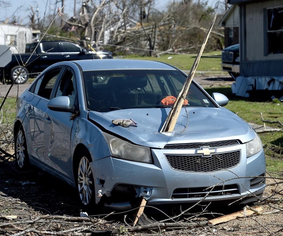
Before we look at this week’s forecast for Oklahoma, I wanted to briefly mention the devastation resulting from an EF-4 tornado that hit the small town of Rolling Fork, MS (population ~1800) which took over two dozen lives as of this writing.
Friday night a cluster of supercell thunderstorms moved through the Arkansas, Louisiana, Mississippi, and Tennessee areas. The ones that developed across Mississippi were particularly devastating due to the violent tornadoes they produced. EF-4/EF-5 are the rarest of tornadoes, making up only a combined 3-5% of all categories. They are the ones that do the most damage and are more difficult to survive through.
I’m not going to post many images here due to those that may suffer from PTSD from their own encounter. Lilapsophobia is a legitimate medical condition and can sometimes take years to get over. What I will show you is the radar image of the storm and the resulting track that went through Rolling Fork to showcase how radar technology allows us to warn for these deadly tornadoes.
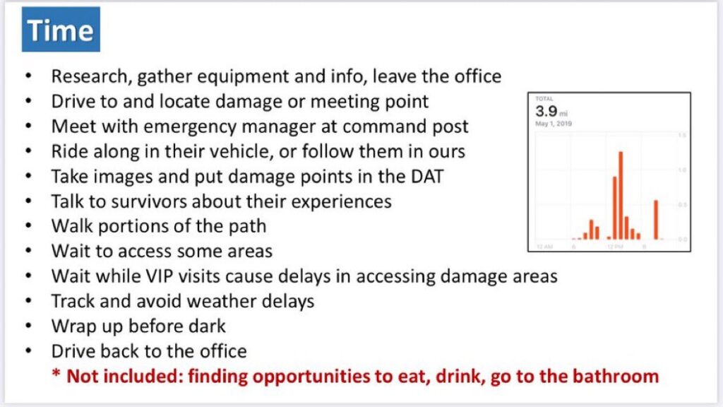
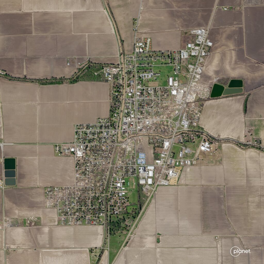
The particular tornado that hit that town traveled for a total of 59 miles, lasted 1 hour and 10 minutes, and was 3/4 of a mile wide. The NWS is still surveying the damage but gave it a preliminary EF-4 rating. It takes a long time to complete these surveys and I’ve shown some of the reasons below.
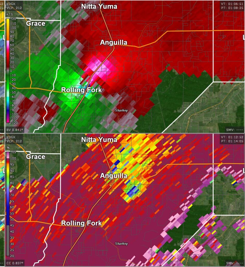
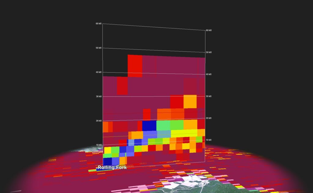
The NWS did a great job at warning those in the path of the storms, including the Rolling Fork tornado. Dual-polarization Doppler Radar sampled the storm well. In the 2-panel image, the velocity data on the top shows the red/green couplet indicating the strong winds with the tornado circulation. The bottom panel shows the blue area which is a low cross-correlation data value, or more plainly said, a debris signature. If we look at that debris signature in the vertical, we can see that it extended for 20,000 feet up into the sky. This is vital information for the nighttime detection of tornadoes when it’s more difficult to see with the naked eye, not to mention far more dangerous to position yourself to do so.
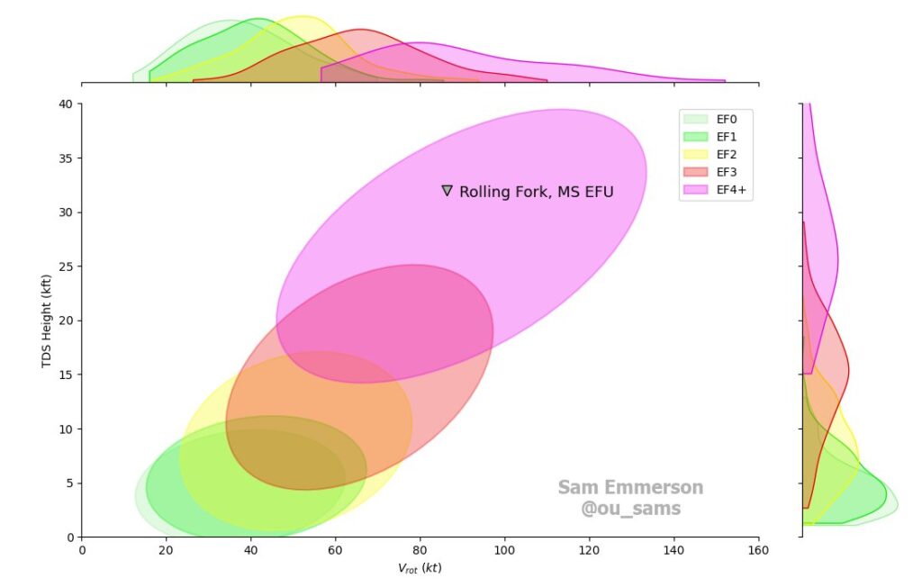
The Tornadic Debris Signature (TDS) vs the Rotational Velocity Vrot can be plotted as well to provide an estimate for the strength of the tornado. Doppler Radar indicated the storm fell well within the EF-4 category.
Unfortunately, despite this advancement in technology many people still lost their lives due to inadequate shelter. The tornado took the worst path it could have, going right through the town. There were other tornadoes that night and some just as deadly. This recap is just another reminder to take tornado watches and warnings seriously and to stay weather aware via weather apps such as ATsWeatherToGo. My app contains a proprietary predictive algorithm for tornadoes, to provide you extra time to seek shelter. It appears I have two users of my app in the town of Rolling Fork. I’ve reached out to them to check on their well-being.
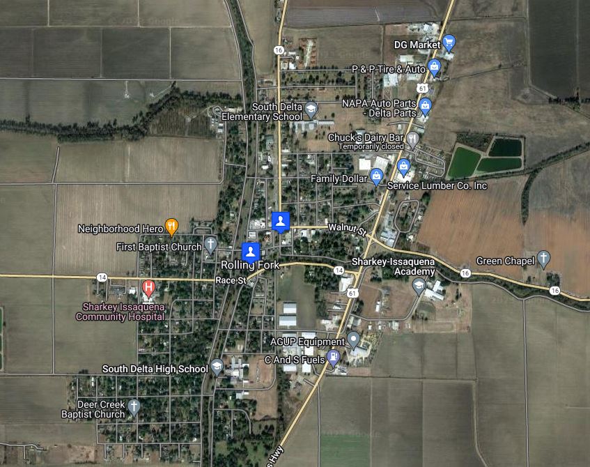
Switching gears to the weather in Oklahoma for this week, we do have a storm system that will affect the region Thursday and Friday. You may have already heard talk of severe weather. I can assure you that a lot of that is taken out of context this far out. The Storm Prediction Center’s job is to search for any potential of severe weather in an 8-day window. Just because they highlight an area, doesn’t mean it won’t later be removed altogether as confidence increases or decreases in an outcome. Let’s take a look at Thursday below and what the data shows us.
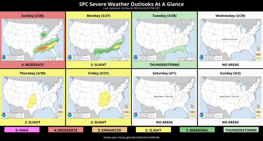
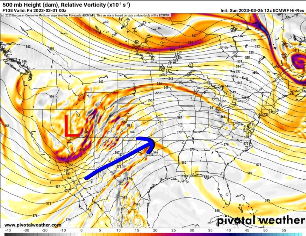
The upper storm system on Thursday is going to be way out west. This puts us in a broad SW flow aloft. Sometimes you can get minor upper-level disturbances to move through to help trigger thunderstorms. However, you need other ingredients in place as well. We’re going to take a look at the limiting factors for this Thursday’s setup.
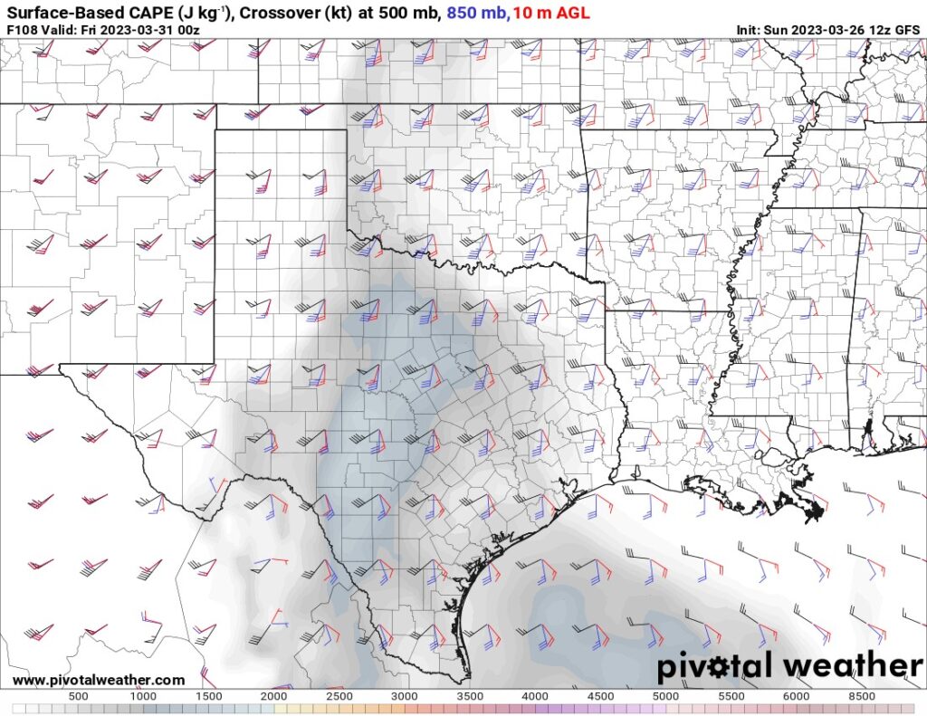
CAPE values (instability) are fairly low at peak daytime heating, less than 1000 J/kg and confined to W 1/3 of OK. Shear is decent for rotating storms, however.
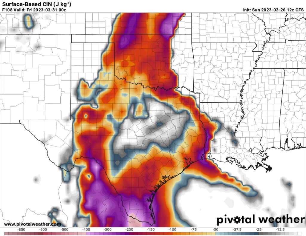
The next limiting factor is the CAP strength. This image shows the area is under a strong inversion layer which tends to suppress thunderstorm development. Any value between -100 to -300 is just not breakable. Sometimes given ideal circumstances, you can break the CIN between -50 and -75. For there to be no question to get storms, you need that CIN (CAP) value to be around -25 to zero.
Lastly, you need a surface trigger and significant low-level moisture, preferably in the 60+ dewpoint range. The map below indicates we will have decent low-level moisture, however, it’s far removed from the dryline. Furthermore, we don’t have good surface convergence with winds more parallel to the line on the west side of it. You really need a strong west and east component of wind on either side of the dryline to increase circulation columns of air to rise and break through the CAP.
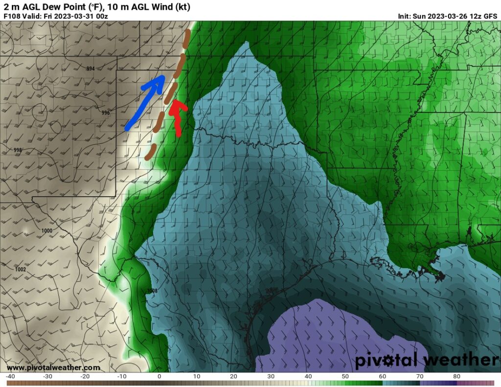
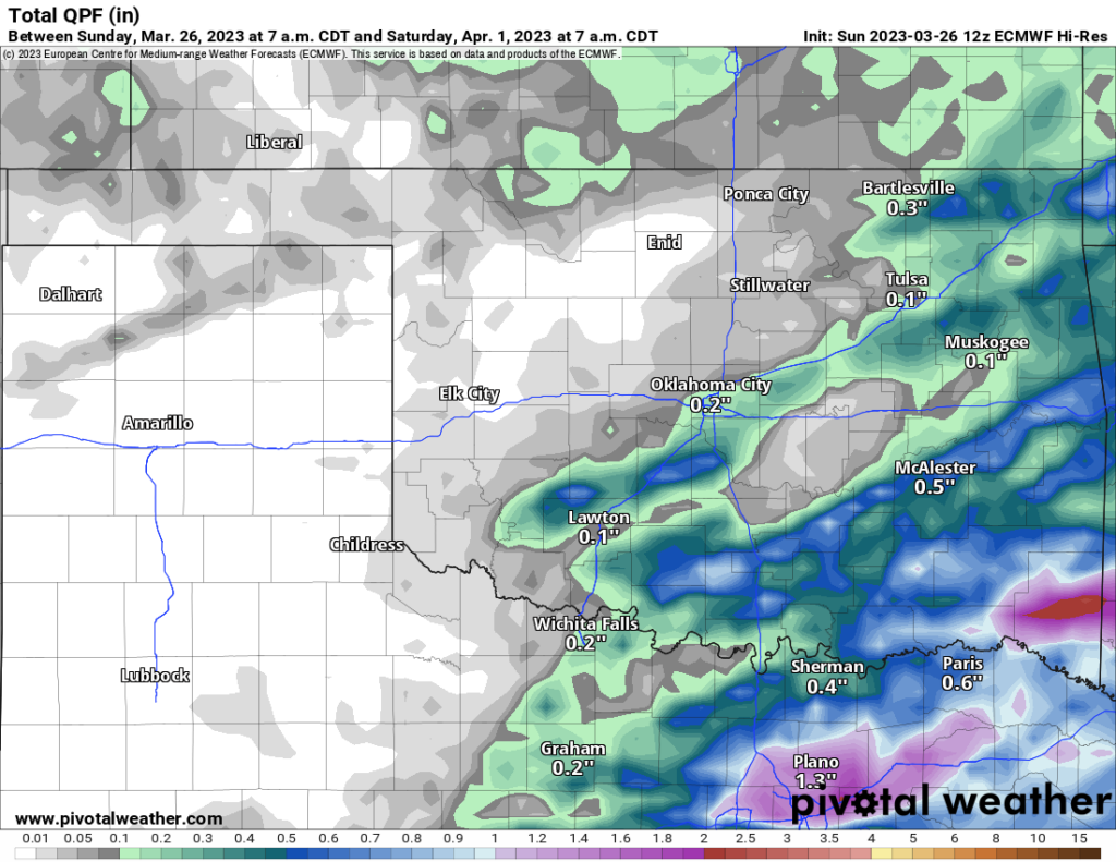
Finally, all of these maps are centered at 7 pm Thursday. This means that ideal conditions are really too late, the system is too far west. Typically what happens in this scenario is no storms form at all. The other option is for a few weak storms at sunset that may become marginally severe out west for an hour or two before dying out. So time will tell if conditions improve for the Thursday setup. As of now, I’m expecting more of an event for Friday across far E OK, and Arkansas with standard wind and hail due to veered SW winds. In addition, we’ll see more rain where we really don’t need it.
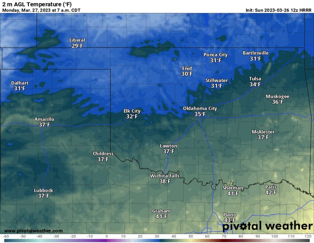
Regarding temperatures, we’re going to still see some chilly nights this week, especially across the N and W. Here is a look at Monday morning for example.
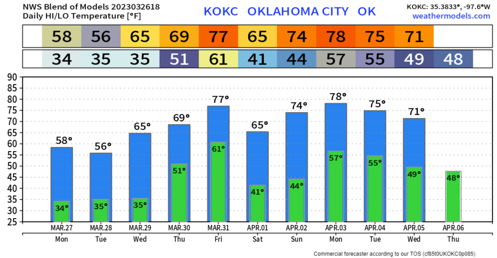
We’ll continue our roller coaster ride of early Spring across the OKC metro.
