Midweek Storms and the 30s Return
This week’s highlights will be the heavy rainfall from Tuesday night through Friday morning and low temperatures on Saturday dipping into the 30s.
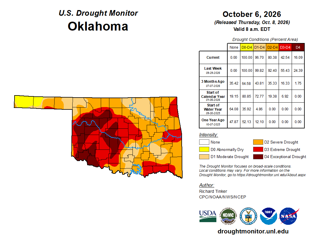
Our Fall is bringing us another opportunity for rain as we combine Hurricane Simon with a cold front. The state desperately needs more rain, so hopefully the drought will continue to be chipped away.

Ferguson Roof Systems is offering an AT's Weather special!
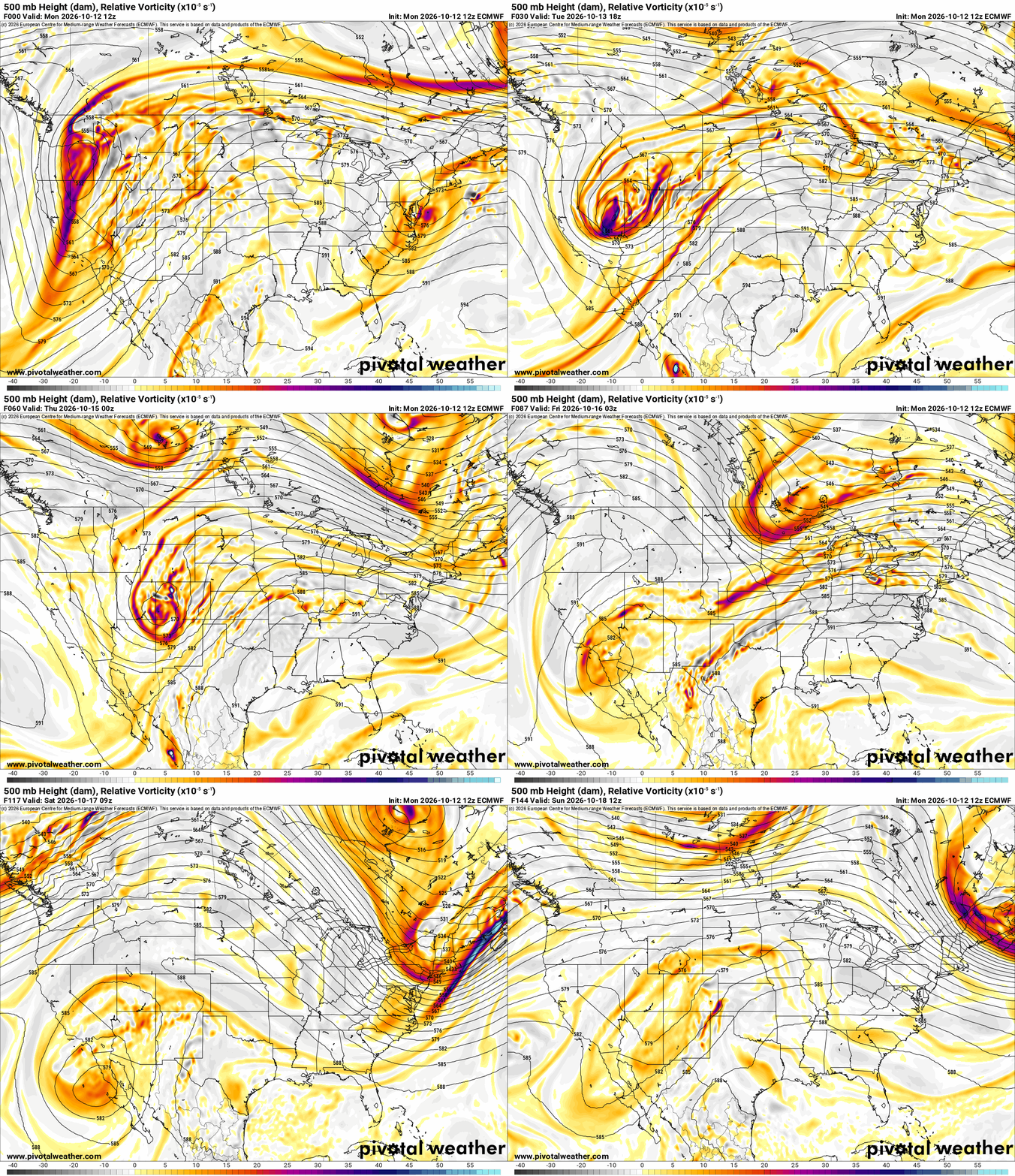
The Jetstream animation shows remnants of Hurricane Simon shearing off across Mexico and into Oklahoma and New Mexico over the coming days. This will add to the mid and upper-level moisture transport to work with a slow-moving cold front.
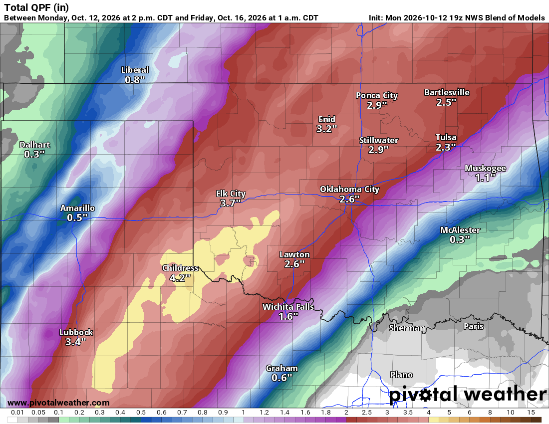
The rainfall animation shows some activity across far W OK Tuesday afternoon, with it becoming more widespread Wednesday and Thursday. Now, as exciting it is to see a bunch of green painted on the map, there is quite a bit of model discrepancy with the coverage and duration. Initially, it starts out west, and the idea is to move into C OK Wednesday morning and then E OK Wednesday night and Thursday. The spigots should shut off by Friday morning, with what’s left across S OK as the cold front clears the region. If things go well, it’s a pretty consistently rainy period; if not, then it’s a main wave Wednesday afternoon/evening and again Thursday afternoon/evening.
 Restoration and Disaster Cleanup Service

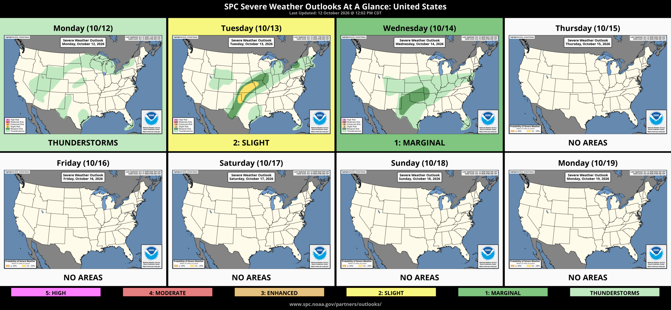
We may have a touch of severe weather to accompany the rainfall. Shear is decent enough to provide a little bit of storm rotation, so wind, hail, and a brief weak tornado are possible during the event. Otherwise, it will be the rainfall we focus on. The model blend shows the conservative amounts. As with all of these systems, there’s going to be a few banding areas where heavy to severe thunderstorms train over a specific spot. Those amounts can double what’s on the map, easily to 5 or 6″. The most likely zone would be along the slow-moving frontal boundary lined up along the I-44 corridor Wednesday into Thursday.
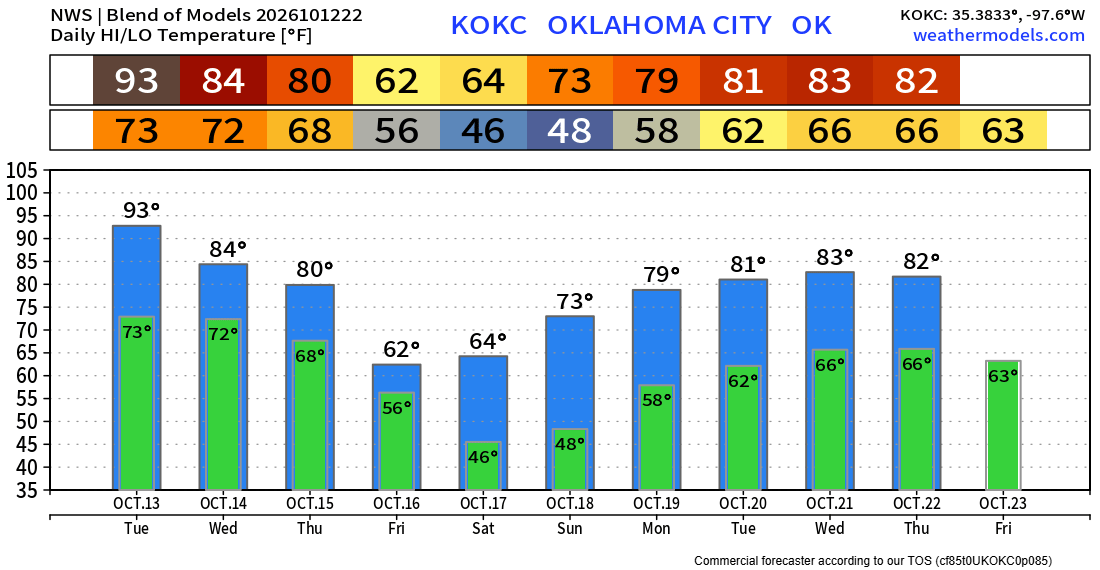
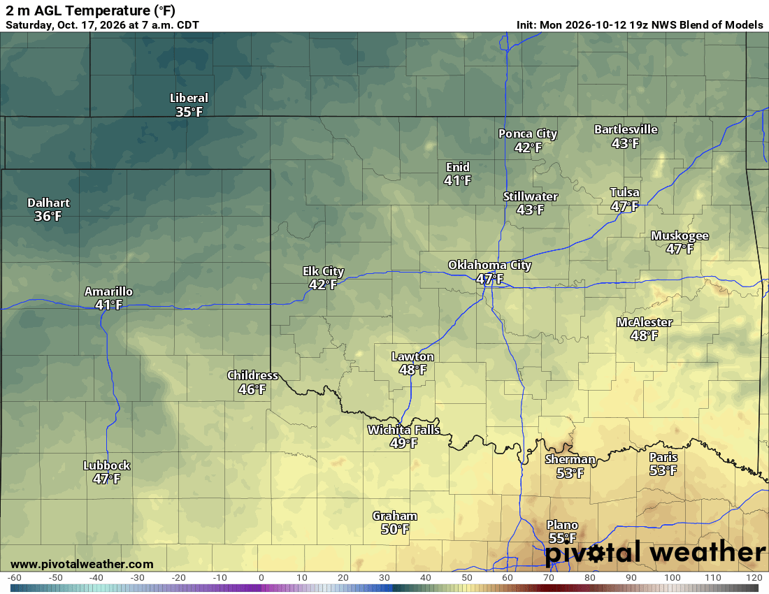
After the rain moves off, beautiful weather moves in. Low temperatures on Saturday will be in the 30s and 40s. We’re not quite in freezing territory yet. It doesn’t look like much frost right now, as high clouds should move across the state and north winds will stay 5-15 mph. Should the clouds and wind not materialize, it’s possible to get a touch colder to generate some frost in the valleys. Don’t get used to the cooler weather this weekend, however, as warmer temperatures kick right back in ahead of the next approaching wave, which will bring us more storms around the 21st or 22nd.
Ferguson Roof Systems is offering an AT's Weather special!
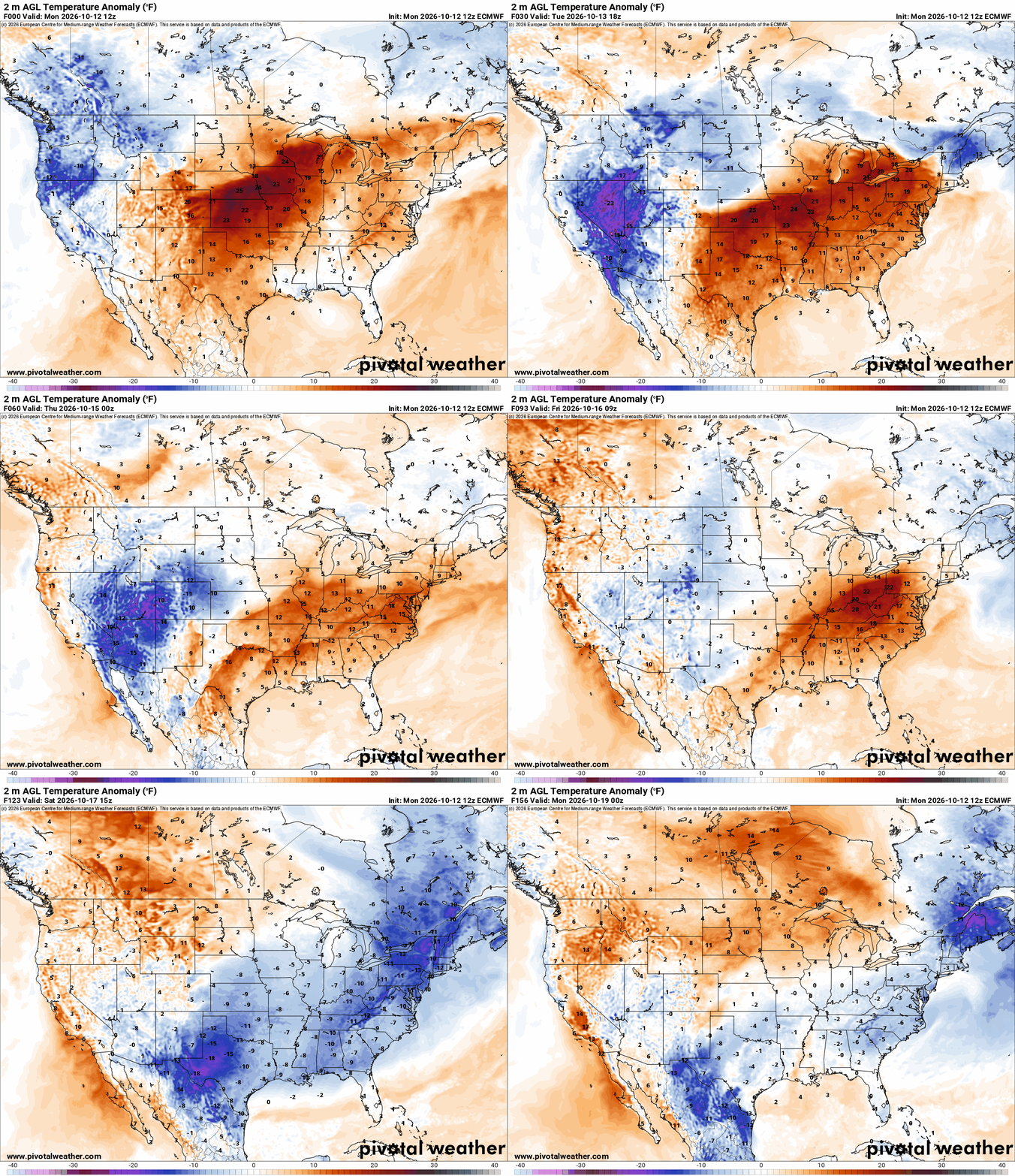
Here is the OKC temperature trend. From summer to fall clothing in just a few days. -AT