Can I Plant Now? and Long Range Outlook

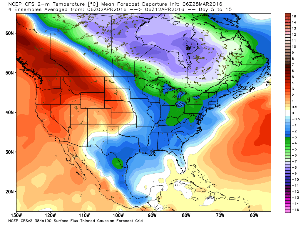
Temperature anomaly across the US and Canada for the period April 2 through the 12th showing below normal temps across most of Oklahoma.
Don’t plant sensitive vegetation just yet. It appears that winter isn’t quite done. The upper pattern has altered to form a polar vortex around the Great Lakes region. That will send arctic source regions of cold air south and east. The good news, is that most of that will be affecting the NE parts of the country. However, Oklahoma will be on the southern end. This pattern holds until about the middle of the month, then it will change again to more of a typical setup.
 Restoration and Disaster Cleanup Service
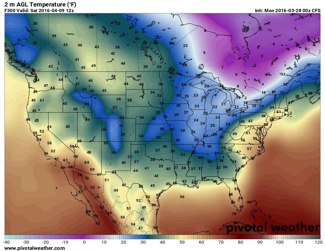
The climate forecast model is indicating a few cold mornings between now and then. This one below references mid to upper 30s on April 9th for example. Keep in mind we’ll have some wild temperature swings into the 70s and 80s for several days over the next couple of weeks as well.
This does help keep the severe weather threat down, so looks like the majority of our severe storm season will get squeezed between the last week of April through the first week of June. About what it was like last year. It should be active during this period as well. We’ll likely have a couple of rounds before then, such as this Wednesday across parts of E half of OK but these threats are few and far between compared to what that active period should bring.
In addition, if La Nina builds as strong as expected starting this summer, that indicates more drought/heat conditions during that time, but also leads to a more active tornado season the following spring. Time will tell on all of this of course, it is still fortune telling with science.