Hot as a Firecracker, July 4th Preview!
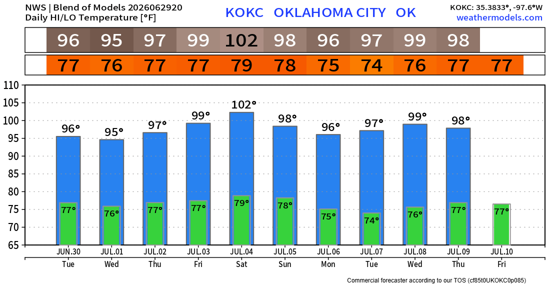
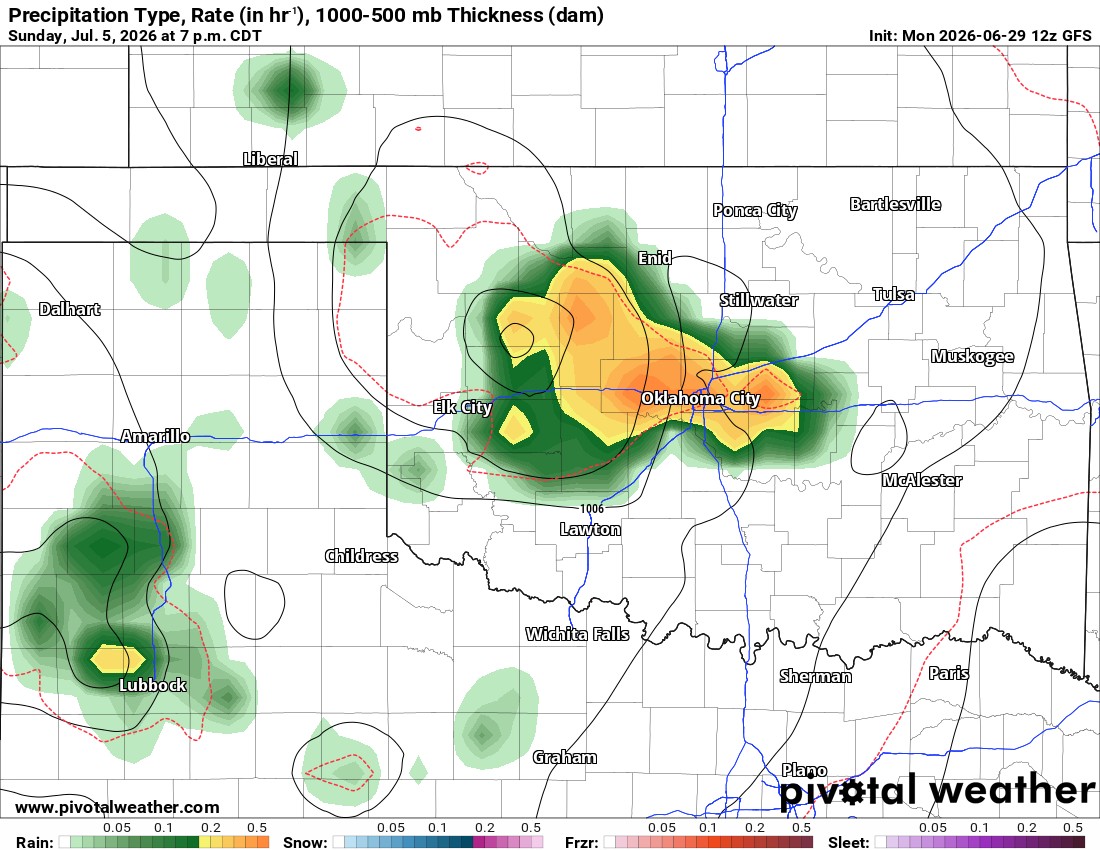
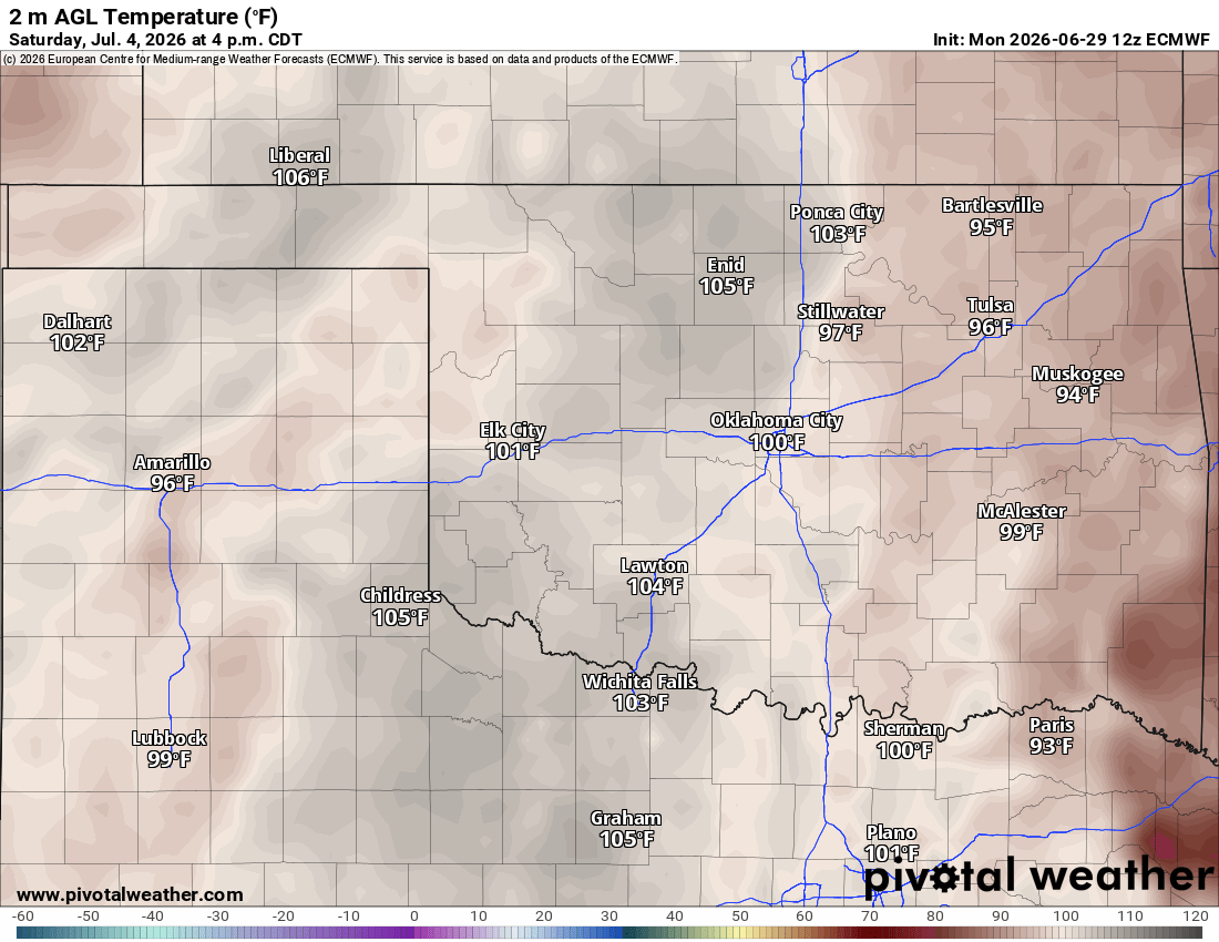
You knew that was coming. The hot pattern has arrived. A few showers and storms will graze far Western Oklahoma and then a little more state coverage Sunday. You’re Independence Day forecast is toasty.
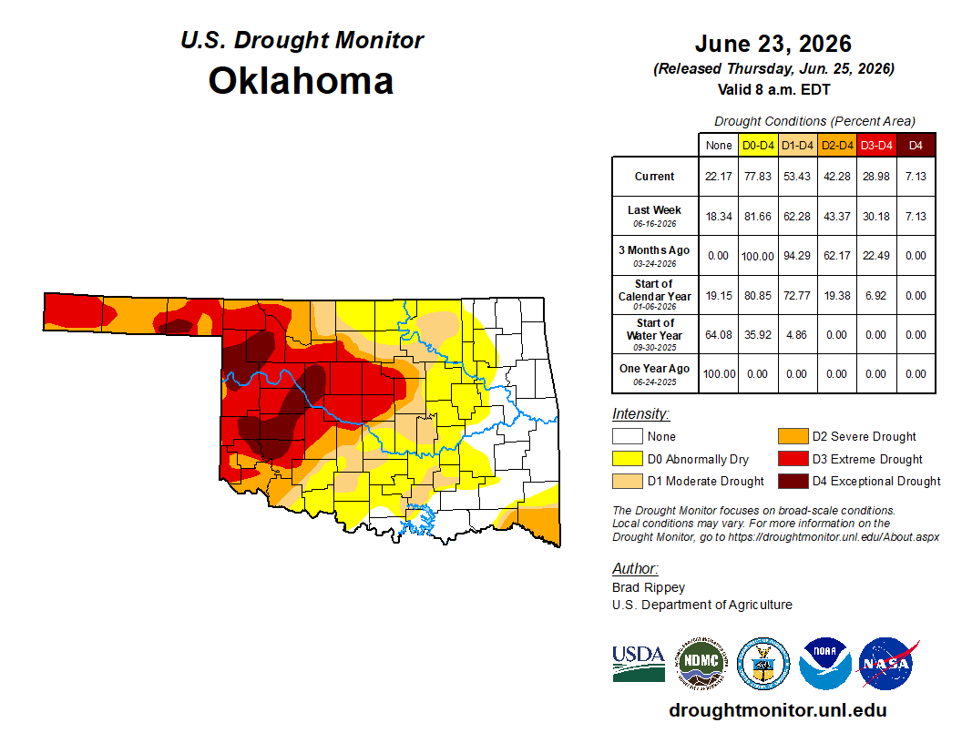
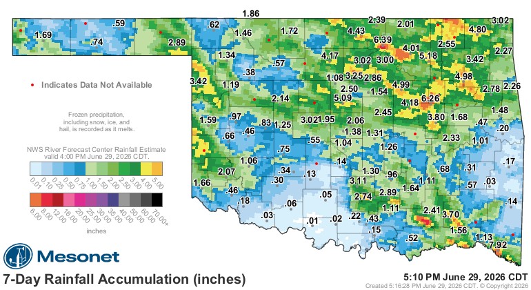
To quickly recap last week, we desperately needed the rainfall. Some areas got way too much, leading to flash flooding, and some got way too much wind. It happens during June. The drought is a lagging indicator and they’ll update it this week, which should have some improvement, but the west is still suffering.
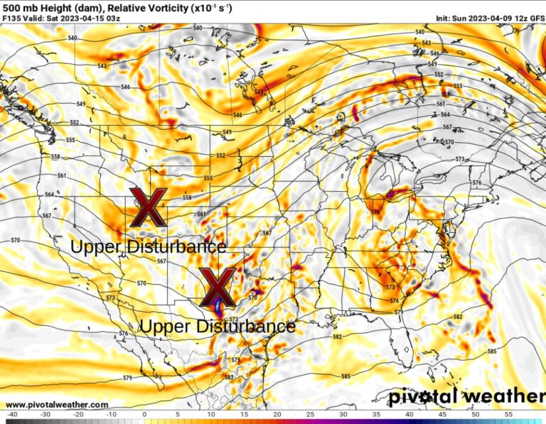
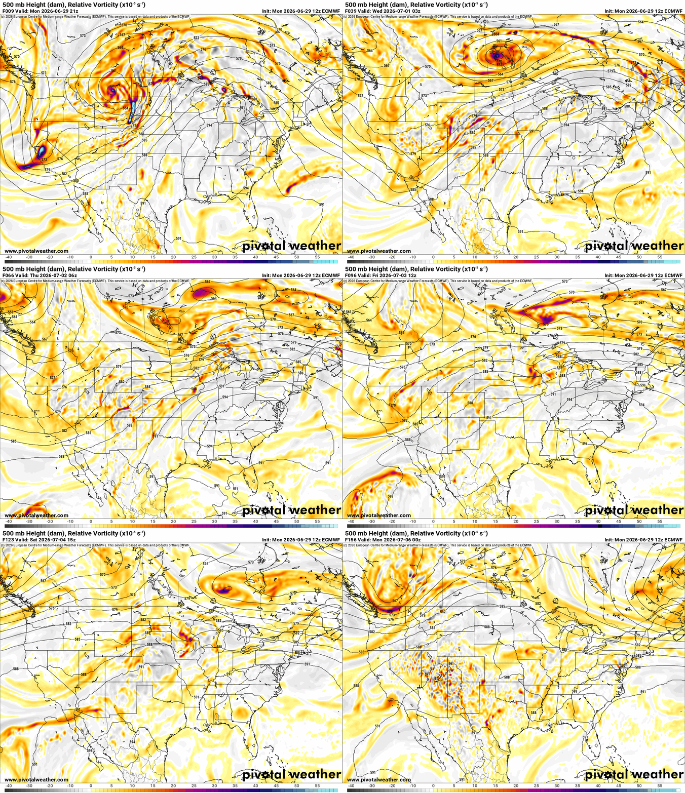
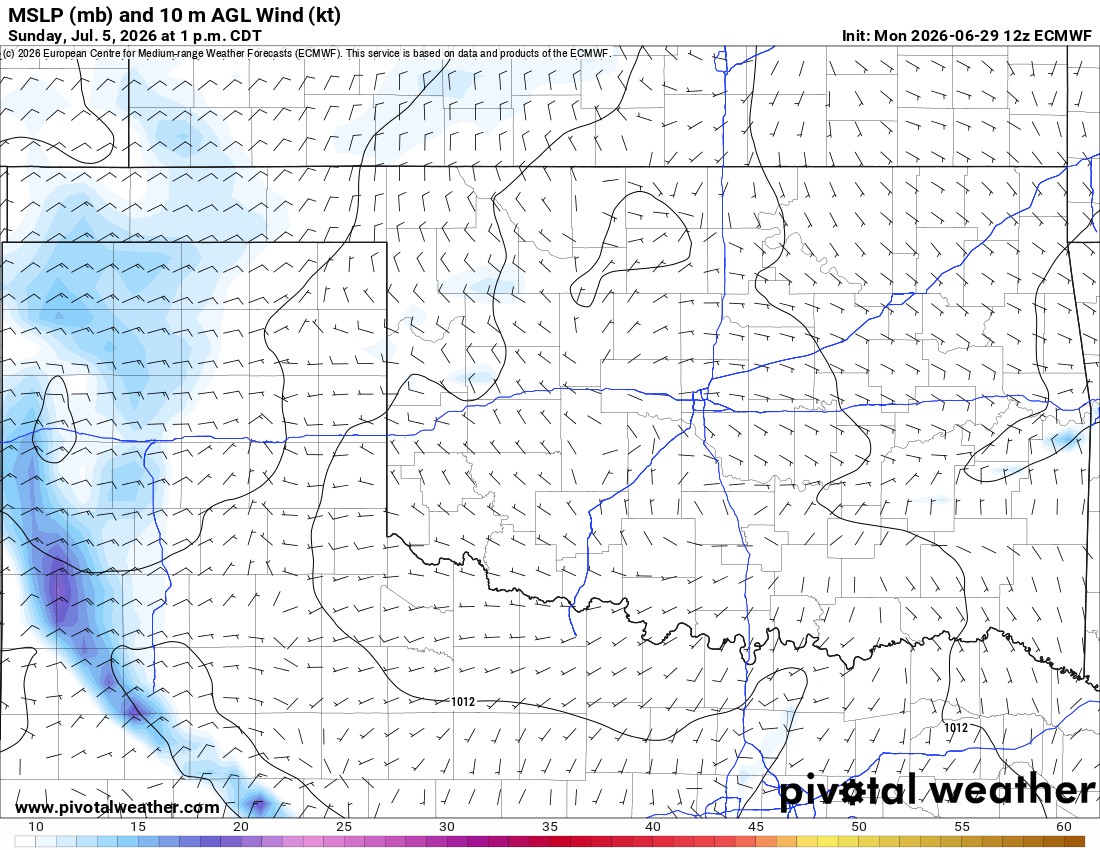
The pattern has a bit of an upper ridge overhead blocking any weather systems from moving in from the west. You will notice the upper energy clips far western Oklahoma. As we transition to the weekend, more of that moves into the body of the state as the ridge breaks down and repositions itself. The best influence of this for more rain will be Sunday with a weak front.
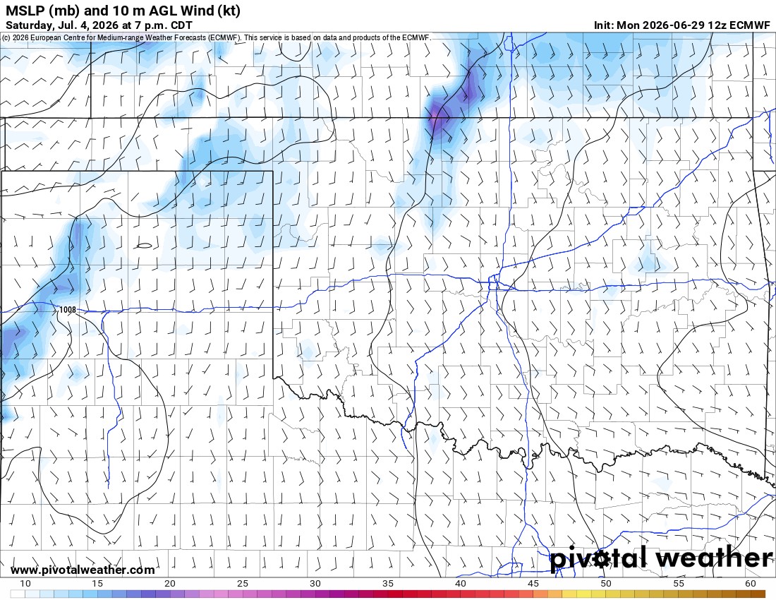
The short-term model animation shows the Texas panhandle will see these isolated to scattered showers and storms. A few will cross over the border before dying out each afternoon/evening. I can’t rule out a completely dry Saturday for your festivities, as an isolated weak shower or storm could develop, but the best signal is for Sunday. For 99% of us, Saturday will be mostly clear skies and SSE wind at 5-15 mph with gust to 20.
 Restoration and Disaster Cleanup Service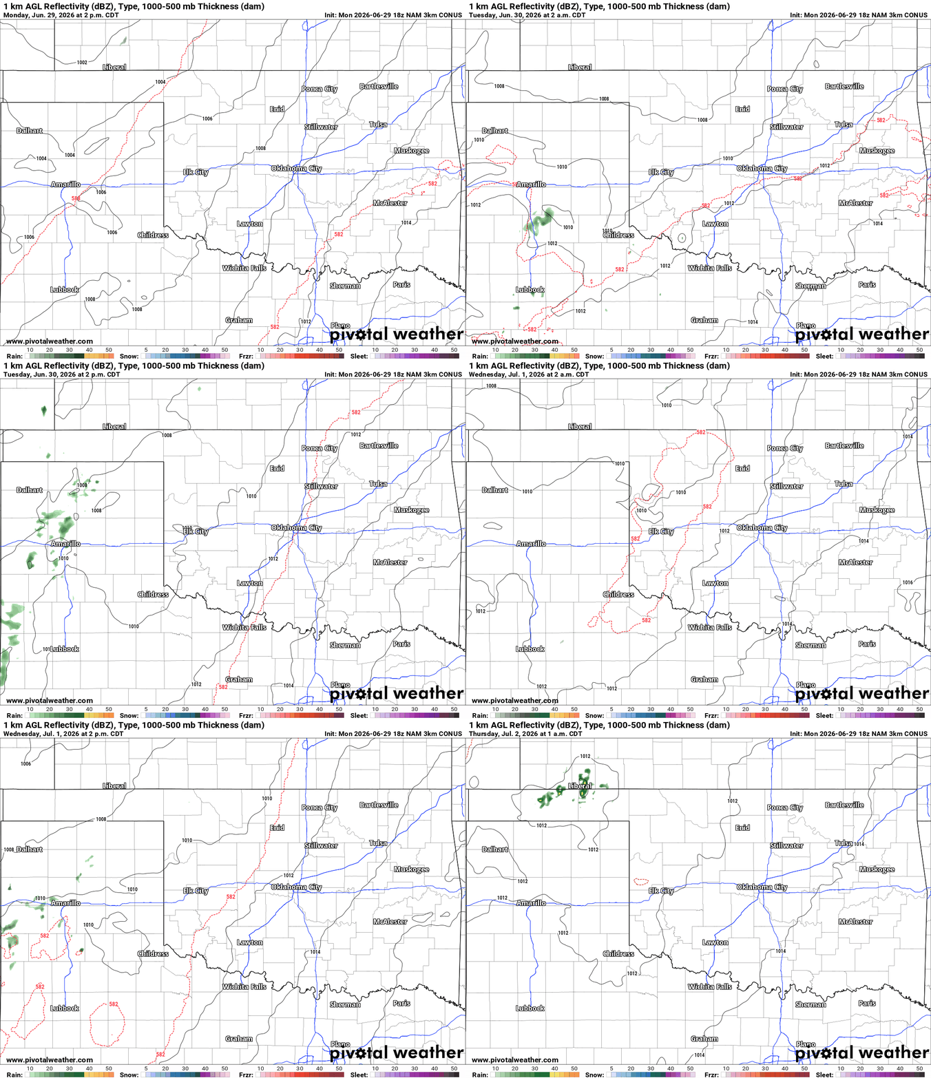

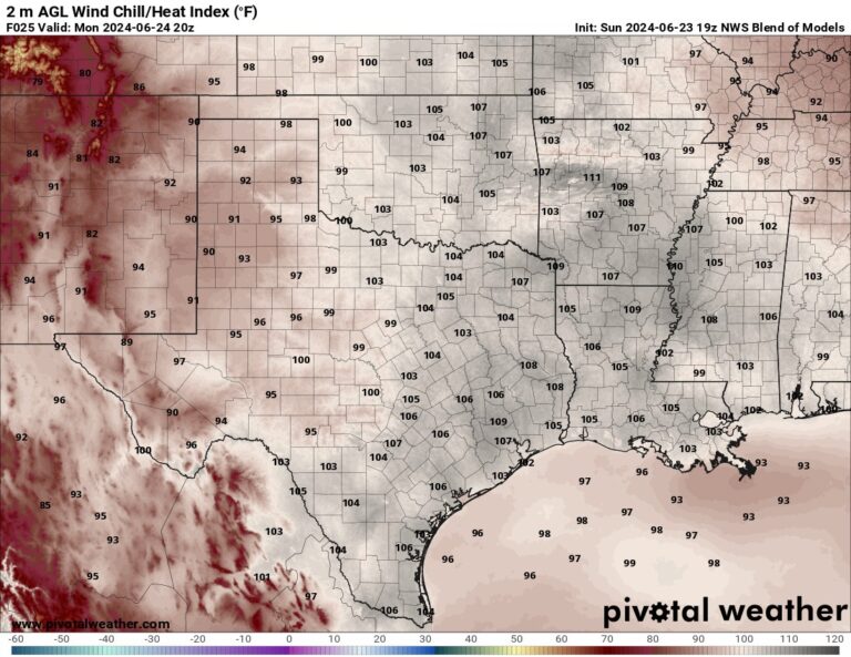
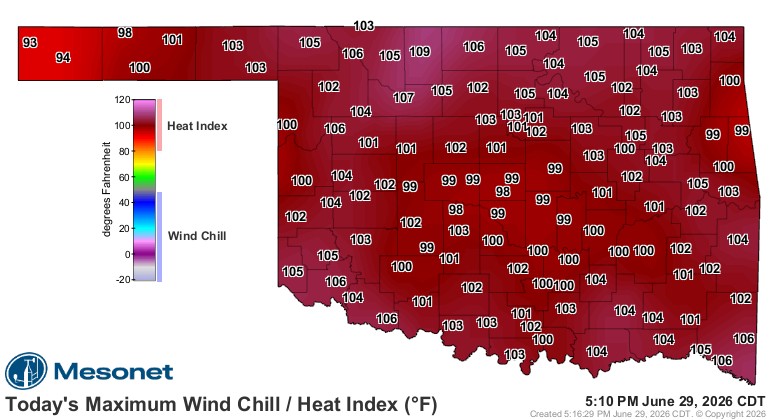
The heat will build throughout the week as well. It’s a tradeoff as the heat index is highest at the onset and then as the air dries out from the recent rains, the temperatures climb to replace the same 100 degree feeling.
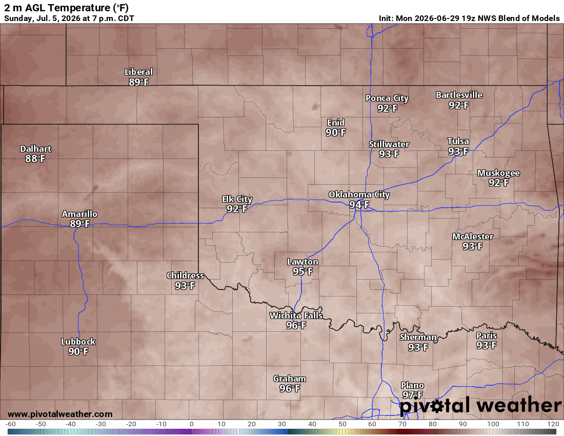
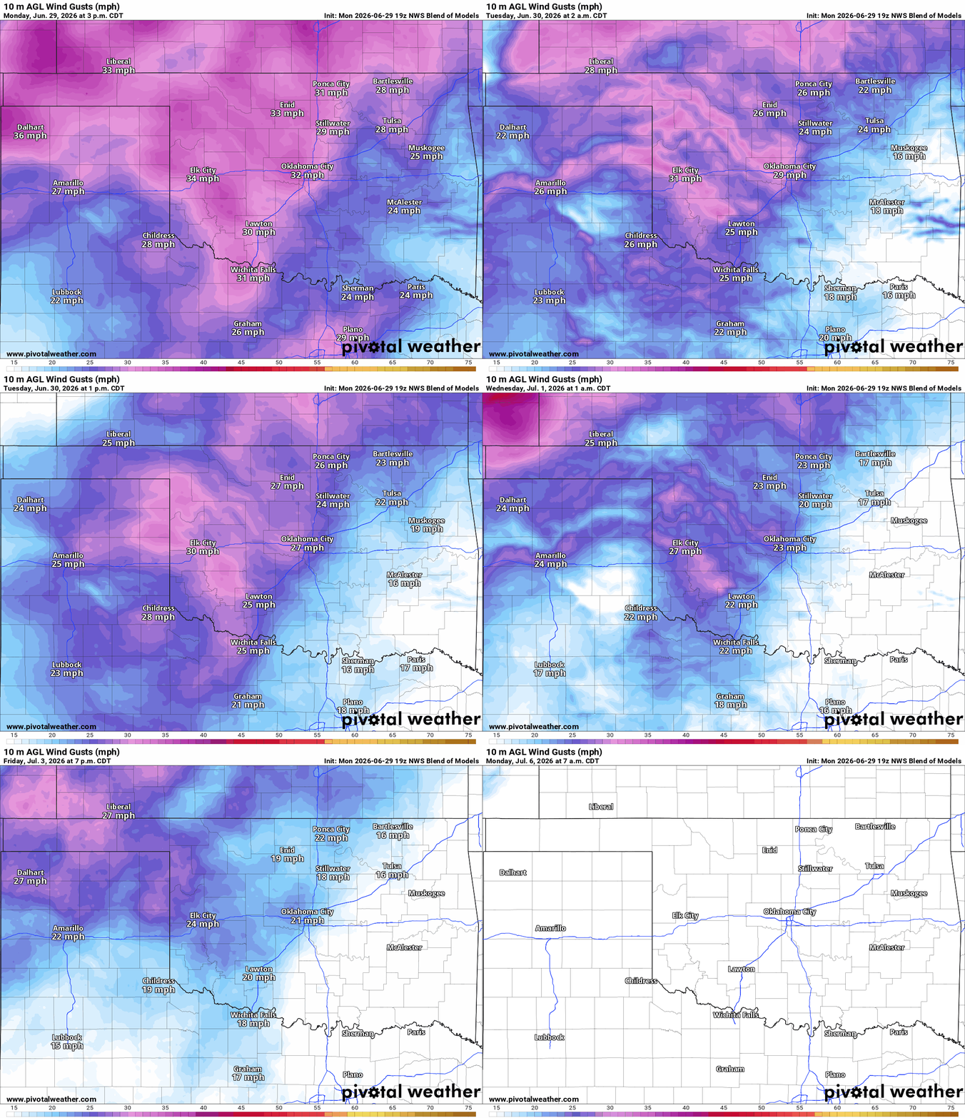
At least the wind helps with the heat, and it’ll be brezy all week, calming down by Saturday and especially calm on Sunday. We’ll see a few wind gusts Saturday evening up to 20 mph, but the wind will generally be light for fireworks.
Be sure to mention Aaron Tuttle when you call (405) 820-1193!
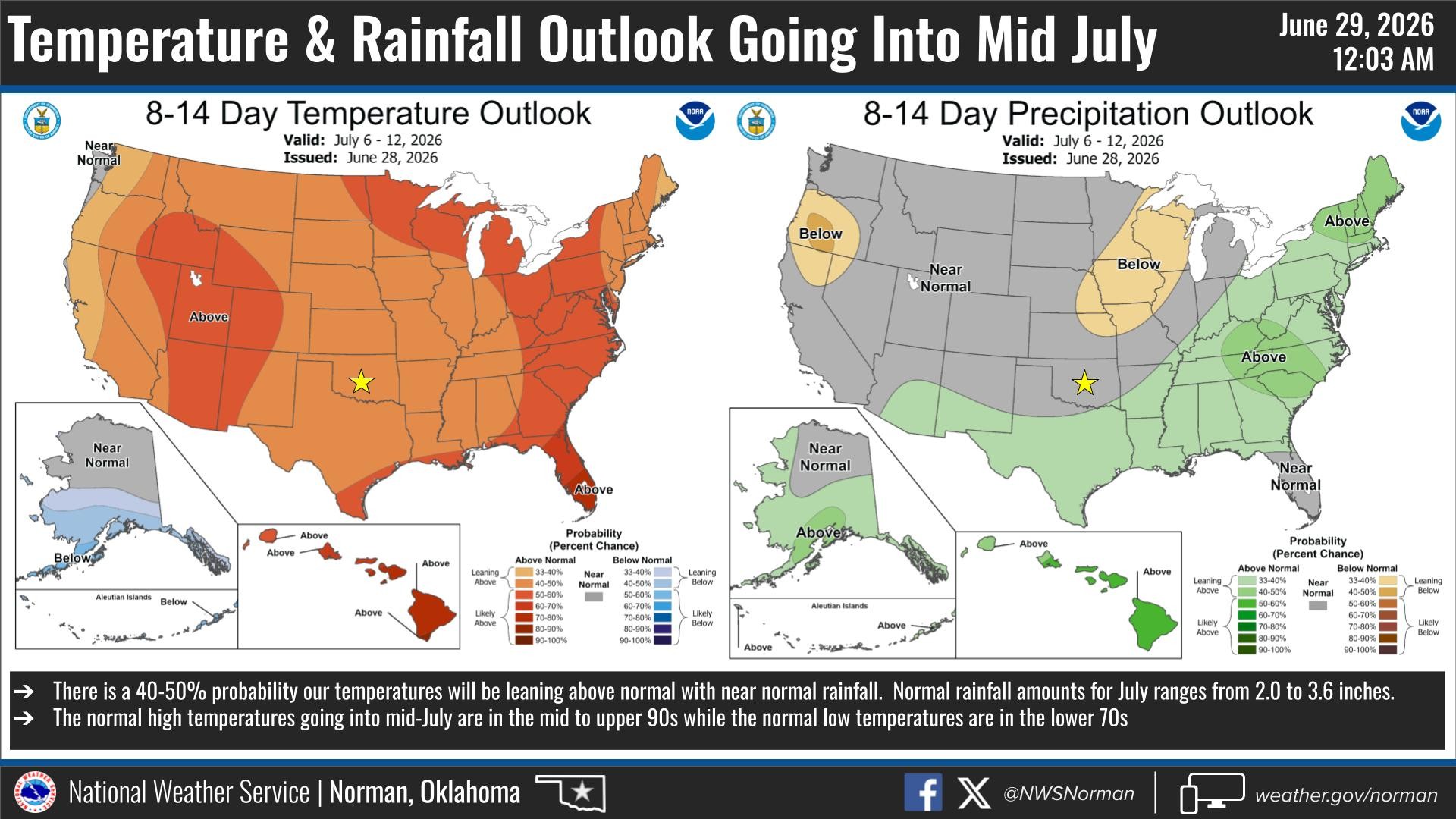
The long-term outlook is mostly hot and dry but there are still a few signals for rain here and there.
Stay cool and safe this holiday weekend, and be sure to have some fun too! -AT