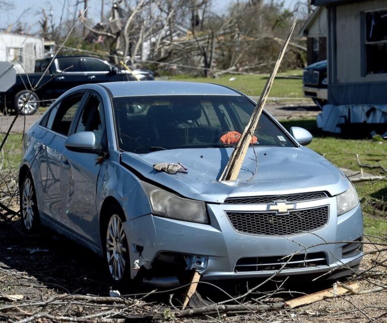
Overnight Tornadoes Possible and Fire Danger Emerges
If you are reading this blog, then you are a subscriber to AT’s Weather. So thank you!!!
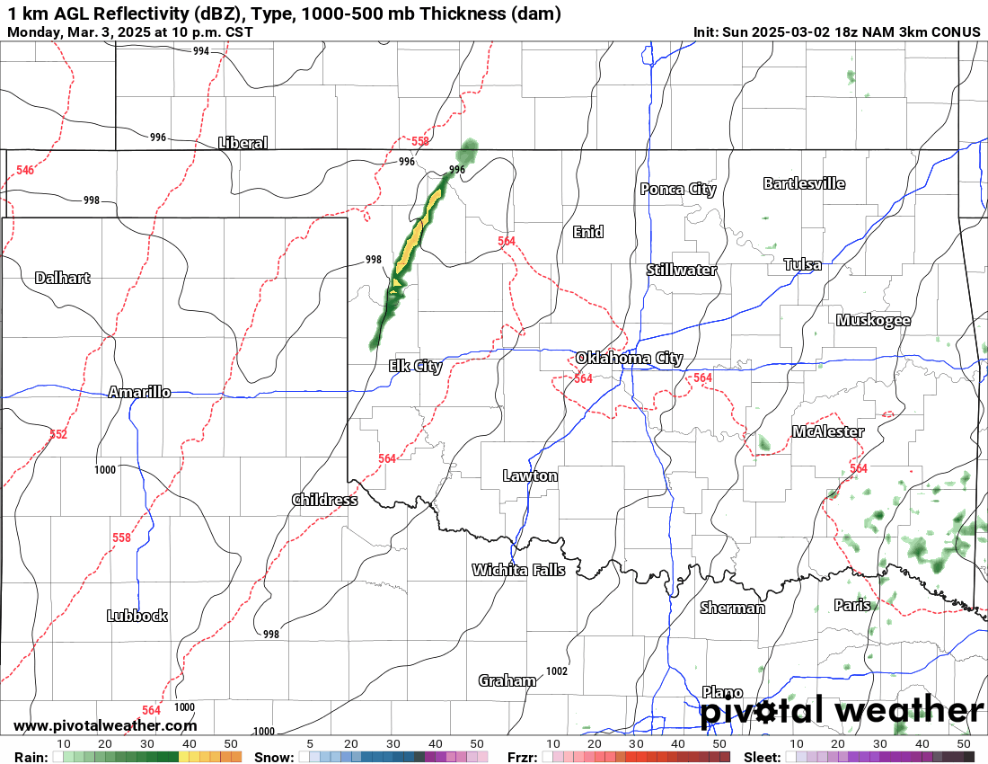
The first thing to address is our return to severe weather season. Often we start it mid-March and it lasts to mid-June. This time around we’ll kick off a little early. We already had a few funnels generated from a wall cloud Sunday afternoon across SW OK.

Ferguson Roof Systems is offering an AT's Weather special!
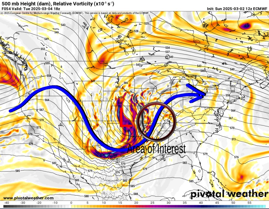
The Jetstream shows our next storm system that will move through Oklahoma late Monday night and Tuesday. Typically later in the season this allows the CAP to build and the atmosphere to cool at the surface, which prevents significant severe storms and tornado threats. This time around, since it’s so early in the season, the CAP doesn’t get a chance to build, which leaves us vulnerable for some overnight tornadoes. After our storms Monday night, severe weather breaks out across MO and AR Tuesday.
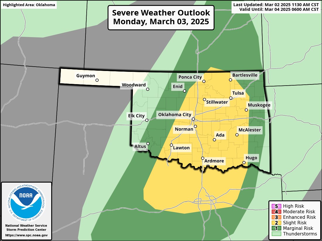
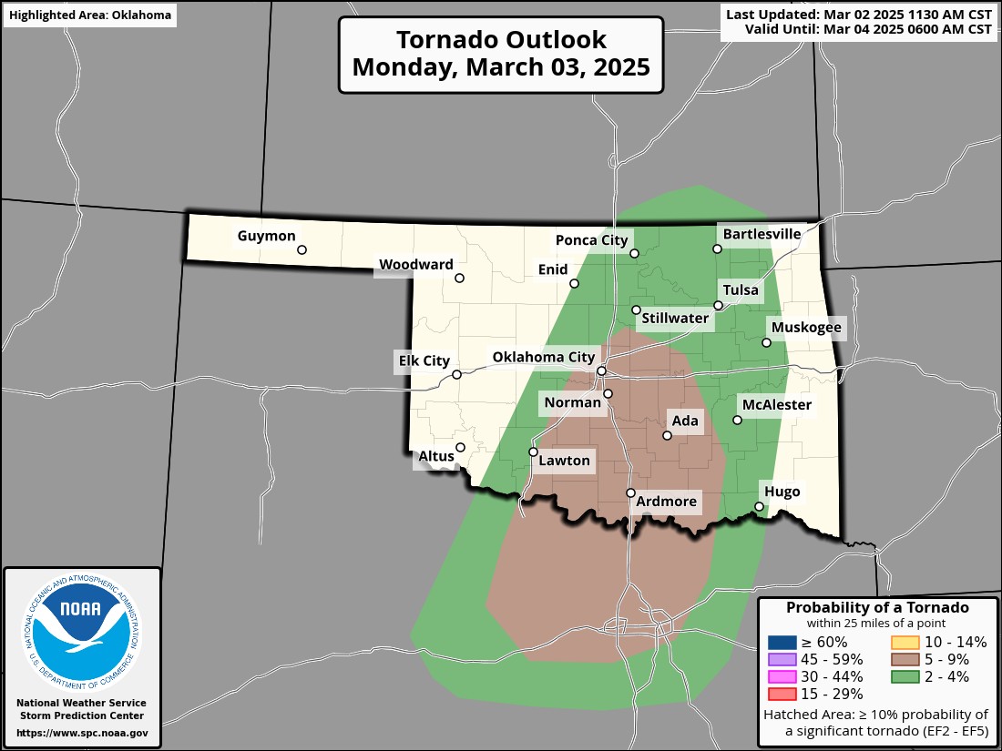
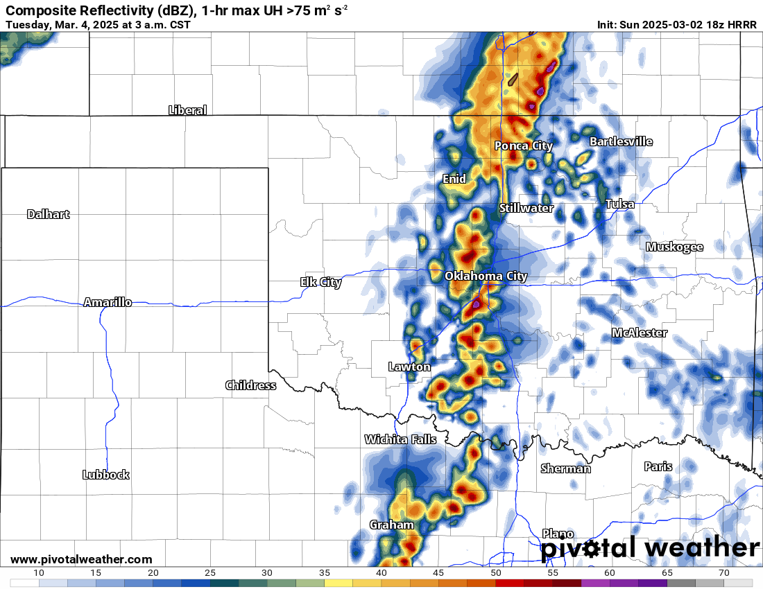
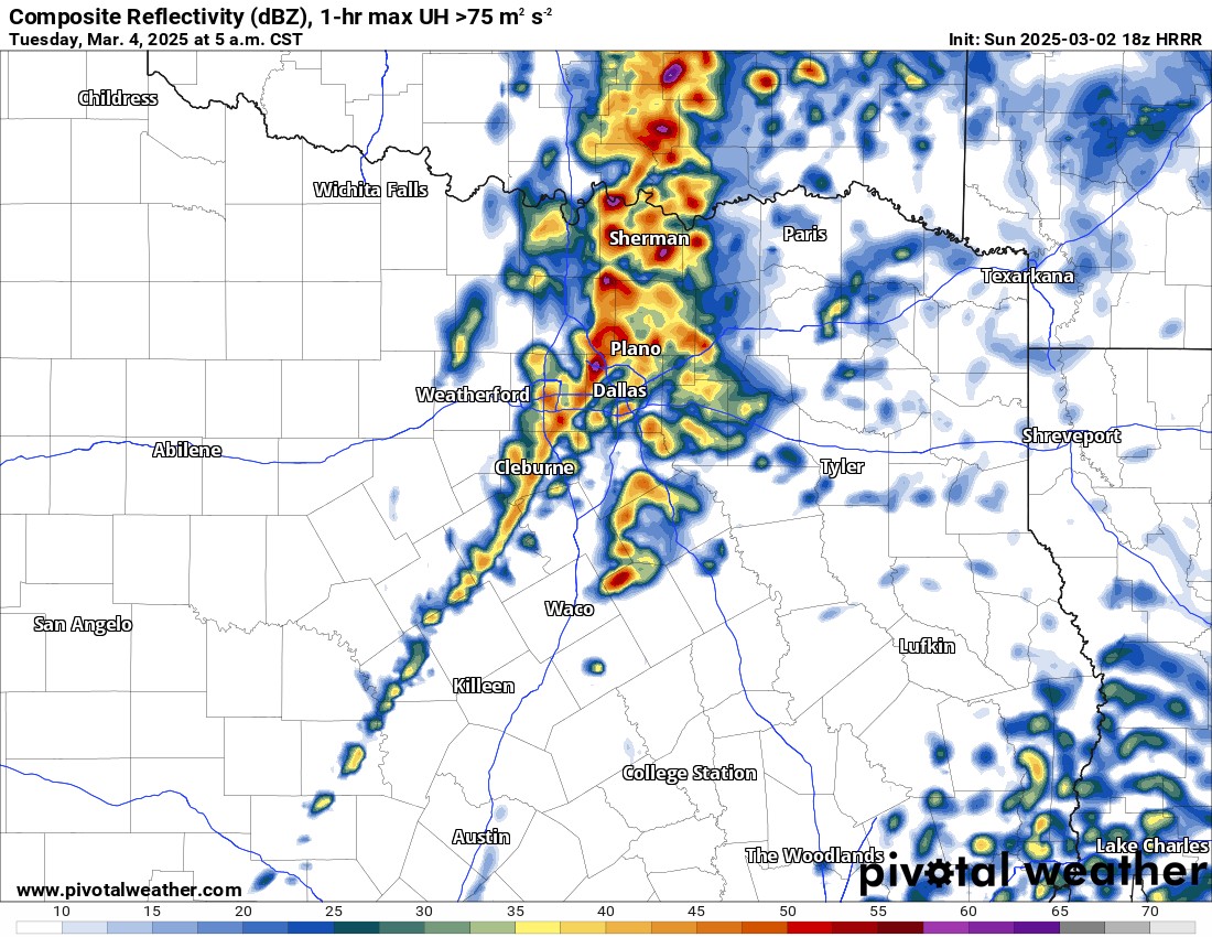
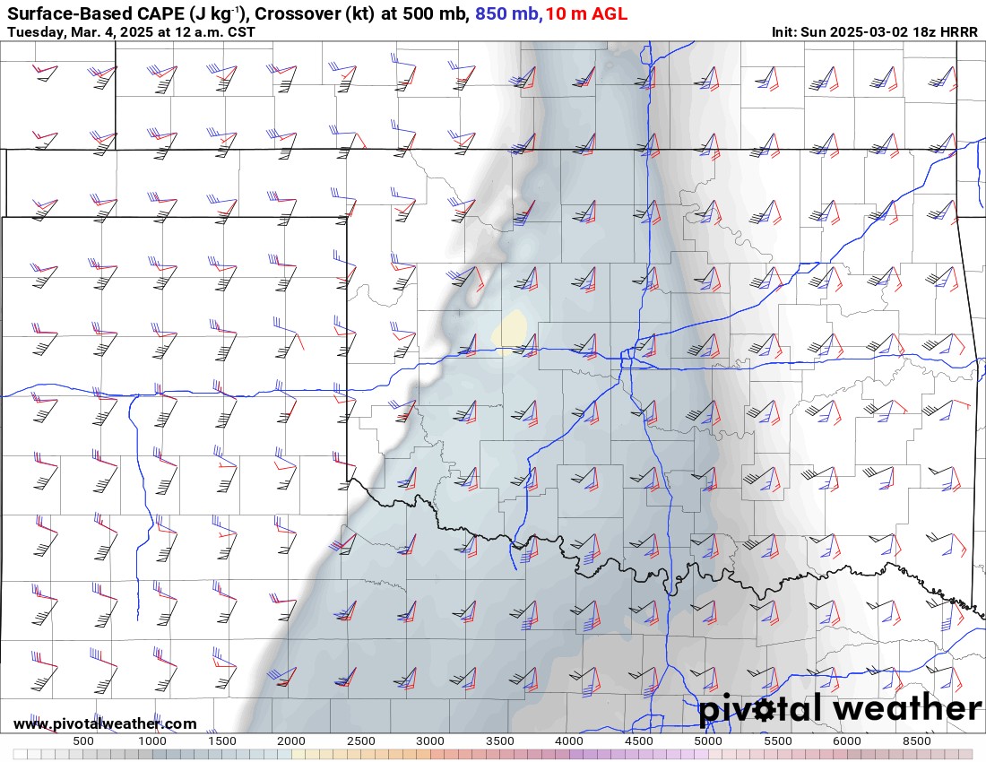
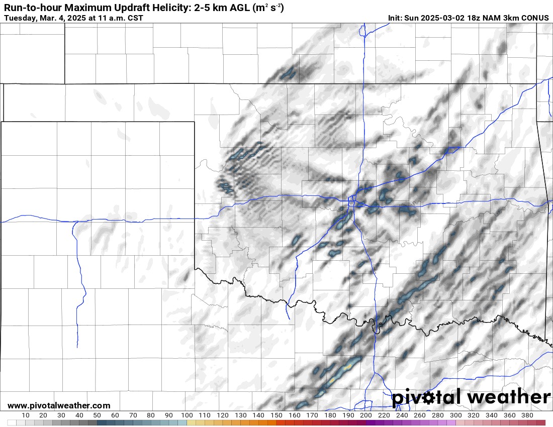
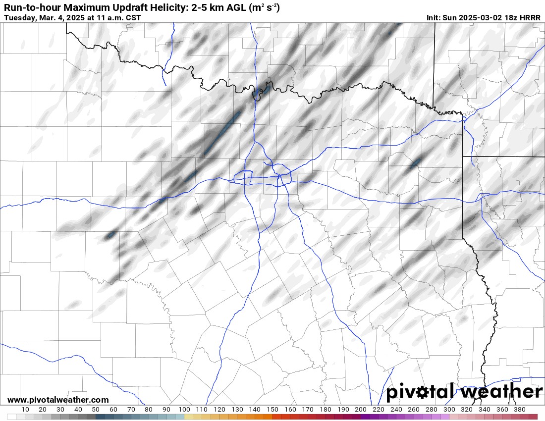
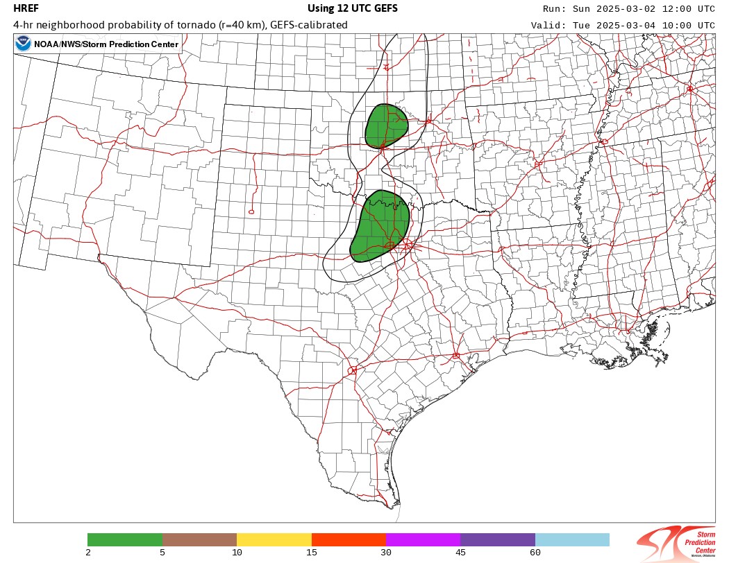
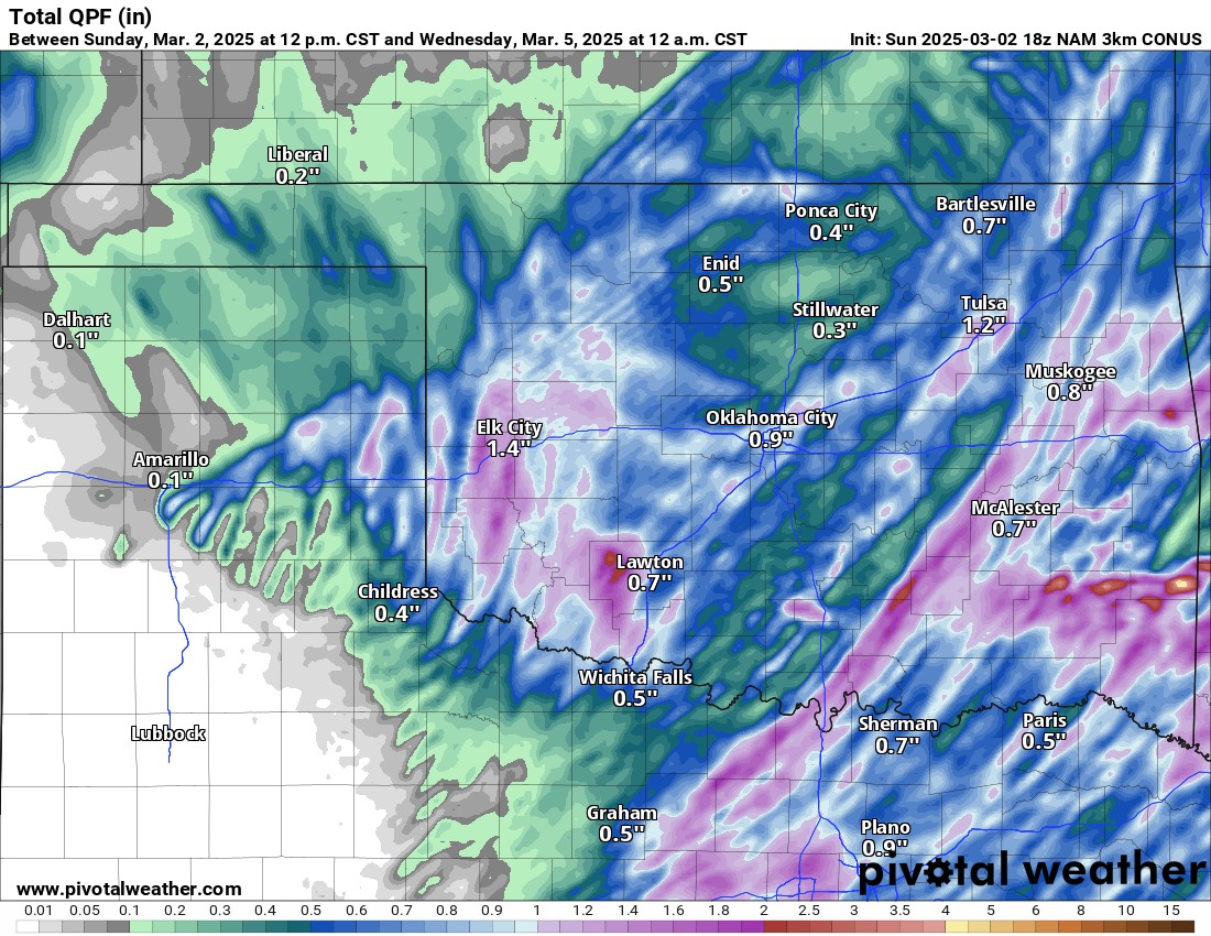
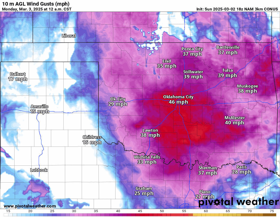
Watch the animation of the rain moving through Monday night and exiting Tuesday. We may even get a little rain/snow mix on the backside of this system along the Kansas border. Instability will move in during the day Monday with CAPE and Shear values adequate for rotating severe storms. There are also several weak helicity tracks indicating potential tornado development. The line of storms will move through the I-35 corridor, including OKC around 2-3 am. The storms will affect the DFW area by 5 am. Tornadoes are possible in N TX as well. As a matter of fact, algorithms favor two target areas noted in the green shading on the probability map.
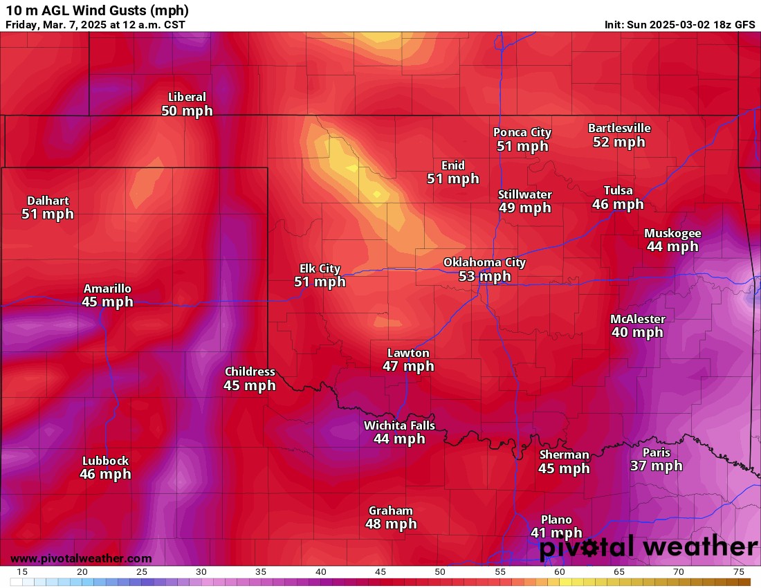
In addition to the storms, the wind will get cranking! Wind gusts in excess of 40 mph will be common with peak winds around 60 mph outside of any storm activity through Tuesday. This can increase the fire danger as vegetation still hasn’t greened up yet. Another enhanced day for fires will be late Thursday into Friday with low dewpoints across the state this week. By the way, it’s going to feel very cold Tuesday afternoon!!!
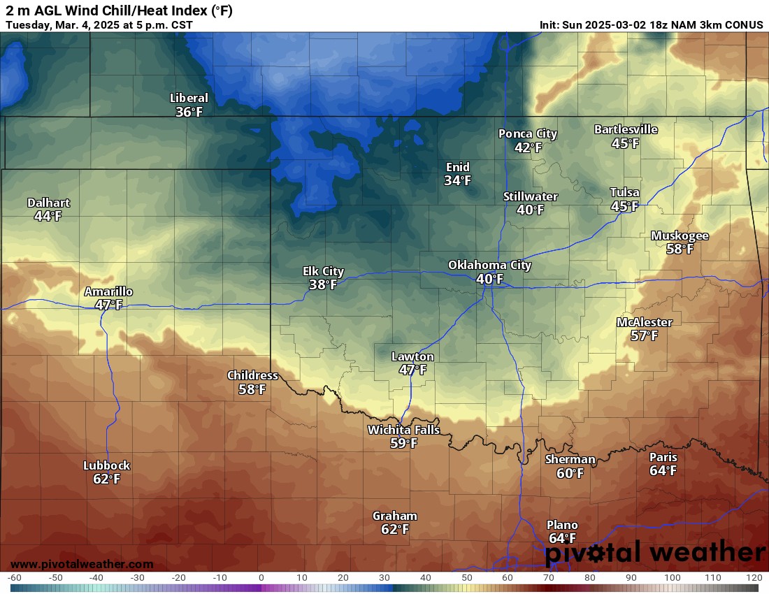
Don’t get Spring Fever just yet, we have a couple of freezes this week and we often get a freeze through early April.
I’ll be keeping an eye on things and it may be a late night of live tornado coverage from around 11 pm to 4 am. Be sure to check your social media feeds. -AT