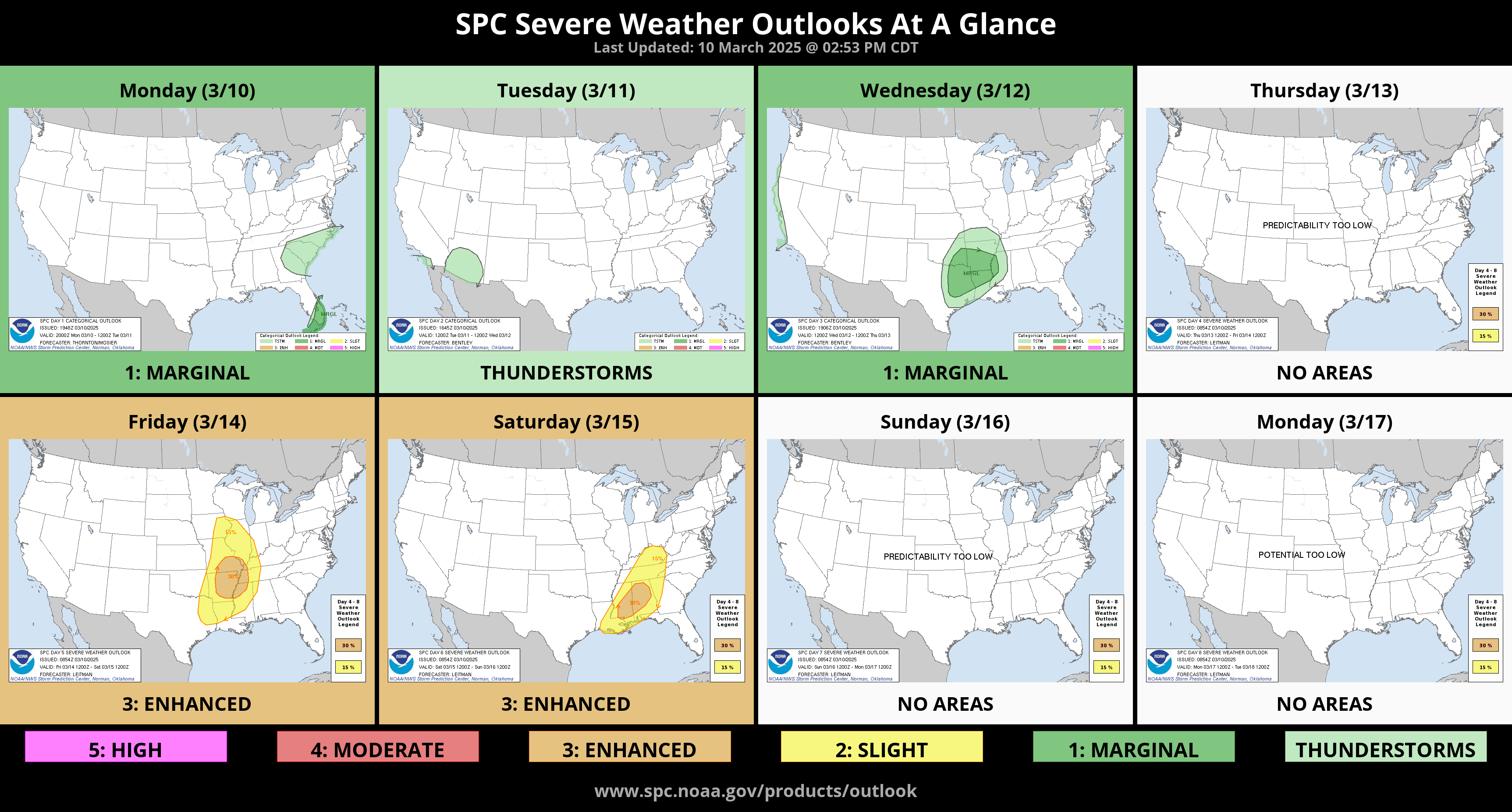
Widespread Wildfires Friday and Severe Weather East
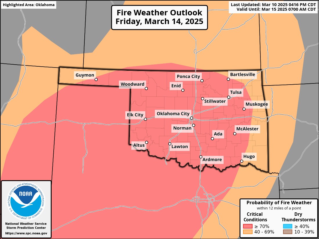
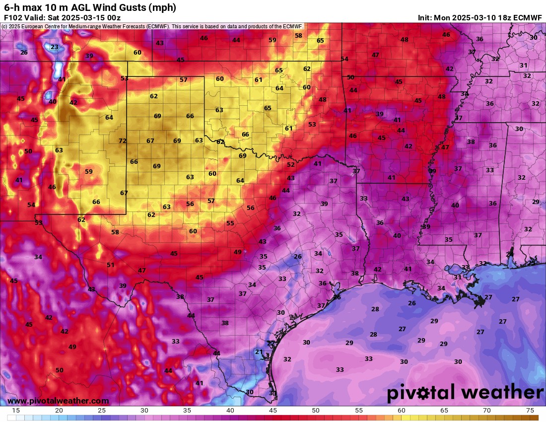
This week’s weather highlight will be the wildfires that will break out across a large area of Texas and Oklahoma. The cause of this will be extremely low humidity, high temperatures, dormant vegetation, and west and southwest winds in excess of 60+ mph.
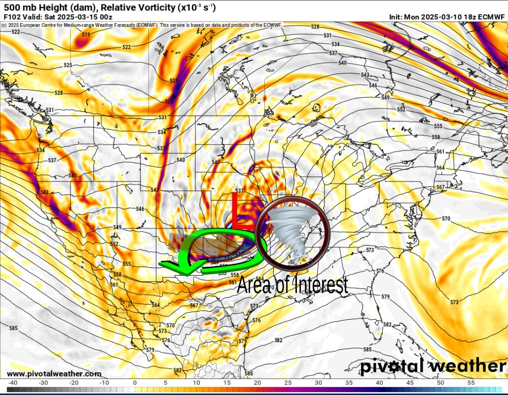
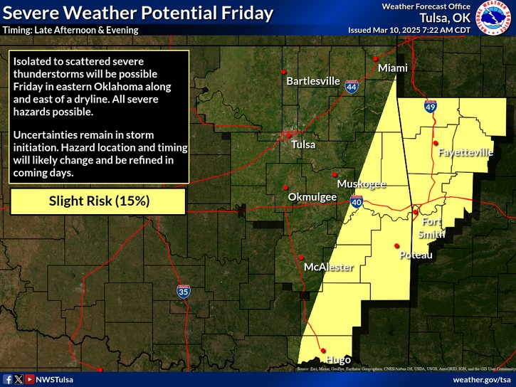
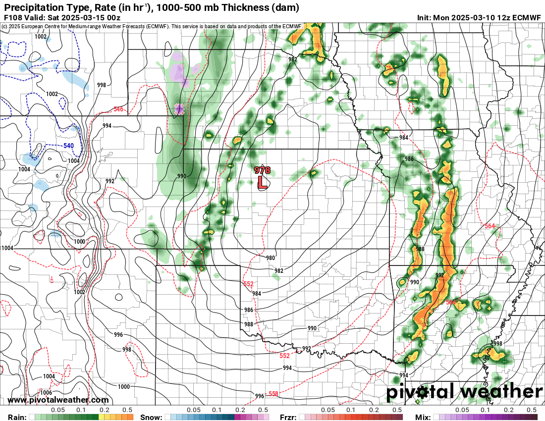
The upper level storm system responsible for this will move across Kansas during the day Friday. By the time it taps into enough instability to produce severe weather, it will be late afternoon, confined mostly to Arkansas. A threat for tornadoes may exist if deep enough moisture can return with the combination of significant speed and directional shear. Should the storm system come in just a little slower, it’s possible far E OK may see some storms before exiting the state.

Be sure to mention Aaron Tuttle when you call (405) 820-1193!
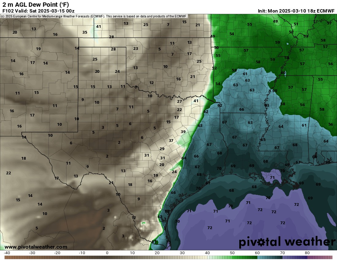
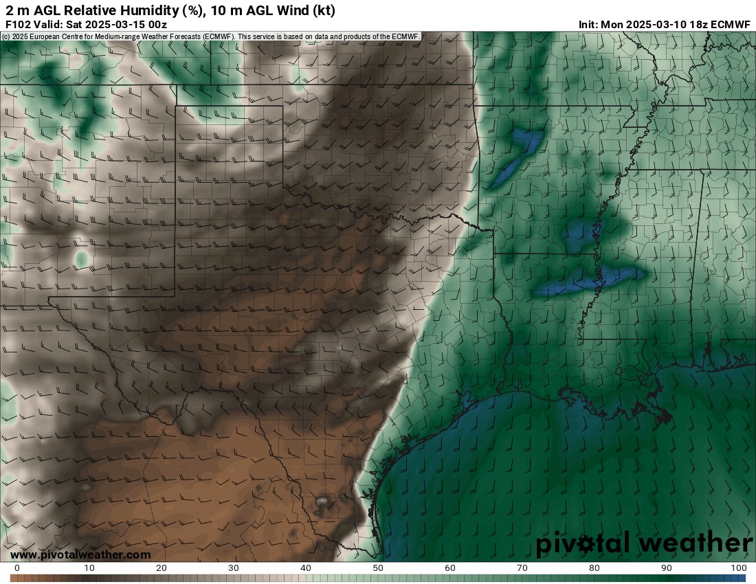
The fire danger is extreme on Friday. Dewpoints will drop into the single digits and teens, which will create relative humidity between 10-20%. As winds increase above 60 mph, it will be extremely easy for wildfires to start. On top of that, we may be dealing with scattered power outages as well over a large area across Oklahoma and Texas.
You can keep up on the fire danger threat throughout the year under the Wildfire Information page on my website: Wildfire Information
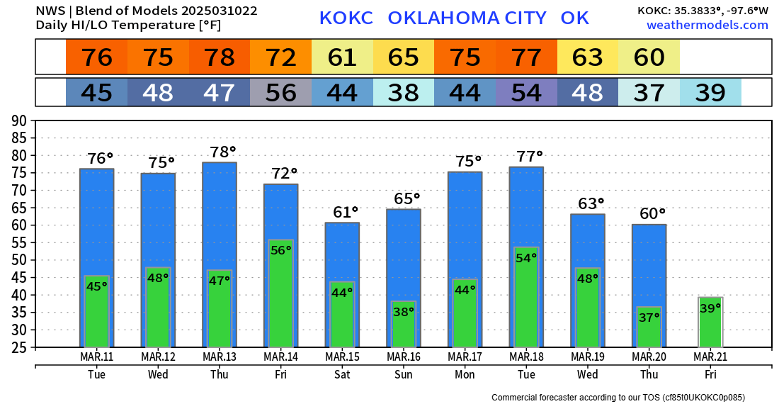
Outside of the threat for fires, the weather the rest of the week looks very nice temperature-wise. Long-range we have more of these wild swings, so if you plant early, just be prepared to protect them on those cold mornings! -AT