Another Week of Oklahoma Wildfires
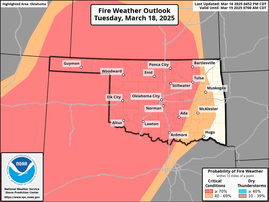
From around mid-February to mid-March is our wildfire season in Oklahoma. It’s the time of year when powerful storm systems move across in the Jetstream while our vegetation remains dormant. As we start to green later in March, the threat lessons. Last Friday was a rough day. Over 170,000 acres burned, hundreds of homes damaged, over 140 injuries, and 4 fatalities. It was a day everyone saw coming but helpless to stop it. This week we’ll have additional fires that will develop across the state.
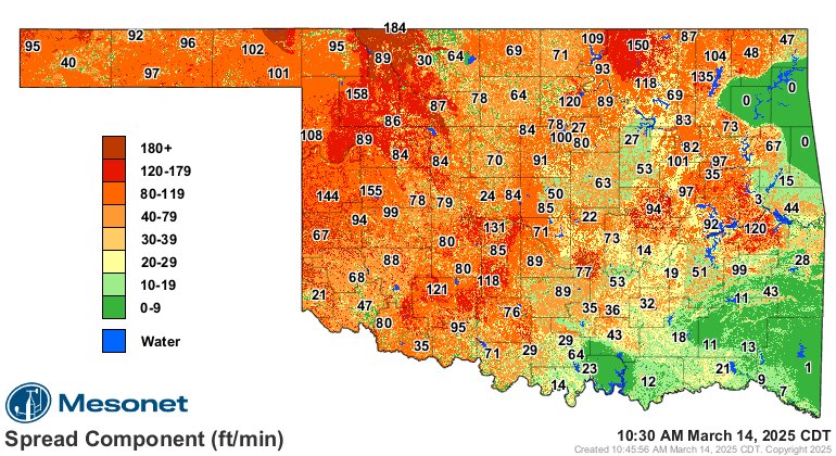
When the fires were ongoing Friday, the burning index was in the severe to critical category and the spread was as high as 180 ft/min. Just an impossible situation to contain for firefighters.
 Restoration and Disaster Cleanup Service
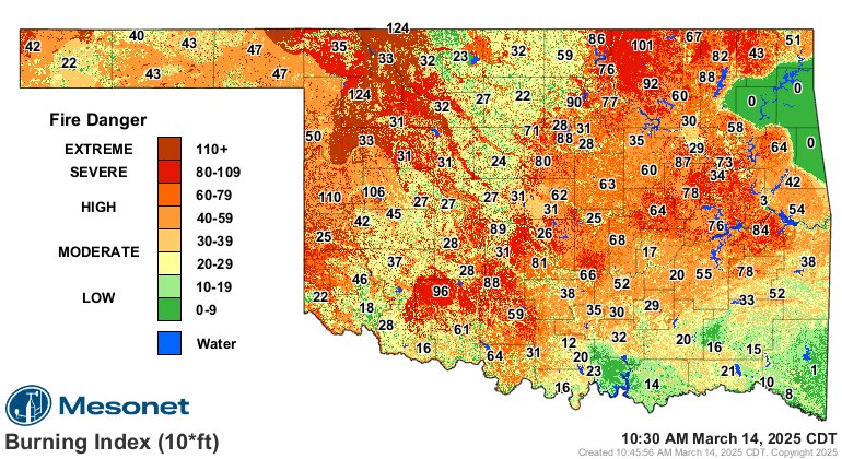
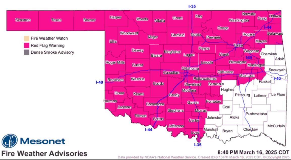
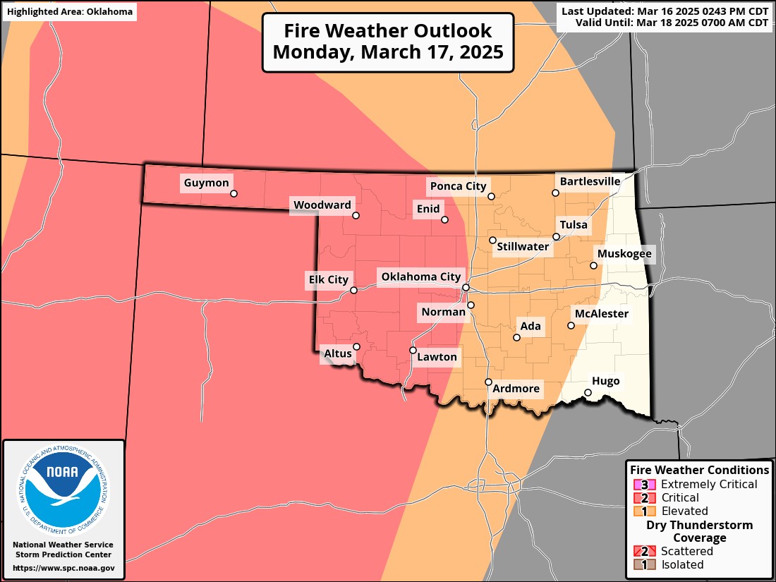
As we start our new week, we already have a Red Flag Warning in place. A Red Flag Warning means that critical fire weather conditions are either occurring now, or will shortly. A combination of strong winds, low relative humidity, and warm temperatures will contribute to extreme fire behavior. A Fire Weather Watch means that critical fire weather conditions
are forecast to occur.
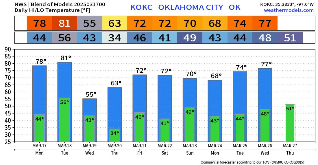
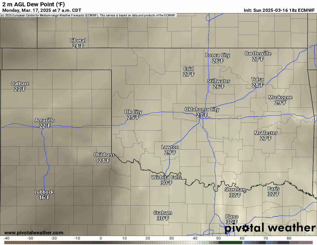
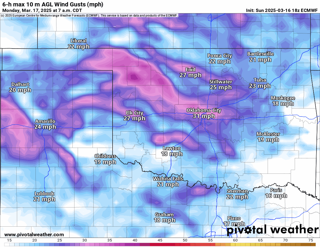
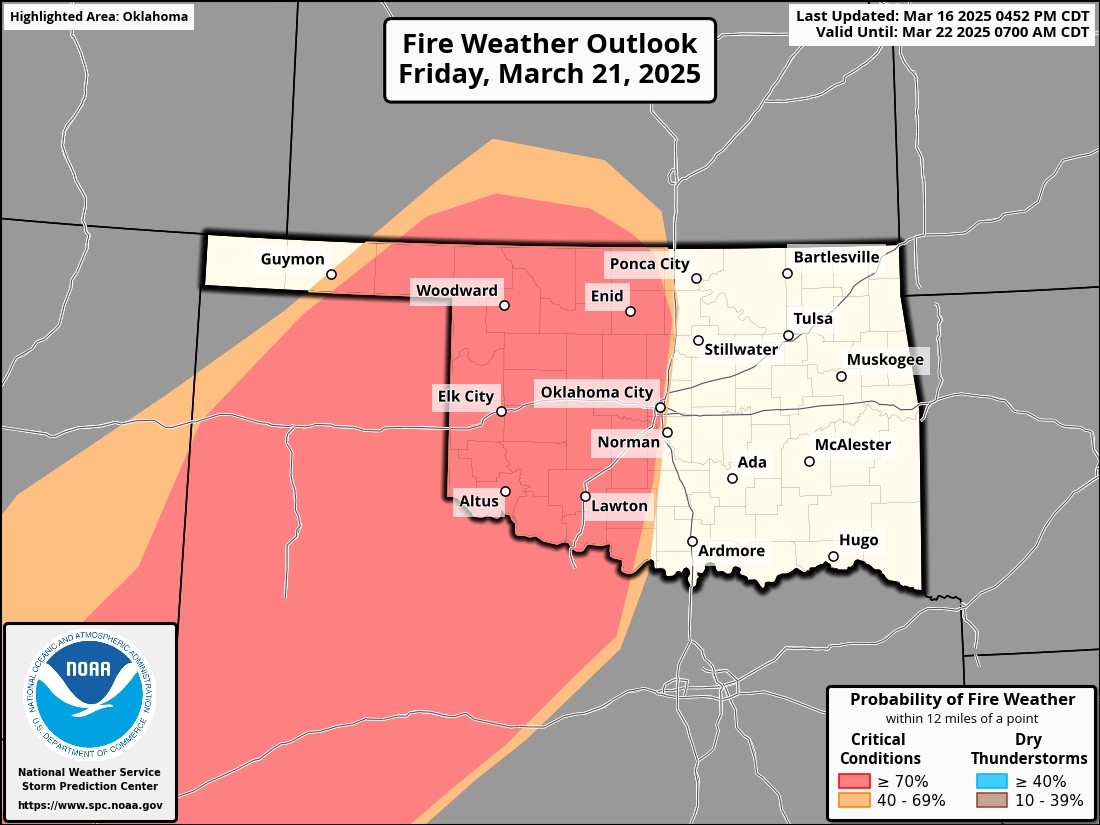
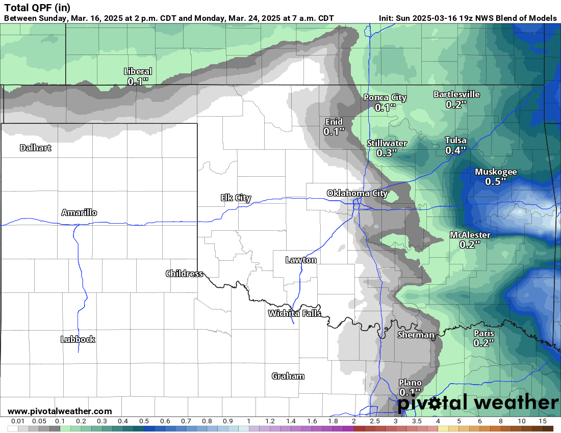
The dewpoints will be low this week as evident by the animation below. This is the indicator of how much moisture is in the atmosphere. The winds will also be strong most days. The worst combination of days will be Monday, Tuesday, and Friday. We do need the rain too, as our drought monitor is slowly creeping upwards.

Ferguson Roof Systems is offering an AT's Weather special!
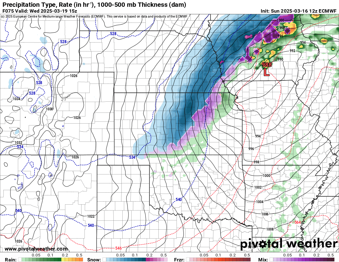
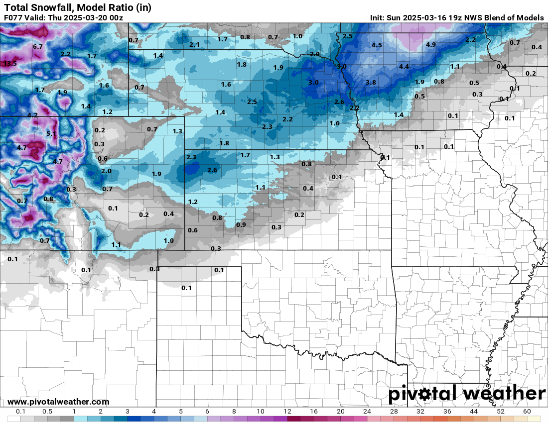
Despite the mostly dry conditions, there will be some precipitation around the area. A strong front will bring snow to Kansas and sprinkles to the northern half of Oklahoma Wednesday. Additional showers or weak storms may occur across far E OK Friday evening. And finally, a cluster of likely non-severe storms will move across the SE quadrant of the state Sunday.


Temperatures will be mostly nice once again this week with a few dips. Be careful out there this week. Don’t do anything that could lead to a wildfire. We don’t want another repeat of last week. -AT
Restoration and Disaster Cleanup Service