Winter Finally Arrives, and a Storm Commeth
Winter takes its gloves off this week and gives Oklahoma the 1 – 2. First, the arctic air, and then the snow and ice. Surrounding states get in on the action as well.
I’ve mentioned how boring this winter season has been. Well, we’re about to make up for it in just one week. We’ve got a lot going on this week, and I’ve opened this forecast blog up from its normal password-protected state for those who have been on the fence about joining. I’ll be doing lives throughout the week, updating you on what I discuss below. You can join a subscription option here: https://aarontuttleweather.com/donate-and-support-options/
 Restoration and Disaster Cleanup Service
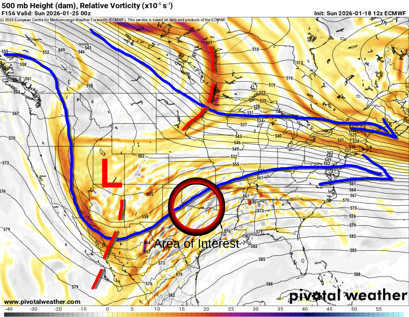
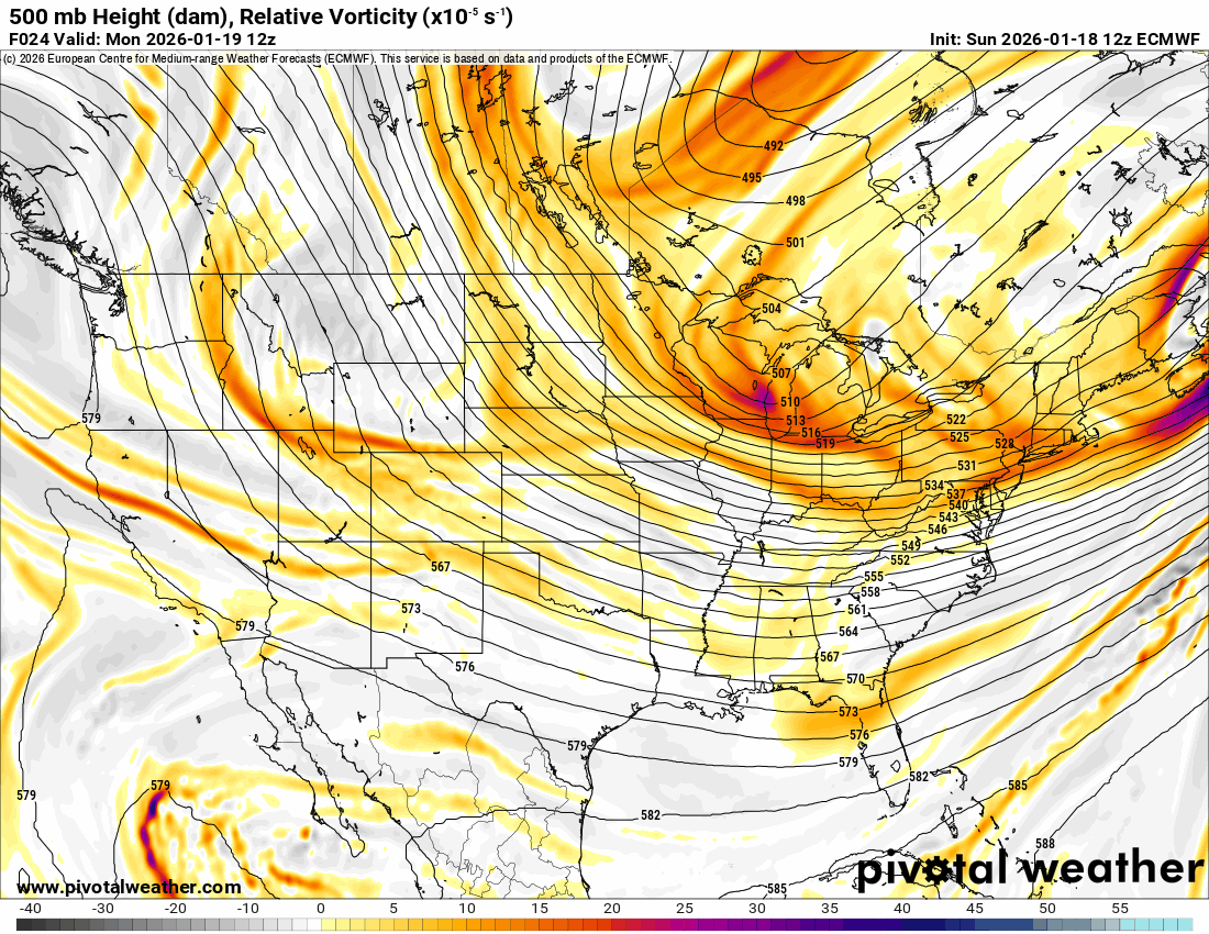
So the Jetstream pattern is finally changing into a configuration that will allow brutally cold air from Canada to dip south, while the southern branch brings in an upper low across the desert southwest that puts the Southern Plains in a SW flow aloft. This always spells trouble for us. Initially, it’ll be a mix of rain and freezing rain (aka ice), then as the cold air deepens, snowfall. You can watch the animation below. The red/yellow colors indicate lift in the atmosphere that will produce the wintry precipitation.
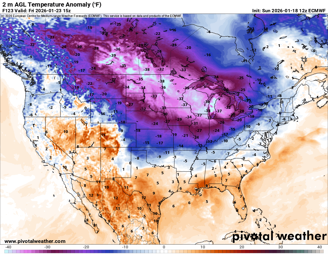
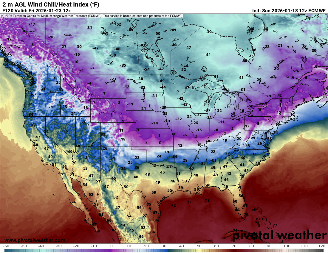
Let’s talk about the big picture first with the cold air. As typical, the brunt of it moves through the NE 1/3 of the country, with Oklahoma getting just a taste of it. That’s enough, of course. Who in their right mind would want to wake up to wind chills at 59 degrees below zero!!! Winni(ter)peg, Canada will. Temperatures will be -40 degrees below normal in the Northern Plains and Great Lakes region.
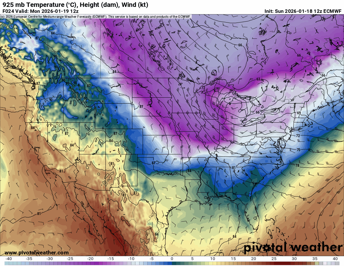
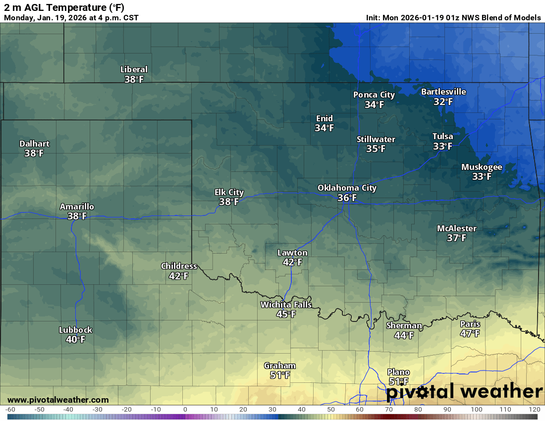
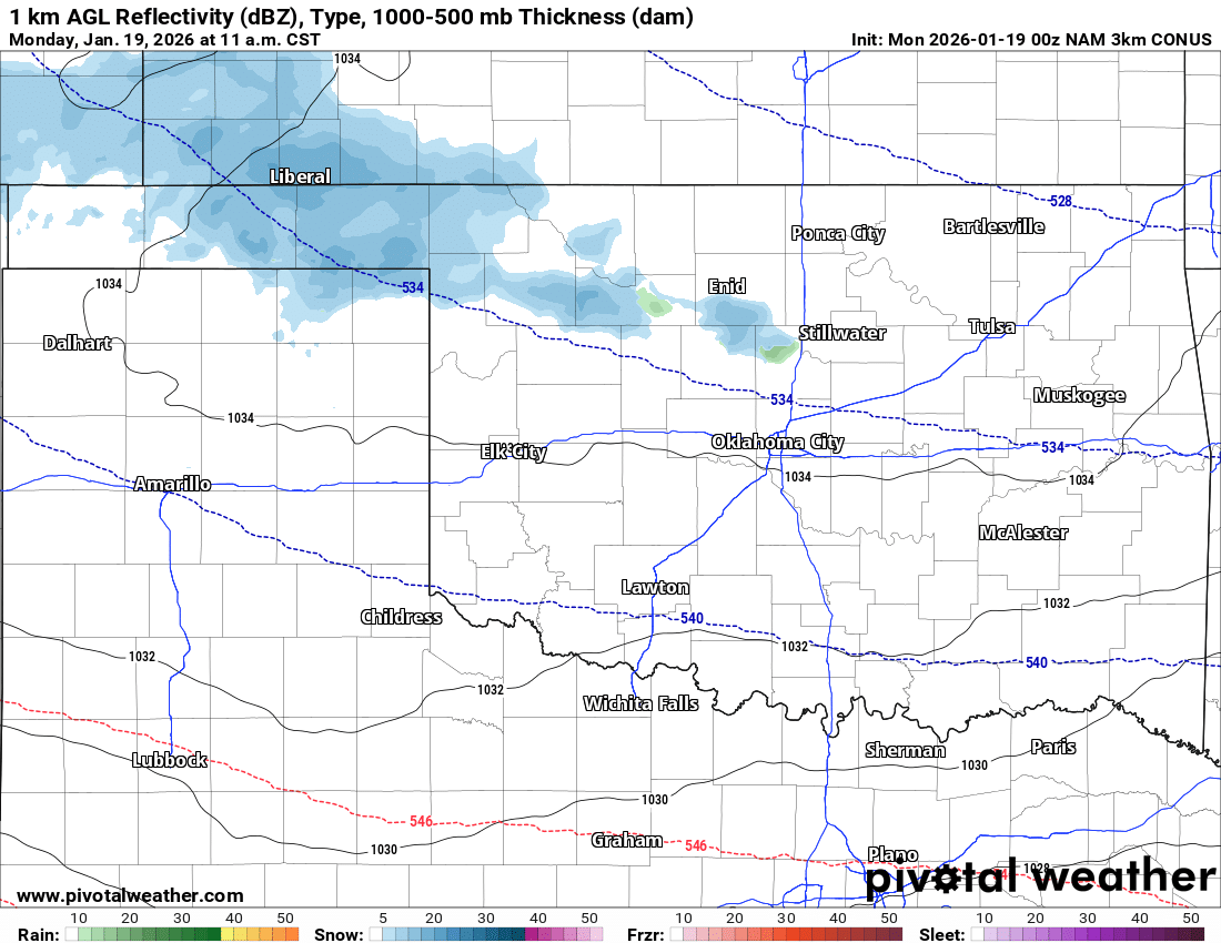
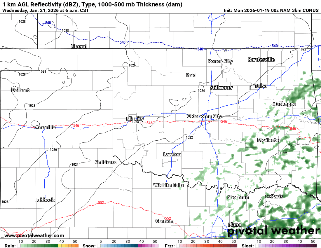
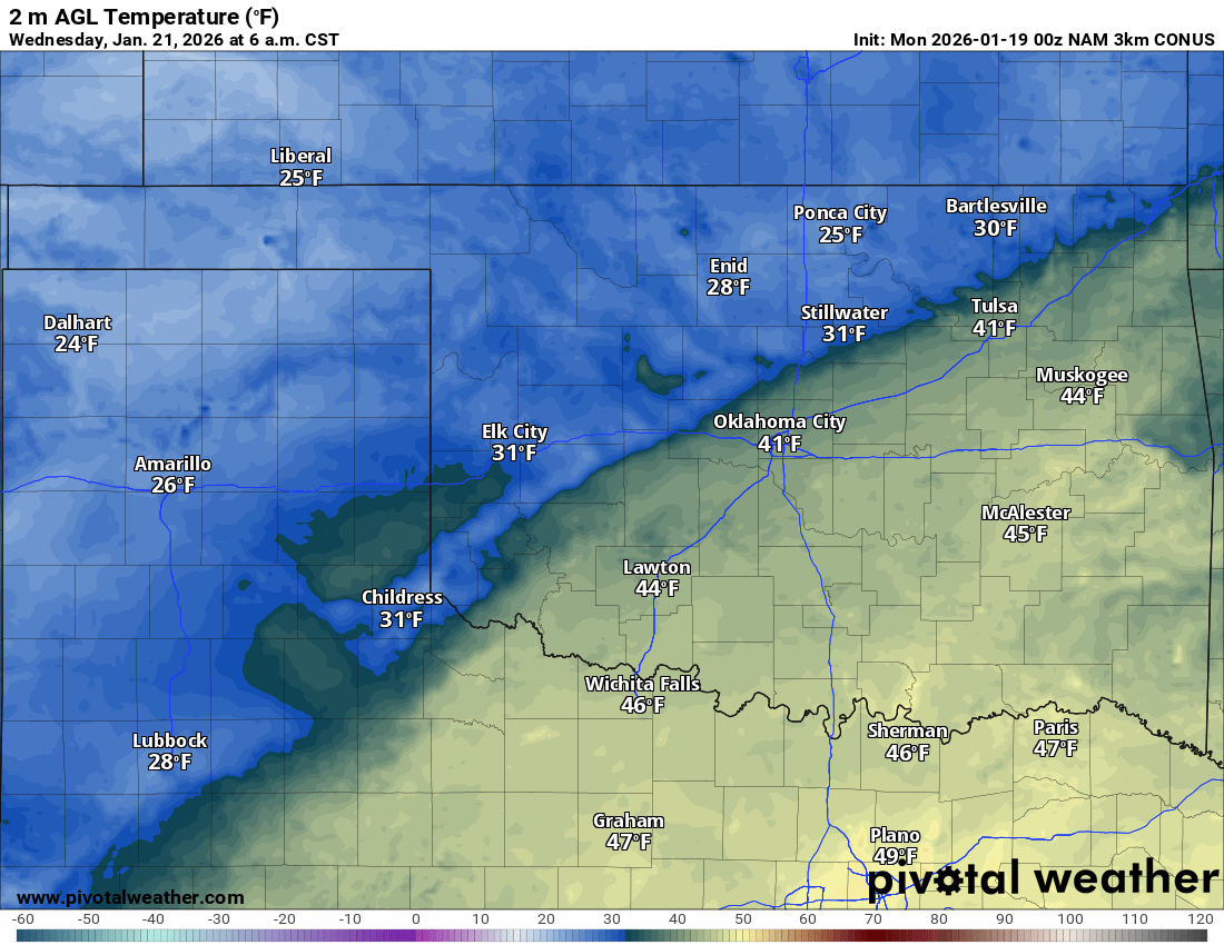
Let’s shift our attention closer to home. While the big story will evolve later in the week, we do have a couple of notes up front. Monday, another reinforcing shot of cold air will have moved in, and with it some very light snow across N/NW OK. You may get a brief skiff of snow to stick for a while before melting. Don’t expect any travel issues. It will be cold on MLK Day. Then we have another cold front moving in on Wednesday morning. There will be light showers and sprinkle activity from C to E OK. As the front moves south, it may cause a very brief light glaze of ice on bridges and overpasses before the drier air moves in. It’s a low probability, but something to watch for. The map shown below highlights the leading edge of the freezing temperatures in blue. By late morning, temperatures will climb above freezing.
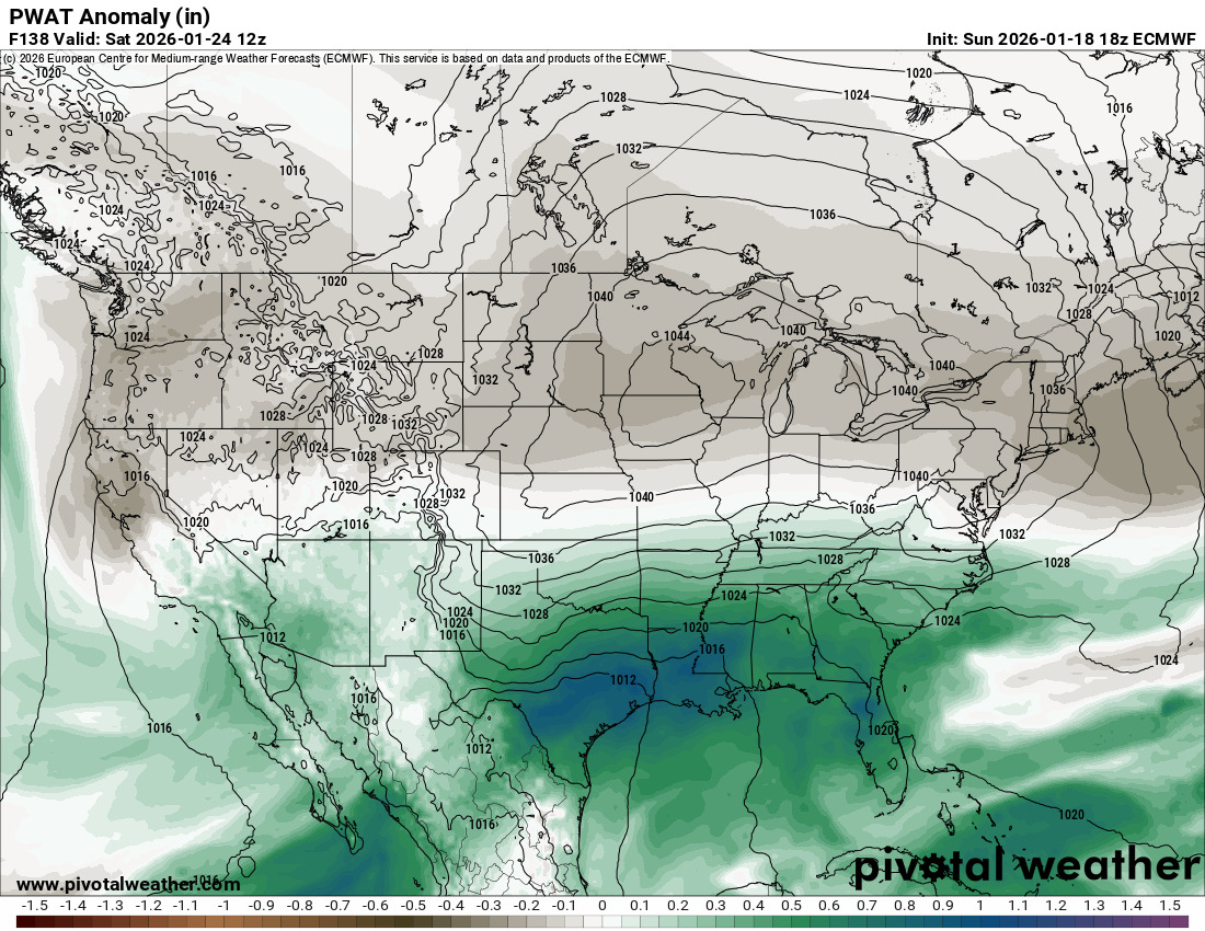
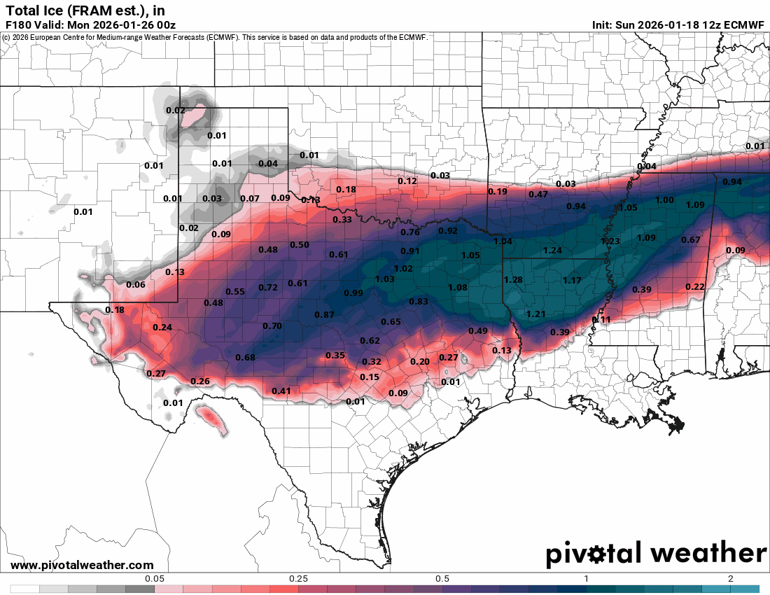
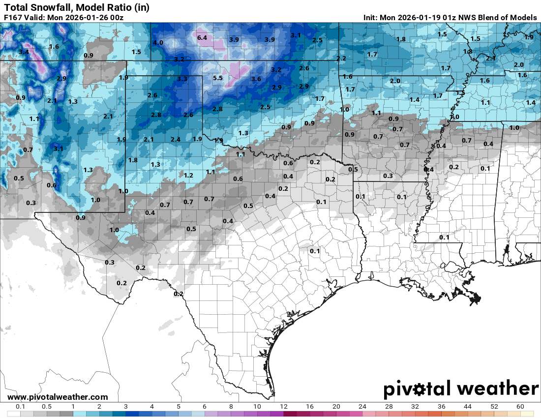
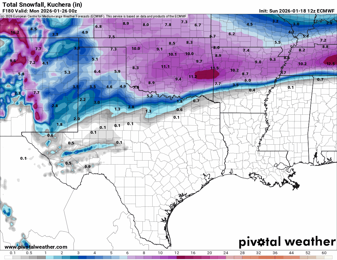
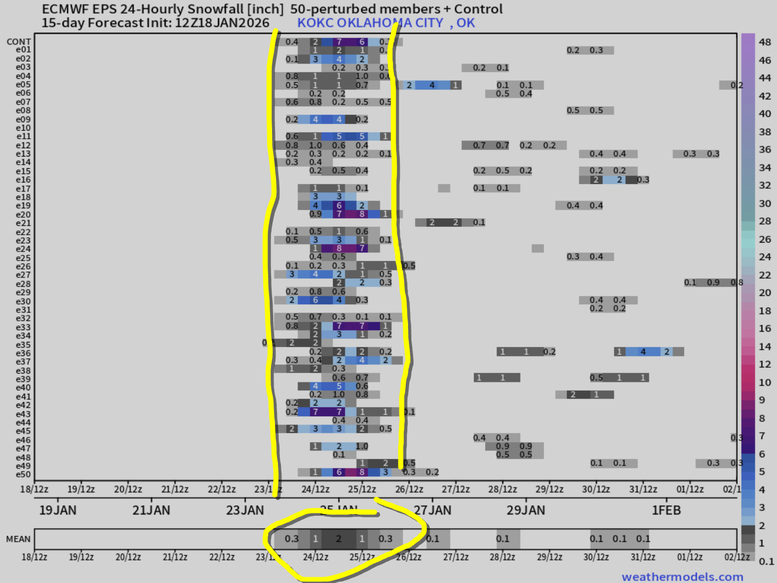
Now, back to the end of the week. The cold air moves in on Friday, and the upper levels start to saturate our atmosphere. So wintry precipitation should begin to develop. The precipitable water column in the atmosphere is above normal, so we finally have some decent moisture to work with. This will be in many forms, from rain, freezing rain (ice), sleet, and snow, stretching from southern Kansas to southern Texas and points east. The activity should continue through the weekend. Right now, the model consensus is to end it Sunday morning. There is a differing option where the upper storm comes across in two waves. The first prolonged wave is Fri-Sat, and the second, Mon-Tue. Today, that solution is an outlier, so going with the weekend time slot for now.

Ferguson Roof Systems is offering an AT's Weather special!
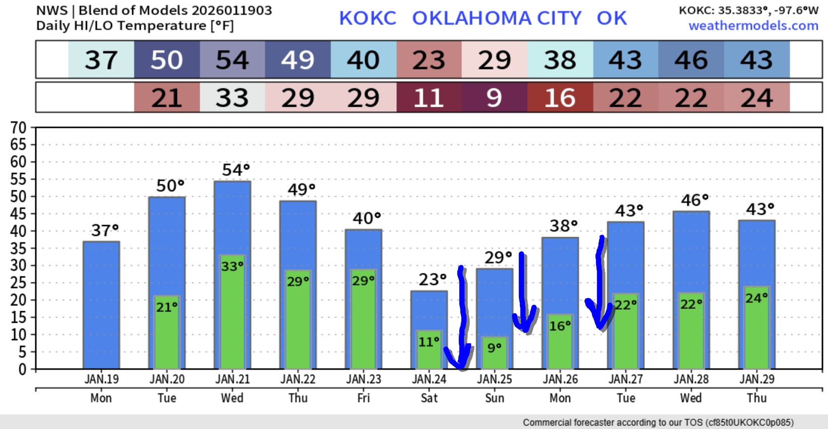
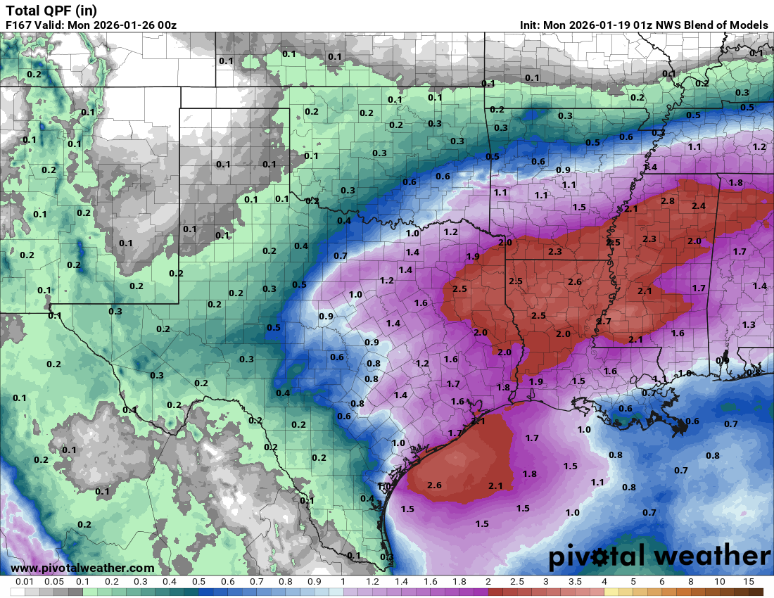
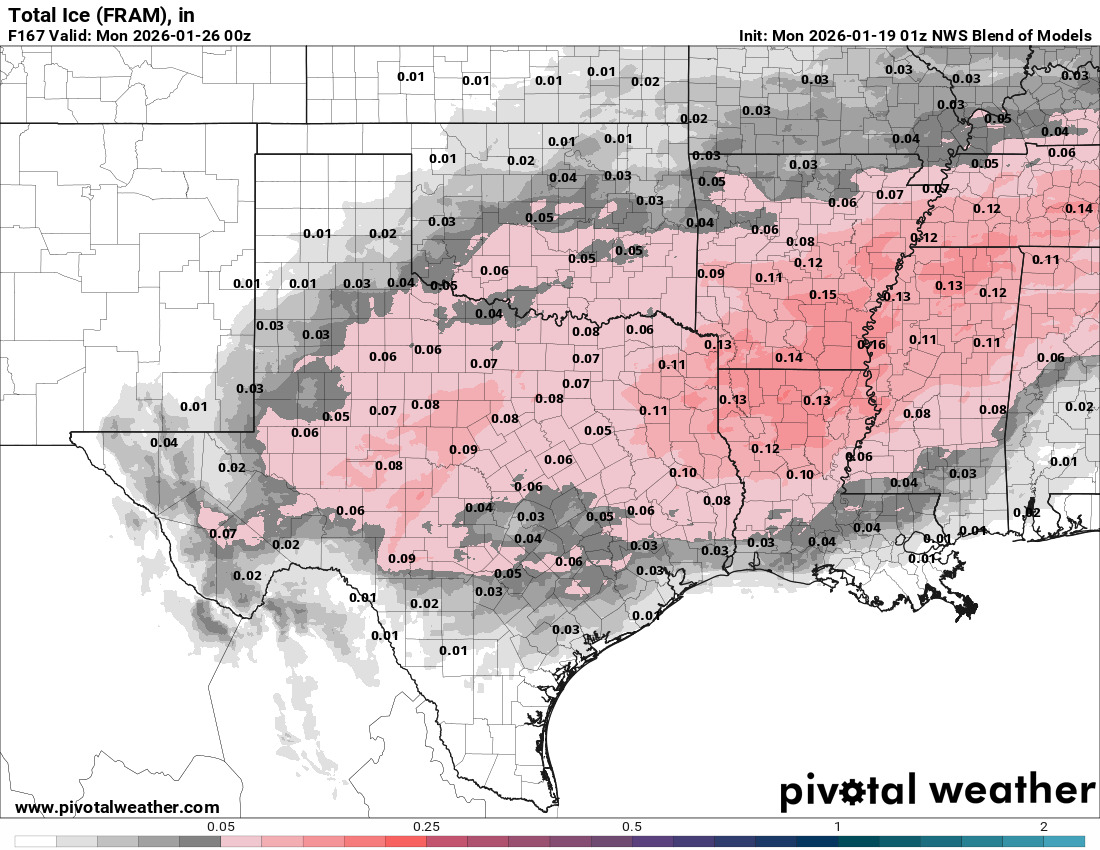
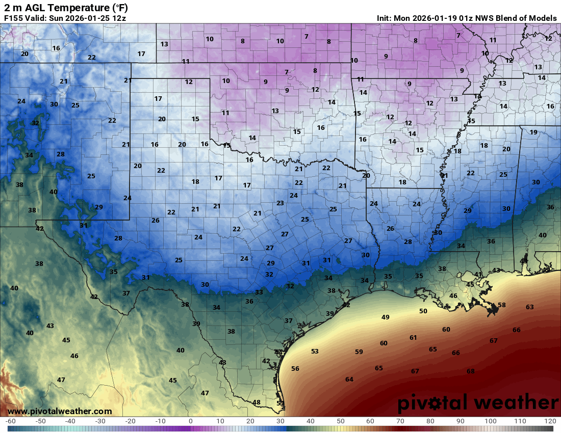
Let’s talk precipitation amounts. The conservative model blend shows the total QPF, what would fall if it were all raindrops. All of these values are likely underdone should the precipitable water count be accurate. There is an old saying though, that drought breeds drought. So this old adage does have me holding back extreme excitement for the higher amounts the other operational models are indicating below. Regardless, I’m showing them to you because it indicates what IS POSSIBLE should things align just right. Sunday morning will be very cold with single digits returning. It could be colder than this. Pipes will need to be protected this weekend.
The temperature trend will be a shock to your system. May get colder than indicated Sat-Tue. Get ready! Break out all the cold-weather gear…and I’ll be updating you throughout the week on the ice and snow totals. Oh, and remember you can get all of your daily weather information and track radar with my free weather app, ATsWeatherToGo, on Apple and Google app stores. -AT