It’s All About the Heat
We’ve finally made it to that period were we bake and suffer. Last week was a nice break before the inevitable arrives.
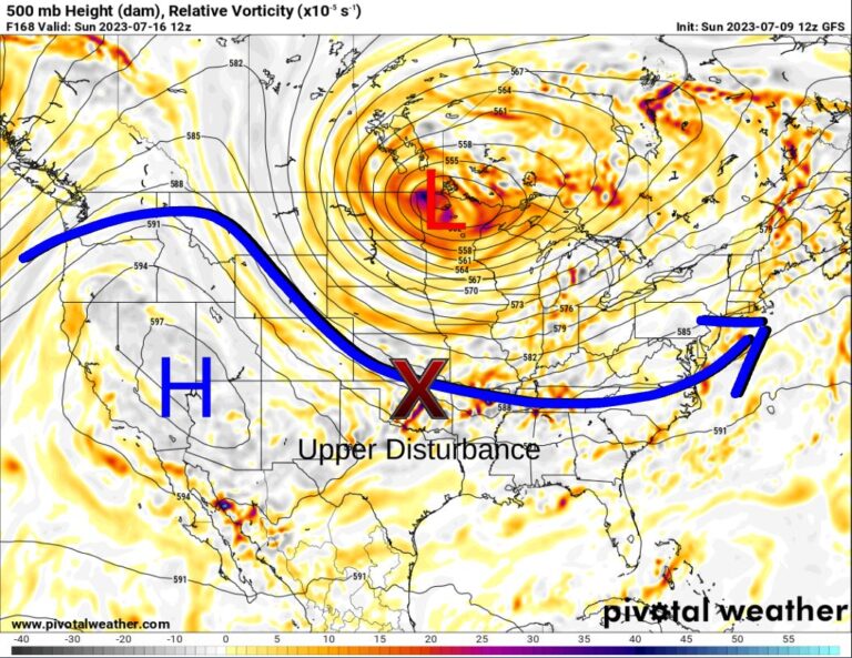
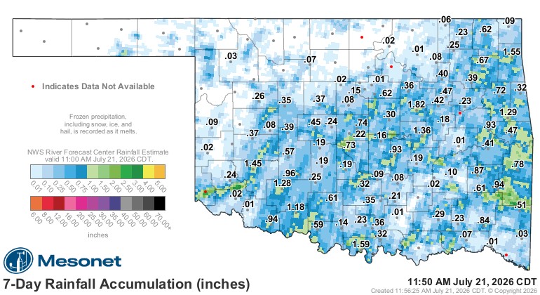
The pattern with the upper ridge centered across the N Plains allowed the E to W flow of isolated showers and storms, which brought some of you some good rain!
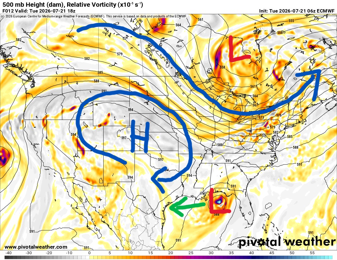
However, that rain train has been shut down for the next several days with the exception of one opportunity. The jetstream animation shows one disturbance riding into Oklahoma from Colorado Friday night, dragging a weak front with it. That’s our only hope for any organized rain activity. After that, the ridge continues to build overhead, and we’ll start to dry things out regarding our vegetation.
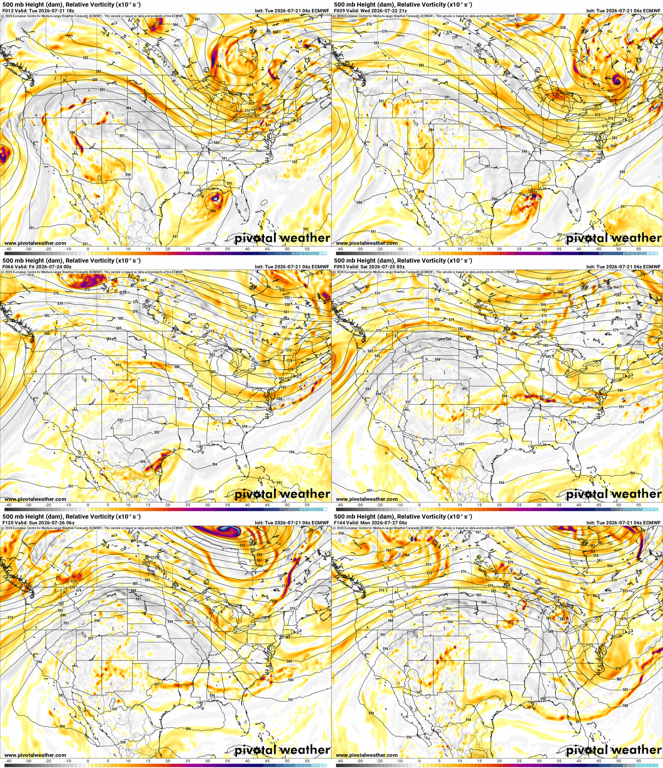
The rain window will be from Friday afternoon in NW OK to the rest of the state through Saturday morning. A lingering weak boundary may allow some isolated activity Saturday afternoon, but that’s about it for the rain signal.

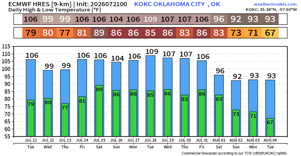
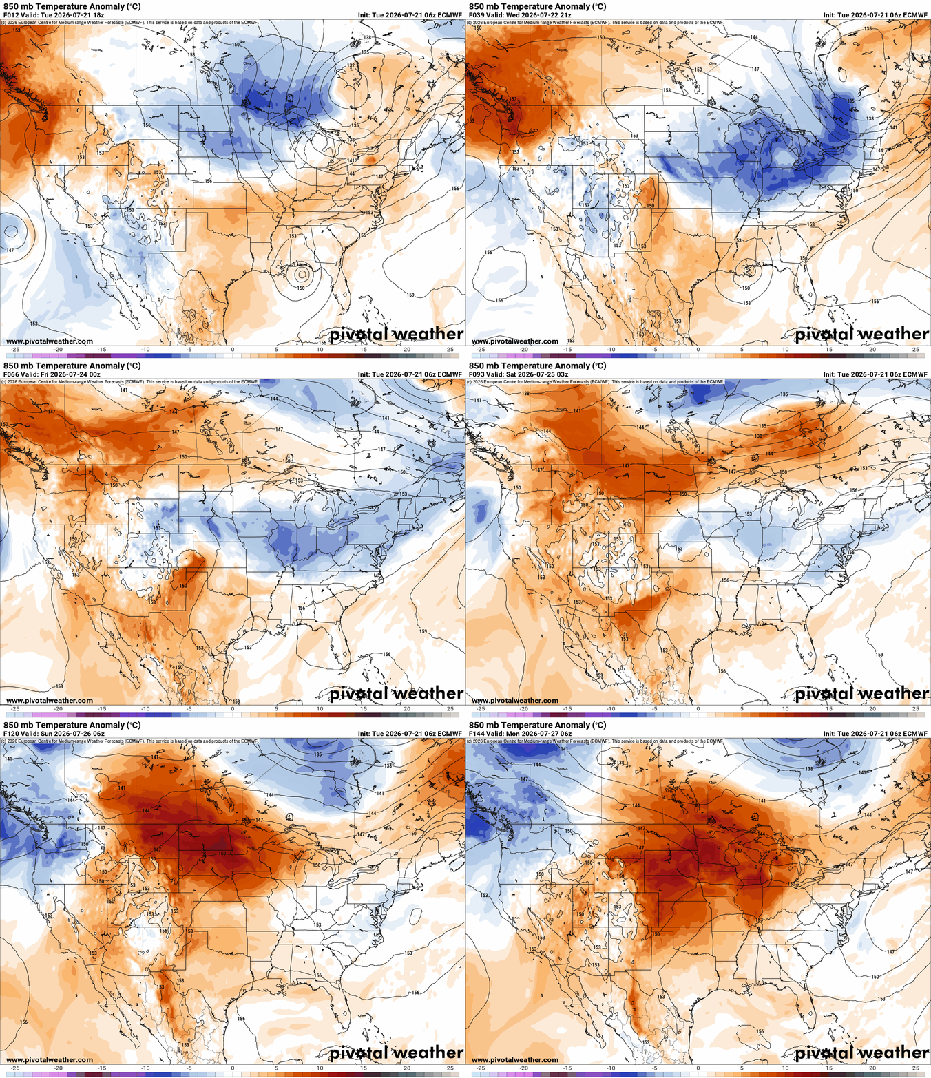
The pattern will build the heat long-term across the C US as the week progresses. The 850mb temperatures are well above normal, and this trend will last through the rest of July. We’ll see how August plays out.
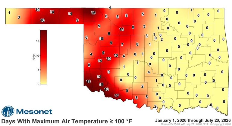
Yesterday we saw a few 100s out there, and surprisingly, most of the extreme heat has been confined to just a few areas of the state where temperatures climbed above 100 degrees several days this year.

Ferguson Roof Systems is offering an AT's Weather special!
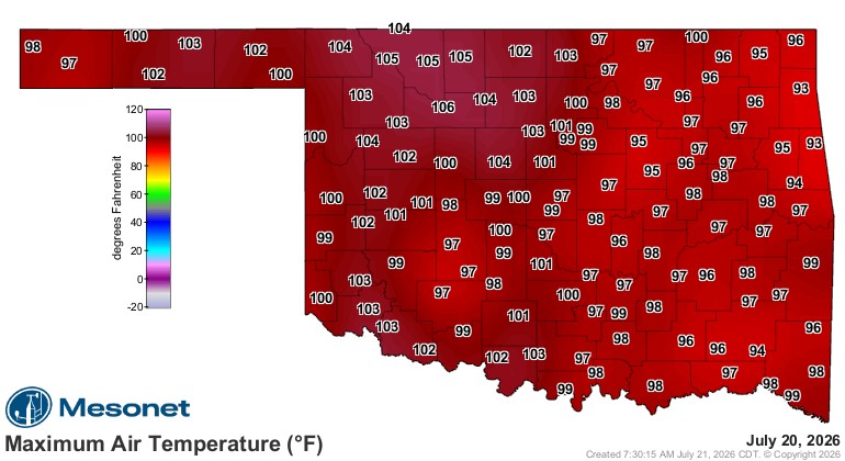
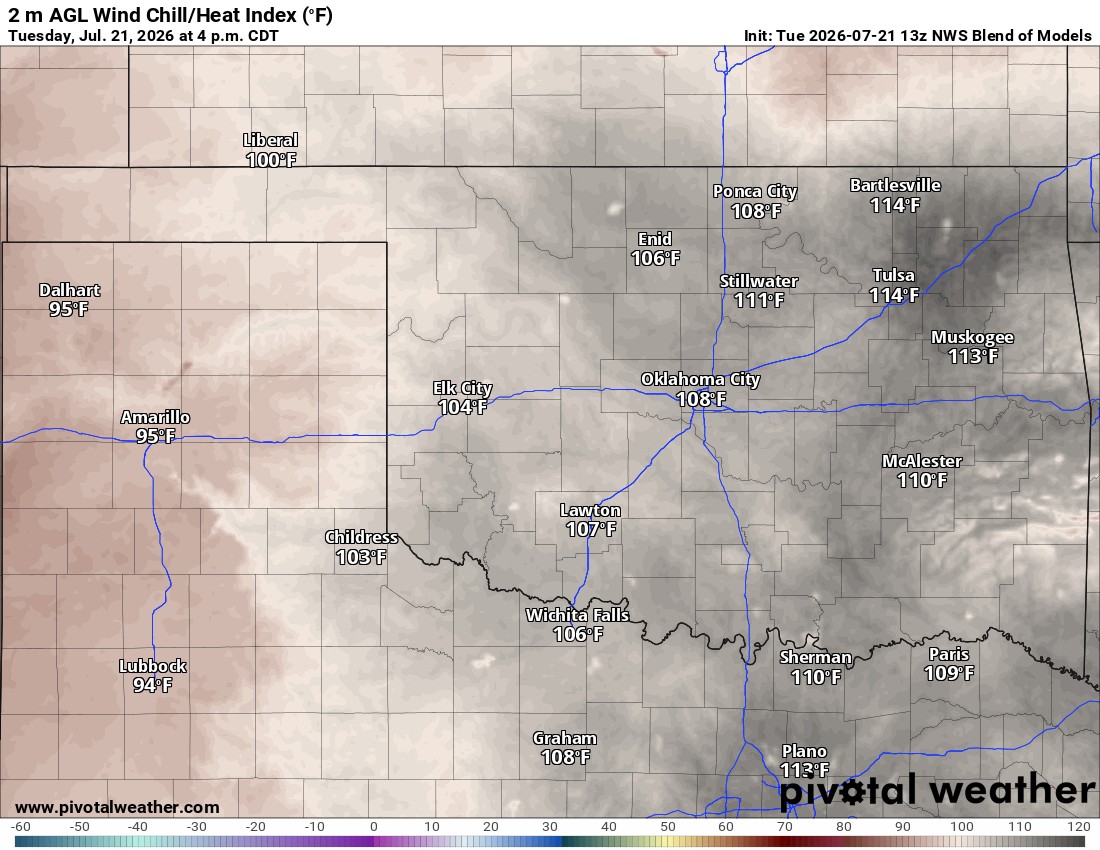
At the time of this writing, we’re already seeing temperatures over 100 degrees at 11:30am! The heat index is even worse.
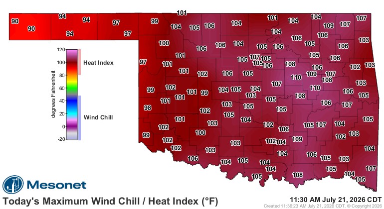
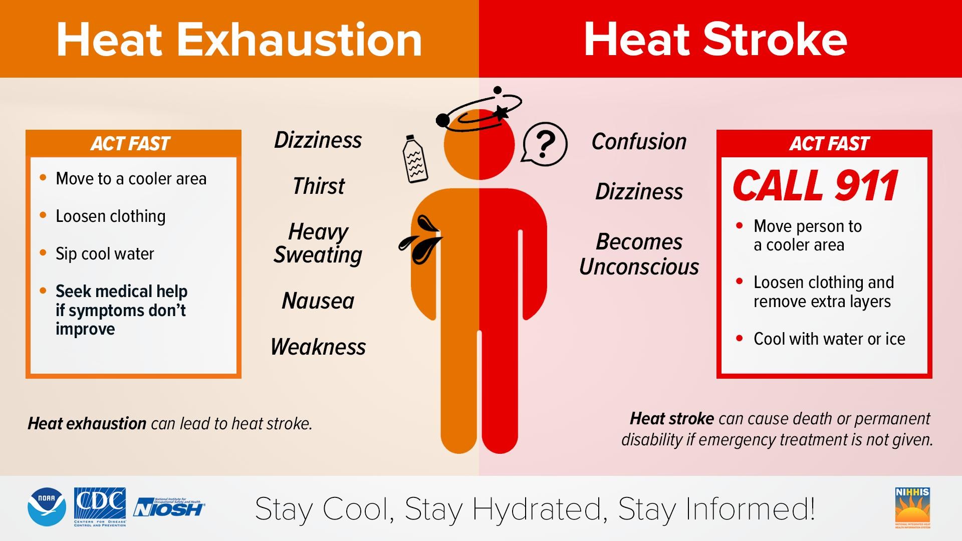
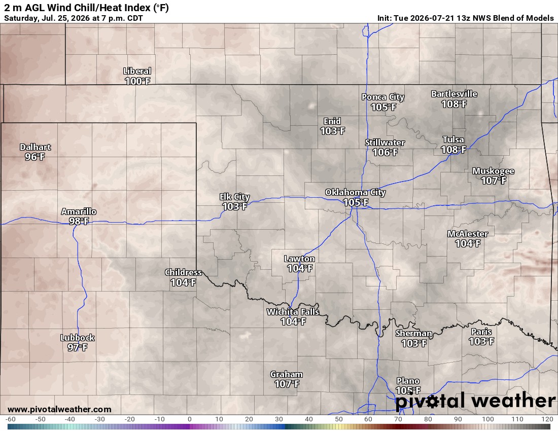
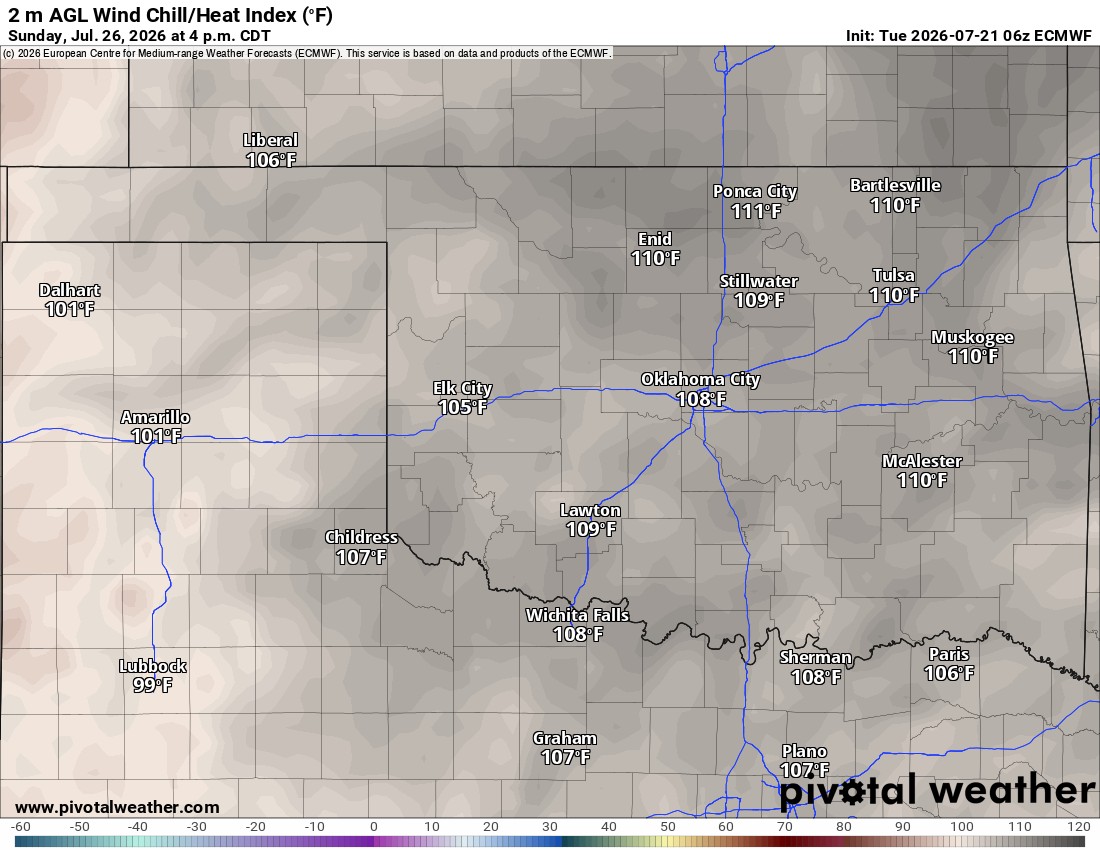
The heat index will be the highest today, Saturday, and Sunday, with it feeling well above 100 degrees. Take the heat safety advice. An extreme heat warning is in effect.
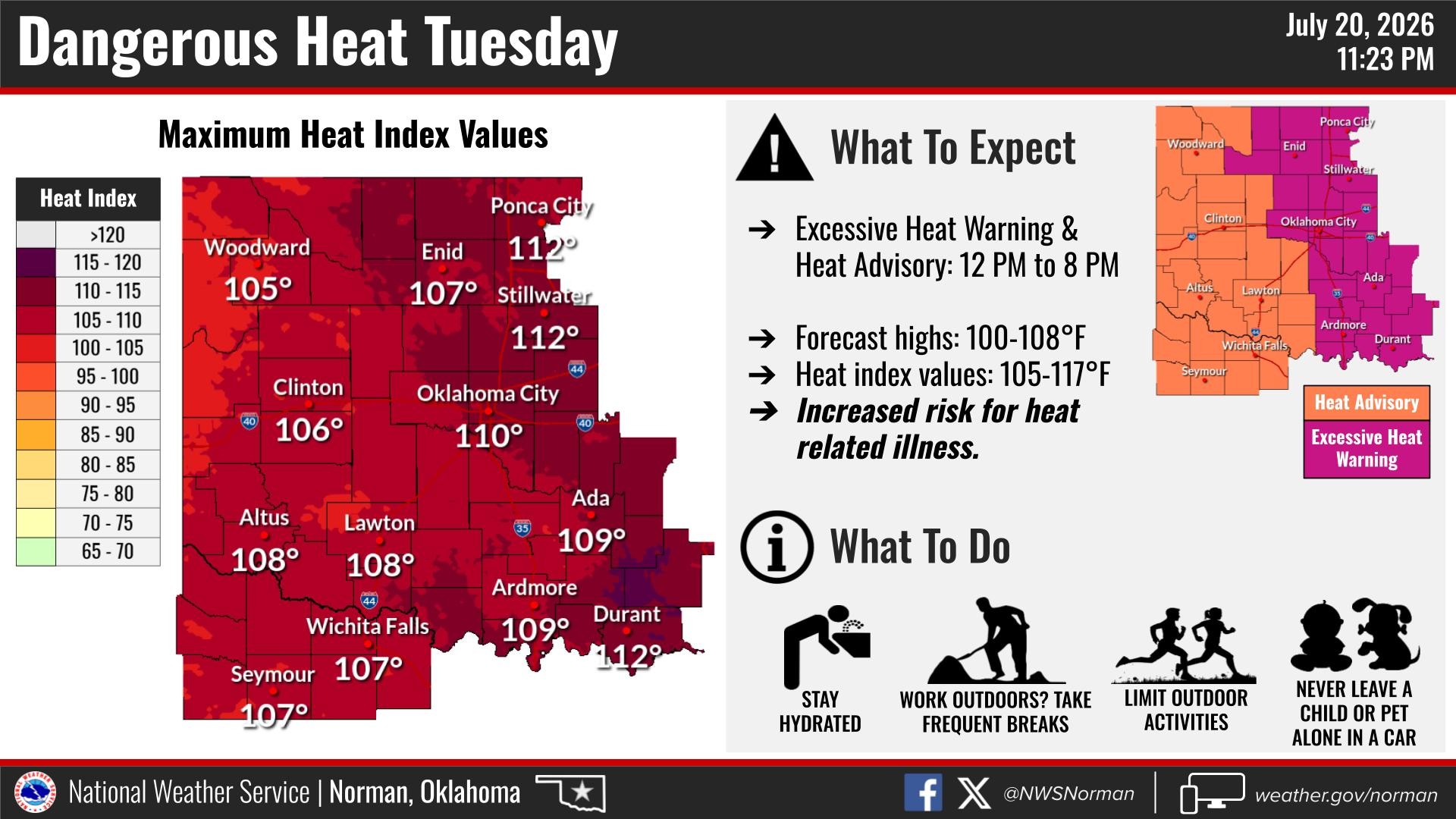
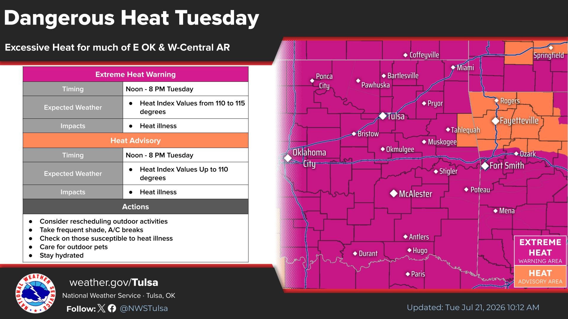
There is no relief from the heat, so get used to it. This too shall pass. -AT