The New Year Brings Rain and Snow…Finally!
Happy New Year! It isn’t much, but we finally have something to talk about this winter season. Two back-to-back storm systems will roll through, with the first bringing rainfall and the second bringing snowfall.
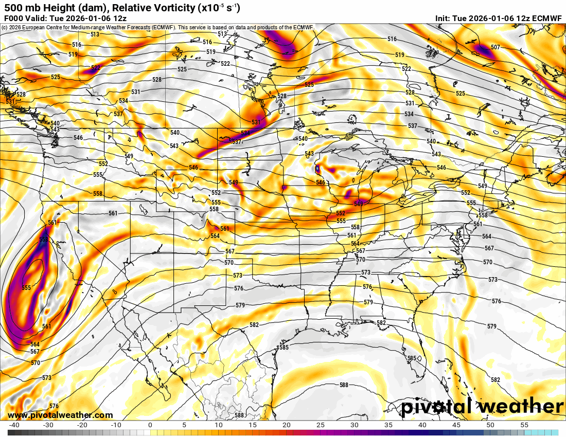
The Jetstream animation shows how they will work through Thursday and Friday.

Be sure to mention Aaron Tuttle when you call (405) 820-1193!
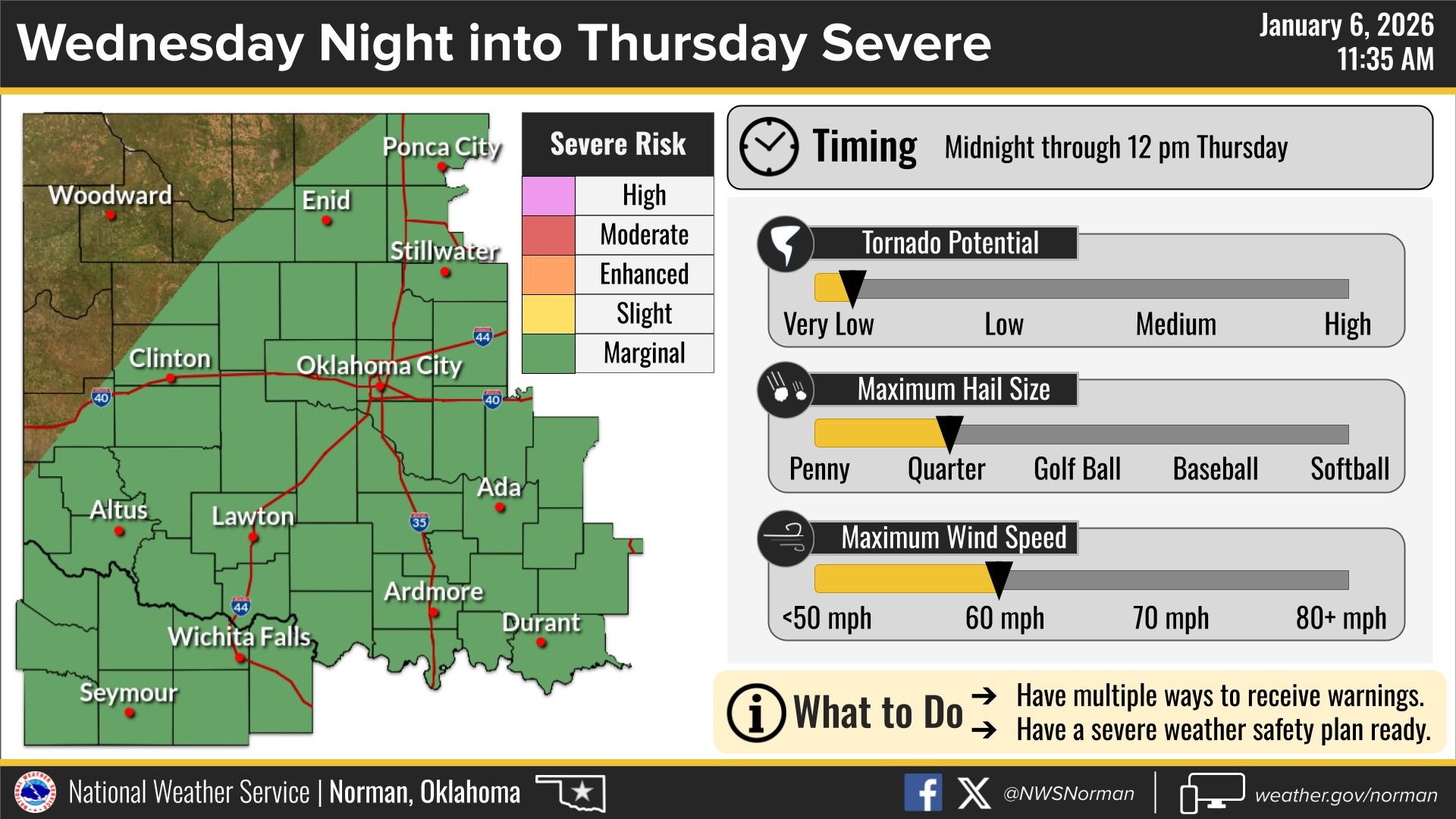
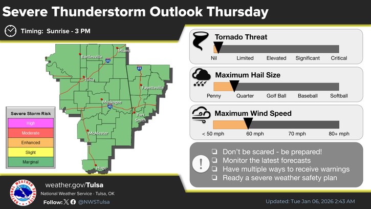
There is actually a marginal risk of severe weather for the storms on Wednesday night and Thursday, but don’t get too excited. Nothing significant is expected.
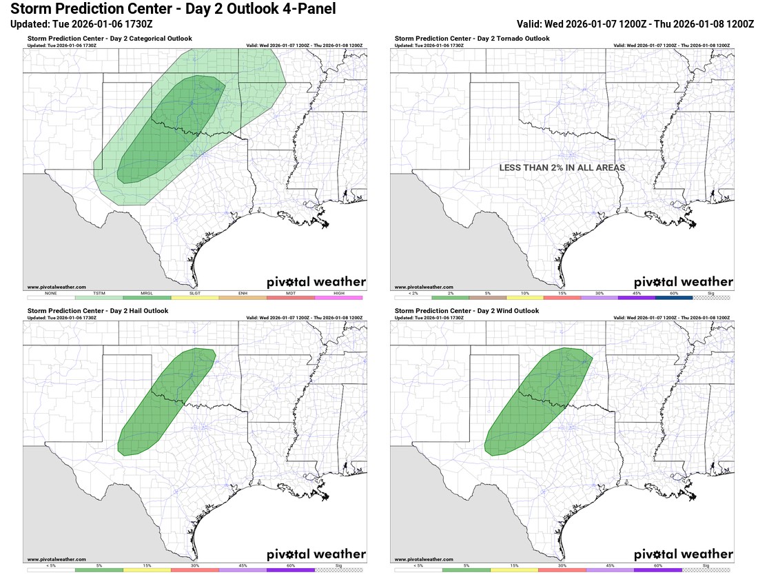
The precipitation is good timing, as we’re getting into a fire weather pattern if we don’t start getting moisture around here. The long-term outlook is fairly dry after this round, and temperatures will finally cool down again. The rain should start mid- Wednesday evening and wrap up Thursday afternoon.

Ferguson Roof Systems is offering an AT's Weather special!

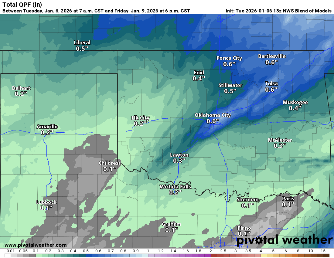
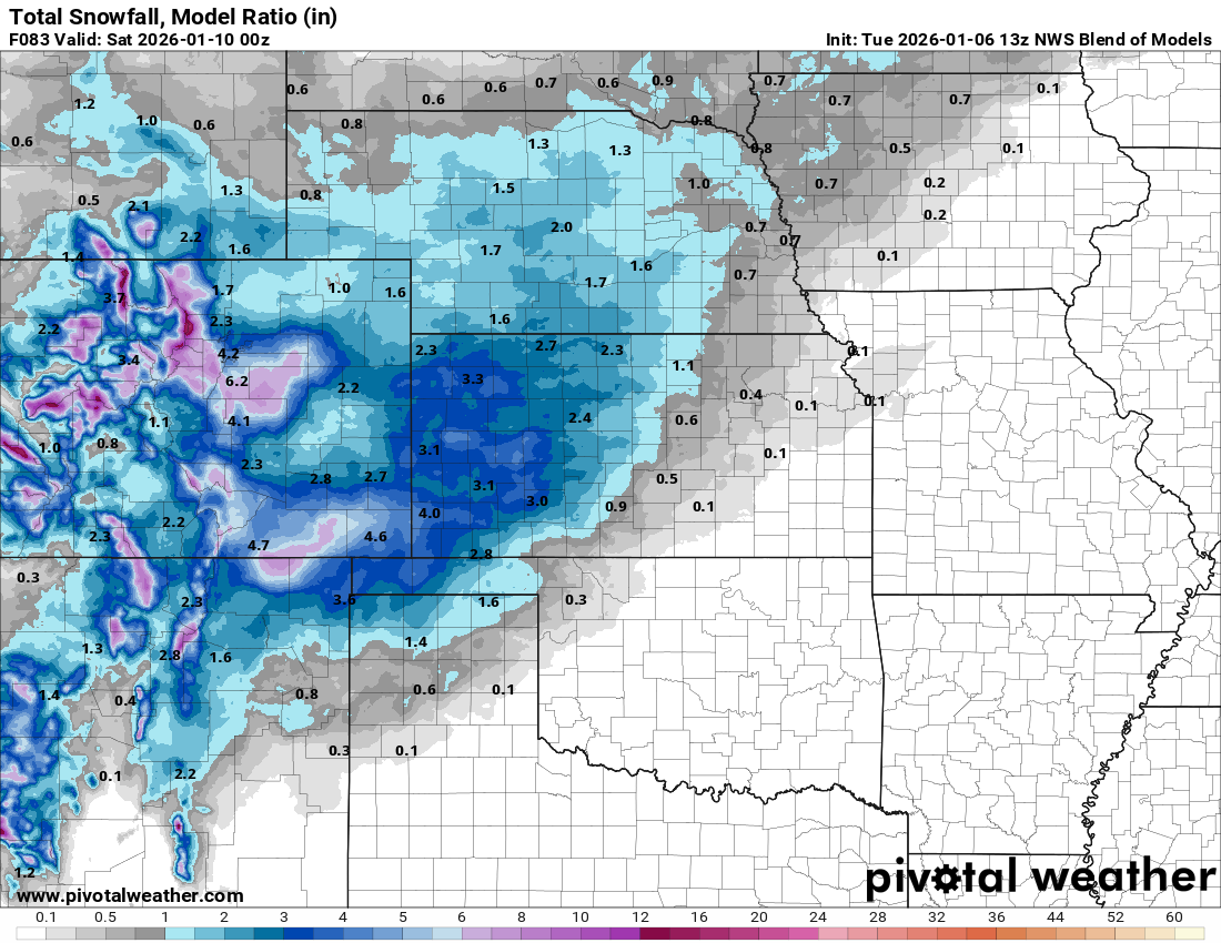
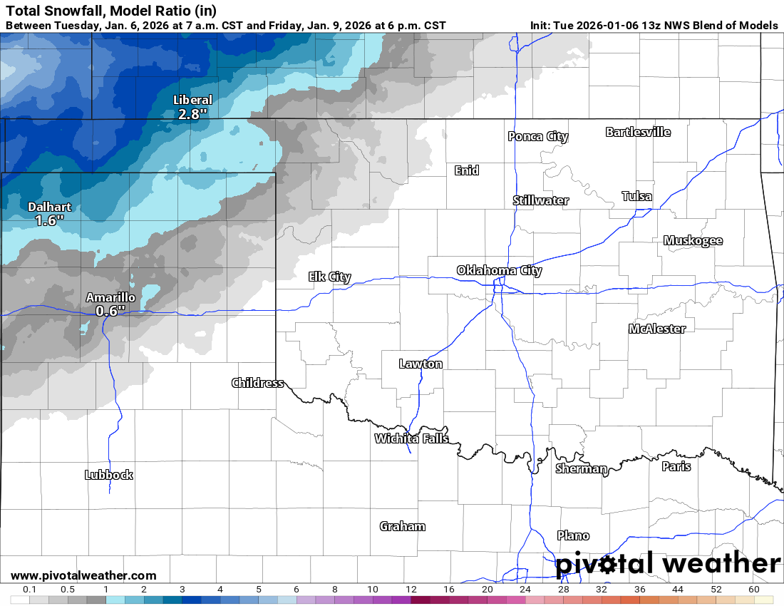
The system for Friday should bring some decent snowfall across the TX and OK panhandles. The gradient will fall off once you get east of Woodward. Additional decent snowfalls will also occur across Kansas. The conservative model blend is shown below. Should be some decent melting with warm ground temperatures and air temperatures fairly mild.
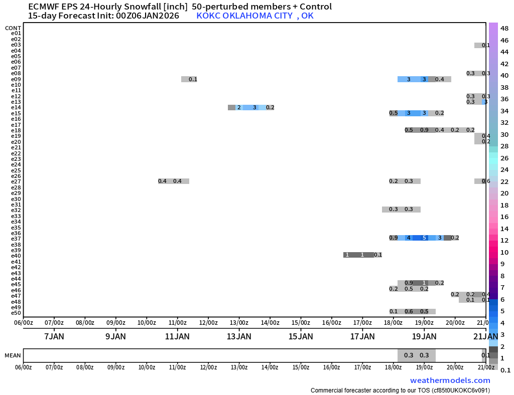
I’m trying to find you some snow for OKC. The Euro ensemble model hints there might be an opportunity around January 18th. We’ll see!
Ferguson Roof Systems is offering an AT's Weather special!
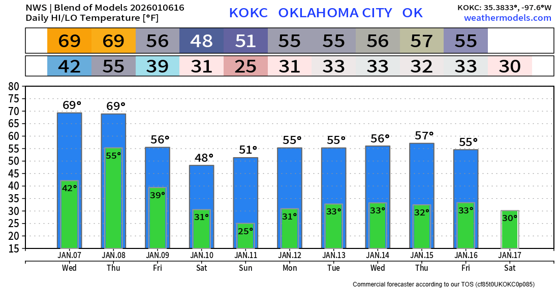
Your OKC temperature trend is below. Enjoy the mild weather through Thursday! -AT