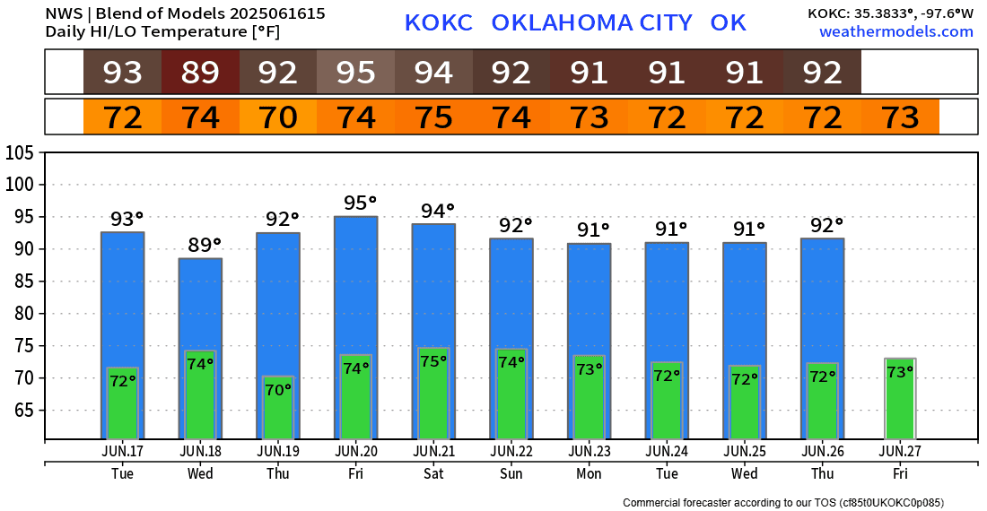
More Storms, Then We Dry Out

We’ll be in a NW flow aloft through Wednesday, which will drive in two rounds of storms, and then a cold front to trigger a final round. After that, we go into a transitioning pattern, which will allow us to dry out and heat up.
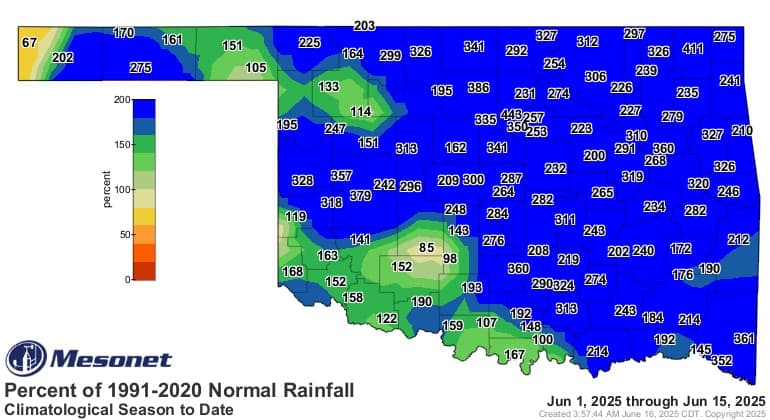
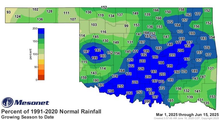
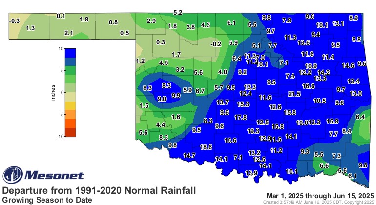
Before we get into the rain ahead, take a look at the rain behind us! Wow! If you thought June was wet, you were right! 400% above normal! Even our growing season, starting March 1st, has been amazing with rainfall totals. Some areas picked up nearly 2 feet more than normal.
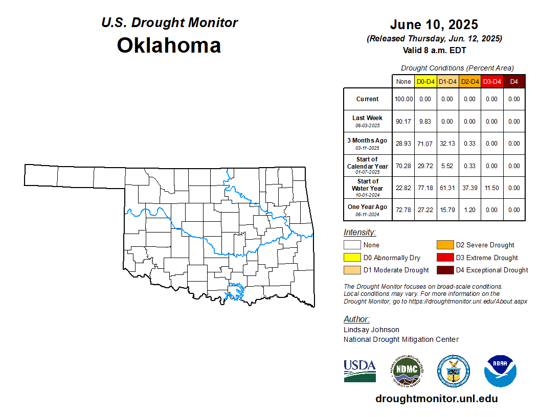
As a result, this is probably the first time in many years that we have absolutely zero drought across Oklahoma. Including the panhandle!
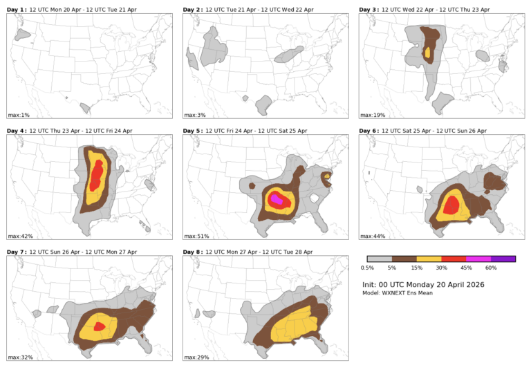
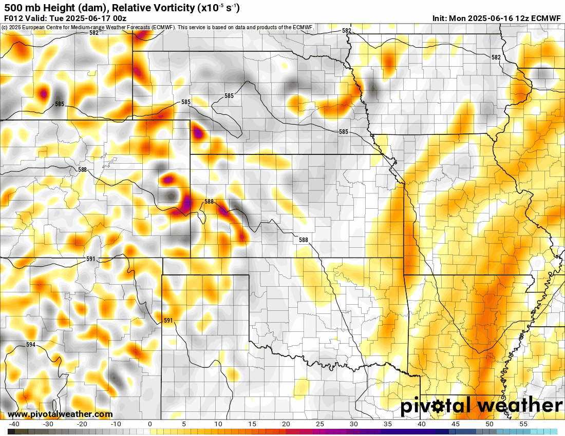
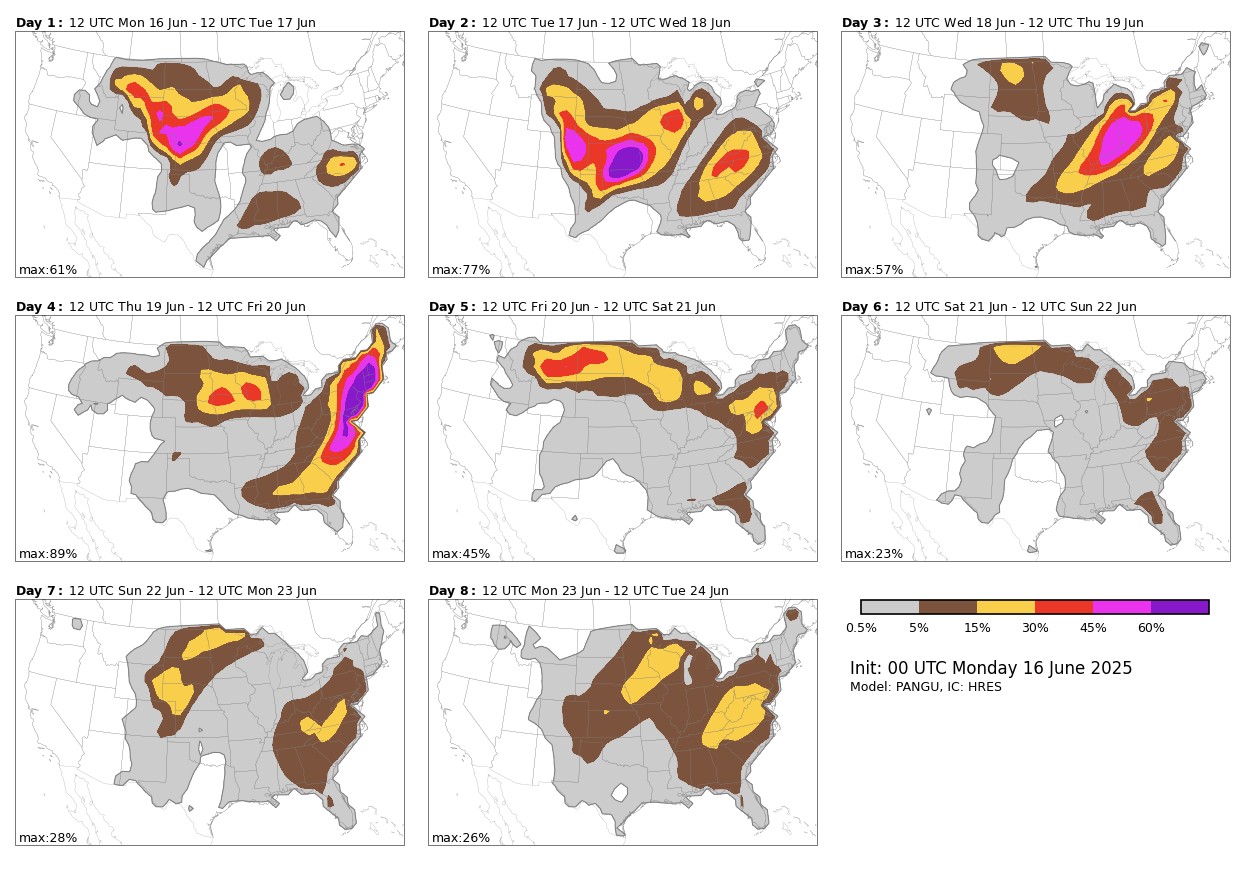
So our upcoming event window is caused by small upper-level disturbances rotating around an upper ridge of high pressure parked over Arizona. While they heat up, we get more rain. The brighter the color, the stronger the lift in the atmosphere, and therefore the rain signal. Play the animation to see how they rotate downward out of Kansas.

Ferguson Roof Systems is offering an AT's Weather special!
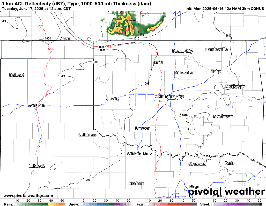
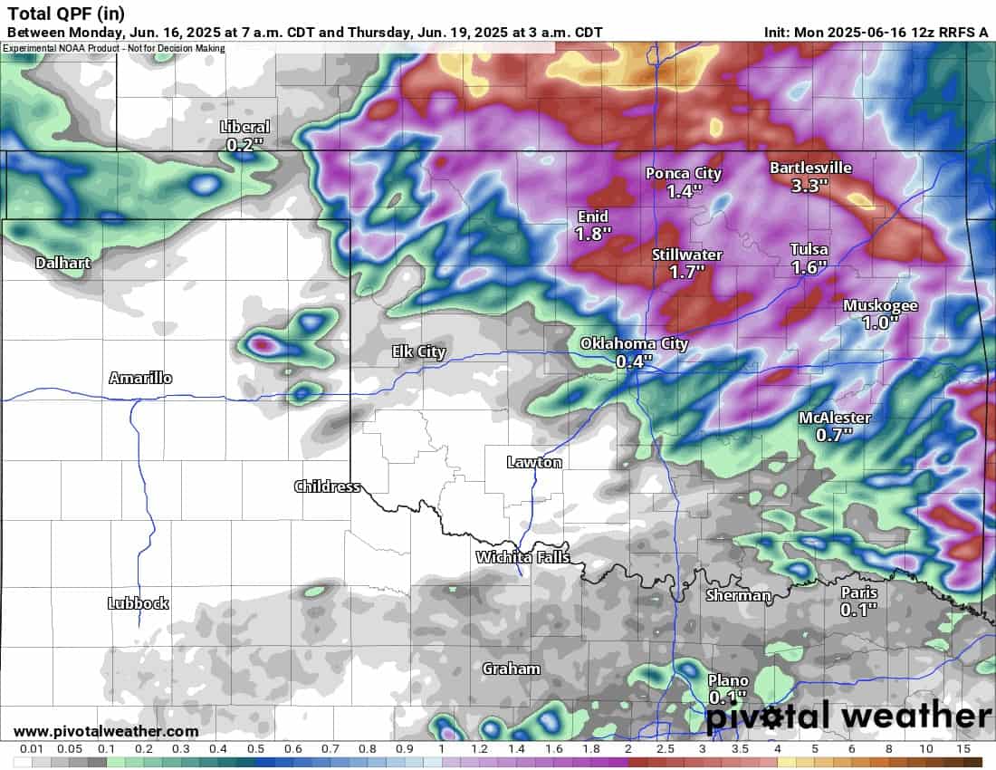
This will translate into an overnight cluster tonight and early Tuesday morning, and another cluster Tuesday night, Wednesday morning. A weak cold front will also move through Wednesday, so expect additional development along that boundary Wednesday afternoon and evening. Most of those storms may be confined to the SE 1/4 of the state. Just depends on where the final positioning ends up by late day.
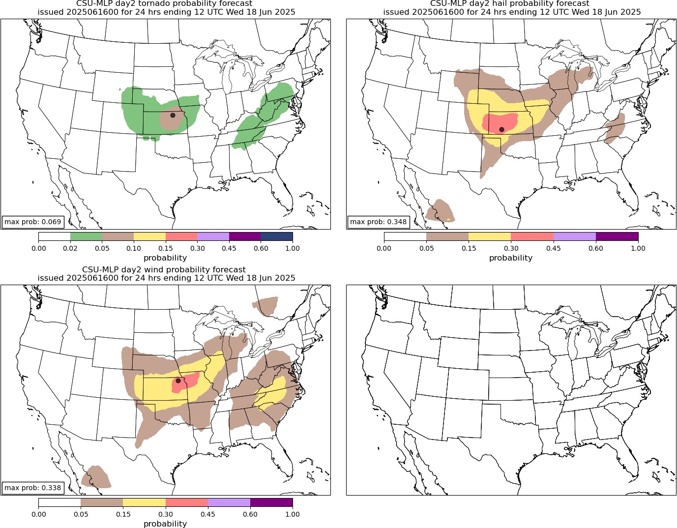
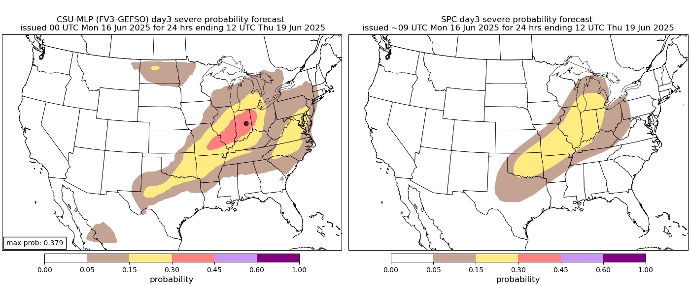
Regarding severe weather, as we’ve found out recently, it can still happen. Tornadoes are freak occurrences, and wind and hail are the primary threats, with slow-moving storms producing brief flash flooding. Typically, the hail sizes come down due to warmer temperatures aloft, and wind can approach 70 mph in the strongest storms. Kansas will be the exception on Tuesday, as it will experience all three threats: large hail, damaging winds, and tornadoes. You can see the severe weather graphics from AI and the SPC.
As far as temperatures are concerned, we’ll heat up after the rain shuts down, but a pattern shift of an upper ridge developing across the SE part of the US will put us in a tropical southerly flow for the rest of the month. This will keep us a little cooler and eventually bring back some rainfall. More on that in the next forecast blog. -AT