More Showers, Storms, and Cooler Heat

Yeah, you’ve got to say cooler heat, because it is still August, but hey, this summer has been great thus far overall! Cooler temperatures will be accompanied by additional rainfall.
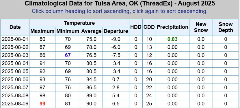
I understand it’s not all roses. NW Oklahoma reached 108 degrees for a daytime high last week. The good news is that it is an exception to the rule this summer and has a lot to do with the lack of vegetation and a downslope flow close to the Rockies. We shouldn’t see that type of heat this week. As a matter of fact, some rain should fall over those same areas starting with Sunday night. You really don’t see these types of temperatures in OKC during the first week of August that often. Tulsa wasn’t quite as cool.
 Restoration and Disaster Cleanup Service
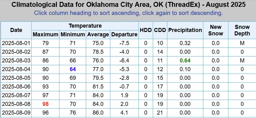
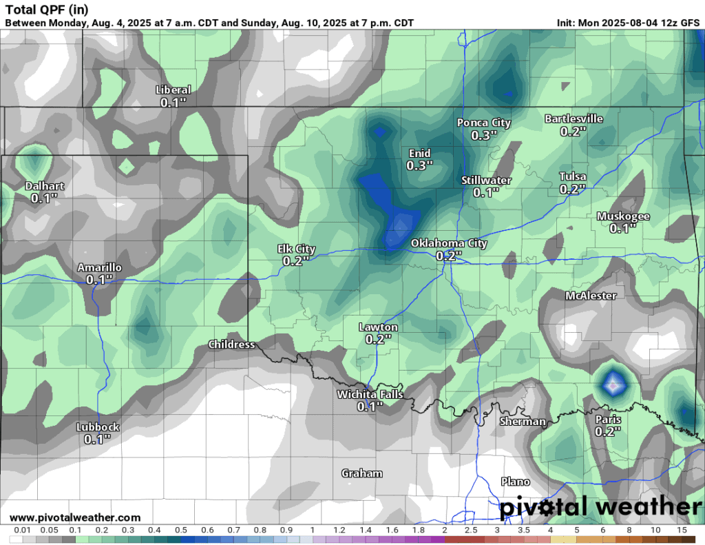
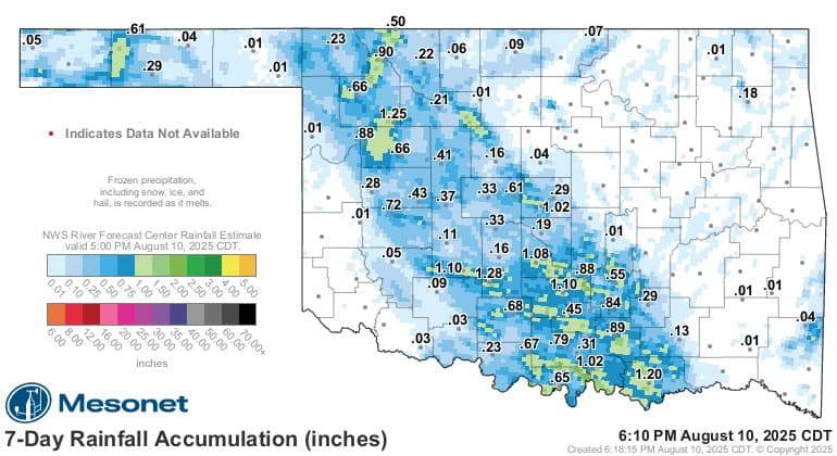
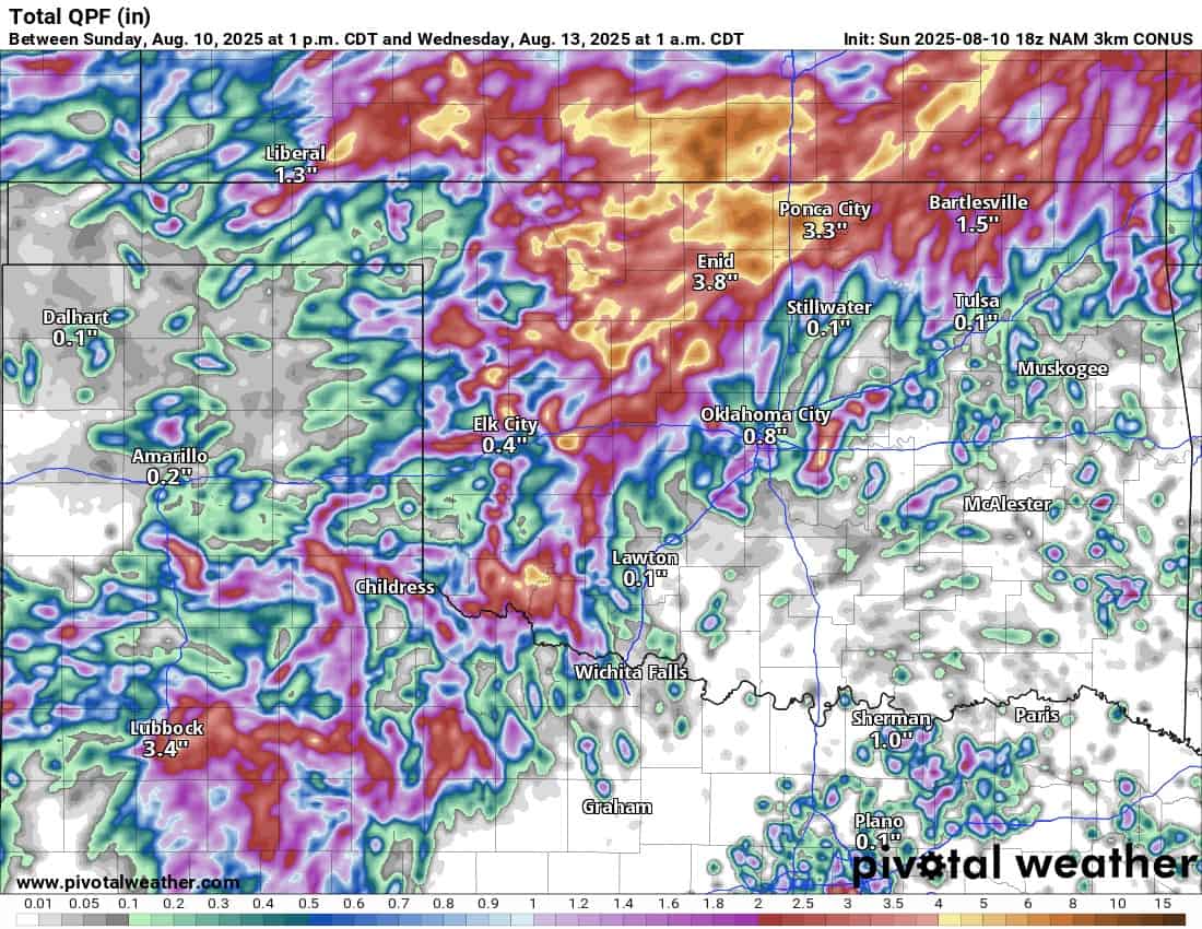
Speaking of rain, before we get into this week’s opportunities, I want to remind you that computer model forecasting of rainfall totals and placement during the summer is far less accurate than during the other times of the year. That’s due to the more isolated nature of the rain showers and the random probability of placement. During the summer, we typically don’t get much synoptic help to drive the rainfall, and that causes the randomness and low probability outcomes. Case in point, here were last week’s forecasted rainfall totals, and the actual totals. Not terrible, as you can see the signal, just don’t depend on complete accuracy.
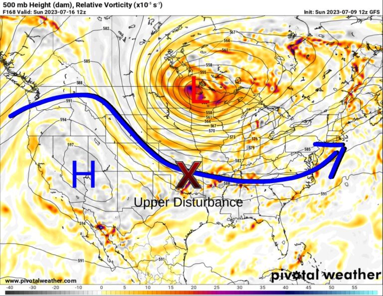
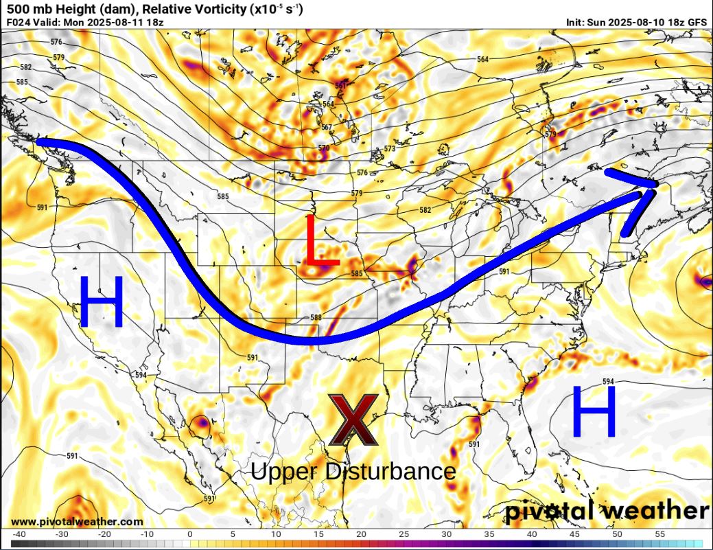
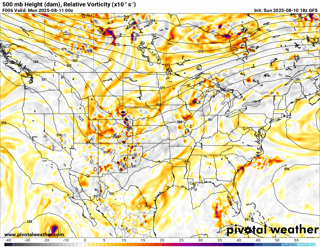
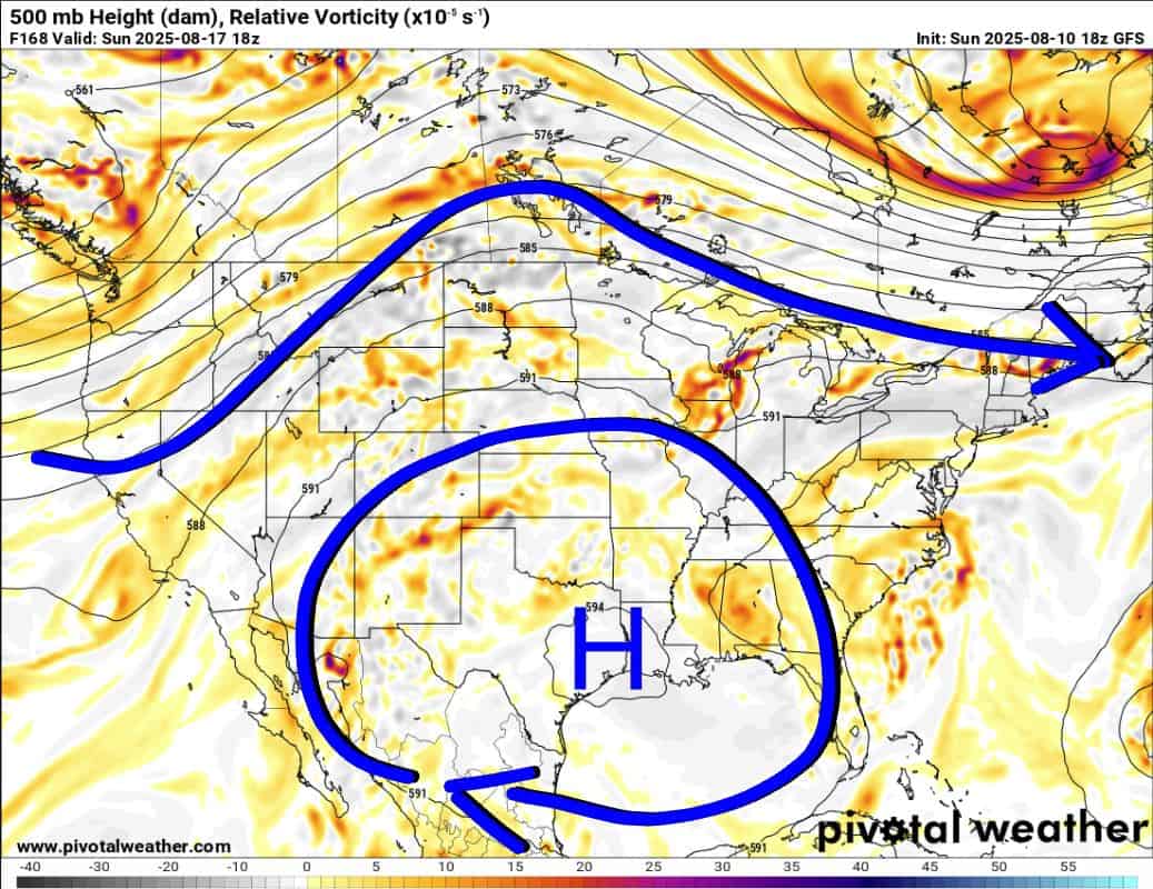
The Jetstream pattern this week will show a weak low in between two high ridges to the east and west to start off the week. Then that high across the SE will transition westward to Texas. That will move an area of weak lift back into Oklahoma to help generate more rainfall. The storm system to the north Sunday/Monday will generate some pretty decent storms, some severe, which is unusual for August. By the way, that upper high will keep moving, repositioning to the SW US, so the heat dome won’t establish itself here. Great news!

Be sure to mention Aaron Tuttle when you call (405) 820-1193!
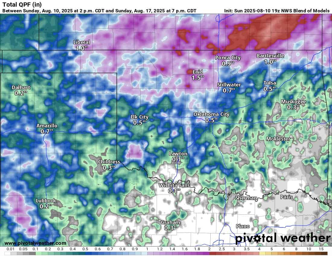
Rainfall animations are posted below from the short-term to the long-term. The majority of our rain this week will be through Tuesday. After that, expect more of the isolated variety through the week.
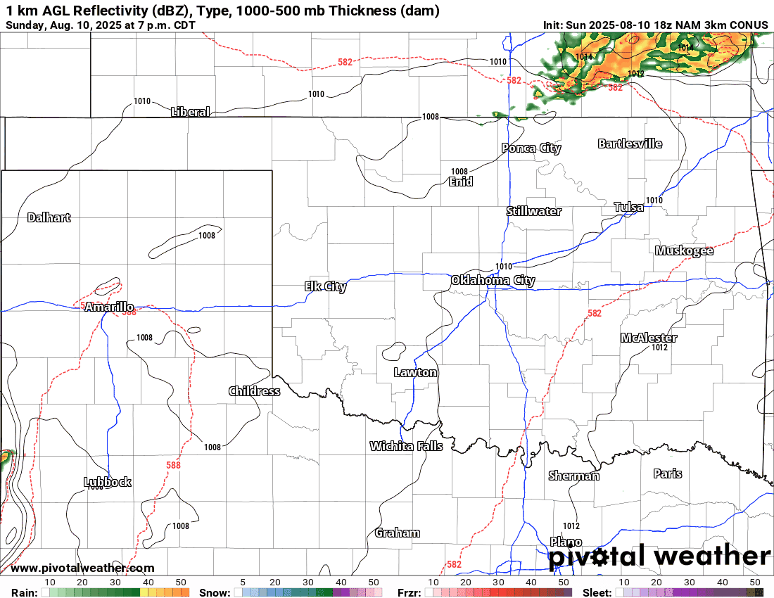
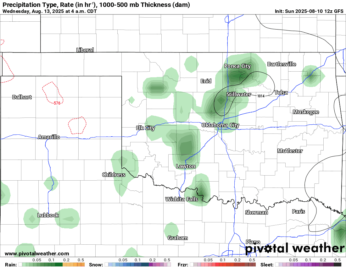
Rainfall amounts, like I mentioned, are tricky. The short-term models indicate the potential for flooding Sunday night and Monday, while the global model blend keeps it reasonable for the week.
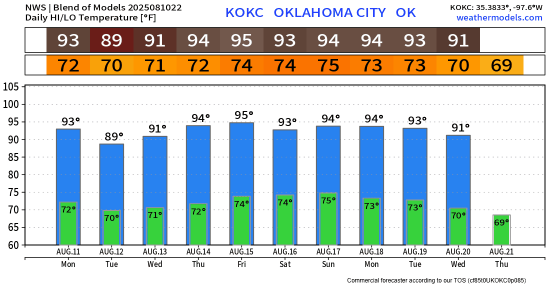
Temperatures for OKC will stay trending below 100 degrees again this week. Other regions will follow suit. Be sure to download my free weather app, ATsWeatherToGo, to get the thermometer readings for your backyard.