Typical Summer Week Ahead

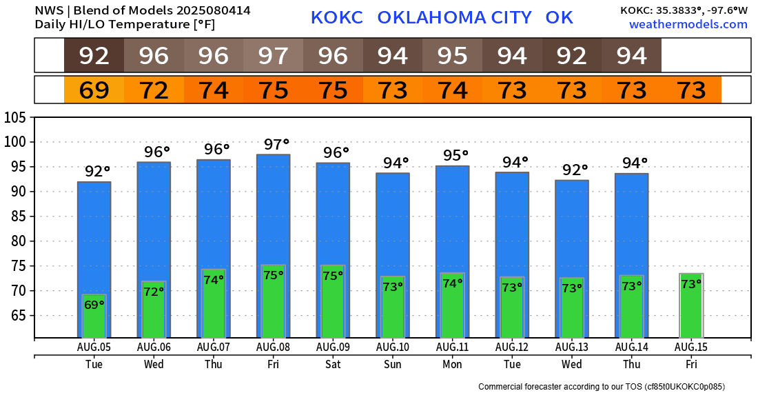
Last week, we broke the century mark in OKC and Tulsa, and then cooled down the week with rainfall. This week, rain will be hard to come by, and the heat will build back in.
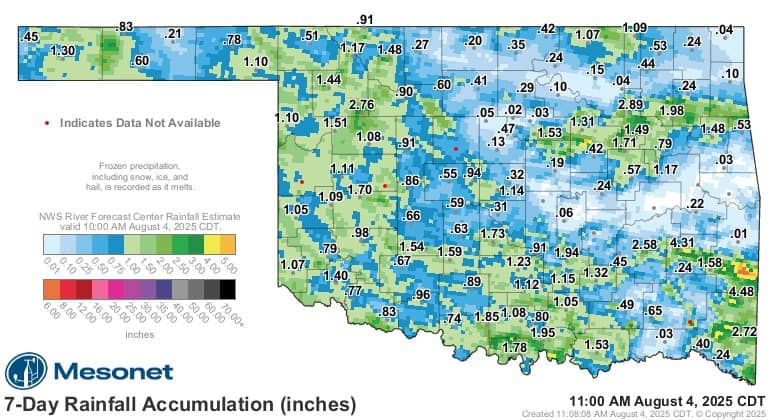
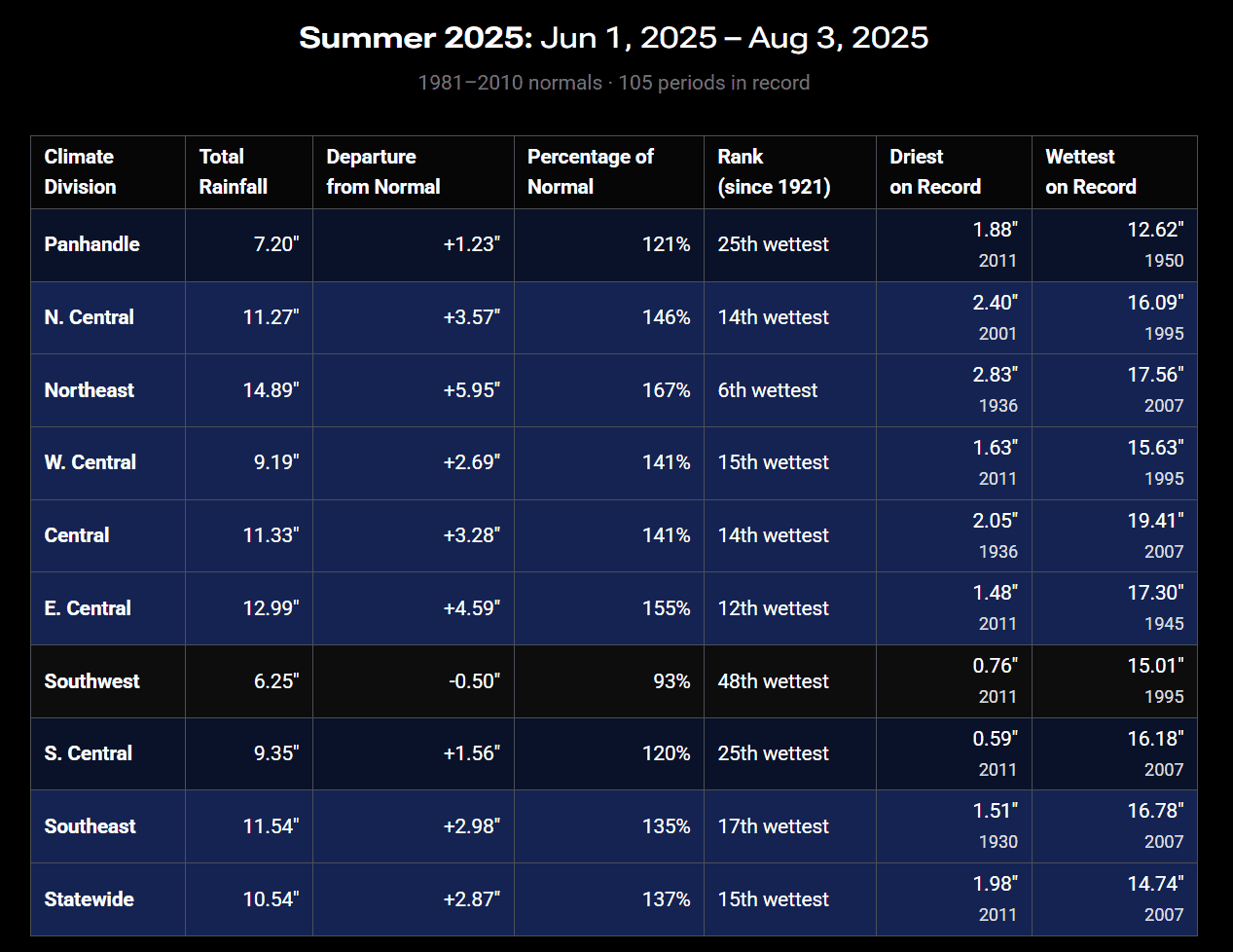
Overall, rainfall totals were decent for the end of July, and of course having afternoon temperatures in the 70s and low 80s wasn’t too bad either! Also, look how our summer ranks so far with respect to rainfall. Very nice!
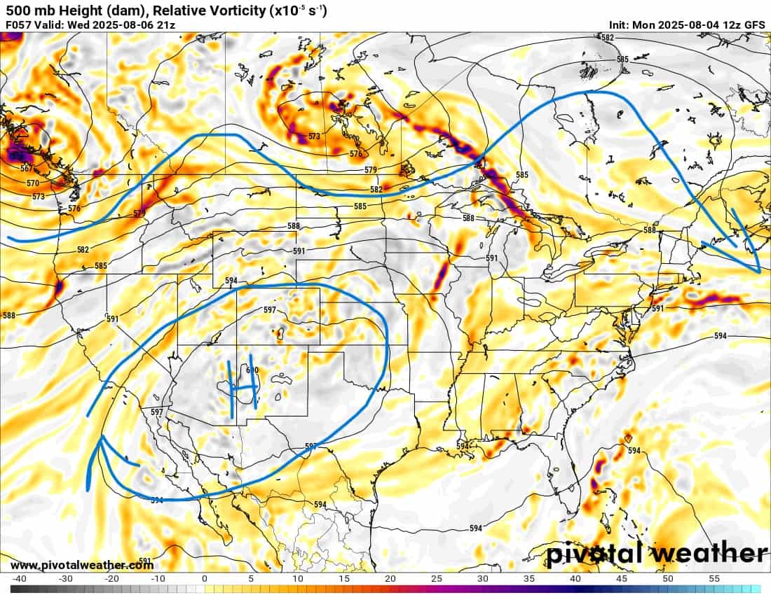
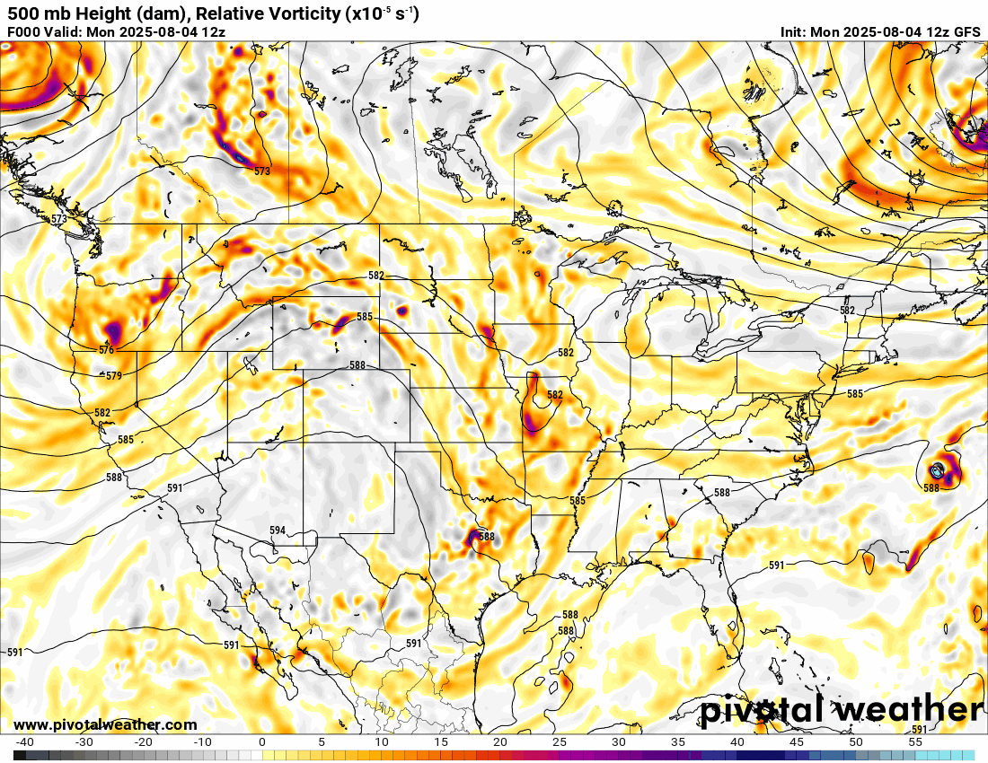
The Jetstream pattern animation below shows an upper high centered across New Mexico and weak disturbances rotating along the northern ridge into the Texas and Oklahoma panhandles this week. Some of that lift may move into the body of the state by Thursday through the upcoming weekend, triggering at least isolated shower or storm activity. You can track that lift in the animation by watching the brighter colors move from NW to SE.
The ridge will build the heat across not only our region, but the country itself. The temperature animation of departure from normal will show that the heat won’t be excessive, but a few degrees above normal in many areas. I really don’t get excited about these heat maps you see posted all over social media these days. After all, it is the heart of summer, and it’s supposed to be hot.
 Restoration and Disaster Cleanup Service
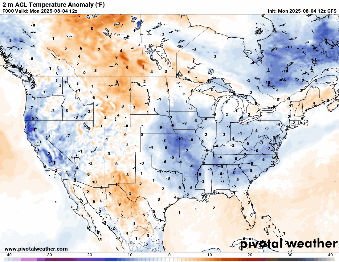
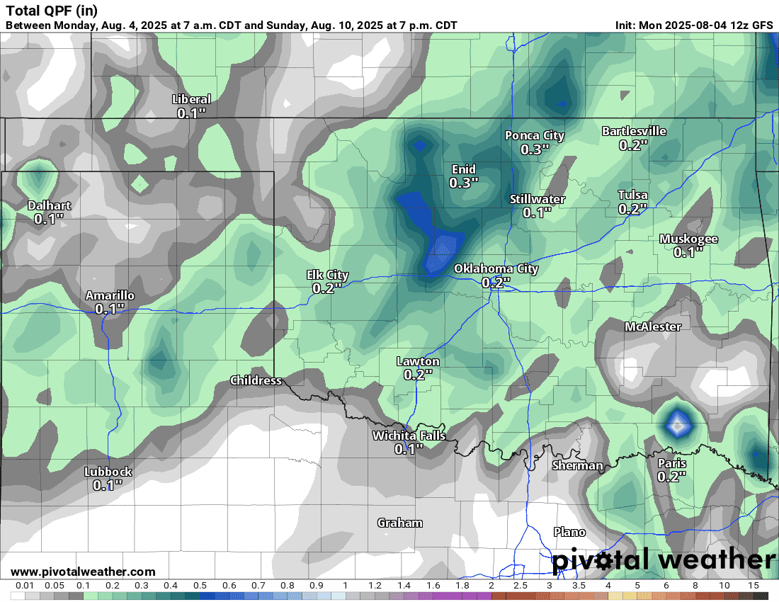
The rainfall later this week isn’t much to write home about, and the output here may be optimistic. So be sure to water well this week to keep those vegetable gardens happy.
Temperatures will be back to where they should be. Some models hint we might squeeze in a 100-degree day in the outlook for OKC, but for now, keeping it just shy.
Restoration and Disaster Cleanup Service