We Crack 100 Degrees, Then a Cooldown with Rain

We’ll round out July with the hottest weather of the year moving into central Oklahoma. Then a cold front will move through along with additional rainfall to set the tone for August.
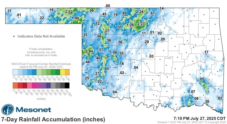
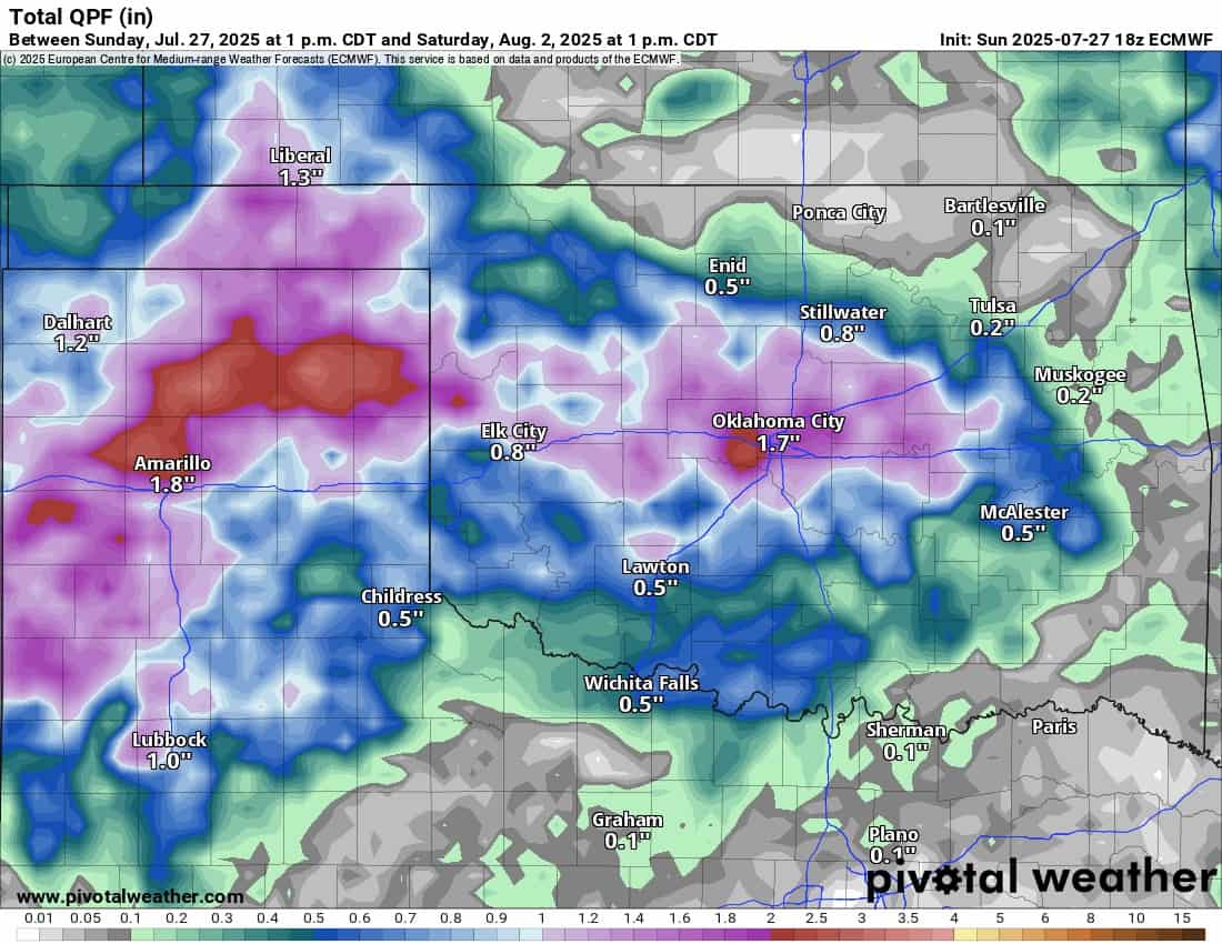
Oklahoma did receive some beneficial rainfall over the past 7 days. It was mostly confined to the west and northwest counties. As is typical in the summer, some brief flash flooding and damaging winds often accompany some of the strongest storms.

Ferguson Roof Systems is offering an AT's Weather special!
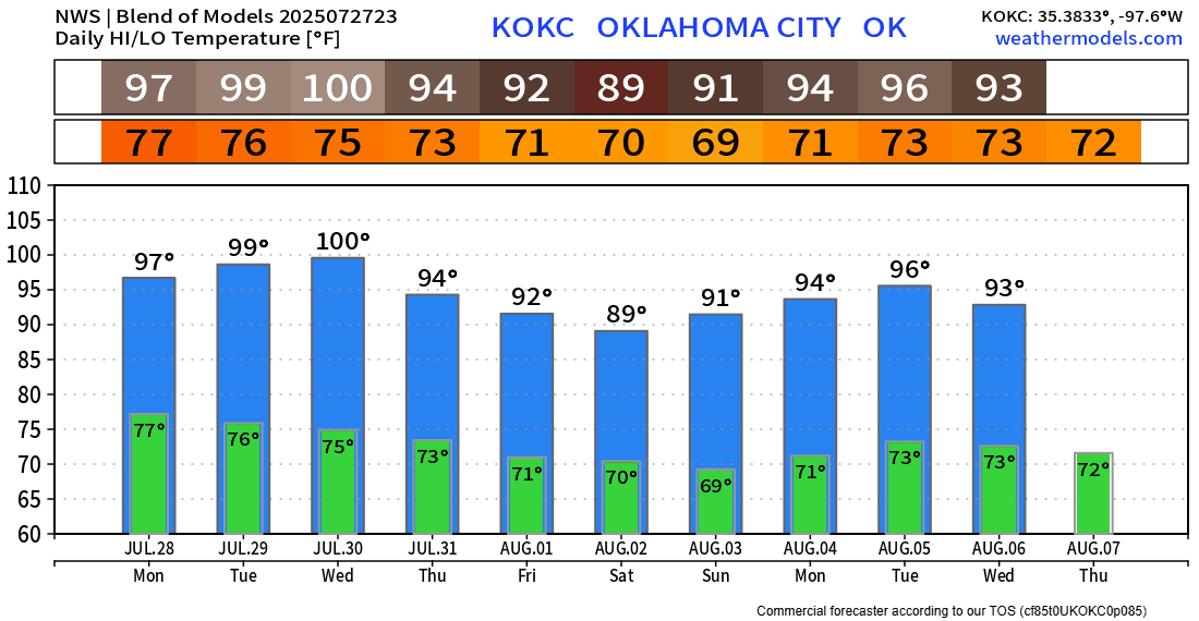
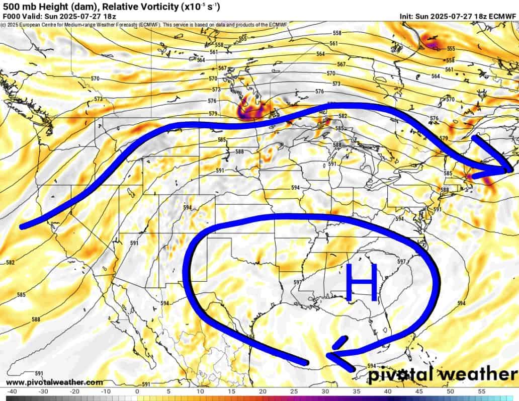
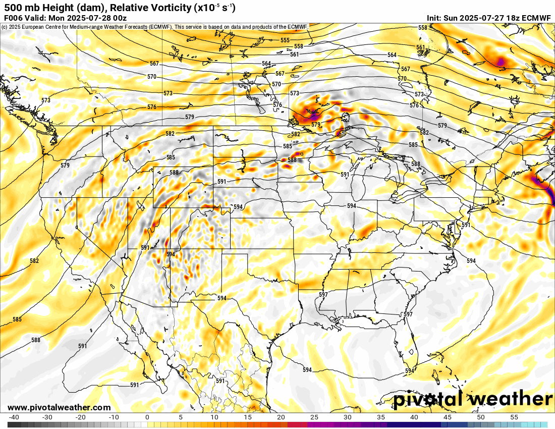
This week, the Jetstream will bring us that dreaded heat dome of high pressure (higher heights for the purists), but it’s transient, so not hanging around. It will shift from the SE US to the SW with a stop across Oklahoma Tuesday and Wednesday. This will allow our hottest temperatures of the year to develop. This means we should finally crack 100 degrees in OKC. So far, we’ve only topped out at 96 degrees. Not bad for summer! You’ll notice an upper-level disturbance will work through starting Thursday, and the lift will continue through Saturday.
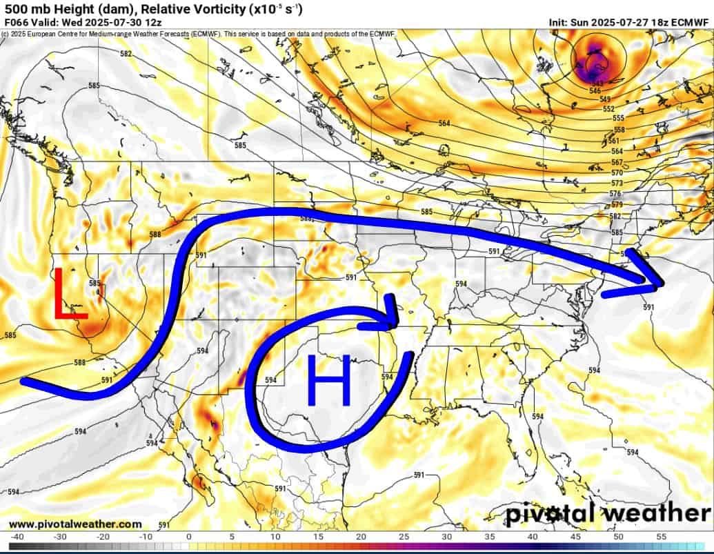
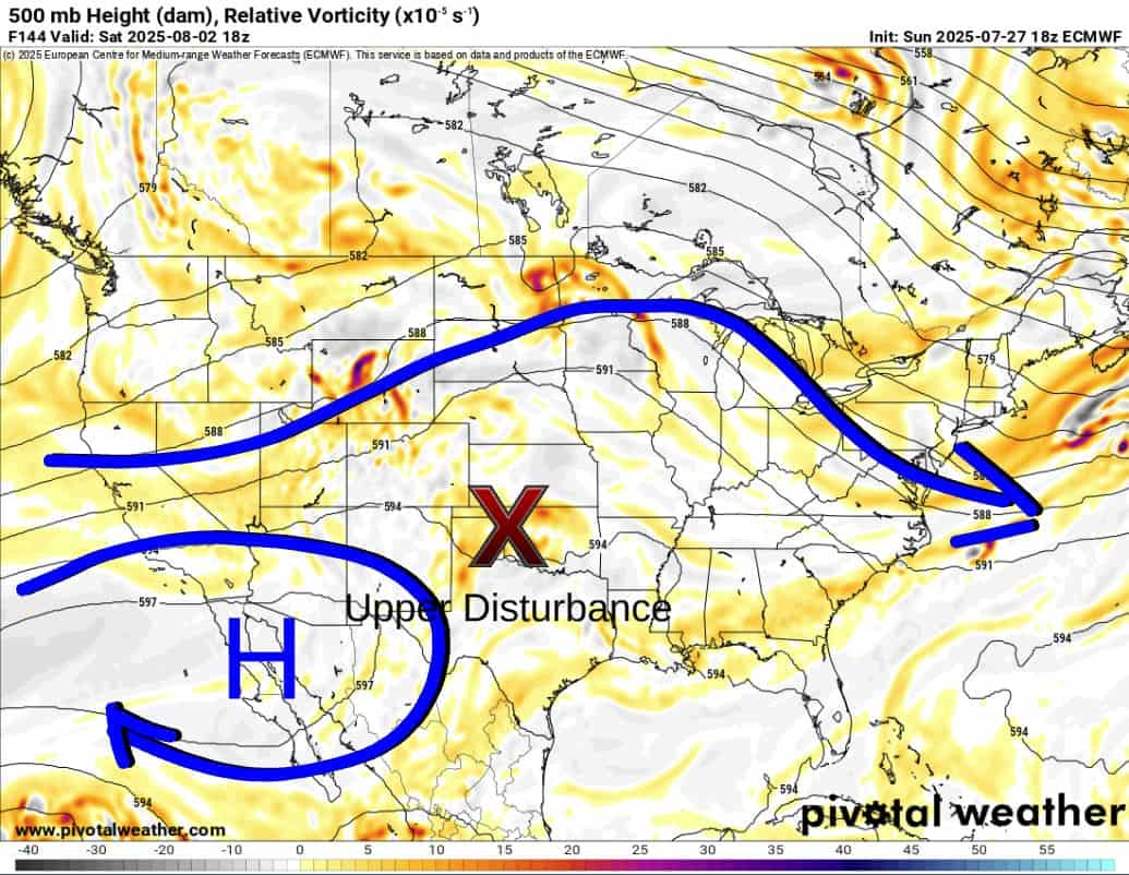
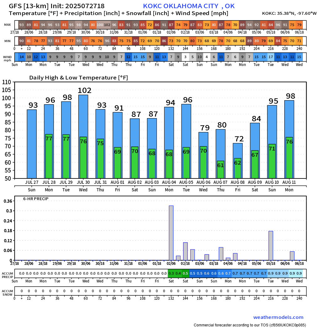
The rain should develop late Wednesday across NW OK as a weak cold front moves into that area. The front will get a push overnight and clear the state by late Thursday. This will bring additional rainfall activity to the region along with that upper disturbance. Rainfall amounts could be significant in some areas. Some of the models produce more than what’s shown below.

Be sure to mention Aaron Tuttle when you call (405) 820-1193!

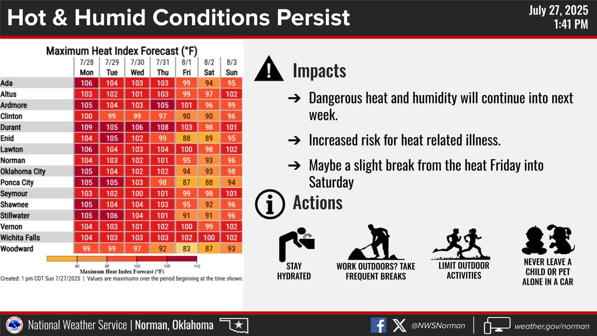
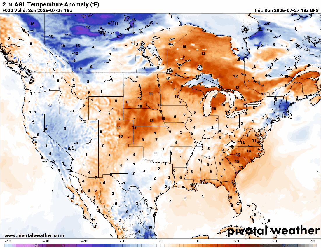
Temperatures will peak on Wednesday, but cool down after that. As a matter of fact, watch the departure from normal temperatures as we move through this week into the first week of August. That’s incredible! Lots of blue coming our way!!! Also, keep those heat indices in the back of your mind for cooling down during the heat of the day.
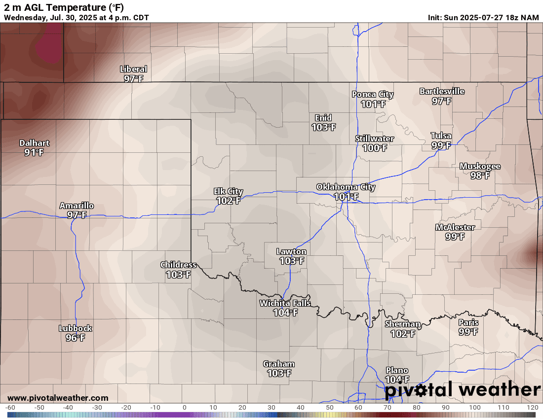
Here is a look at the OKC temperature trend for the week. I’ll also show you what one of the models does with temperatures and rainfall in the extended outlook. That’s crazy for August!
 Restoration and Disaster Cleanup Service