Typical July Pattern
The weather this week will be typical for this time of year. Hot and humid conditions will greet us daily with rain staying in the forecast for a few. The upper ridge threatens to return.
Before we get to this week, what was that nonsense on the 4th!!! 90+ mph winds made their way through the Norman area and pockets of 60 to 80 were felt in other areas of the state as well. Many firework celebrations were delayed, canceled, or rescheduled. Horrible timing. An MCS developed across Kansas late Friday and the outflow from that storm system moved into N OK Saturday morning. This allowed those storms to develop Saturday evening and cruise through the rest of the state. We did see some decent rainfall amounts with all of the severe wind reports. Several mentions of tree damage and power outages.
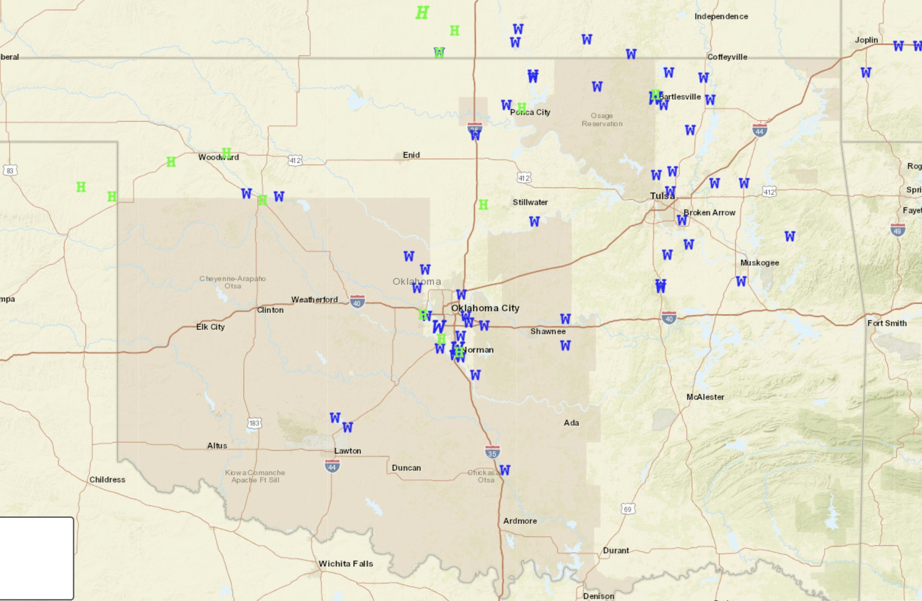
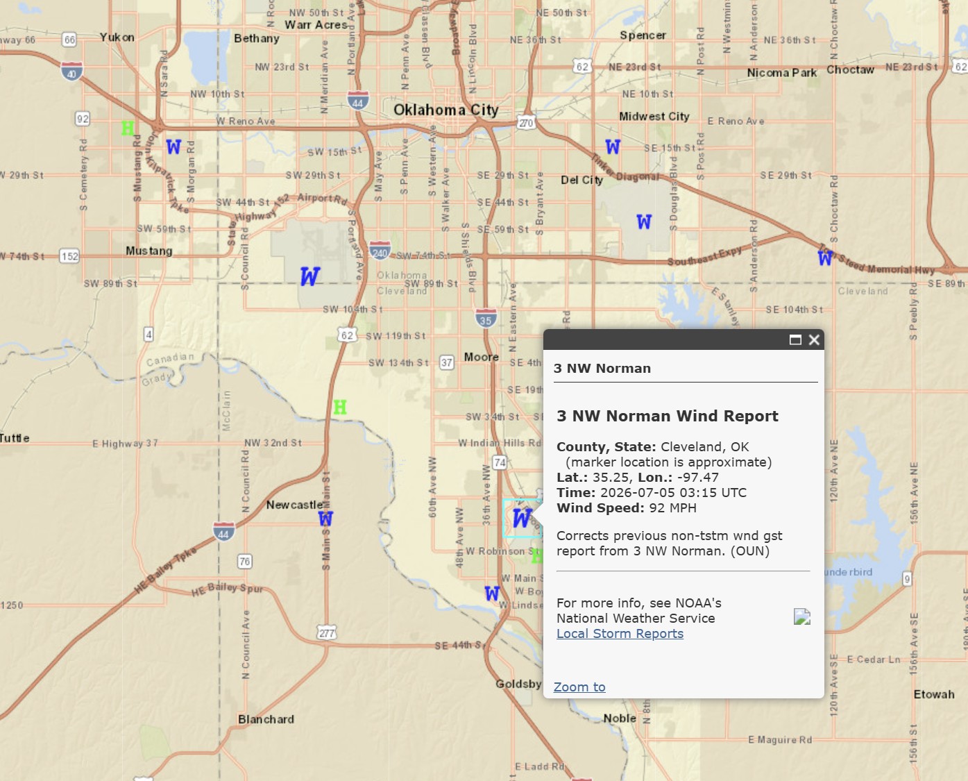
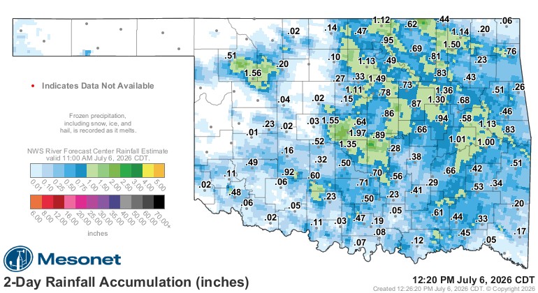
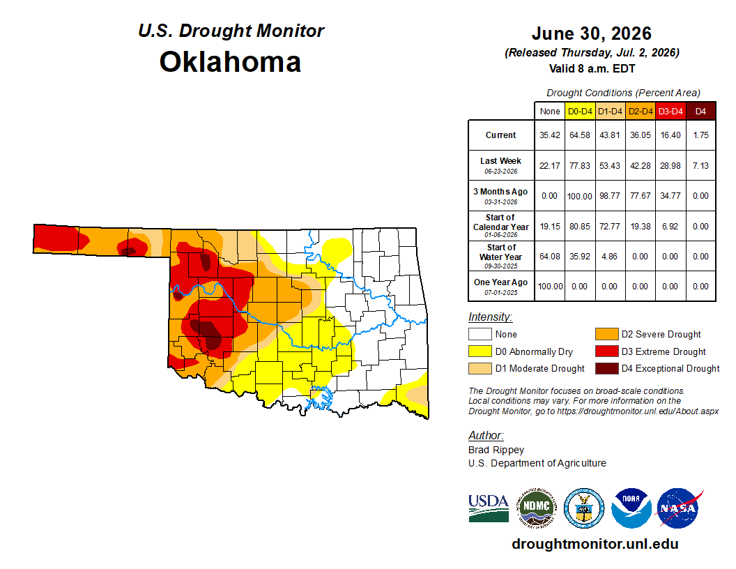
At least the drought improved a bit on the last update.
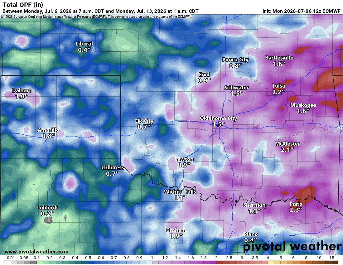
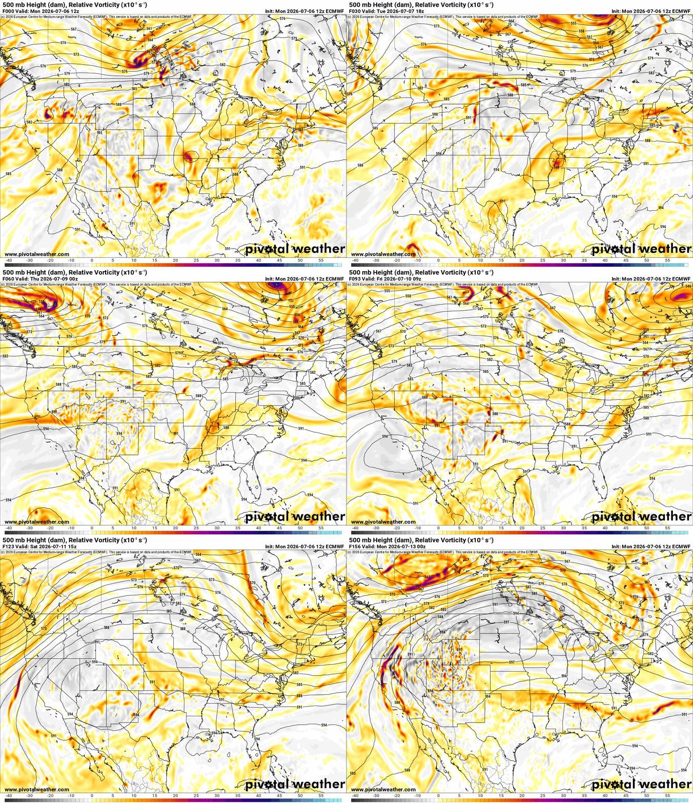
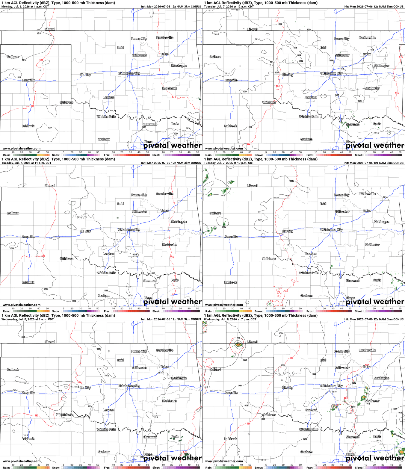
The Jetstream animation below will show more weak disturbances moving into the state starting Thursday. Each day one will rotate through and trigger some shower and storm activity. As with any storm this time of year, damaging wind is the primary threat and they can be quite high, upwards of that 90+ mph on the big events. As far as rain specifics are concerned, isolated activity in SE OK for Monday, same for WC and S OK Tuesday, a little activity in NW OK Wednesday, and then we should see a little more scattered activity Thursday through Sunday with some decent rainfall totals.
Be sure to mention Aaron Tuttle when you call (405) 820-1193!

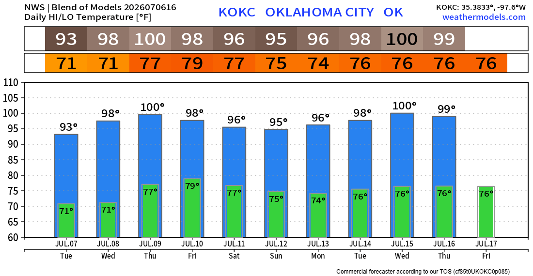
Temperatures will get hot again as the century mark is back midweek. The increase in clouds and rain should help to take the edge off the heat for the weekend. An upper ridge will move overhead the following week, so more 100s are coming in the extended. The OKC temperature trend is shown below. My weather app, ATsWeatherToGo, will give you your backyard temperature forecast as well. Stay cool and hydrated! -AT