The State Fair Brings Changes
We all know the saying: just wait until the fair comes to town for the rain to return. That was true today, but the changes will be more subtle for the week ahead.
Overall, for the yearly rainfall, we are very low, but not record low. It’s certainly been worse, but that’s no consolation. As a result, we’re in a tough drought that is going to be slow to release its grip.
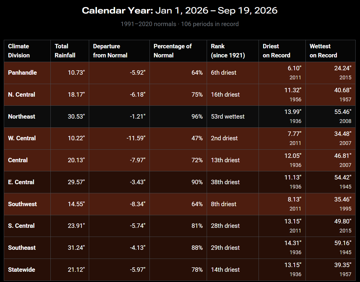
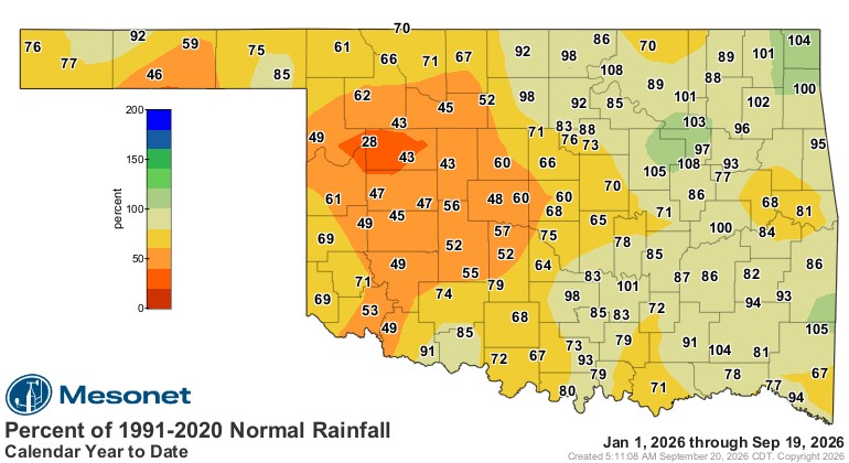
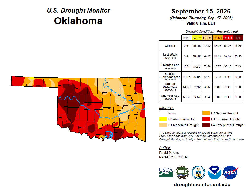
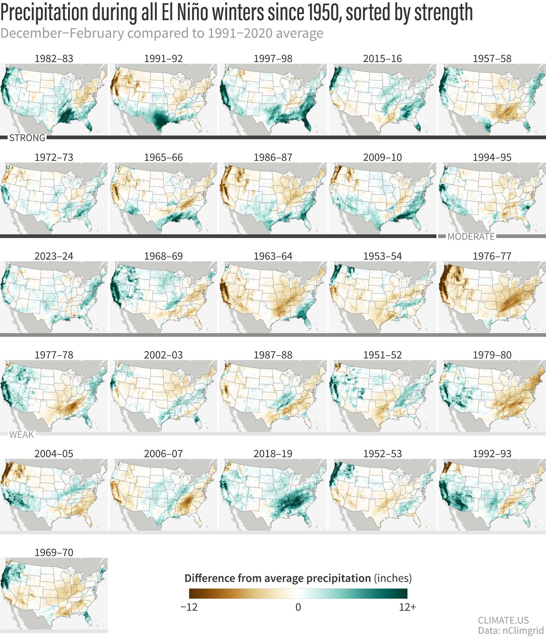
So what about the “super” El Niño this season? First off, it’s just El Niño; any use of a superlative is for clickbait and attention-seeking. As I’ve mentioned many times, an El Niño pattern for the winter typically leads to milder and wetter weather, but that’s relative, as we are normally not that cold during our winters overall, and we’re usually dry. So when you factor this in, the maps over the previous periods are about 50/50 on any significant moisture.
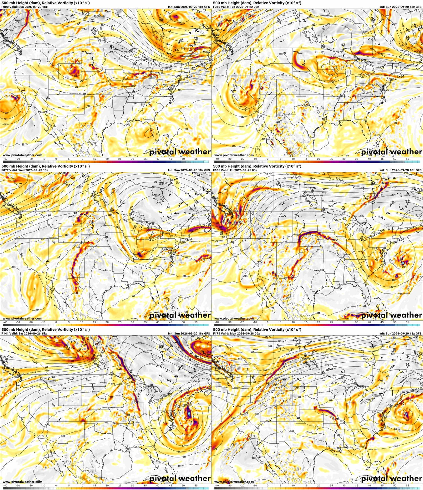
Regarding this week’s jet stream, the upper ridge is still hanging tough to our southeast. It will continue to slowly break down and shift south as the upper pattern becomes more active in late September and October. The influence is going to keep most of Oklahoma protected from rainfall. You’ll notice how the upper disturbances rotate north across the Texas Panhandle and only barely clip western Oklahoma. As we move into Friday and the following weekend, you’ll notice more of a push across the rest of the state, and that is when we’ll have another opportunity for more rainfall. But don’t get too excited, as the signal is still pretty weak.

Ferguson Roof Systems is offering an AT's Weather special!
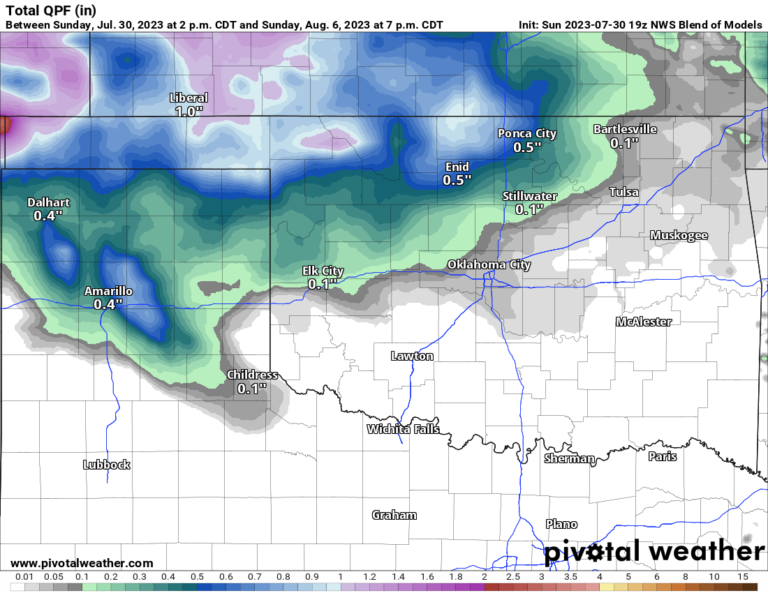
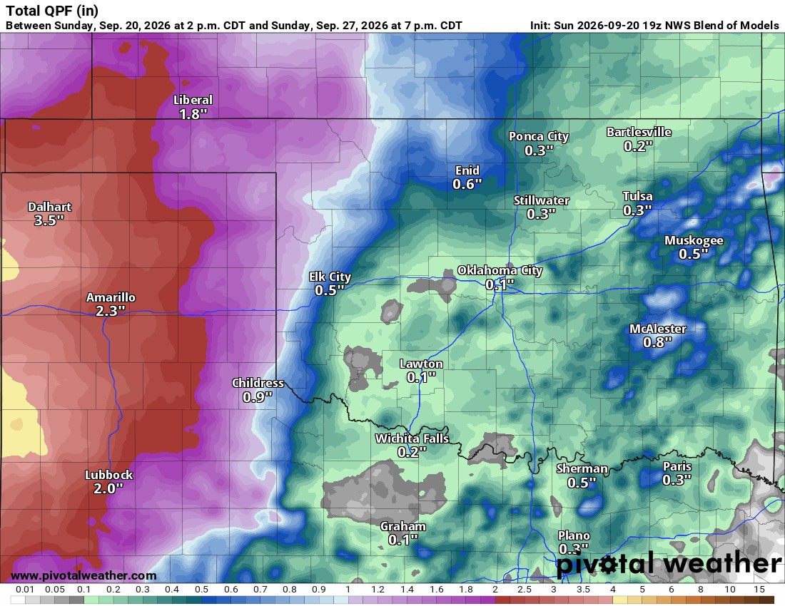
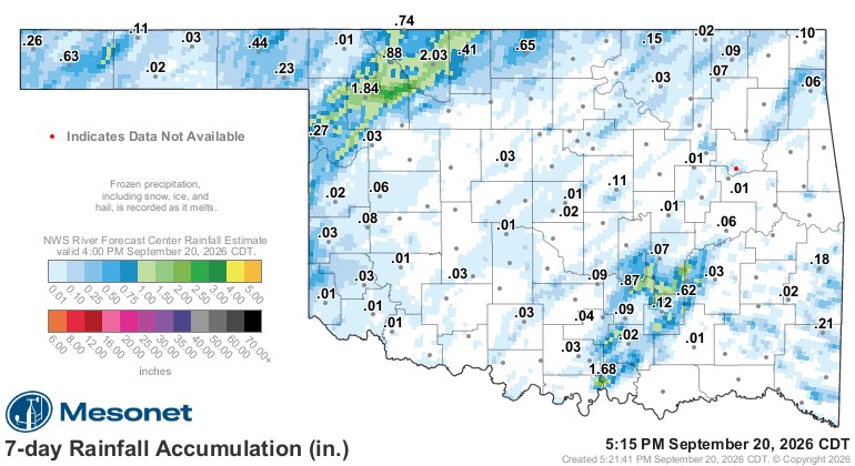
The rainfall we had over the past 7 days is representative of the next 7. Notice most of the rainfall fell across the W/NW parts of Oklahoma. The activity we saw Saturday night and today moved through the rest of Oklahoma. This is the type of trend we’ll repeat for the week ahead. I’ve posted the model blend of precipitation for the week. Outside of the amounts shown across the Southeast (which is for today), the rest of the totals are mostly for Friday through Sunday.
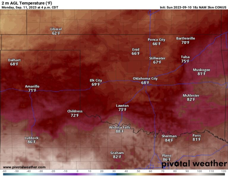
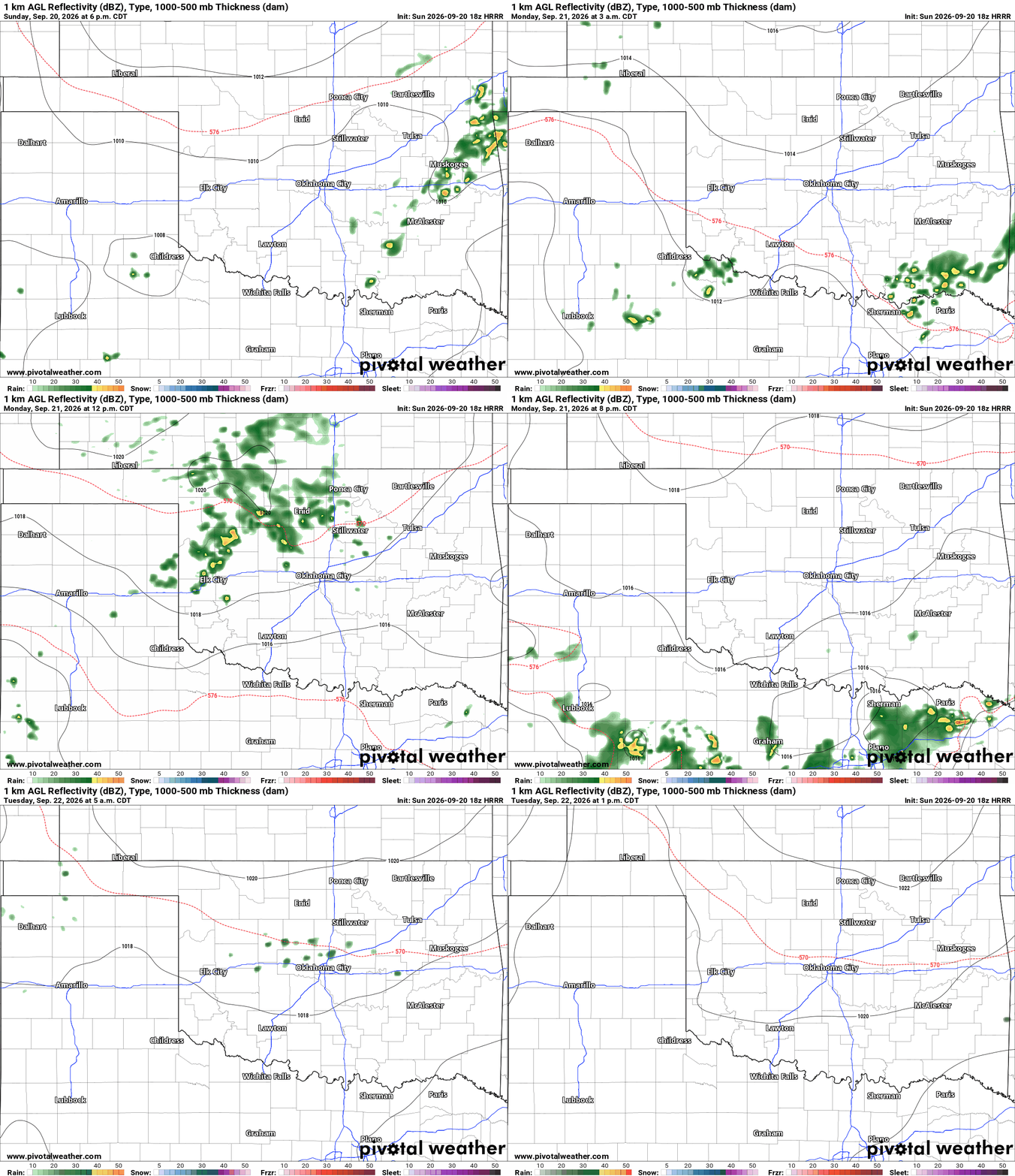
There is one exception to the rainfall this week. A very weak disturbance will move from CO to KS tonight and tomorrow morning. This should trigger a cluster of showers and weak storms. What holds together overnight will drift SE into Oklahoma Monday morning and continue south into C OK by midday before falling apart. So for any Monday fairgoers, expect at least some clouds with this event and, worst case, about a tenth to a quarter inch of rain midday Monday. My thoughts are glorified sprinkles and just enough to keep the heat down for the day.
Ferguson Roof Systems is offering an AT's Weather special!
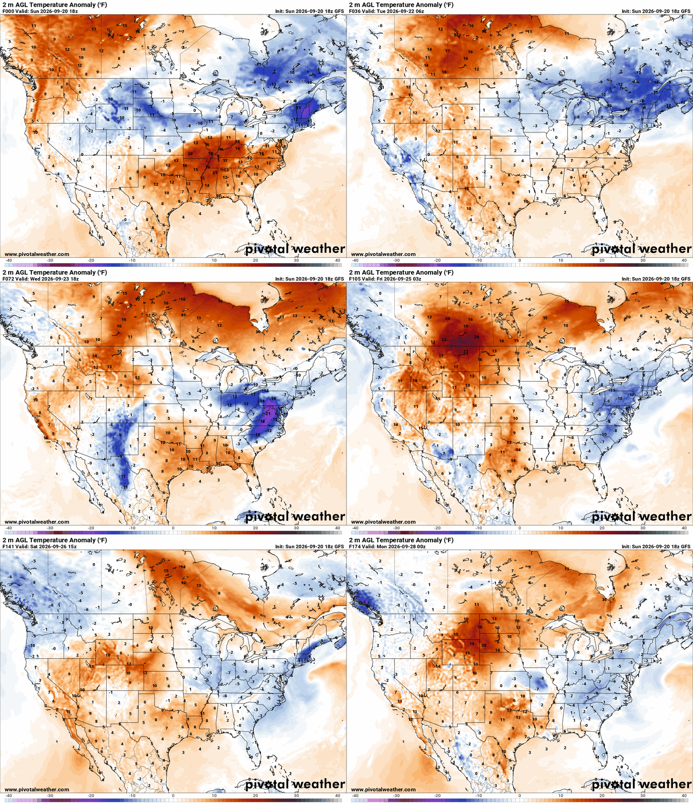
Speaking of the heat, temperatures continue to slowly come down due to the change in solar insulation and angle. It’s the calendar that’s cooling Oklahoma down, not the weather patterns or strong cold fronts. Those will come in October. Until then, temperatures are still running above normal across a large area of the country, but at least “normal” is coming down.
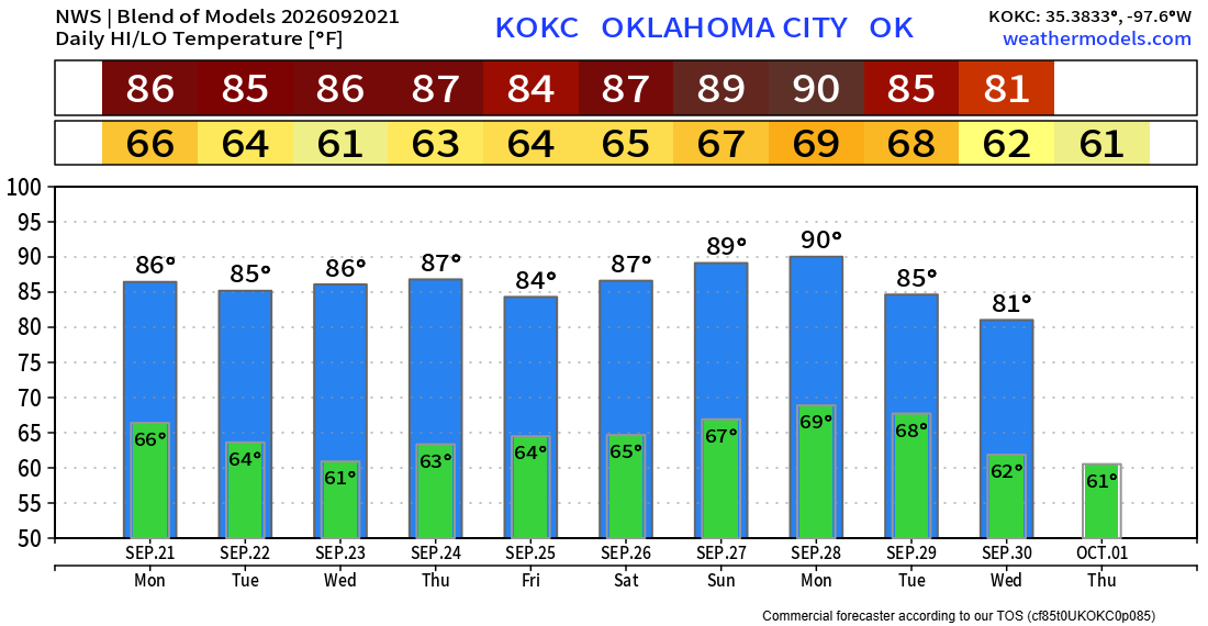
The trend for OKC will be lots of 80s this week, but I’m sure a few low 90s will sneak in many areas of the state.