Pattern Change Brings Cooler Temps and Rain
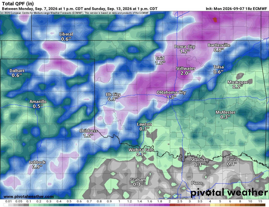
The upper ridge will break down and allow some relief from the heat this week. We’ll also have a few more opportunities for rainfall.
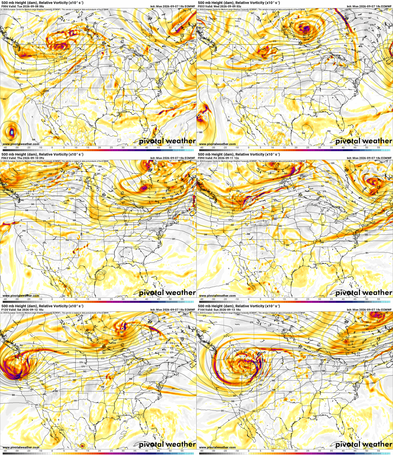
Our Labor Day Holiday weekend brought the return of isolated shower and storm activity for parts of E OK. A weak cold front and upper pattern change will bring more widespread activity to the rest of the state. The Jetstream animation shows how the upper ridge centered overhead breaks down to the east and west of us, allowing an upper trough moving through the central US to give us a taste of relief. You’ll notice the red/yellow colors of the upper disturbance rain triggers moving through Thursday, Friday, and Saturday.

Ferguson Roof Systems is offering an AT's Weather special!
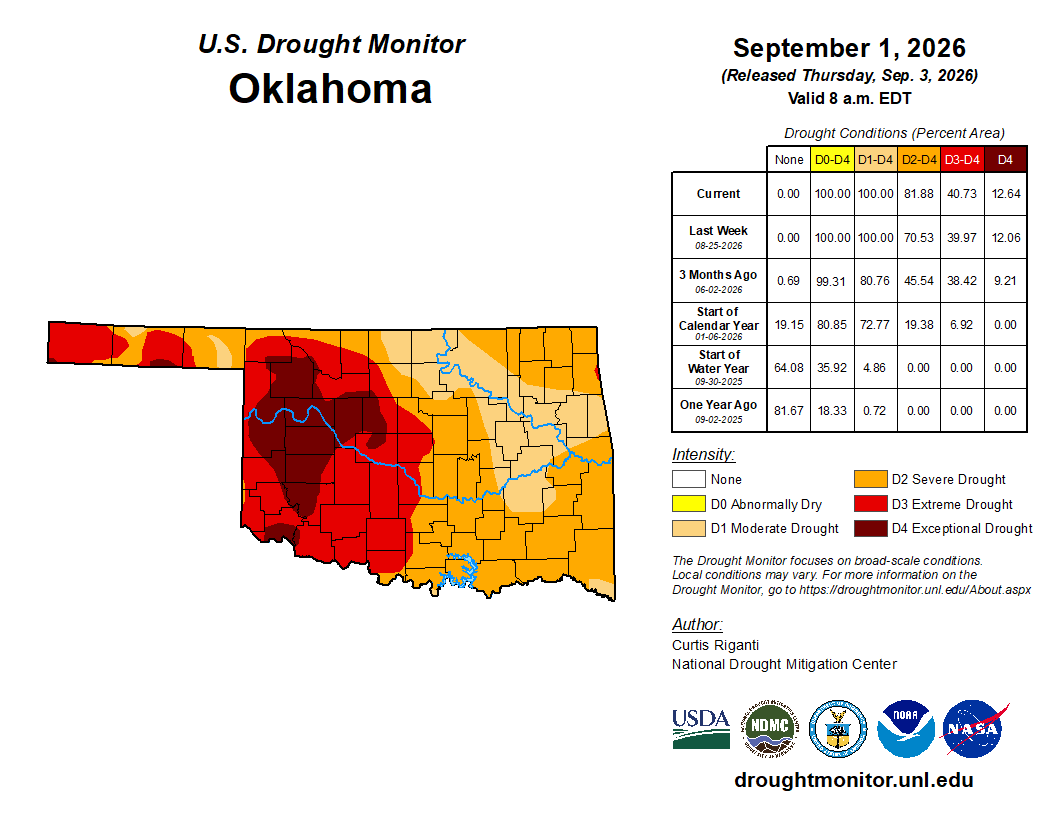
The rainfall is coming at a good time, as the trees are going dormant and shedding their leaves to survive, and the rest of our vegetation is dying in the 100-degree sun. The drought has held tough this summer.
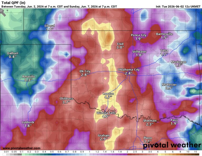
Other than isolated activity out east Tuesday afternoon, the front-triggered rainfall will fire up across NW OK Wednesday afternoon and travel SE during the evening and overnight. Additional activity will occur Thursday and Friday, but on the lower side of coverage. The next big signal will be on Saturday. Rainfall totals could be quite decent!
 Restoration and Disaster Cleanup Service
If clouds hang tough on Thursday and we do receive some decent rainfall, temperatures may have a hard time getting out of the 80s in some areas. I’m looking forward to this map for sure!
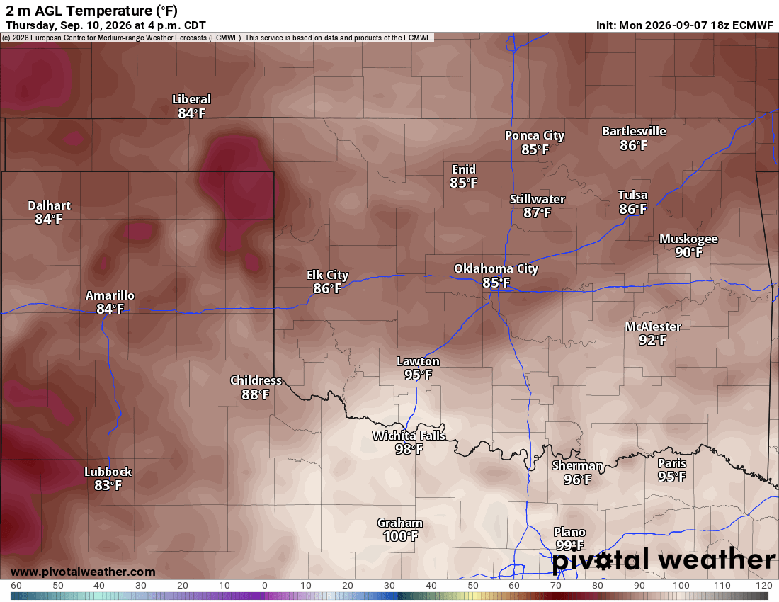
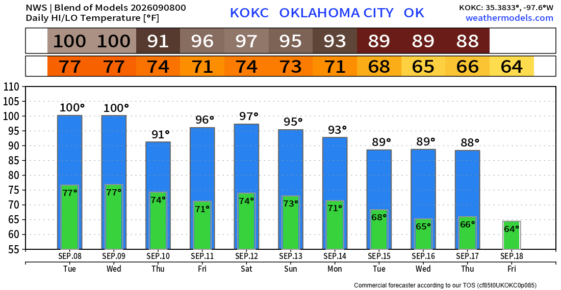
The temperature trend will be up and down, but fingers crossed we’re done with these week-long 100-degree stretches. We cool down pretty quickly in September, so although we’ll likely still squeeze out a day here or there at 100, the trend is your friend.
Be sure to mention Aaron Tuttle when you call (405) 820-1193!