The Heat Slowly Gives Out
Sunday was another triple-digit afternoon. We’re all so over it. Last week’s pattern change was temporary, and towards the end of this week, we’ll get another change that signifies the switch to Fall.
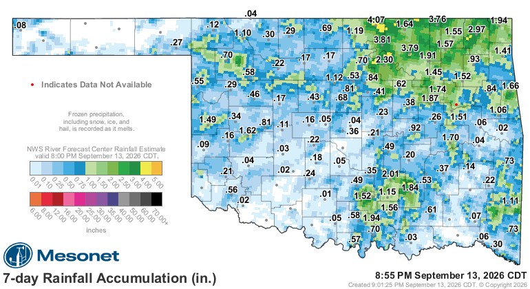
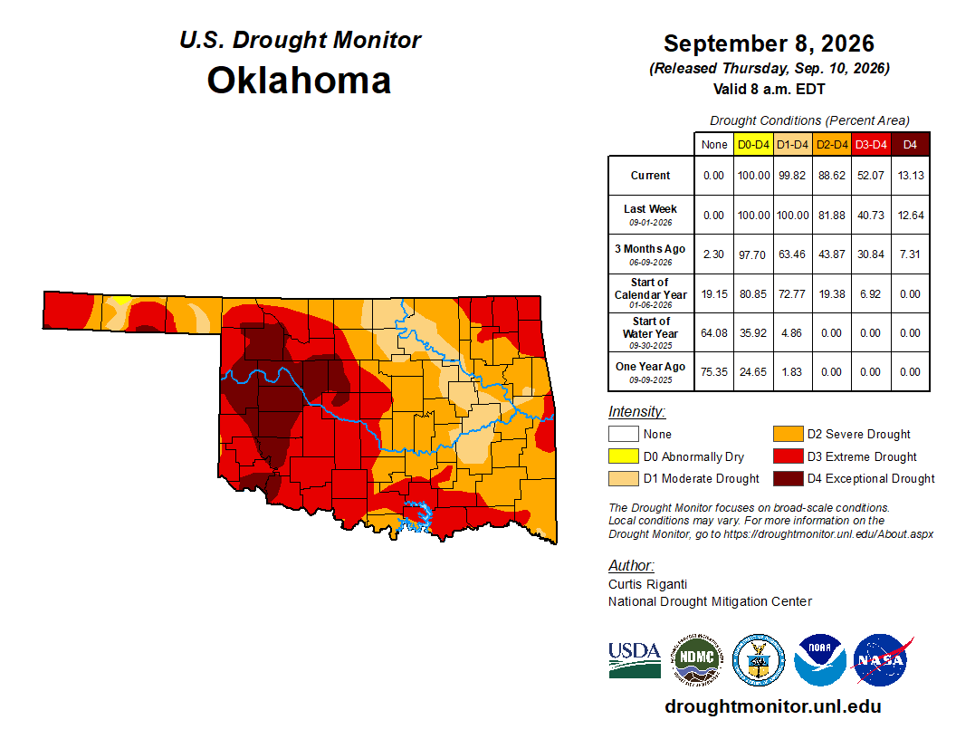
The rain over the past few days was welcomed, just wasn’t enough. The drought expanded its grip and will be a slow retreat.

Be sure to mention Aaron Tuttle when you call (405) 820-1193!
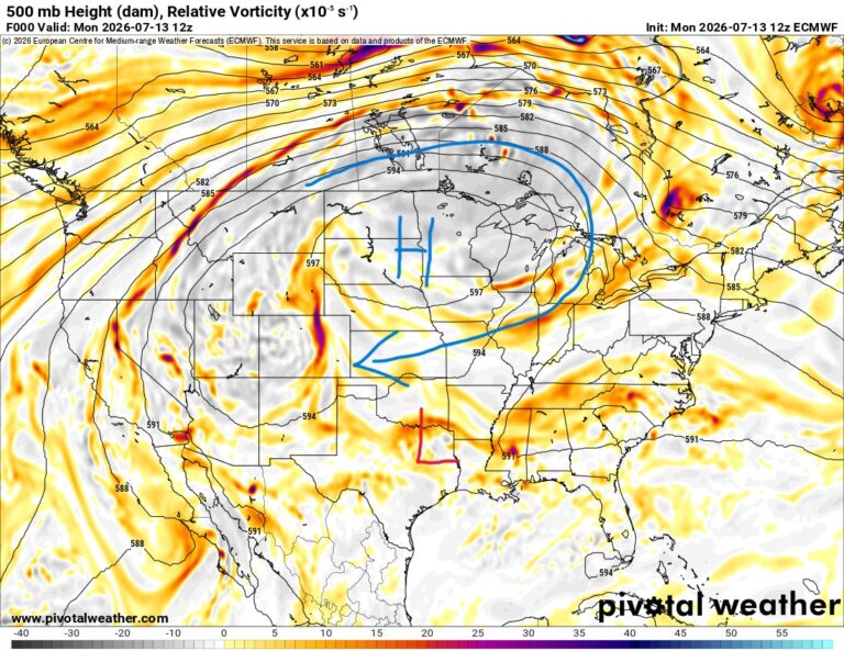
The upper pattern shows a ridge off to our east and an upper low running underneath it from the SE along the Gulf coast. Unfortunately, it won’t make it to Texas and Oklahoma, but we do have a weak trough across the West that will put us back in a SW flow aloft. This will allow temperatures to slowly cool and the opportunity for rainfall.
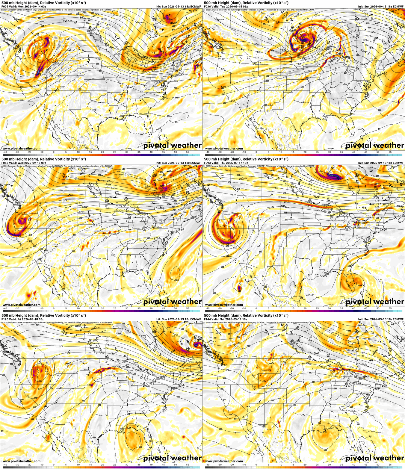
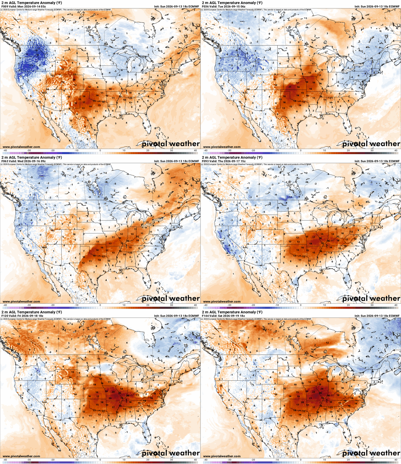
Temperatures will still run above normal this week, and there isn’t any real cold air in sight. The main thing that cools us is the shorter daylight that you may have noticed and the solar angle. This alone will break the extreme heat moving forward.
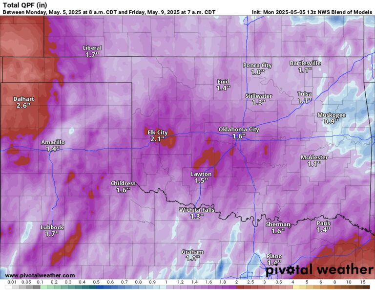
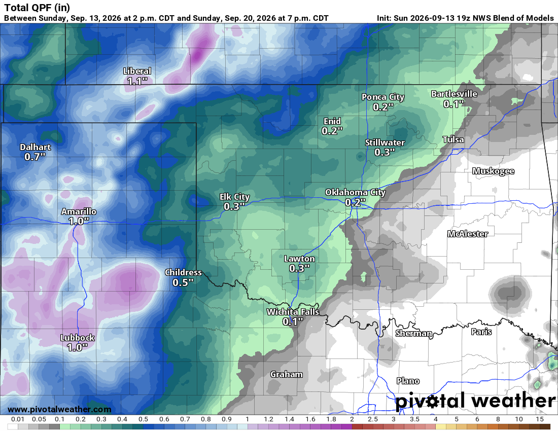
Rain will be relegated to the Texas and Oklahoma panhandle regions off and on this week. Eventually, we should see some of this activity work more into W/NW parts of the state and, if things go well, move into C OK Saturday night and Sunday. The signal is weak but will likely be the outcome. That means the State Fair may help to make it rain!
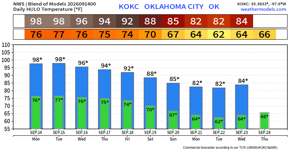
Temperatures will still be up around 100 degrees through Tuesday and then start to cool ever so slowly, although I’m a little leery of those 80s in the extended… -AT

Ferguson Roof Systems is offering an AT's Weather special!