A Big Week for Rain with Polo
Will this week live up to the hype? Will our drought break? Do temperatures finally crater? Let’s dive in.
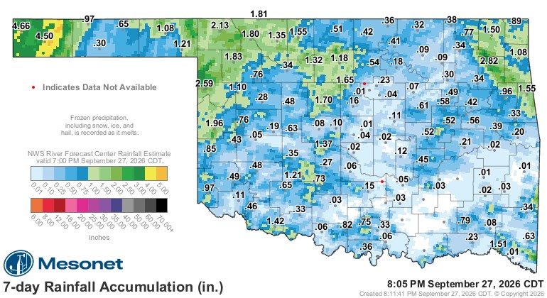
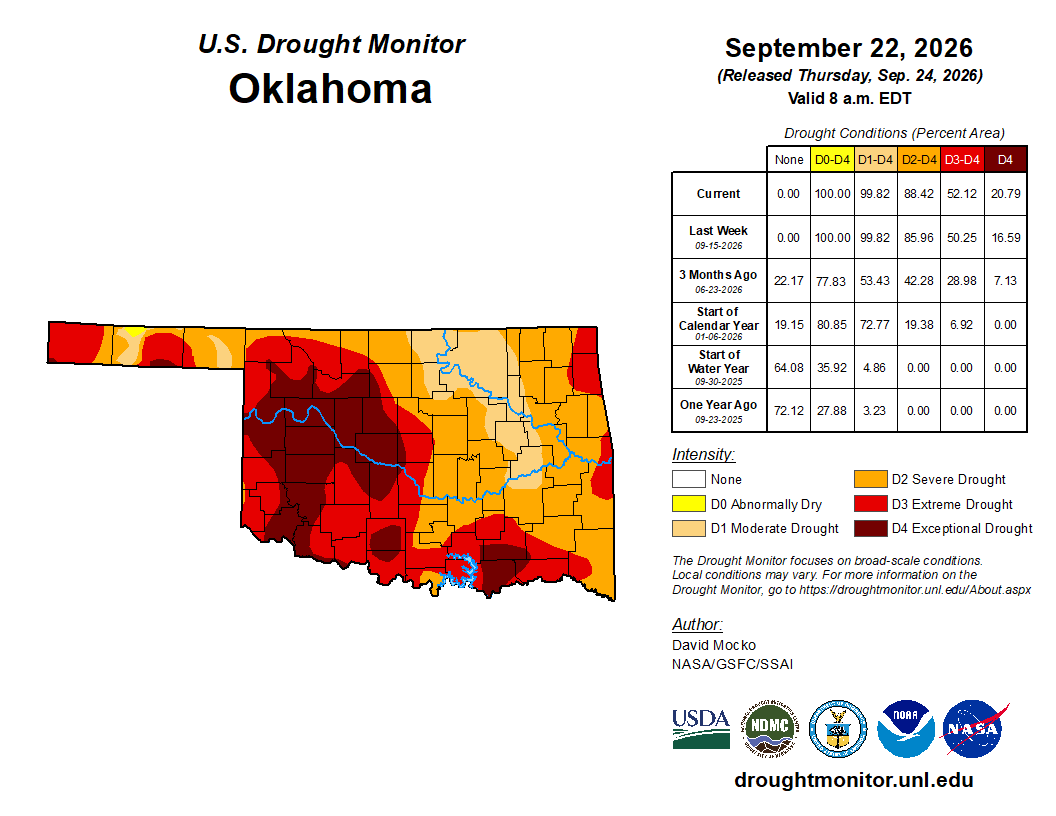
Last week, the State Fair brought its typical change in the weather, although not as drastic as some years. We were able to squeeze out rainfall over the past 7 days, mostly out west and in a few spots east. The western half of the state desperately needs rainfall, as the east hasn’t suffered as much.

Ferguson Roof Systems is offering an AT's Weather special!
The Jetstream pattern shows the upper low entering the SW US and swinging into Oklahoma. As it travels east, it picks up the remnants of Hurricane Polo to boost its moisture supply. This will bring numerous showers and some storms to the state and elsewhere across the Southern Plains and adjoining areas. The system will stall and fall apart by the time we approach next Sunday.
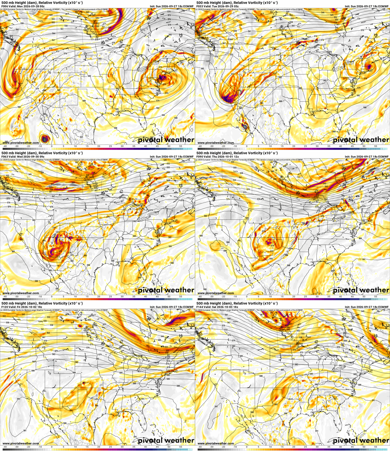
As moisture increases ahead of the system, look for isolated shower and storm activity Monday and Tuesday afternoon and early evening. Just about anywhere is fair game as there is no ryme or reason for any specific targeted locations. However, as the trough approaches and upper forcing commences, look for more widespread storm activity across W OK during the day and shifting to E OK at night. Additional activity will continue off and on Thursday through Sunday, with less and less coverage starting Friday as the system winds down.

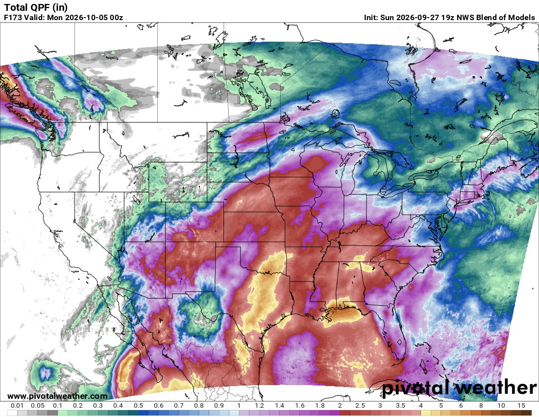
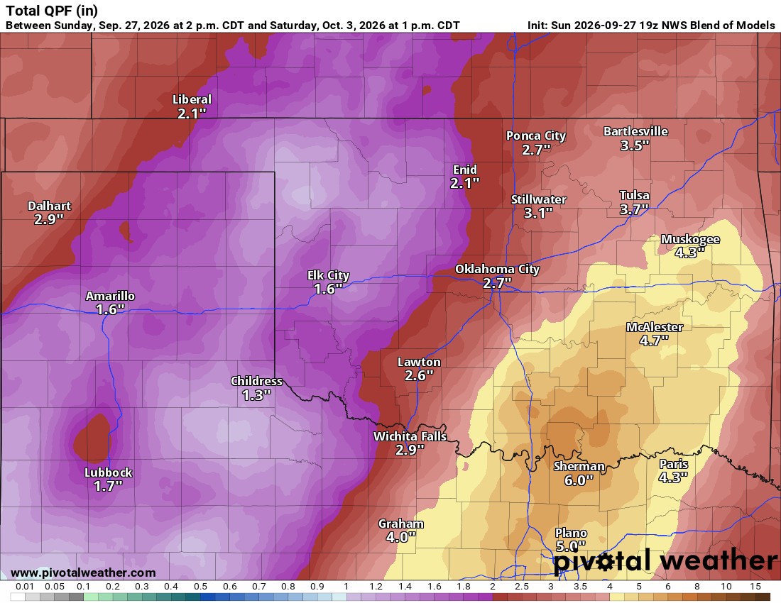
The good news is that much-needed rainfall is coming to Oklahoma. The bad news is that the majority of it will be along and east of I-35, where the state was already doing better. We really needed this across the west. So in the end, while it will help drought conditions somewhat, it’s unfortunately focused on the wrong part of Oklahoma. The map below is the conservative model blend through Sunday. As always, it will miss the isolated convective storms that can dump a quick 1 to 2 inches, so there will be isolated spots on this map that will receive far more than shown here.
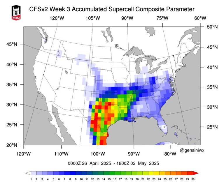
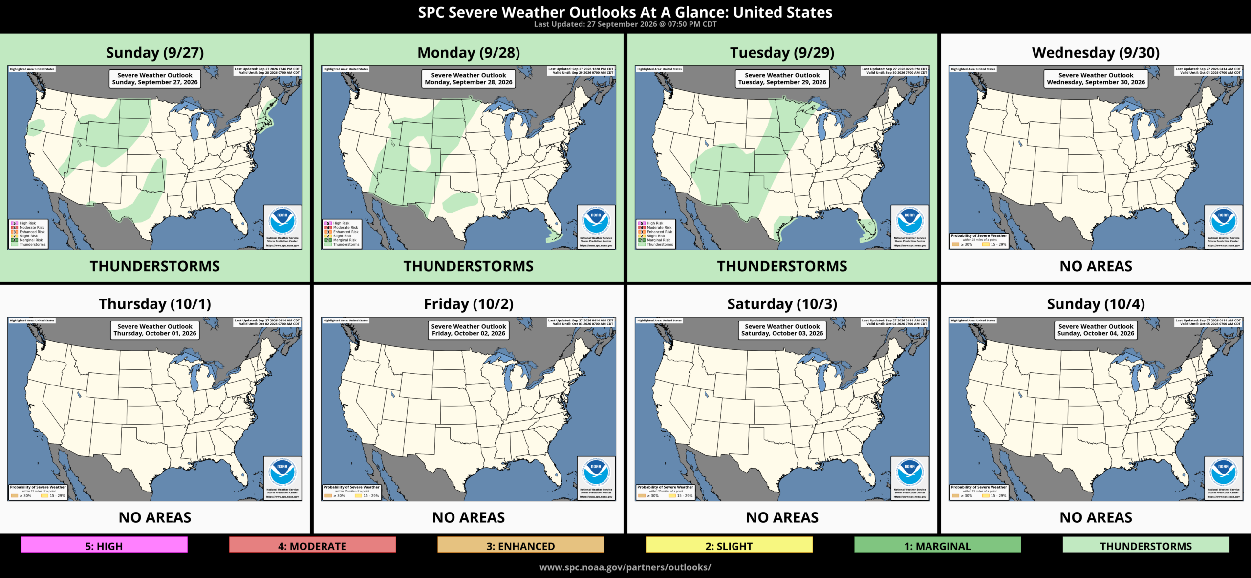
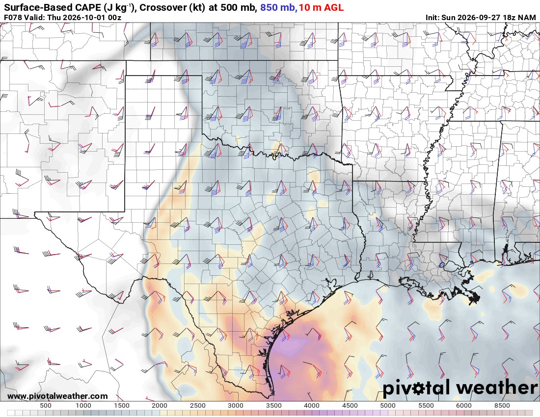
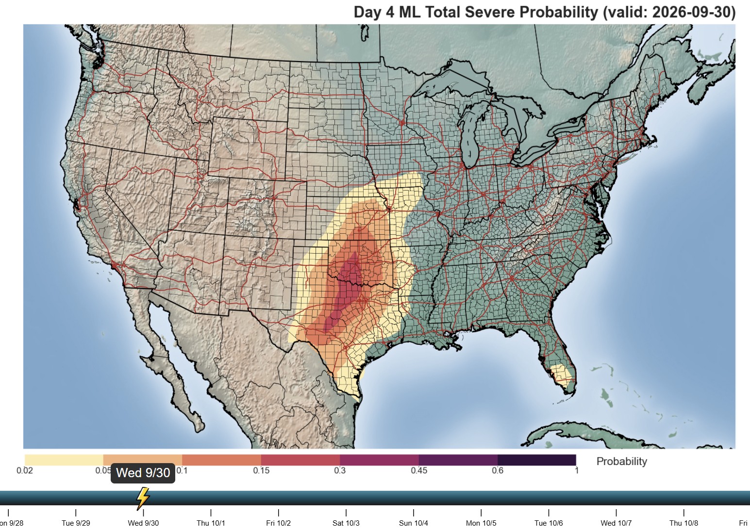
Regarding any severe weather, this is mostly a tropical-type airmass moving in, but wind shear and instability will improve for Wednesday. The Storm Prediction Center does not have Oklahoma in a risk at this time, but the NAM model and one of the AI models do indicate we may be dealing with a few that day. Weak tornadoes may be possible.
Be sure to mention Aaron Tuttle when you call (405) 820-1193!
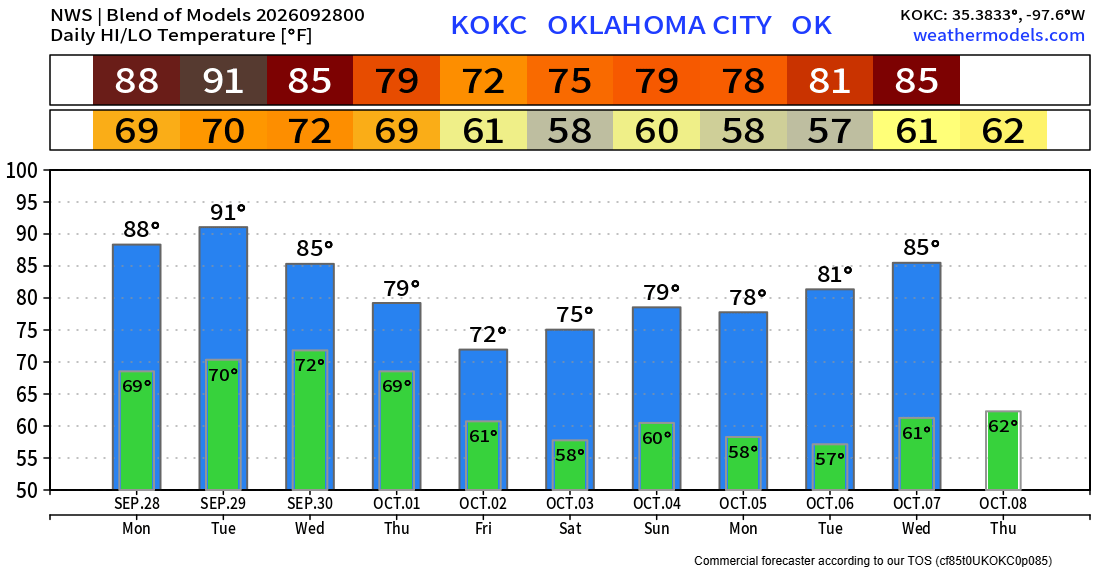
Temperatures are going to continue the downward slide, mostly affected by the increase in cloud cover and rainfall rather than any significant pattern changes for strong autumn air masses. Those will come later in October. I’ll keep an eye on things and do a couple of live broadcasts this week. -AT