A Week of Severe Storms

This week will be particularly active across Oklahoma and surrounding states. Other than Monday, just about every day will have a threat of severe weather. Large hail and damaging winds are the standard given any day in May, but we’ll also likely add to the tornado count as well.
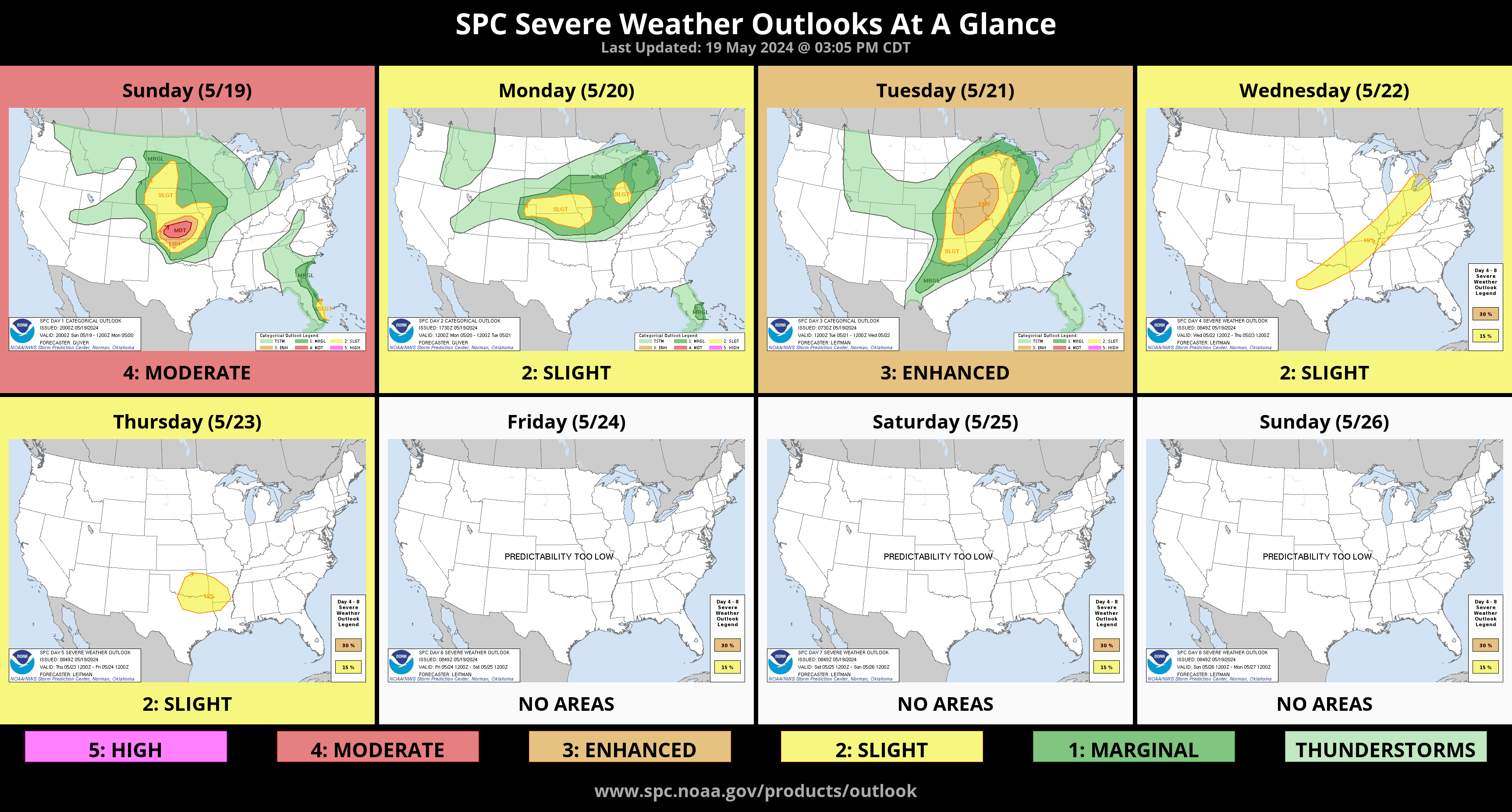
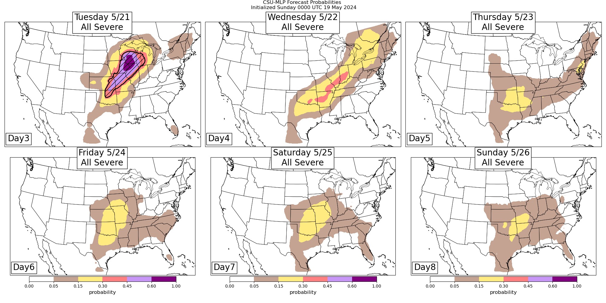
The Storm Prediction Center has a few days highlighted. We’ll compare that to the AI model. The pattern favors the AI output.

Ferguson Roof Systems is offering an AT's Weather special!
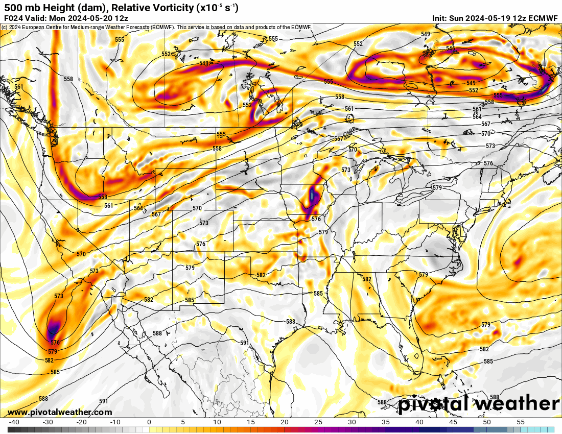
The Jetstream shows us in a SW flow aloft with these disturbances riding through the plains. As long as we’re in this pattern, severe weather is possible. Notice how the brighter colors rotate through the animation. That is where max lift occurs in the atmosphere to produce storms. This pattern also favors high CAPE with speed and directional shear at times. That animation showcases how the atmosphere has the ingredients ready. Note, this doesn’t always mean you’ll get storms in these areas, as oftentimes the CAP holds or limits coverage.
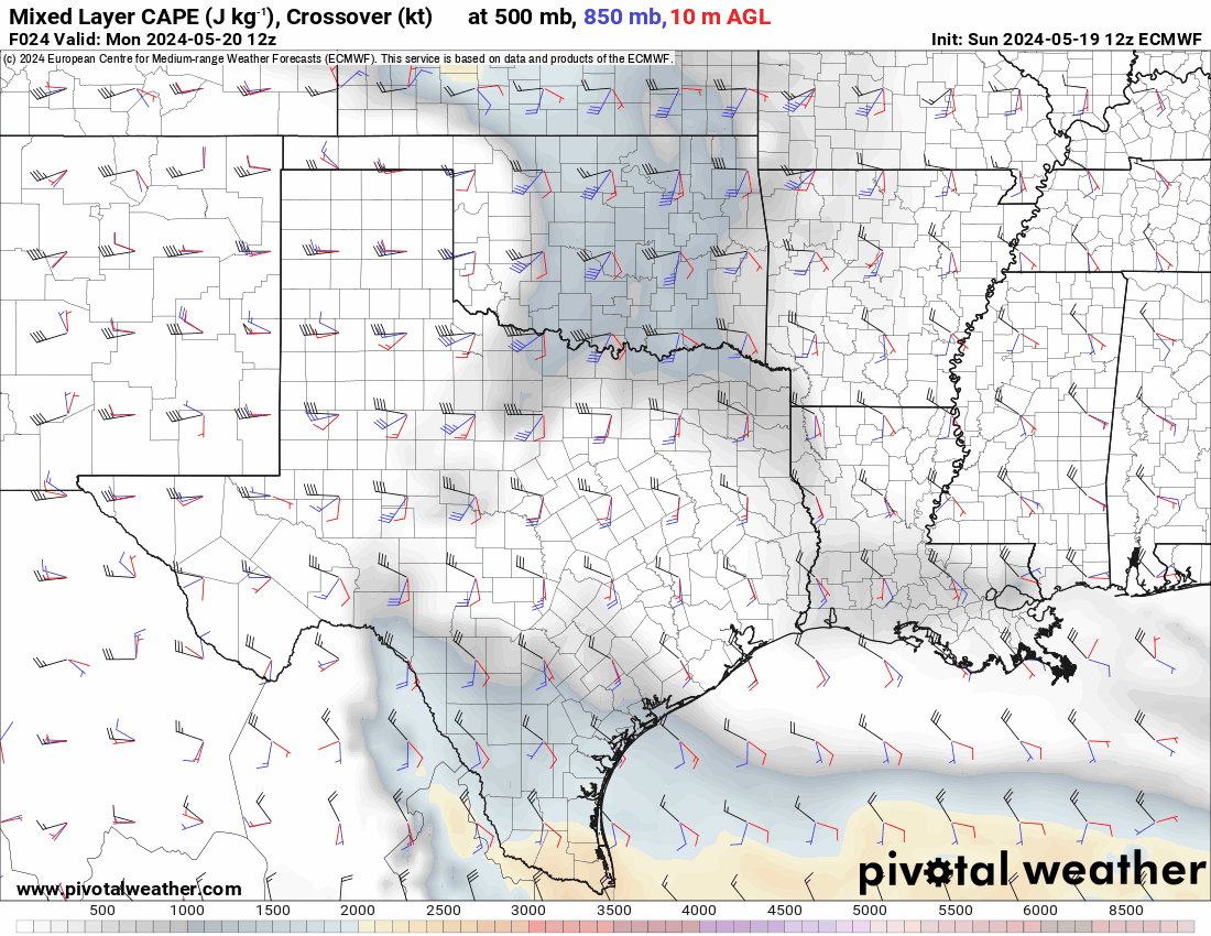
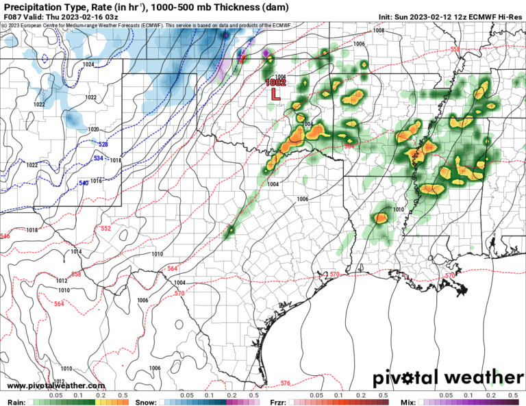
As of today, this is how things look to develop. Storms Sunday night will weaken slowly as they travel from NW to NE Oklahoma, but not before producing wind, hail, and potential tornado. The CAP holds Monday. A dryline approaches the I-35 corridor Tuesday afternoon. Expect a CAP to keep storms isolated that develop along the dryline after 5pm Tuesday. They may start in the OKC metro before moving east. The cold front Wednesday should keep storms focused across the southern half of Oklahoma. Thursday that front lifts back as a warm front bringing uncapped warm sector severe storms during the afternoon/evening just about anywhere. Friday the dryline will fire additional storms across W OK and those travel east late afternoon/evening. We’ll repeat Friday on Saturday and Sunday as well. As far as tornadoes are concerned, Tuesday and Thursday may be the most active days for those. Time will tell.
Ferguson Roof Systems is offering an AT's Weather special!
We will be getting more beneficial rainfall this week as a result. The conservative model blend is posted below. It will not pick out those isolated areas that get dumped on by supercells or training. So expect at minimum what is shown on the map. Some places will get 5″ or more which may lead to brief flash flooding.

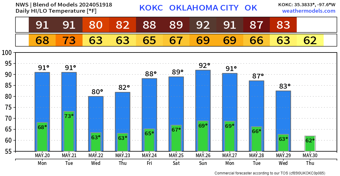
Unfortunately, the heat builds even more this week, so we’ll be seeing a lot more 90s, and with higher dewpoints, it’s going to feel a bit humid around. A weak front will give us a break Wednesday. Here is a look at the OKC metro temperature trend. I’ll be around this week covering severe storms and providing live forecast updates, so check my social media for details. -AT