A Little Spring Snow and Several Freezes
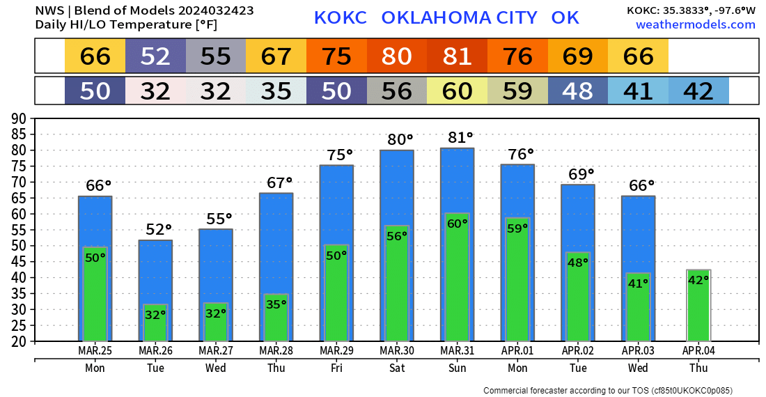
This week was supposed to be uneventful, but a little surprise snow will kick off our Monday as we say goodbye to Sunday storms. In addition, we’ll see a freeze for many a few mornings this week. The upcoming Easter weekend looks great!
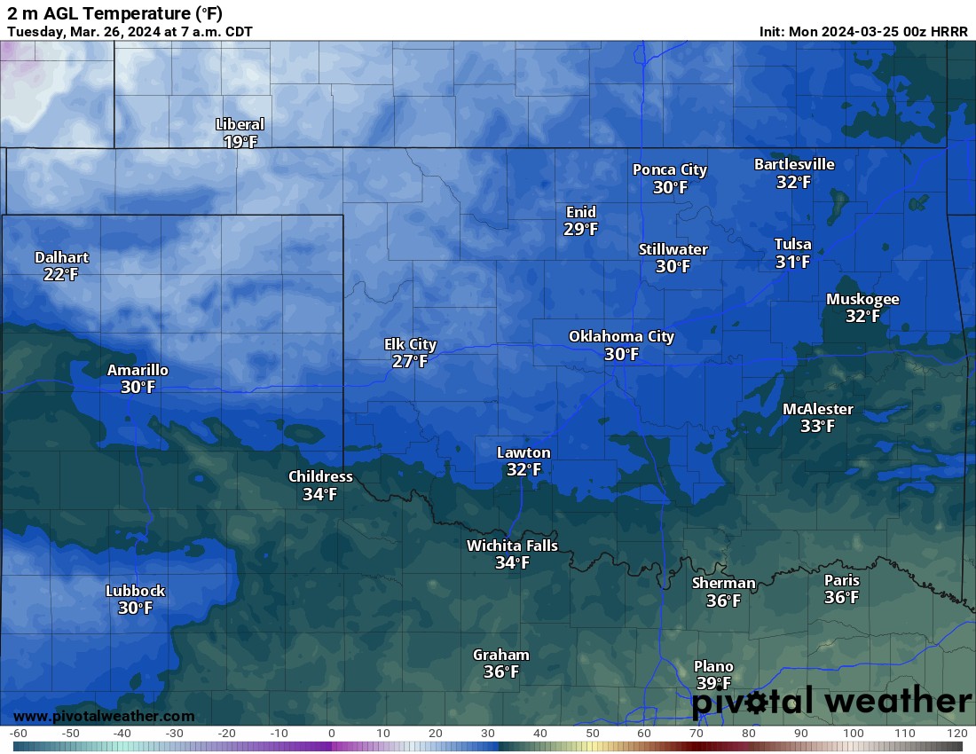
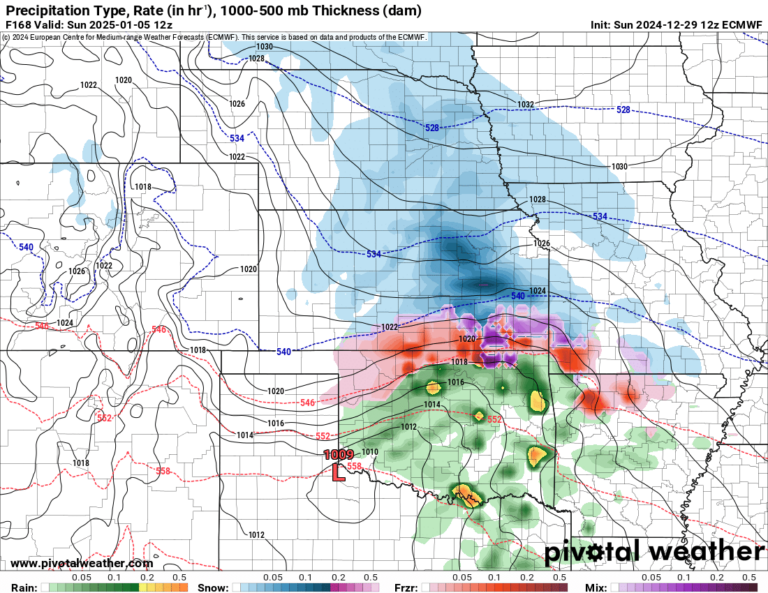
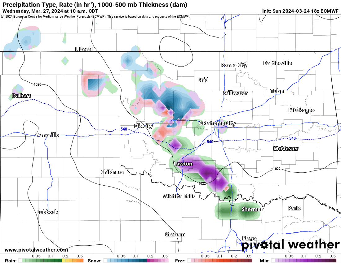
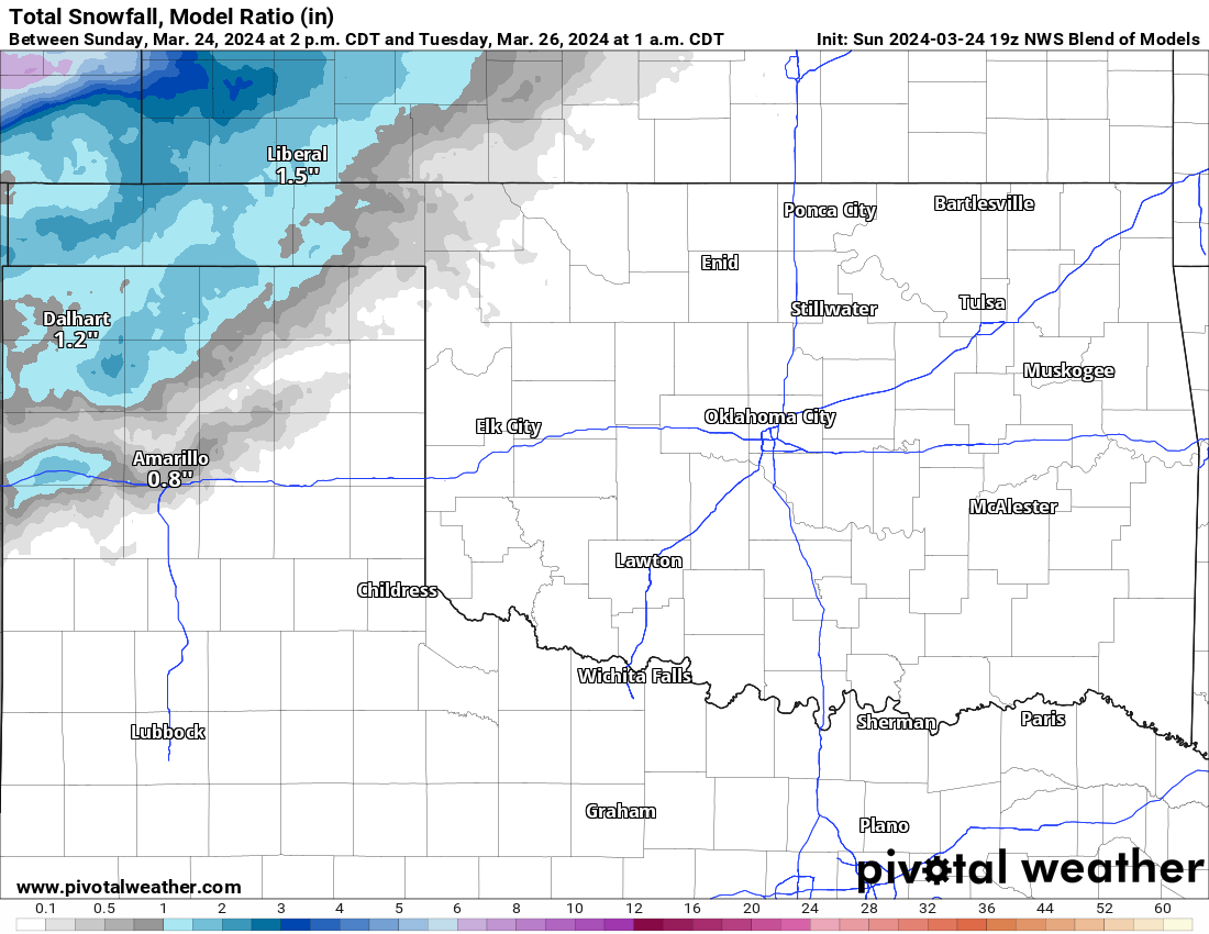
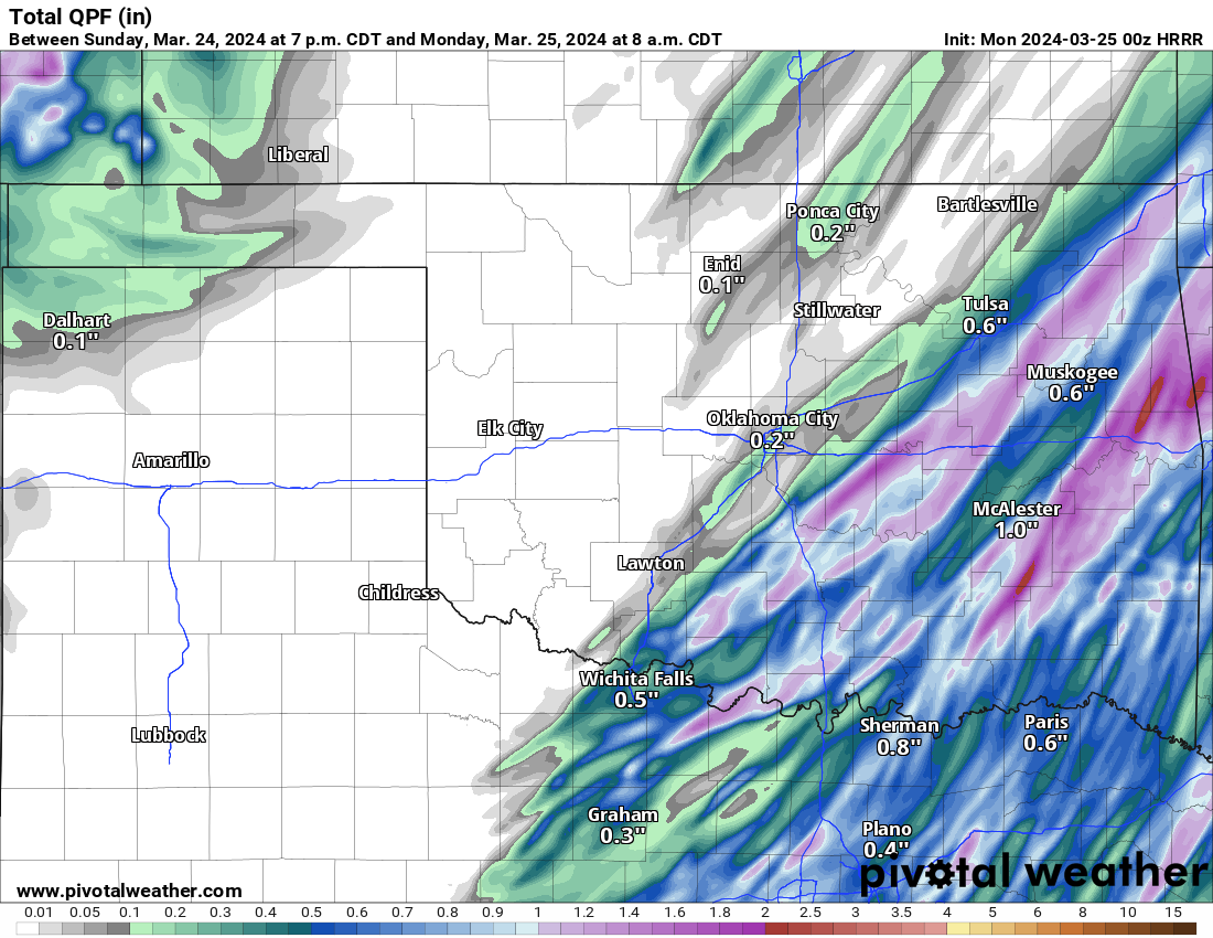
Showers and storms will exit the state Monday morning with a few more across far E OK in the mid-afternoon. Otherwise, light snow will move through the OK/TX panhandle and across the N 1/3rd of Oklahoma Monday morning. There will likely be significant snow accumulation in the NW. Rainfall amounts are decent across SE OK.

Ferguson Roof Systems is offering an AT's Weather special!
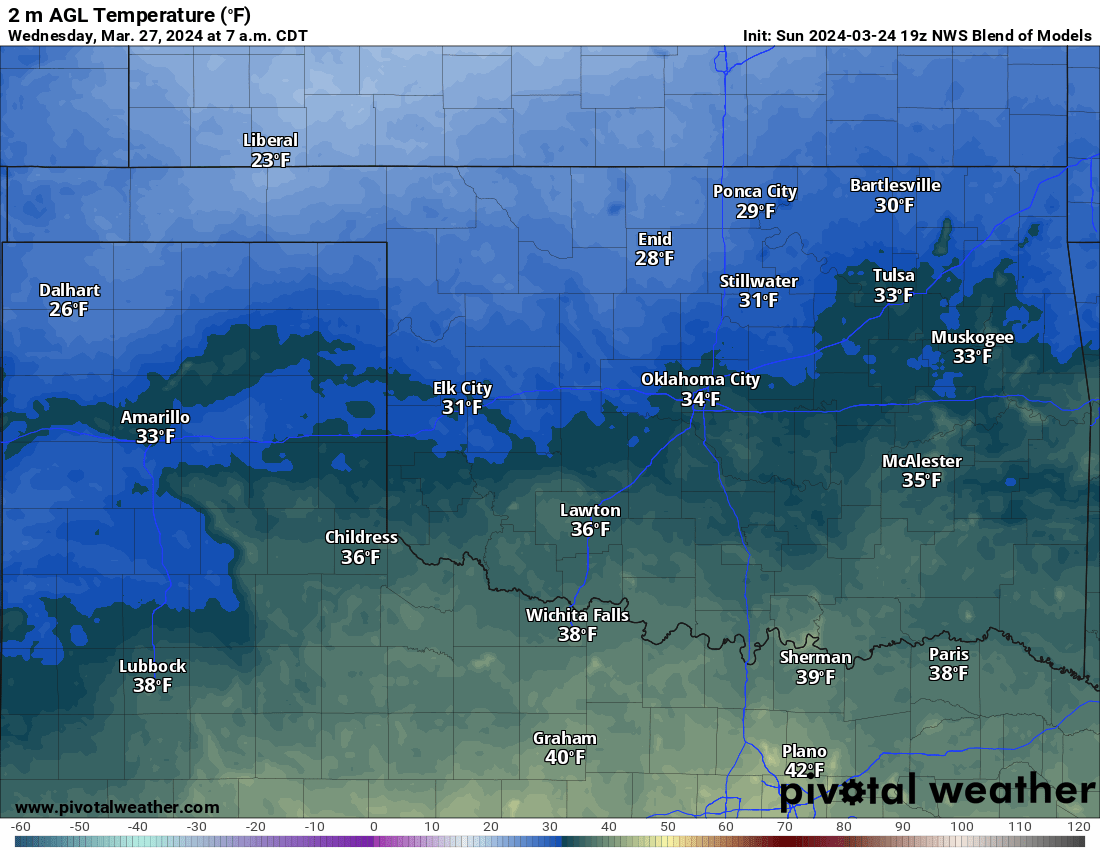
The mid-level vertical velocity map indicates areas of lift across W/NW OK early Wednesday morning. This will likely cause a few light raindrops and snowflakes to move through that area. Don’t expect any significant accumulation.

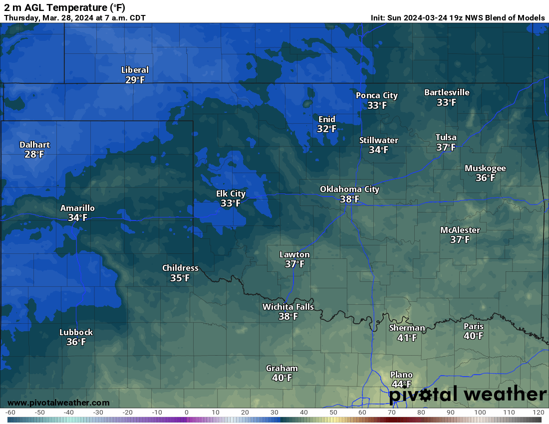
The other story is cold mornings! Looks like a freeze for many Tuesday, Wednesday, and Thursday mornings. Temperatures will warm nicely each afternoon, however. The Easter weekend looks great with a warming trend for the OKC metro. Your backyard forecast will be similar as well. Enjoy the week! -AT
 Restoration and Disaster Cleanup Service