Slow Snow Melt, Freezing Fog, and More Arctic Air
Wow, what a storm! A very prolonged period of freezing rain, sleet, and snow across such a large region of the country, expanding all the way to New England. Insane amounts of power outages and hazardous travel. This week, we deal with the remnants of the storm and reinforcing cold shots.
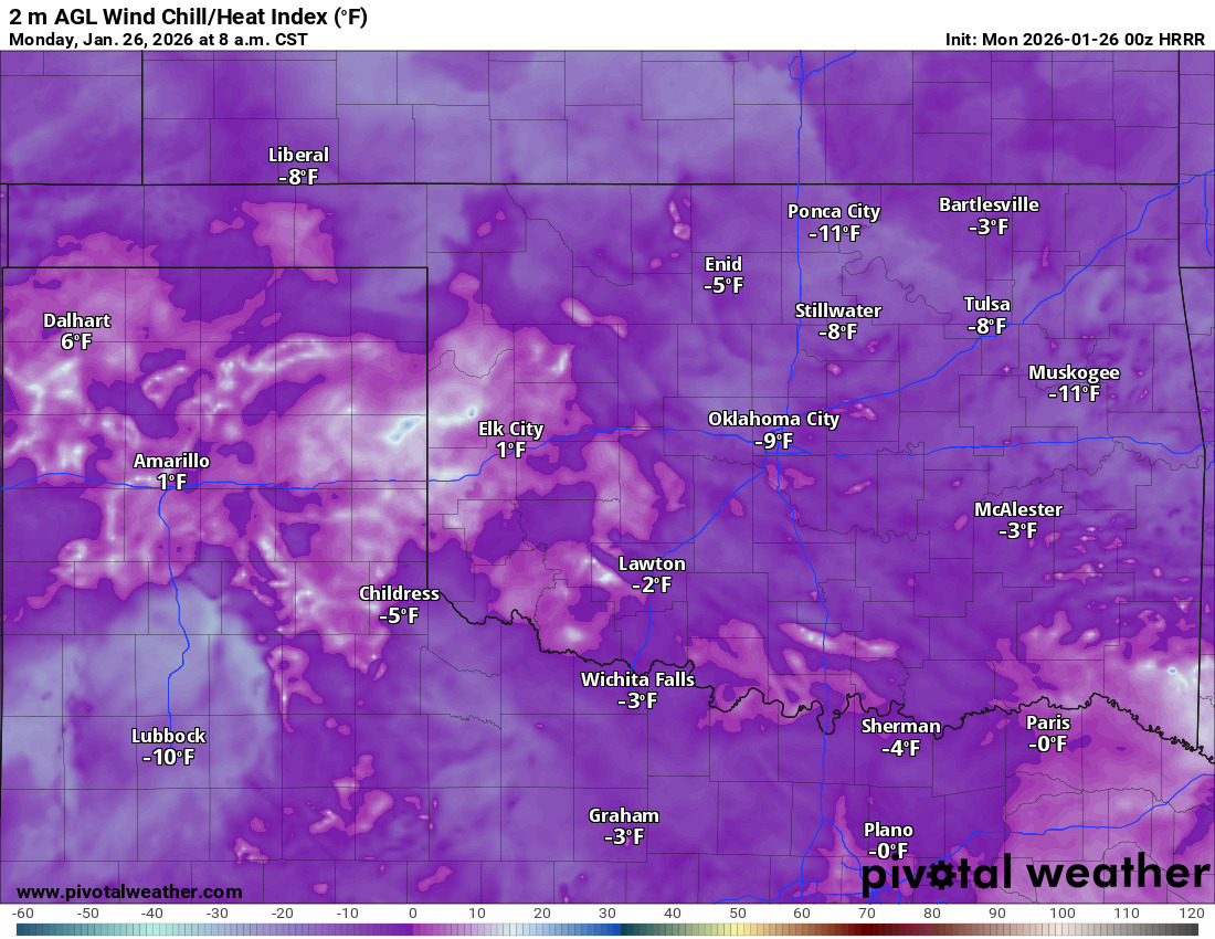
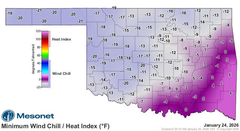
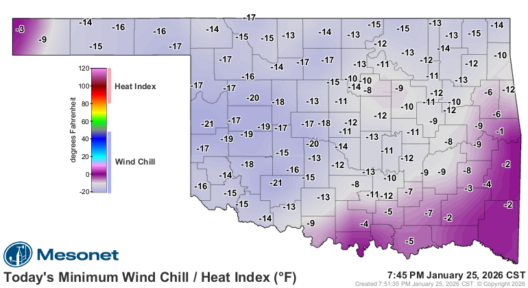
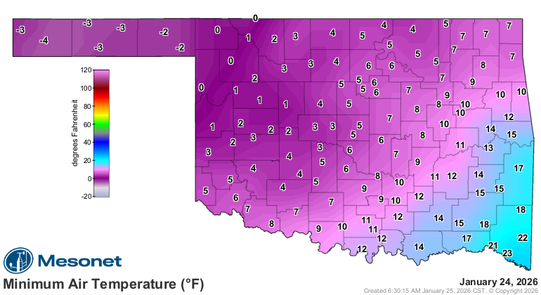
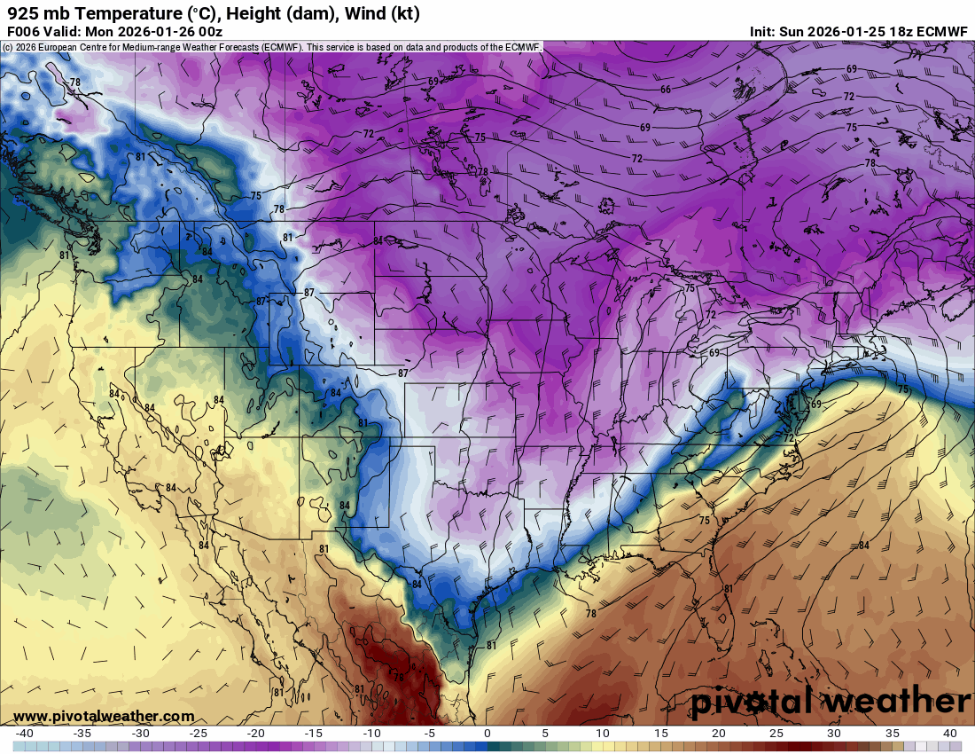
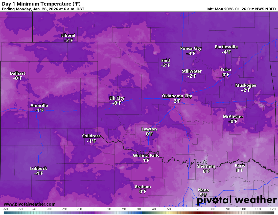
We spent the weekend with wind chill values well below zero across a large portion of the state. Actual air temperatures were pipe-bursting cold as well. In relation to this, I interviewed two of my sponsors, Nathan Snyder Electric and Pronto Heat and Air. Be sure to check out their replays for incredible information about powering and heating your home during extreme winter events. Just click the link on each name above.

Ferguson Roof Systems is offering an AT's Weather special!
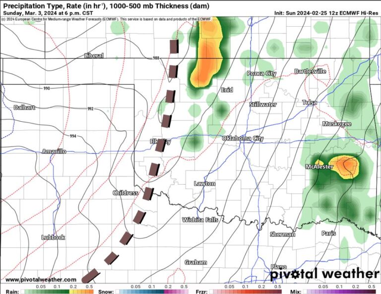
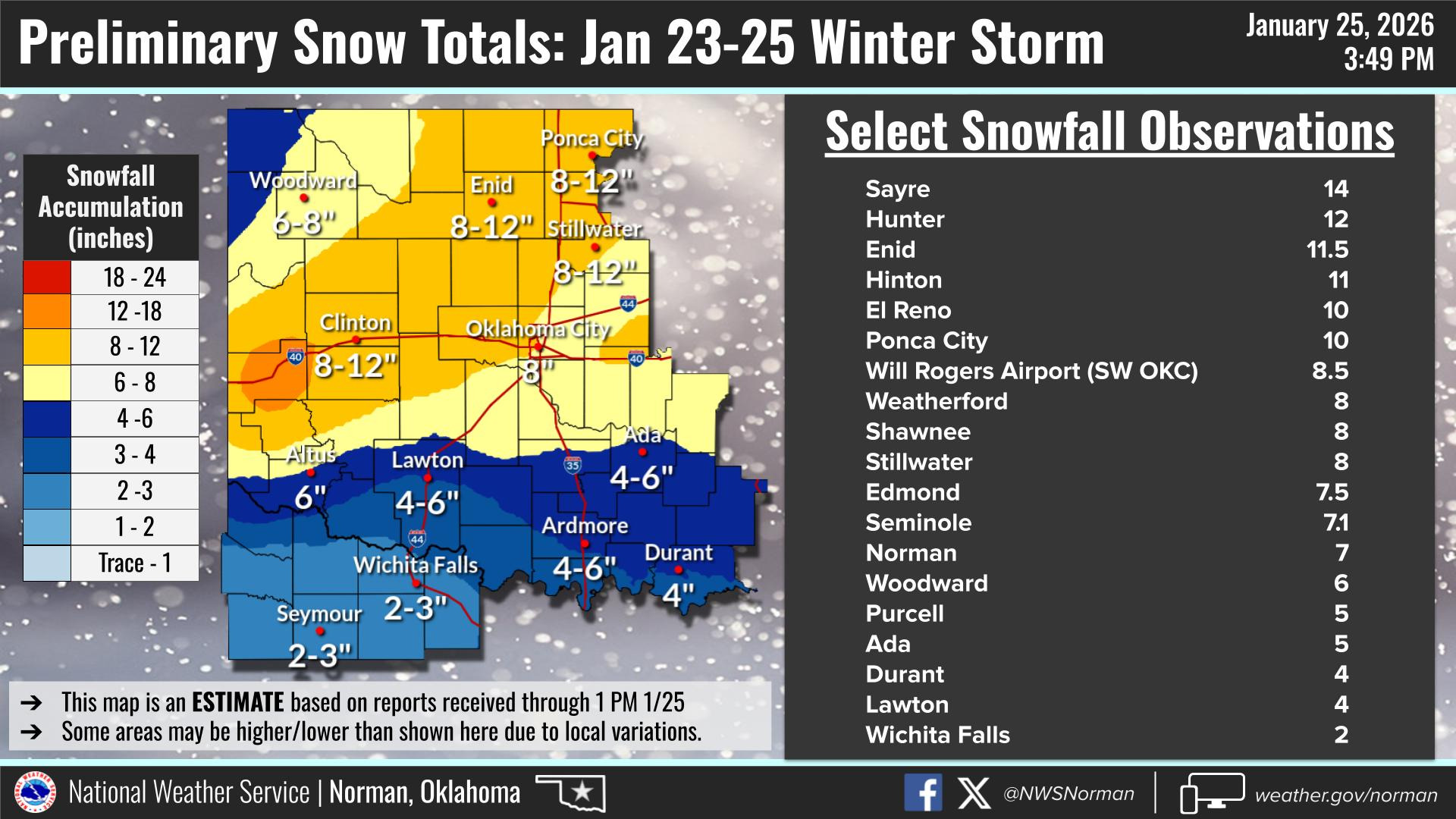
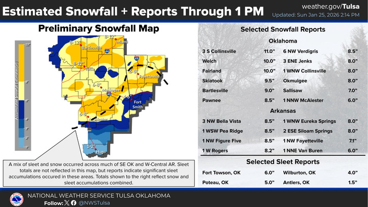
The system came out in waves and generated quite a bit of wintry precipitation with as much as 6″ of sleet across SE OK. Snow totals varied wildly.
The back end of this pattern brings a weak short-wave trough across tonight and Monday morning. This will trigger very light snow overnight through Monday midday across NW and C OK, but not accumulate to anything significant.
Ferguson Roof Systems is offering an AT's Weather special!
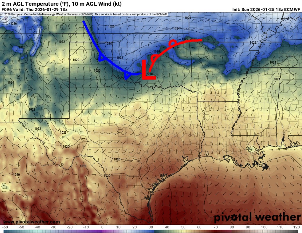
Another upper disturbance will swing by on Thursday. This should cause a surface low to develop, which will increase low-level moisture with temperatures below freezing. This may lead to light freezing drizzle across C OK. So be very careful on roadways.
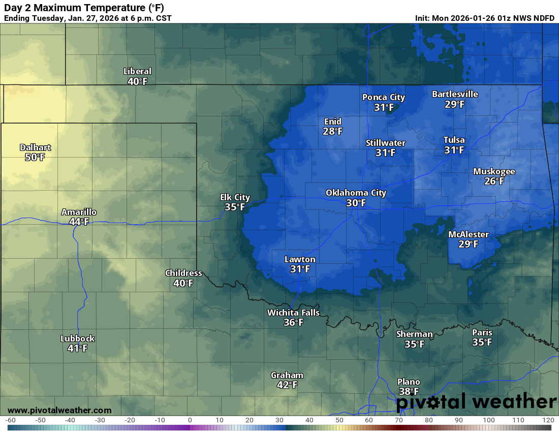
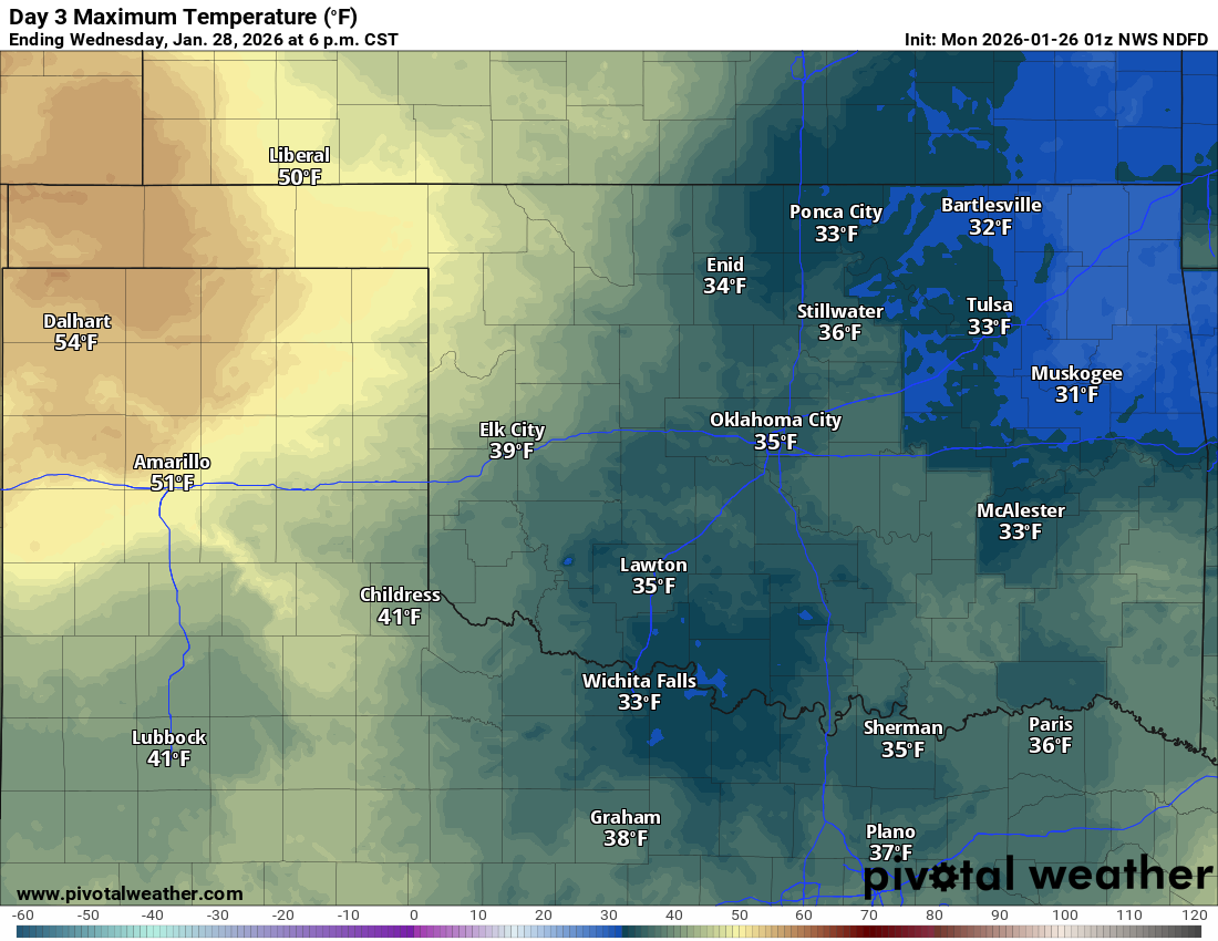
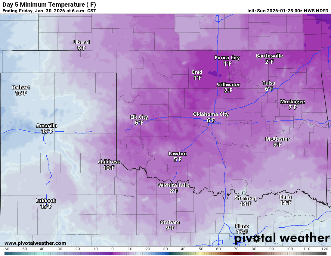
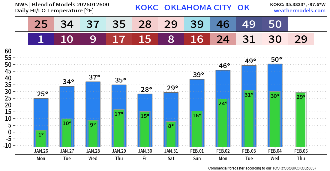
Speaking of roadways, the slow thaw will commence on Monday, but air temperatures will not be helping out much. As a matter of fact, we have weak cold fronts slipping in and the bigger one on Thursday. So getting above freezing is going to be challenging this week. Tuesday and Wednesday will barely get us there in some areas. So expect any daytime melt to refreeze at night, and also we’ll see pockets of freezing fog develop on Tuesday and especially Wednesday morning. That can also make the roadways icy once again. At least on the national picture, the bulk of the cold air leaves Oklahoma alone.
Ferguson Roof Systems is offering an AT's Weather special!
Don’t look for a lot of sun this week. Sometimes low clouds develop and hang tough due to the ground moisture from trying to thaw the snow. This also curtails any big warmups in the near term. The extended outlook doesn’t give us much hope until February 1st. The wind will bump up on occasion, especially on Tuesday and Thursday, so dress very warmly this week!
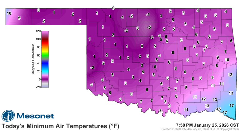
And before I let you go, many are concerned about pipes freezing and water lines breaking. It’s a valid concern during this deep freeze and extended time below freezing, lasting so many days. I’ll be interviewing my sponsor, All Dry Solutions of OKC, to ask all of those important questions of “now what” when you find yourself in this situation. Join me on Facebook and YouTube at 6:30 pm Monday evening. -AT