Heat Builds and Severe Storms Take a Brief Break
The highlight this week will be a nice start before the heat builds in. Instability will return for storms, but the CAP will be an issue. Next weekend will likely be wet again for some.
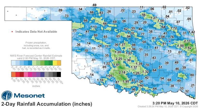
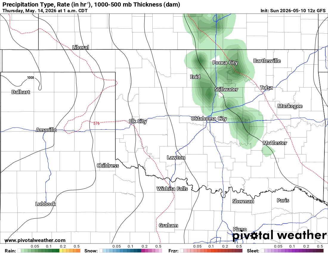
Normally, my weekly blogs give you the highlights of what to expect for the week. This past weekend shows that a jetstream configured in northwest flow can produce these tiny upper disturbances, which can trigger events without much lead time. I am grateful for the weekend rain, but those hailstorms on Friday can go pound sand. At the time of this blog, rain was still falling, so the rain total map below will gain additional amounts through Sunday evening.
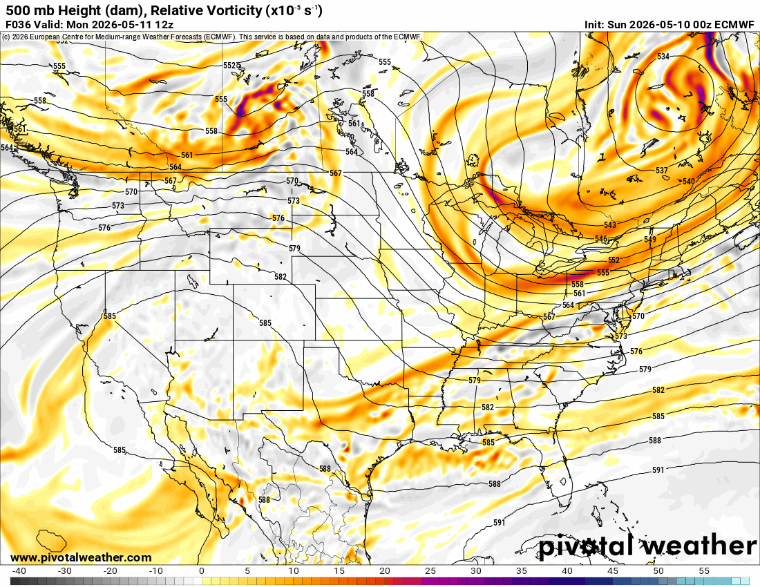
The pattern for this upcoming week does have a few rain opportunities, but it is mostly dry for the state until the weekend. A NW flow aloft will transition to a more zonal (west to east) flow. There aren’t any large storm systems, just these subtle waves. So if any of those signals create more of a problem than what is known today, I’ll let you know during the week.
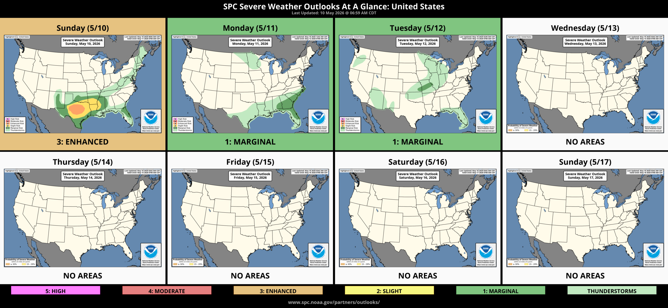
The CAPE/Shear (severe weather metric) will return for the week, transitioning over different areas of the state from Tuesday through Sunday. The CAP will be quite strong during this time period, which should offset this and keep most of the period quiet. The Storm Prediction Center isn’t outlining anything in the extended outlook at this time. I will caution that it is mid-May, which is the peak of our severe weather season and our tornado season. So to have a significant lull is rare for this time of year.
I’ll post the signals for rainfall below. Each event appears to be hail and wind. Sunday would have the better severe weather ingredients overall.
The first event will be Tuesday late day along the OK/KS border with a weak cold front. Storms should develop up north and travel east and then south as they fall apart Tuesday night. They would affect NE OK and, if held together long enough, into C OK down to the I-40 corridor.

Be sure to mention Aaron Tuttle when you call (405) 820-1193!

Return flow moisture may kick off some showers or weak elevated thunderstorms Wednesday night into Thursday morning across the E half of the state.
There’s a dryline across WC OK that may try to fire a few storms along it, if the CAP can break. A cold front in KS will trigger a few storms that may hold together and move into NE OK Friday night.


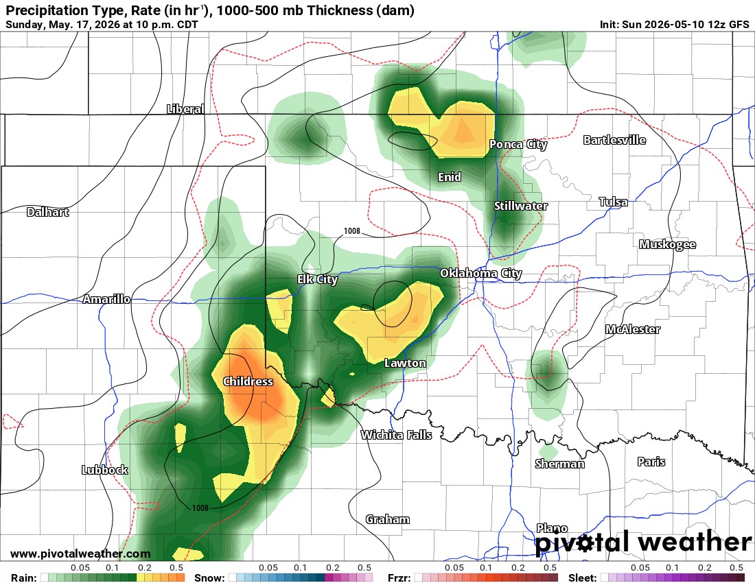
The crystal ball gets a little cloudy for the weekend. There will be a cold front in the area. If the Friday night storms arriving out of Kansas end up being a bigger deal and congeal as a slow-moving squall line that moves south and backbuilds SW, then it covers the entire NE 1/4 of Oklahoma and moves SW to cover parts of C OK as well before diminishing by mid Saturday morning. This would likely prevent any additional storm formation for the rest of the day. If that doesn’t happen, then the weak surface front/trough will push east of I-35 for Saturday and may trigger a few storms across E OK for the afternoon, and as it retreats, a couple in C OK during the evening.

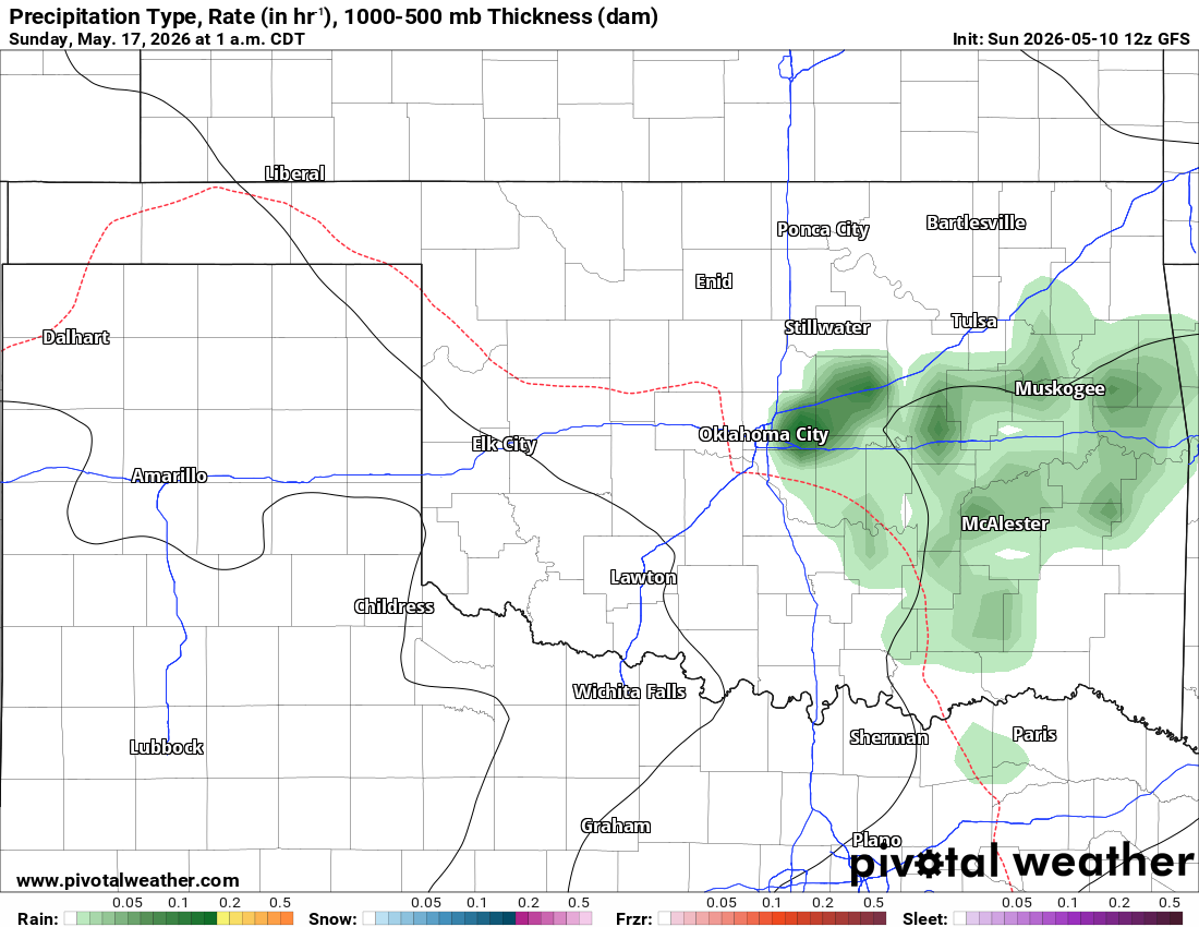
Sunday, we’ll likely have the residual of that cold front across N OK and the dryline back on the Texas state line. So that puts the W half of the state with storms Sunday afternoon and evening. If they hold together, then those will move across the eastern half of the state Sunday night. There are signals that additional rounds of storms will occur the following week.
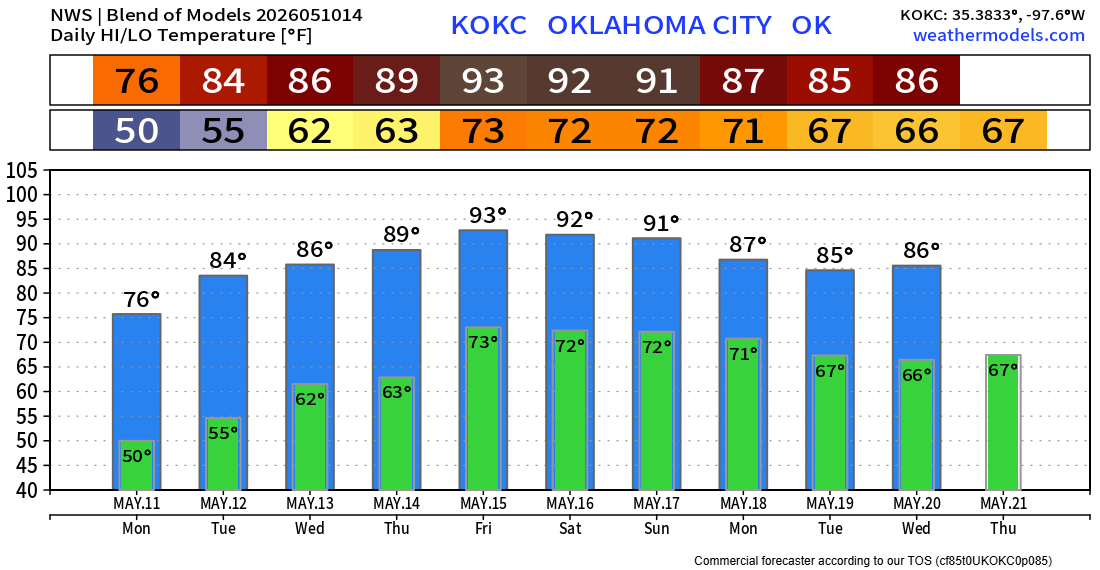
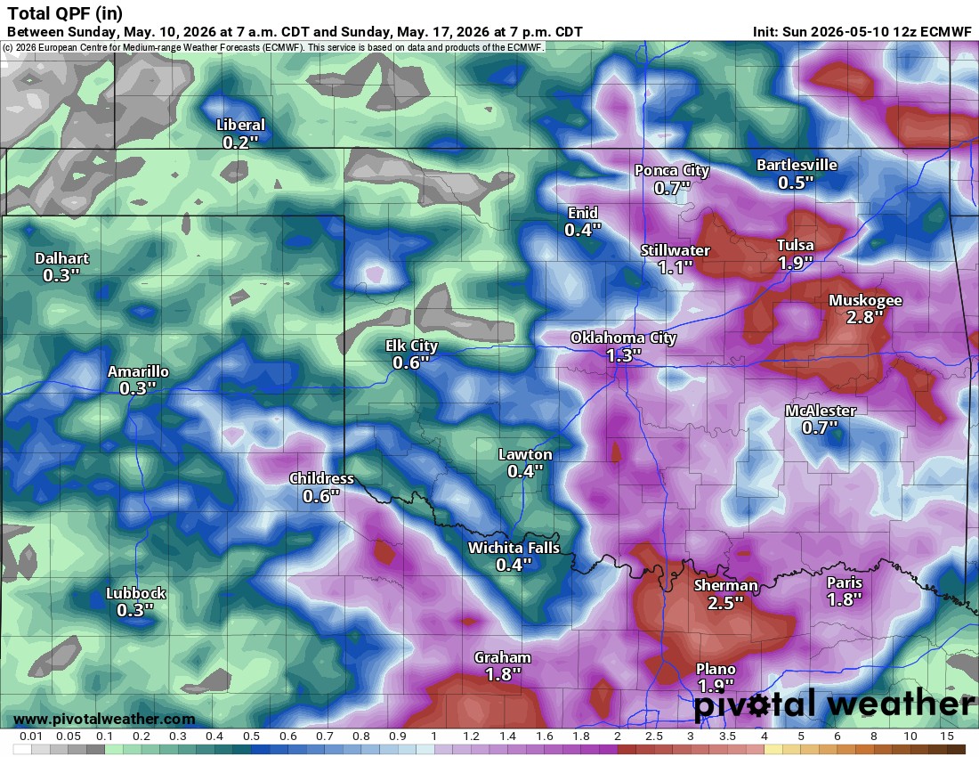
So, given this breakdown, rainfall estimates are likely not going to be very accurate. This is the model blend below. Time will tell.
One thing is for sure: temperatures are going to get hot. Some models tried to sneak in a couple of 100-degree readings in far W OK Friday afternoon. I think it’s a little early for that, but mid to a few upper 90s is definitely on the table.