Record Heat Midweek and Weekend Storms

I hope you enjoyed last week and Mother’s Day weekend a bit outdoors. Phenomenal for May! This week, a hot pattern develops and then a return to a stormy one.
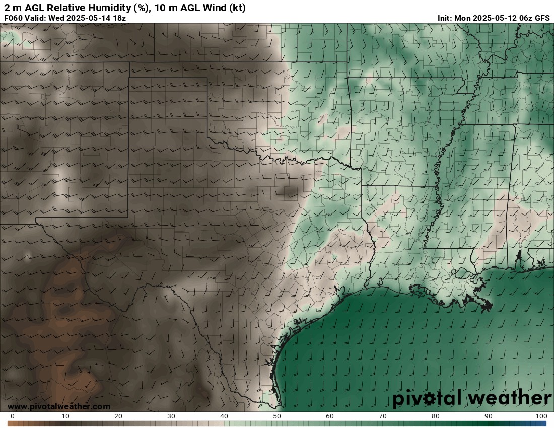
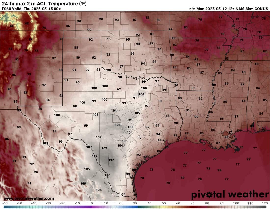
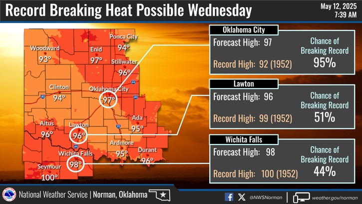
The first discussion point is the heat that will build. An upper ridge is centered across Mexico which is warming up the mountains with compressional warming and downslope flow. This will push extremely hot air with very low humidity into W TX. It will travel as far east as the I-35 corridor from Texas to Oklahoma by Wednesday. So brace yourself!

Ferguson Roof Systems is offering an AT's Weather special!

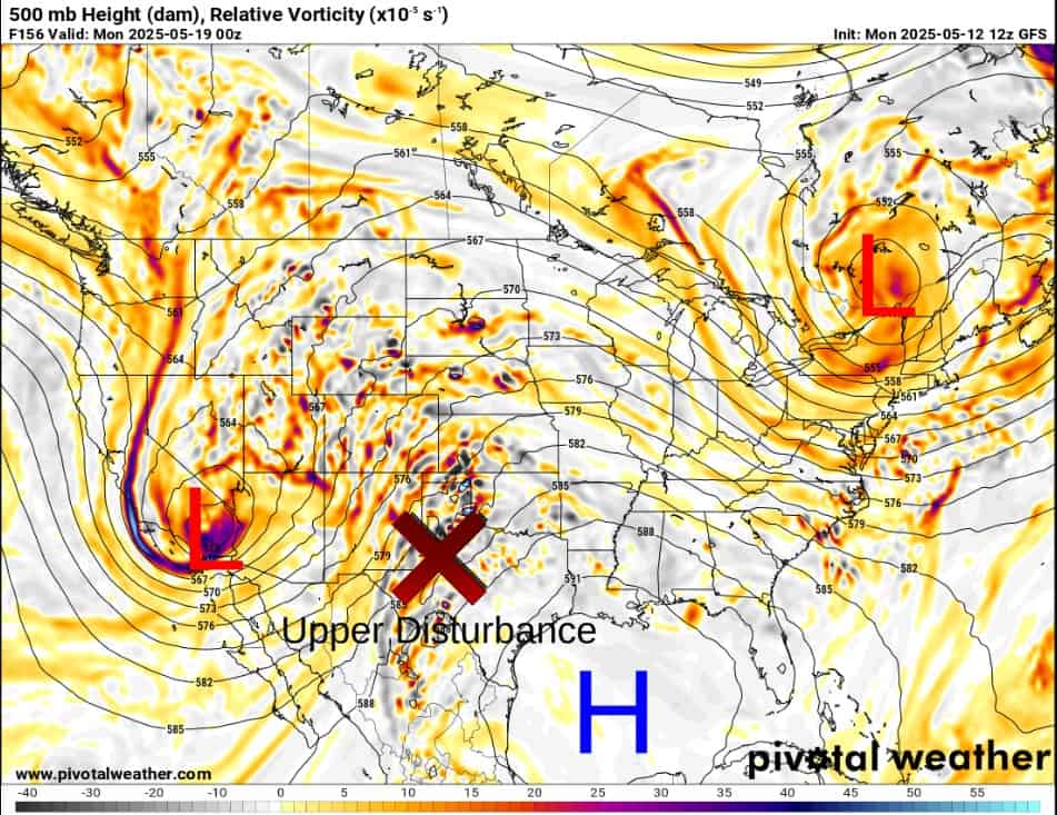
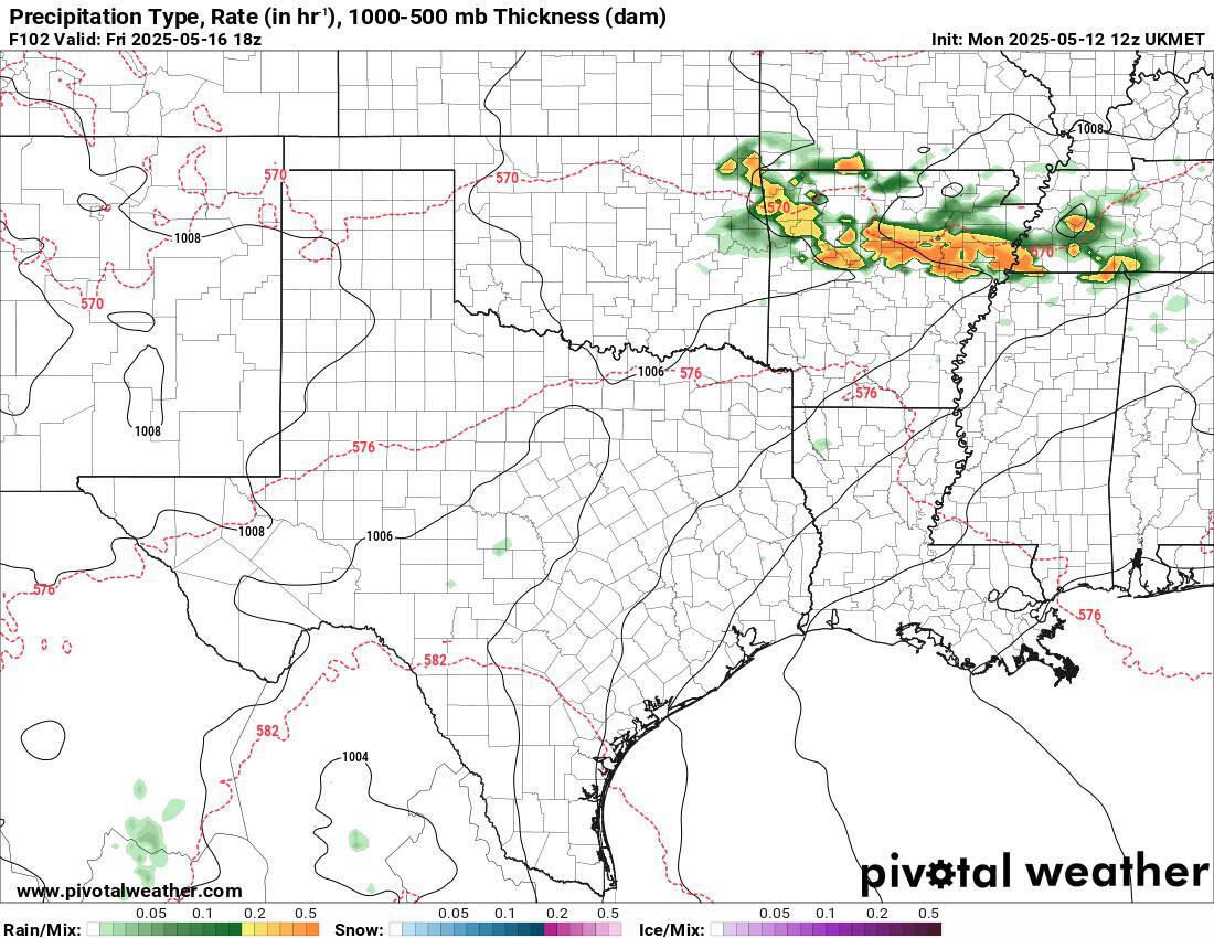
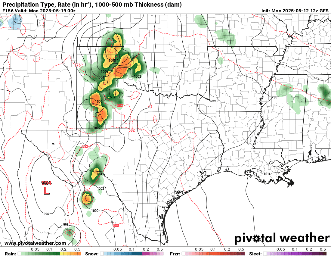
Then the pattern shifts to a SW flow aloft as that ridge moves into the Gulf of America. This allows weak disturbances to swing across Friday through Monday ahead of the upper storm system across the desert southwest. It appears the most likely area for scattered storms on Friday afternoon and evening will be in far E/NE OK and Arkansas. On Saturday, a wave will develop across the Red River and travel across the E half of OK during the afternoon and evening. On Sunday, the dryline sets up across W OK, and storms will attempt to fire along it late afternoon. Those storms would travel east during the evening. Additional storms will occur on Monday before the system moves out.

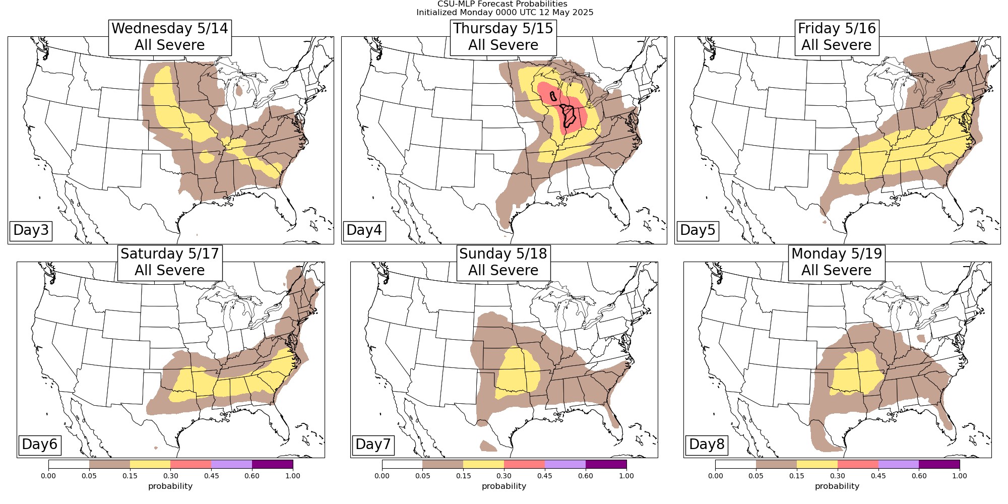
It should be the standard type of wind/hail with the first two waves. On Sunday/Monday, shear and instability improve more for rotating storms, but so does the CAP trying to prevent their formation. This may lead to an elevated storm structure, which can form into a squall line with wind and hail again. I’ll have more as the week progresses. The Storm Prediction Center doesn’t have anything regarding severe weather, but AI hints at a low threat.
 Restoration and Disaster Cleanup Service
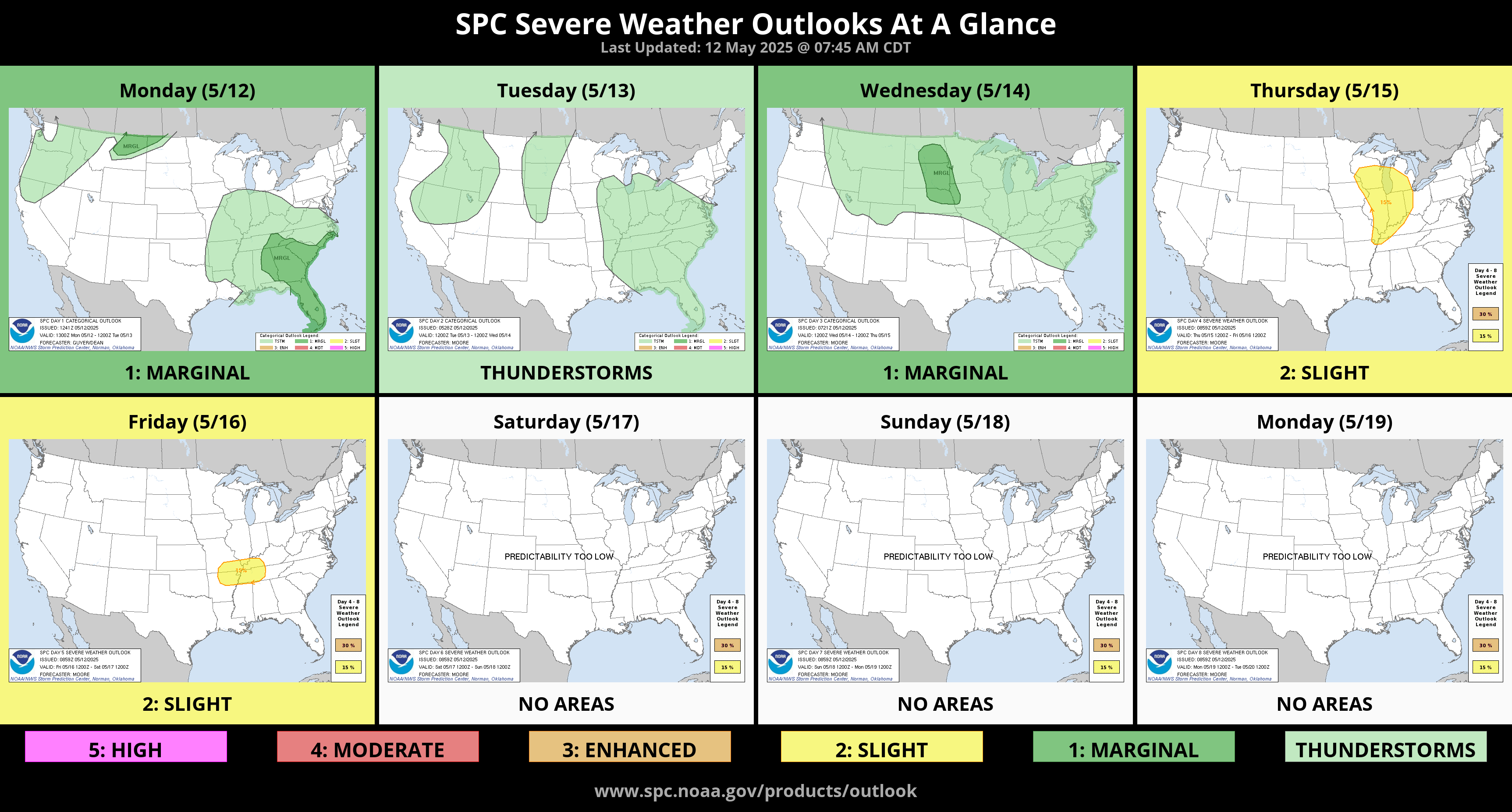
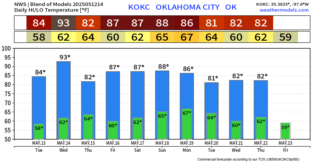
Here is the model blend for OKC this week. Thankfully, a cold front will move in Wednesday night, cooling us down from those hot Wednesday temperatures! -AT