Summer Has Arrived with Heat and Showers

You’ve noticed a big change compared to the past week or so. The water spigot has been turned off, and the heat has been building. It was quite humid for a few days with all of the evapotranspiration underway from recent rains and green vegetation. The crazy wind did help provide some relief. Things will change a bit this week. Details below.
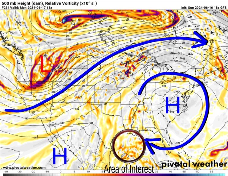
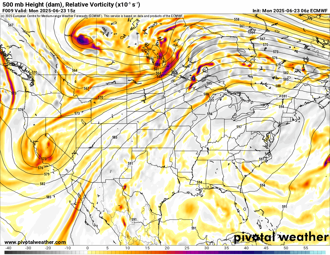
The Jetstream shows an upper ridge positioned across the SE US and a Low in the SW. This puts us in the squeeze play in between. This will funnel Gulf moisture along the eastern slopes of the Mexican and New Mexico mountain divide, allowing showers and storms to develop east of those areas. Some of this will work into W/NW OK this week. We can also get minor upper-level disturbances rotating around the bottom of the ridge, across Texas, and into Oklahoma to trigger isolated activity elsewhere. The best days for that may end up being Thursday and Friday.

Ferguson Roof Systems is offering an AT's Weather special!

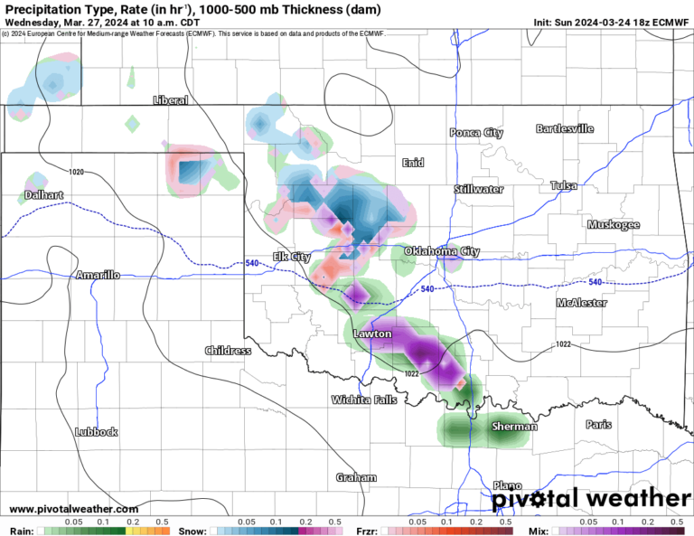
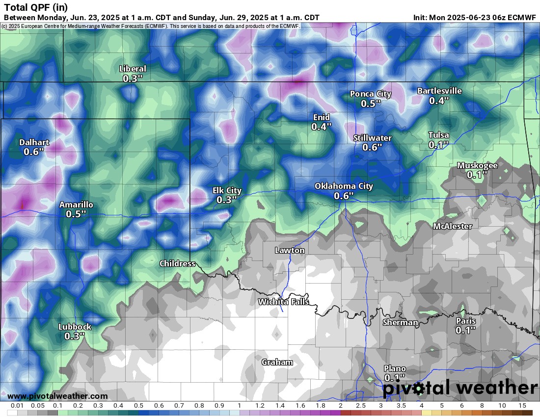
The rainfall animation shows the best rain out in NW OK today and other sparse activity through the week. Rainfall totals could be decent across the NW half of the state through Sunday.

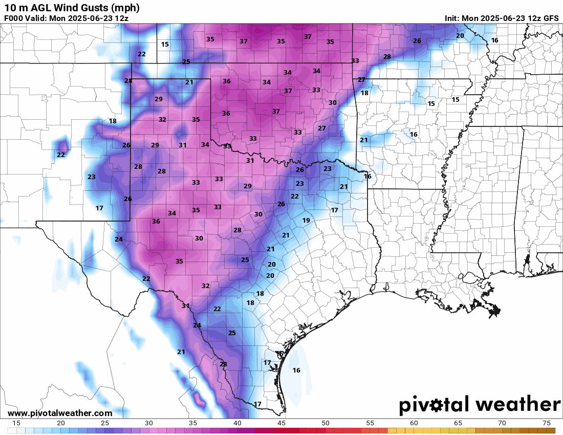
The wind is going to remain a bit breezy through the week as well. Being pinched between two systems keeps the pressure gradient force up, allowing those wind gusts from the south in excess of 30 mph at times. It will be windier in W OK than in the east.
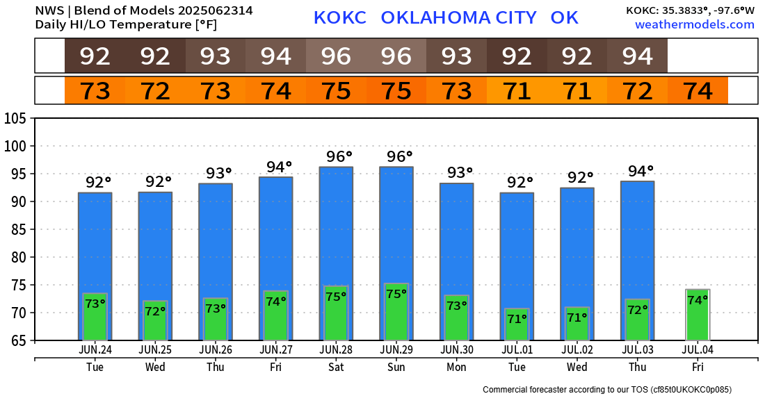
Temperatures are about what you would expect this time of year. Remember, as we get deeper into our summer season and while the vegetation remains lush and green, heat index values often creep higher than the actually forecasted air temperature. This only affects humans and pets, not objects. It’s a function of internal body cooling. More humidity makes it a little more difficult, so heat exhaustion can sneak up on you.