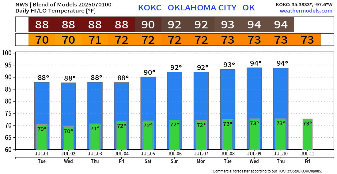
Stormy Independence Day Week

The pattern this week will trap upper-level lift across Texas and Oklahoma, which will help to spawn isolated to widely scattered showers and storms from Wednesday through Sunday. Temperatures will be moderate as a result.
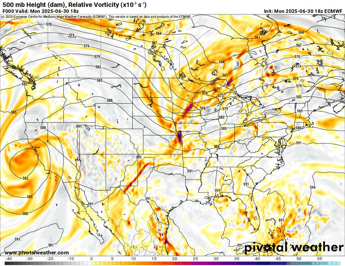
The Jetstream animation shows the brighter yellow/red colors circulating from Texas to Oklahoma mid-week, with a transition to a W/NW flow aloft by Saturday and Sunday. This causes the rain to form.
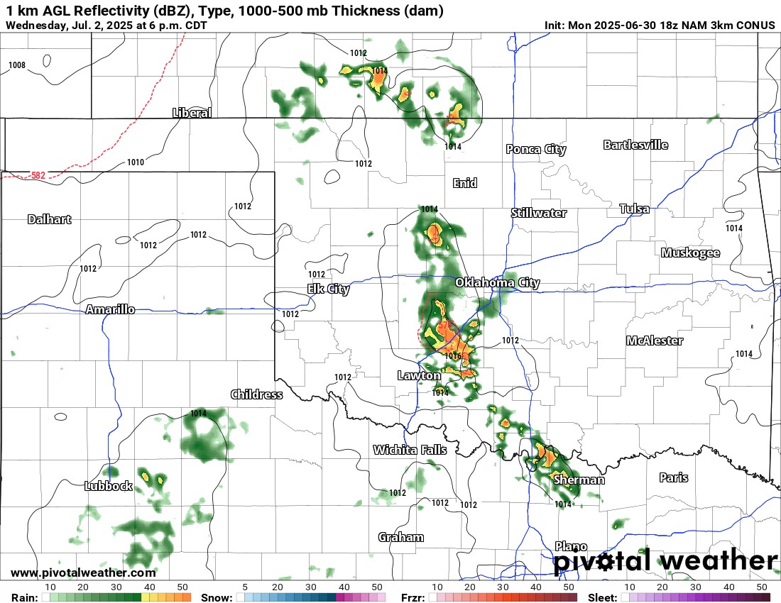
The first day of decent scattered activity will form across W OK Wednesday afternoon and drift eastward into C OK. Isolated activity returns Thursday, with more scattered activity Friday and Saturday. There will be several dry hours each day, and the timing of these summer events can be quite problematic, as they can occur at any time, although mostly focused from afternoon/evening. Make sure you have backup plans for your holiday outdoor activities. Regarding Firework Friday, expect partly cloudy skies outside of any rain activity with south winds around 15 mph and occasional gusts to 30 mph during the afternoon. They’ll drop down to half that after dark.

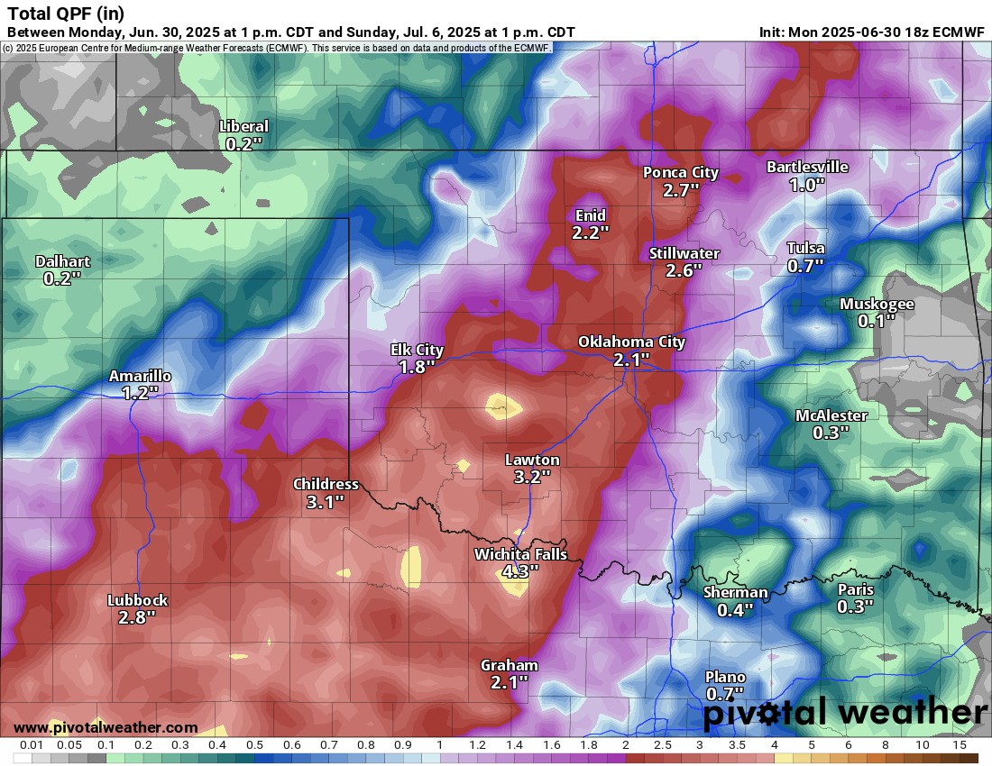
Rainfall amounts are centered across W/C OK for the week. Summertime storms can drop a significant amount of rain due to slow movement. As they collapse, they can also release gusty winds, which can be damaging in the form of a microburst.

Be sure to mention Aaron Tuttle when you call (405) 820-1193!
Temperatures in this pattern don’t get too hot, which is a plus. Have a safe holiday week!