More Rain This Week, Flash Flooding Possible

The pattern will favor isolated to scattered shower and storm activity all week long, with a few thunderstorm complexes to travel across the state as well. Additionally, we’ll recap the events that occurred in Texas over the holiday weekend. It’s a reminder of how important it is to take flash flooding seriously.
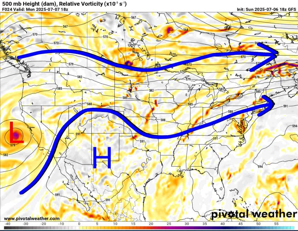
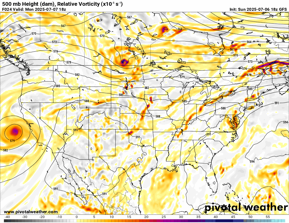
The Jetstream sets up with an upper ridge of higher heights across New Mexico. This allows disturbances to rotate off the California coast and travel east across the Central Plains. This often spawns MCS (mesoscale convective systems) that travel far distances, producing quite a bit of rain and some wind. We have strong signals for those Tuesday, and Friday-Sunday. Otherwise, it’s scattered activity you’ll need to plan around.

Be sure to mention Aaron Tuttle when you call (405) 820-1193!
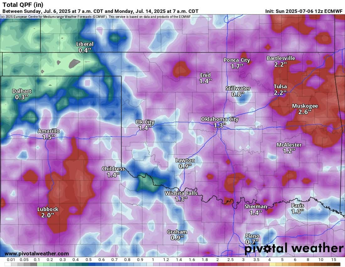
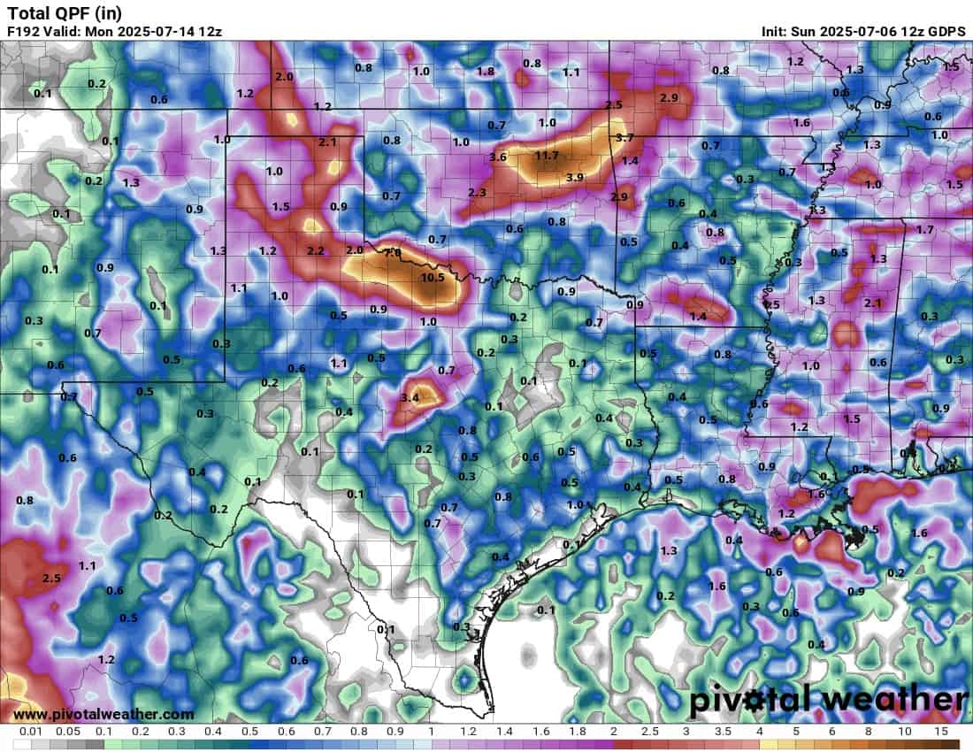
The rainfall animation shows how it’s just about anytime, day or night, and any day of the week for a specific location. Your best bet is to have a backup plan in place and track radar often on my free weather app, ATsWeatherToGo, if you have sensitive outdoor activities. Collectively through the week, rainfall totals will be significant, and yes, as the Canadian model suggests, there may be a couple of places that see nearly a foot of rain. This can happen with a weak wind pattern in the atmosphere. That means flash flooding could be a problem. The models won’t know the exact area this far out, but it will be something to pay attention to.

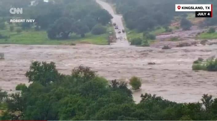
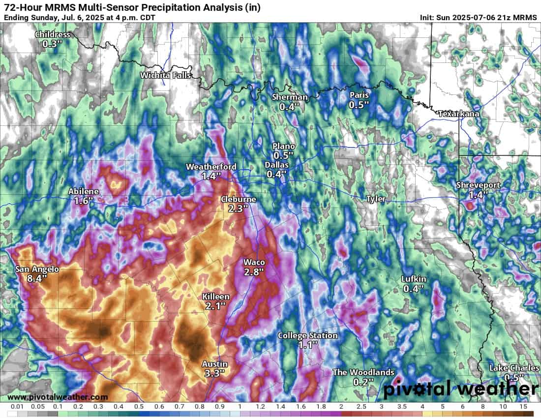
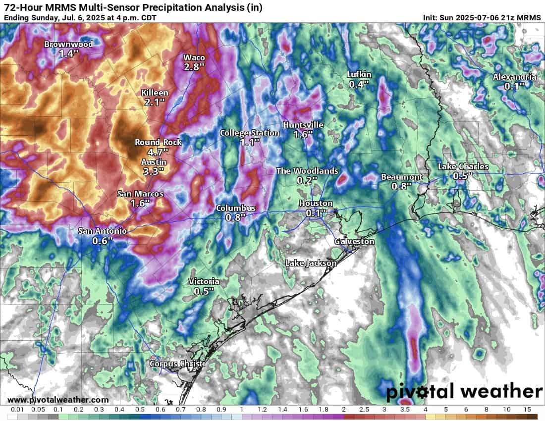
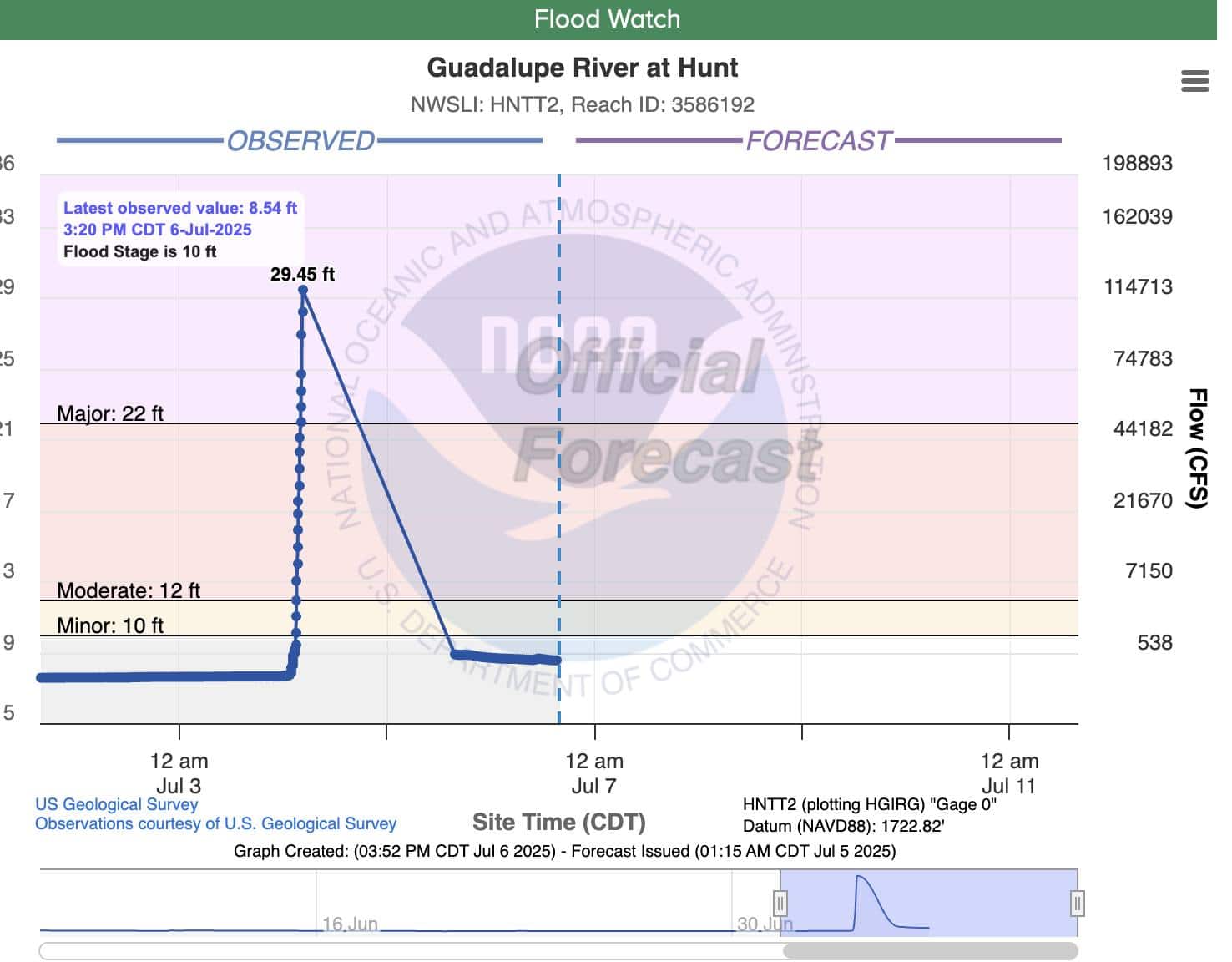
Speaking of flash flooding, a horrific situation developed across the Texas Hill Country region over the holiday weekend. A flash flooding event developed overnight after midnight, catching a lot of campers off guard along the river bottoms in West Central Texas. Lake Travis was hit the hardest with an estimated 20″ of rainfall. Even though the National Weather Service did a great job warning people, with weak cell coverage and a lack of NOAA weather radios, few knew the event was unfolding, and for those who may have known, did they know where to go at 4 am? Over 80 people lost their lives in the event, and searches are still underway. It is a stark reminder that you must have multiple ways to receive weather information and to take flash flooding very seriously. Notice how quickly the Guadalupe River exceeded the major flood stage of 29ft in less than an hour. You just can’t plan for this or comprehend what it means. It’s a declared federal disaster area.
Be sure to mention Aaron Tuttle when you call (405) 820-1193!
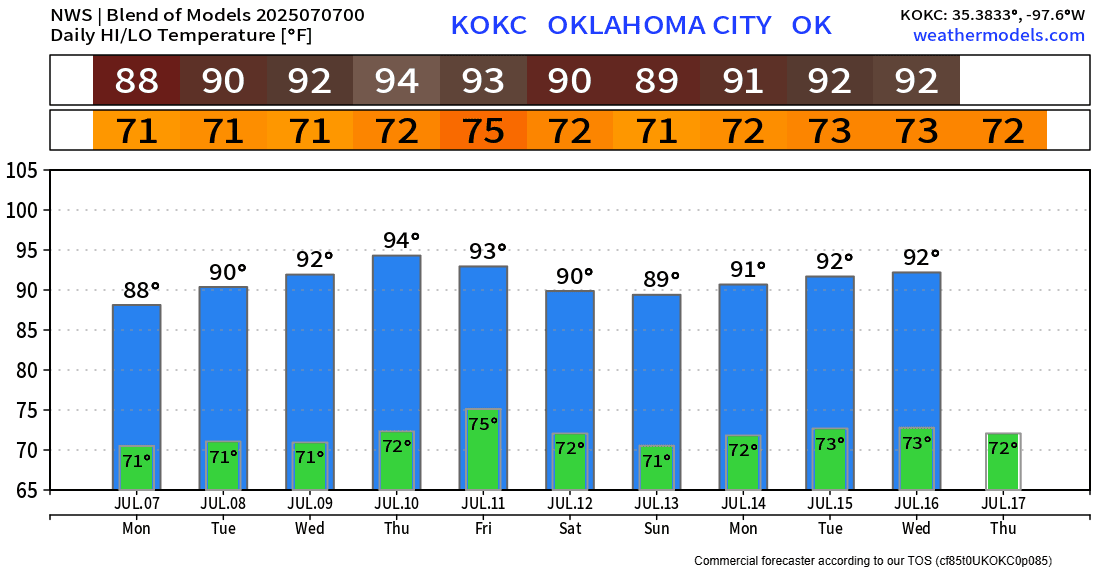
Regarding temperatures this week, we’re going to attempt to reach the low 90s most days. It all depends on rainfall and cloud cover, but we don’t have that upper ridge on top of us yet, so that means we get a break without extreme heat.