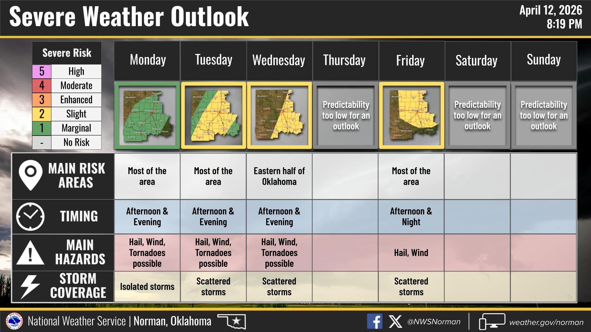
Severe Weather Ramps Up This Week
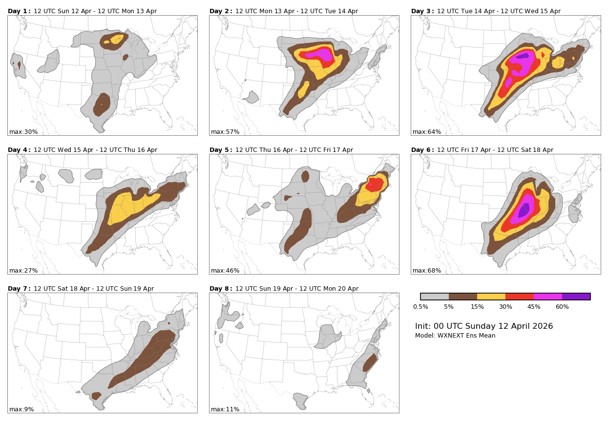
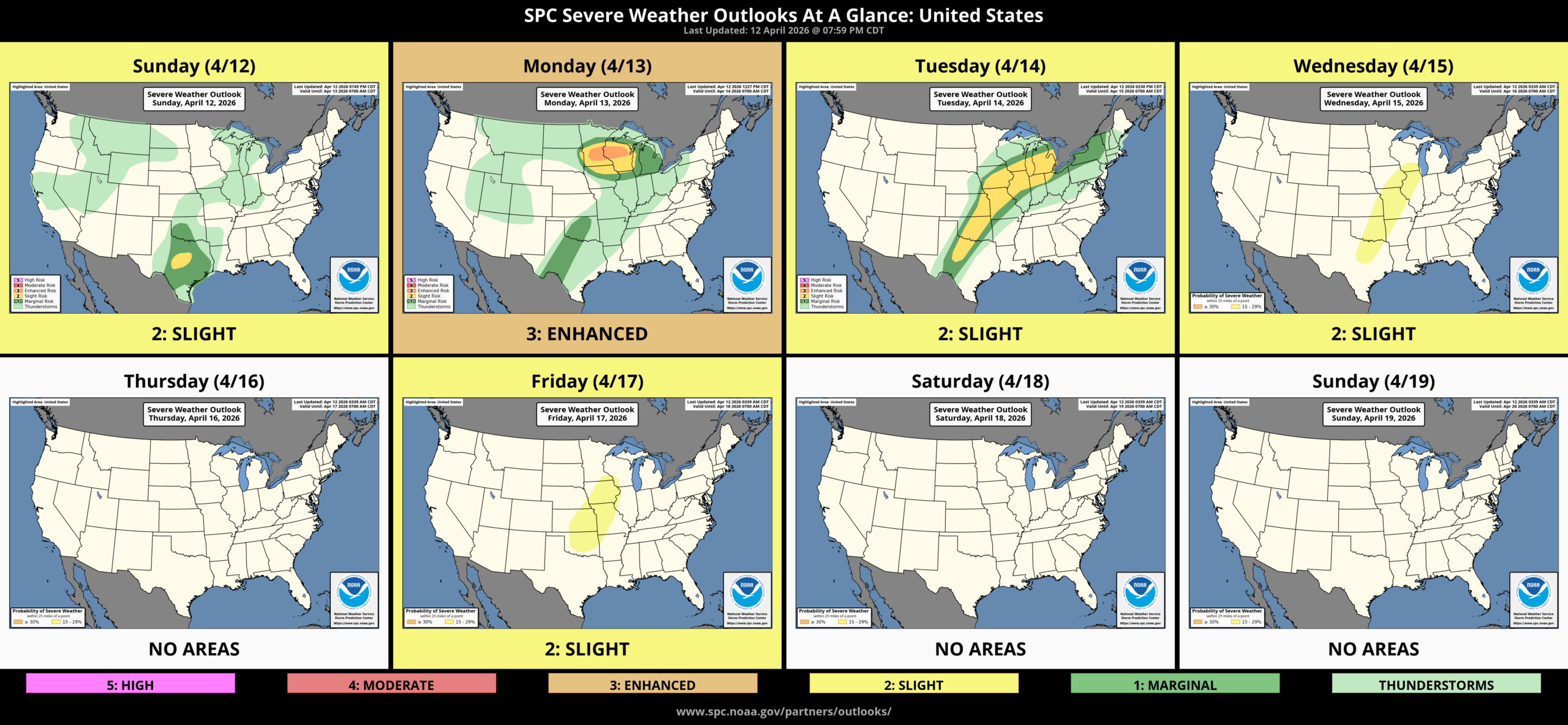
We’ll have several opportunities for severe storms this week. Large hail, damaging winds, and tornadoes are expected.
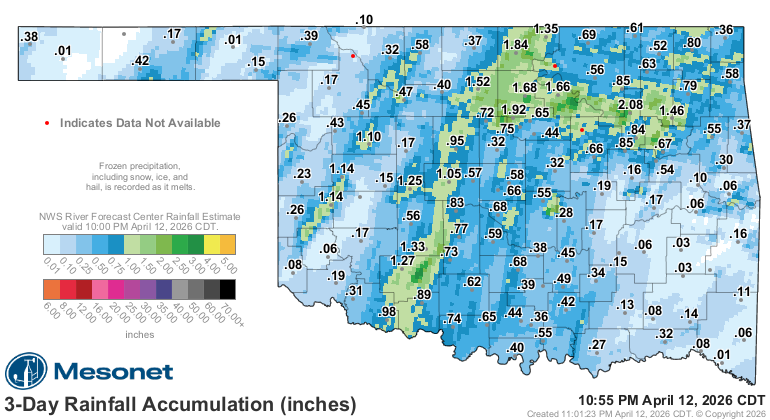
This time of year, we expect to see the type of storms that bring us the aforementioned severe outcome. But they also bring beneficial rainfall. We were lucky to get the beneficial rain Friday through Sunday morning without the severe part.

Ferguson Roof Systems is offering an AT's Weather special!
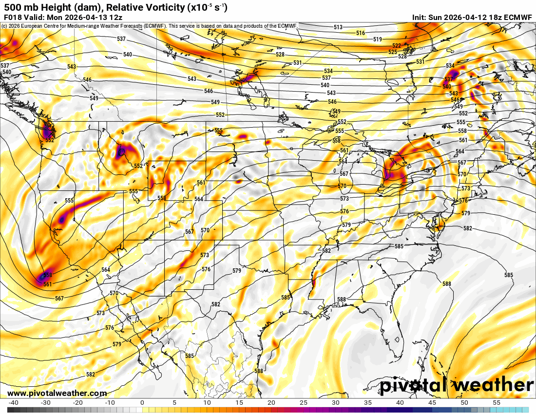
This week, the Jetstream has an upper system across the desert SW kicking through Wednesday. Until then, we have two weak waves that will move across Monday afternoon and Tuesday afternoon. And a final wave will move through on Friday. You can watch the animation below, focusing on those brighter colors in red, which signify the regions of lift in the atmosphere.
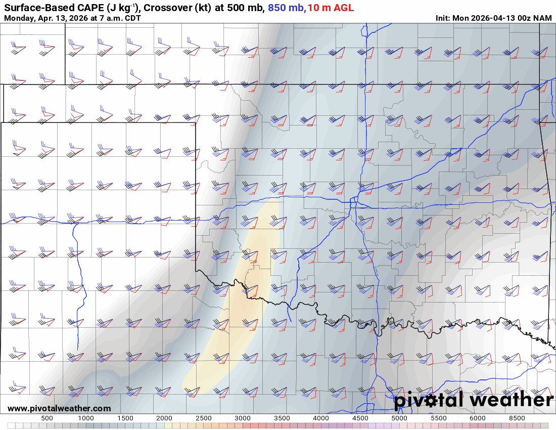
The most significant parameters for severe weather are CAPE and Shear. The animation shows that both will be in place on Monday, Tuesday, and Wednesday. One thing is certain: any supercellular storm that develops will contain very large hail and strong, damaging winds this week. The CAP will be a factor to help limit the coverage, however.

Be sure to mention Aaron Tuttle when you call (405) 820-1193!
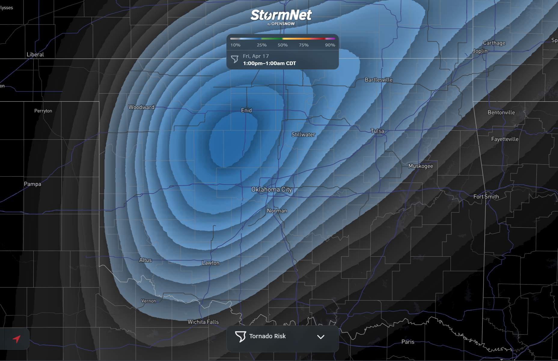
The Storm Prediction Center and AI models are all indicating an active period ahead. I’ve added two new AI models to see how well they do. One is Google DeepMind, and the other is a long-term tornado indicator called StormNet. My rule is 48 hours when discussing tornadic activity, as too many things can change. It will be interesting to see how well this StormNet product does.
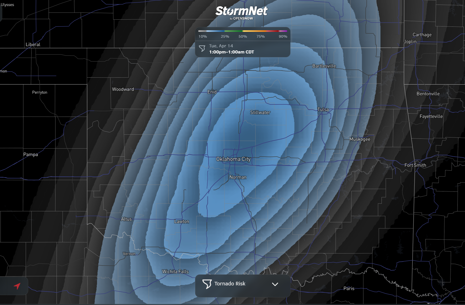
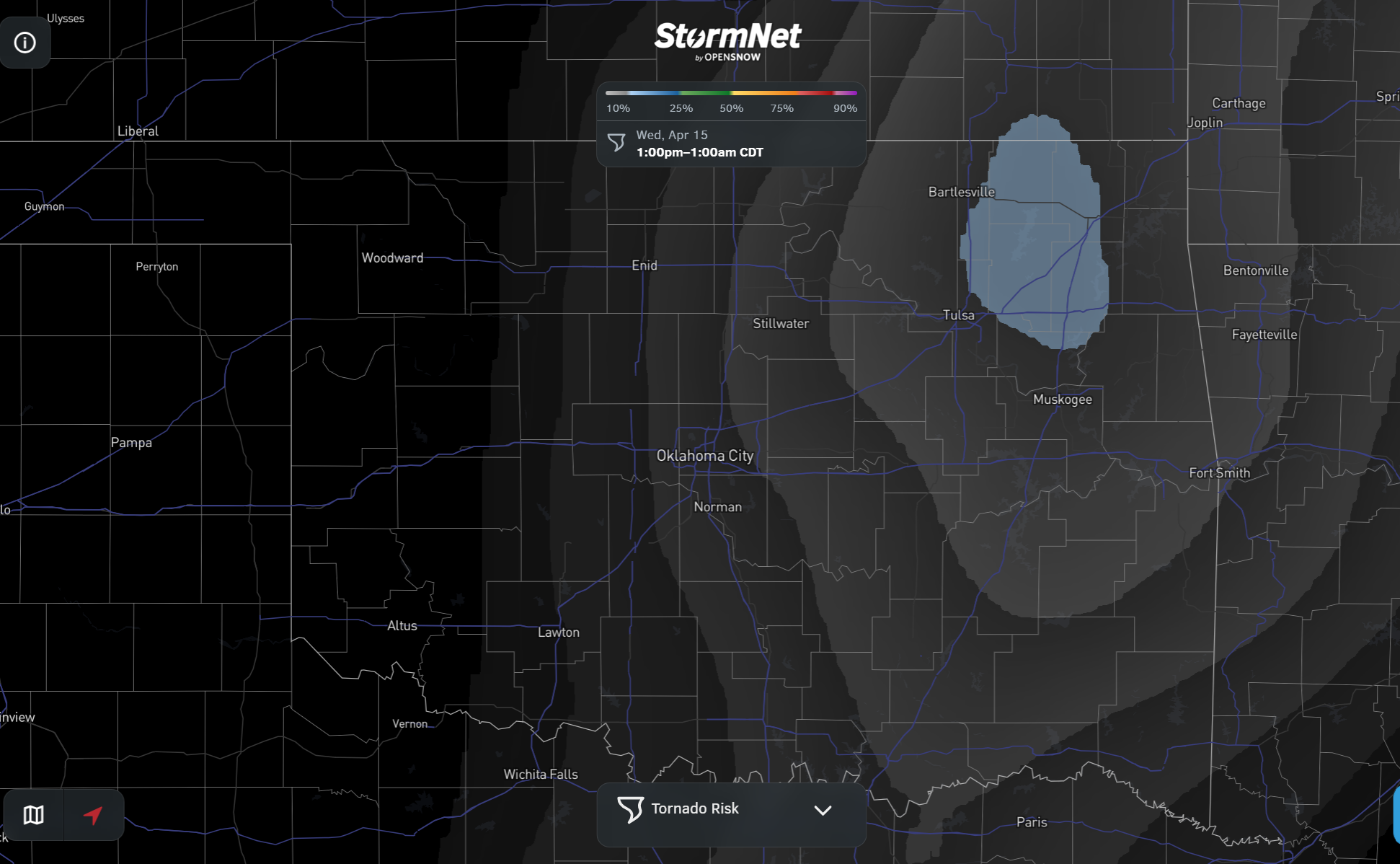
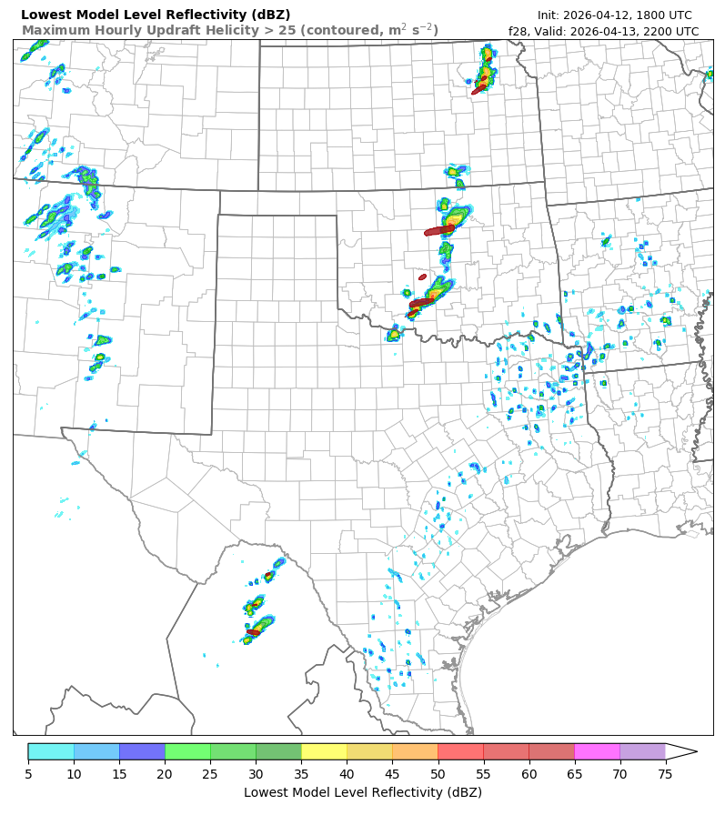
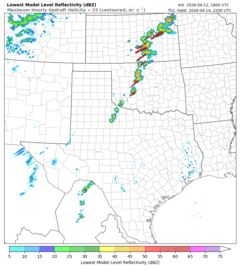
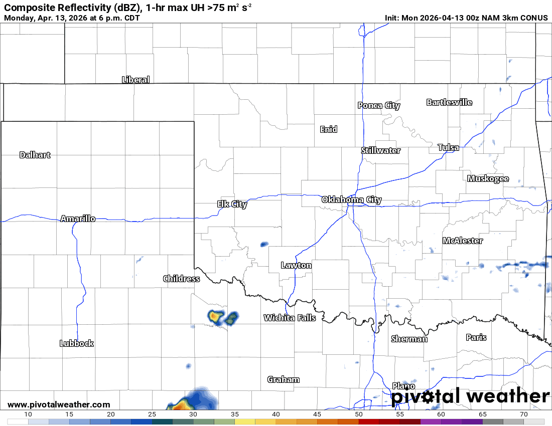
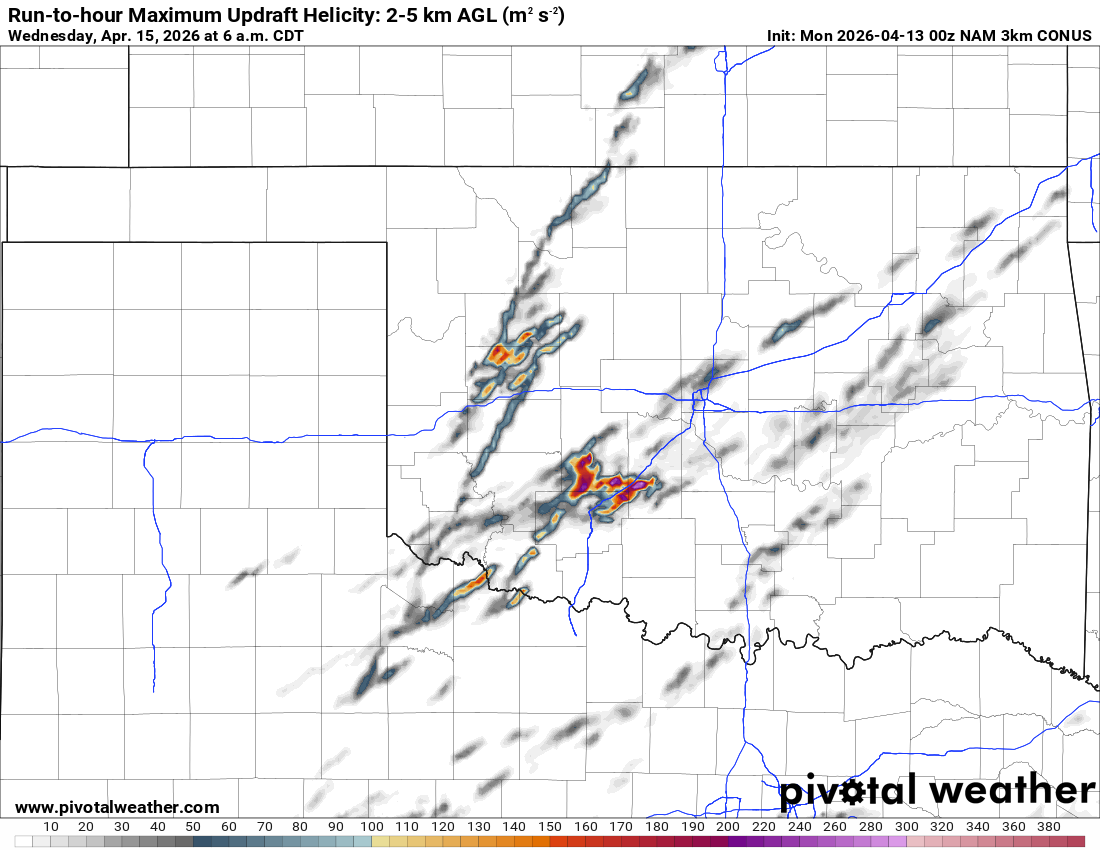
The radar simulated output from the Texas Tech model indicates a couple of severe storms should develop and hold together off the dryline tomorrow afternoon here in C OK. It indicates even more activity along the dryline on Wednesday afternoon. It typically does pretty well in these setups. The 3kmNam model animation also hints at some supercellular activity with the indication of helicity (rotation) tracks in the data output. The European model animation shows additional rainfall/storms on Wednesday and again on Friday.
Ferguson Roof Systems is offering an AT's Weather special!

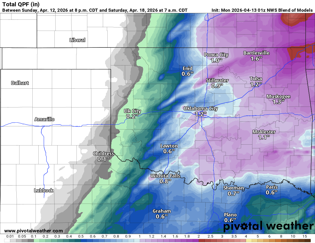
Rainfall amounts from these events aren’t excessive when you blend the data conservatively. That’s due to the fact that most of these storms will be supercellular, isolated, remote, and few and far between. That said, they can also produce way more rainfall than what this map shows. Not to mention, there will be some extreme hail sizes in some of these storms this week, with baseballs, softballs, and grapefruits being mentioned. These will be some mean storms.
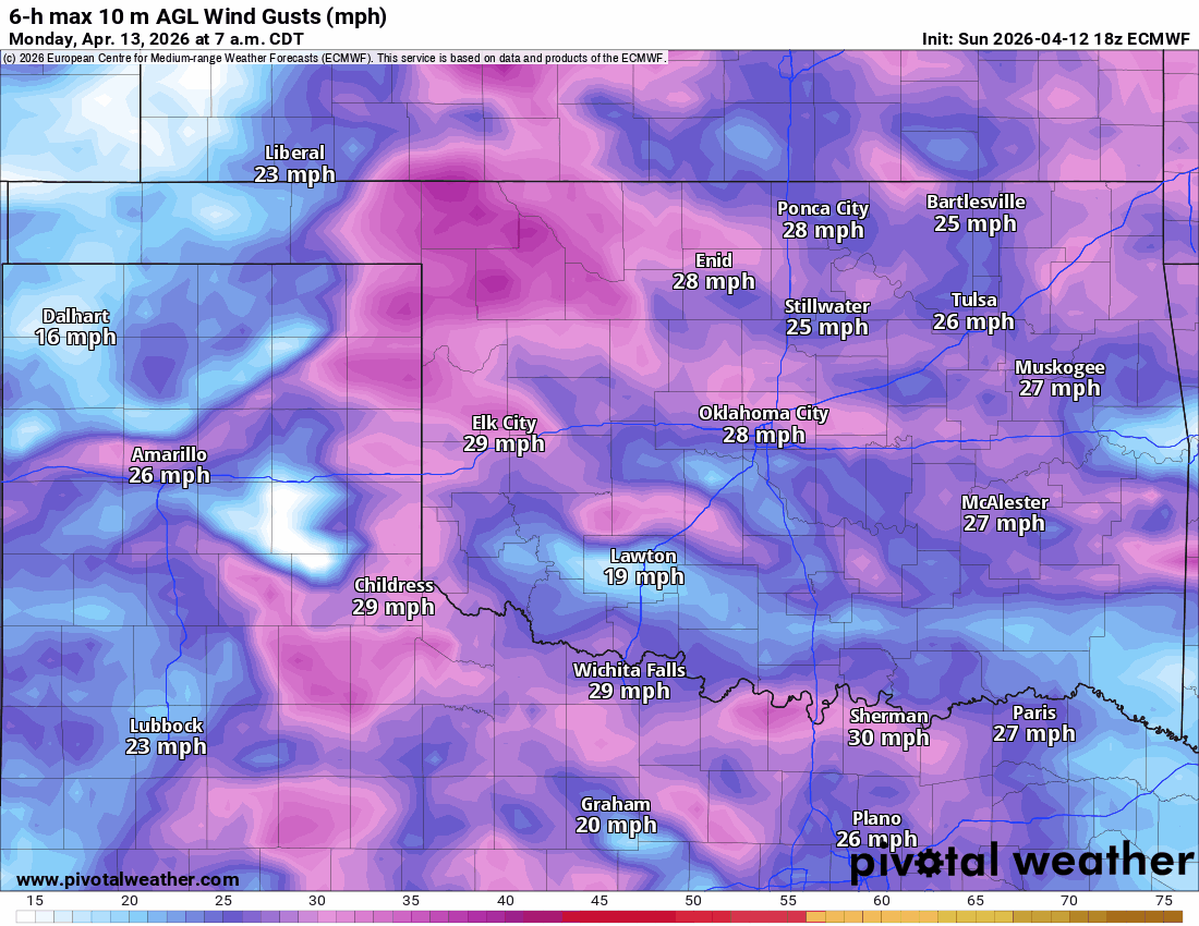
As if I need to mention it, but yes, the wind is just stupid this time of year, and this week will be no different. It kicked in Sunday afternoon, and it’ll stay quite high until Thursday, and will finally calm down next weekend.
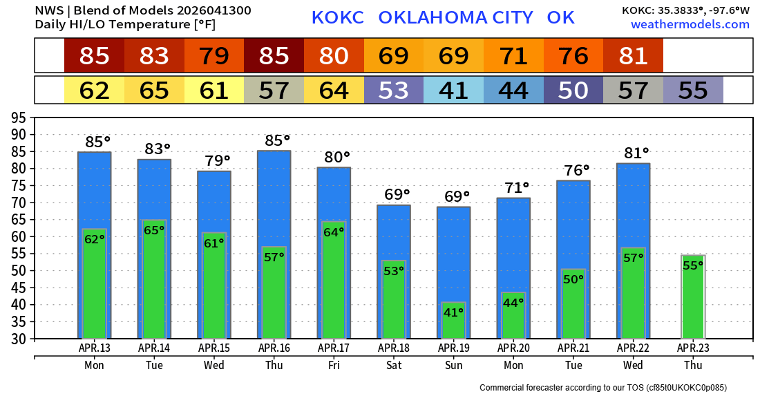
Temperatures are going to feel muggy this week, but after the cold front arrives Friday night, very nice weather is expected for the upcoming weekend and early the following week. If you haven’t done so yet, download my free weather app, ATsWeatherToGo. It tracks those developing tornadoes before an official warning comes out. And it looks like I’ll be going live for tornado coverage at some point as well. -AT