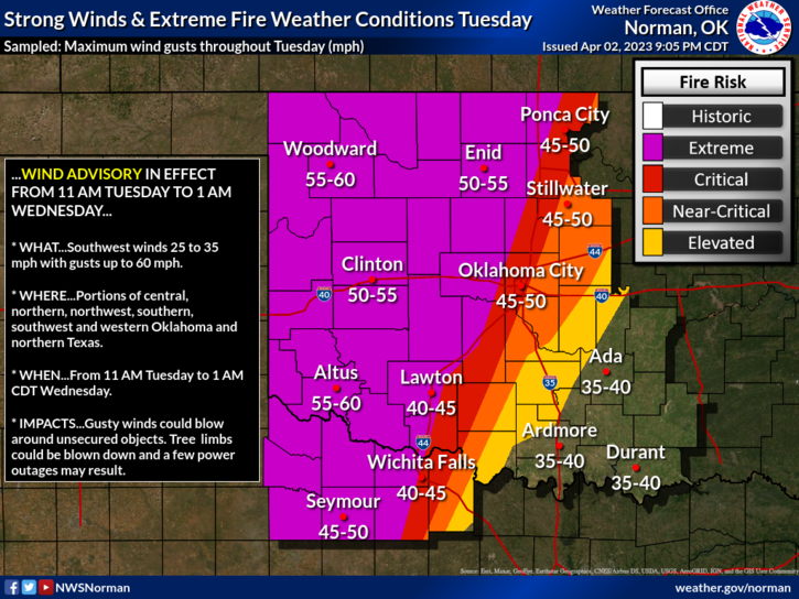
Severe Storms Tuesday and More Freezes
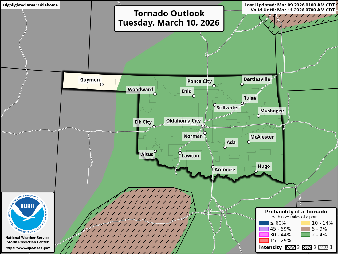
Our tornado season started early for March, as back-to-back days with tornadoes brought the loss of life, near Fairview and Beggs. It is a harsh reminder that you must stay weather aware and have methods to receive warnings and take proper shelter. Tuesday will be another day where tornadoes are possible, then it’s quiet with more cold shots.
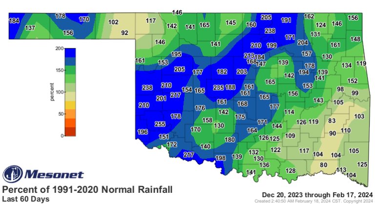
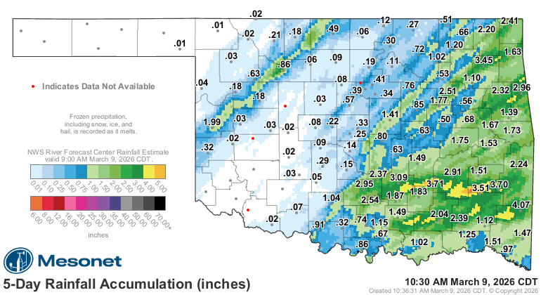
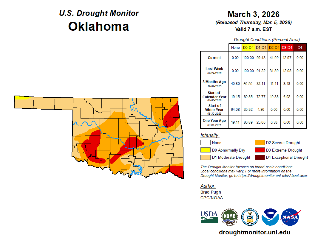
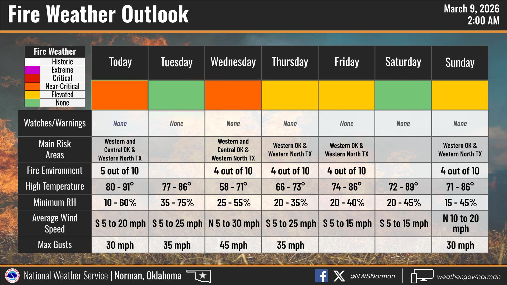
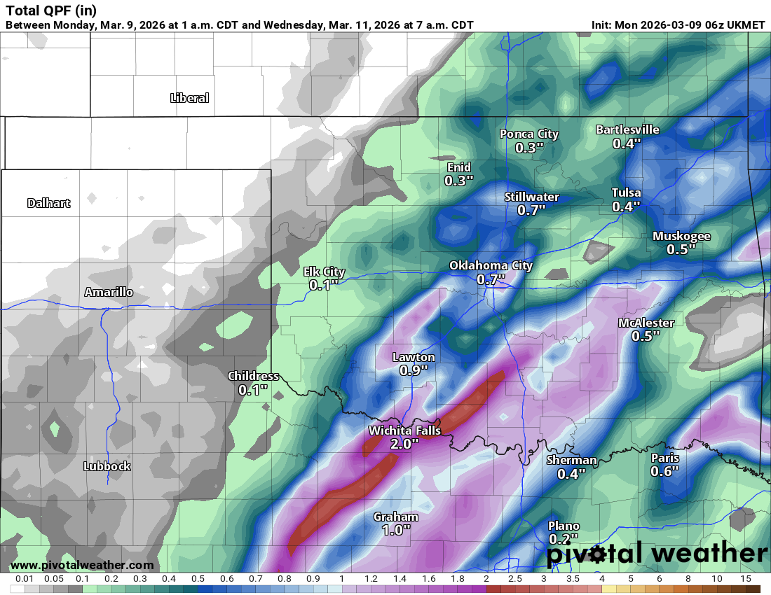
The rain was copious for SE OK last week, and it will be the same areas hit hard tomorrow as well. The drought has expanded, so any rain we receive will help with fire weather concerns. There are a couple of days this week when the fire threat is elevated.
The Jetstream pattern shows our upper storm system moving quickly by on Tuesday, then a dry NW flow aloft drives in a couple of significant cold fronts.
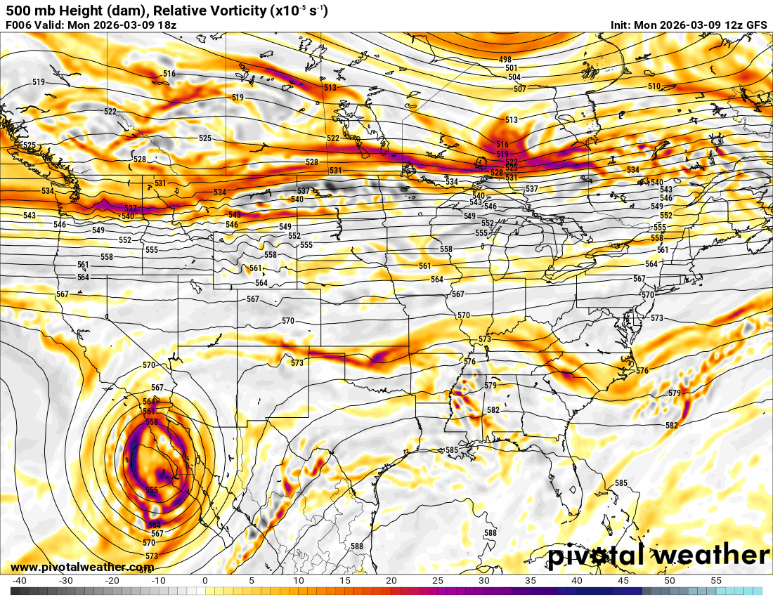
The severe weather outlook differs between AI models and the SPC. The forecast is messy with a lot of uncertainty on Tuesday.
 Restoration and Disaster Cleanup Service
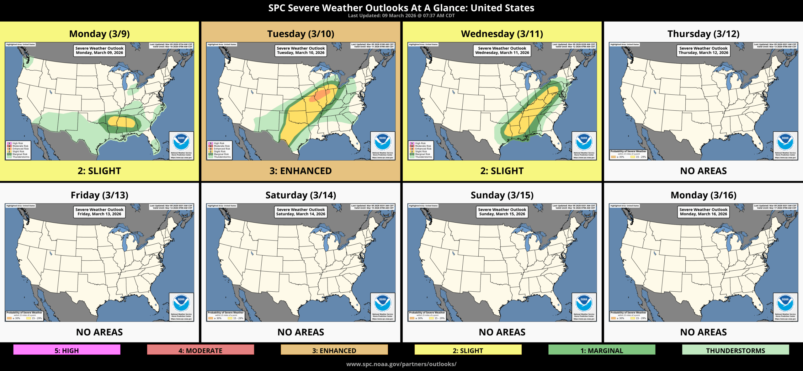
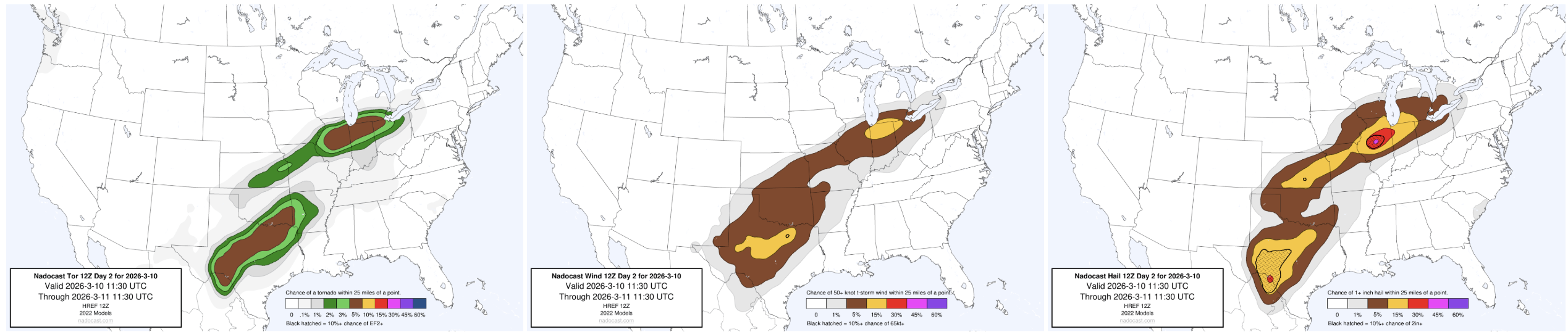
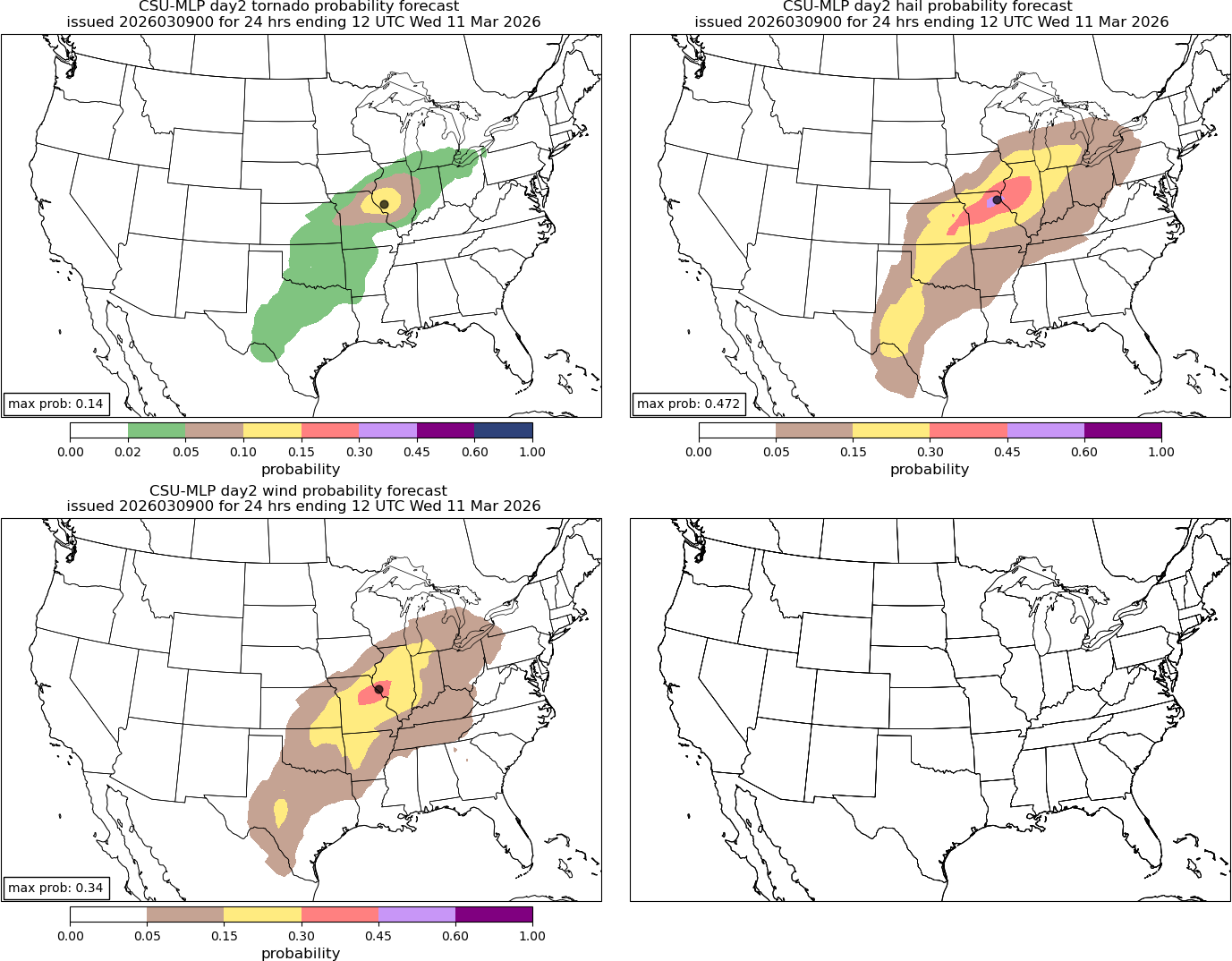
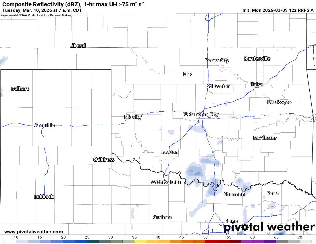
Elevated showers and storms should develop off/on Tuesday in isolated coverage across the state. As we transition to late afternoon/evening, a line of severe storms should move across SW OK eastward. The southern half of the state would see the most likely region for a QLCS-type squall-line tornado. Otherwise, expect pockets of damaging wind along the line.
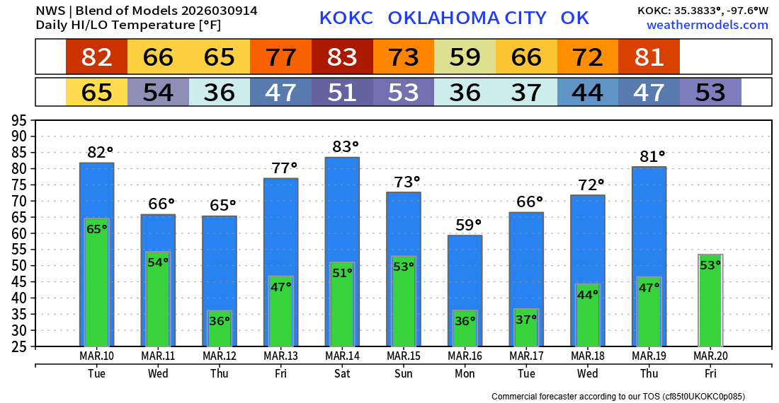
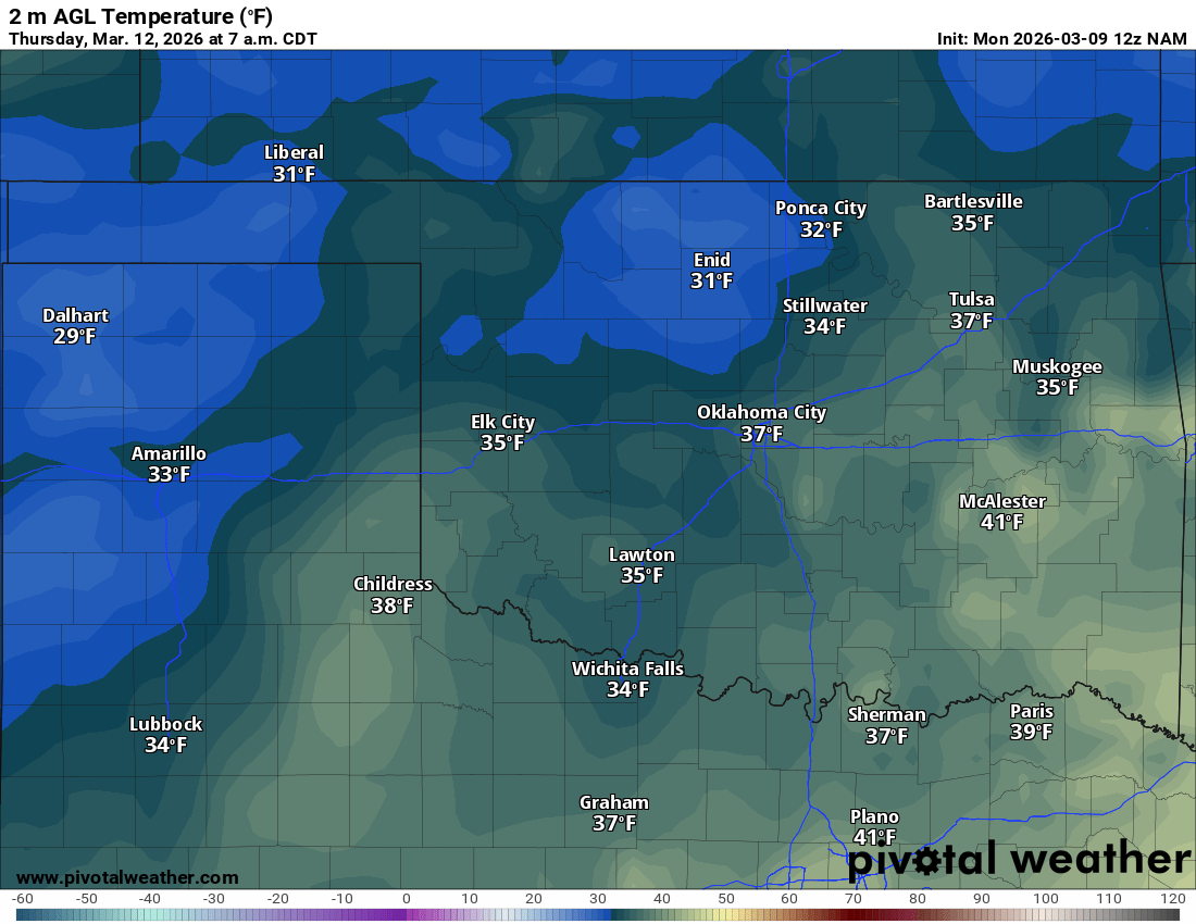
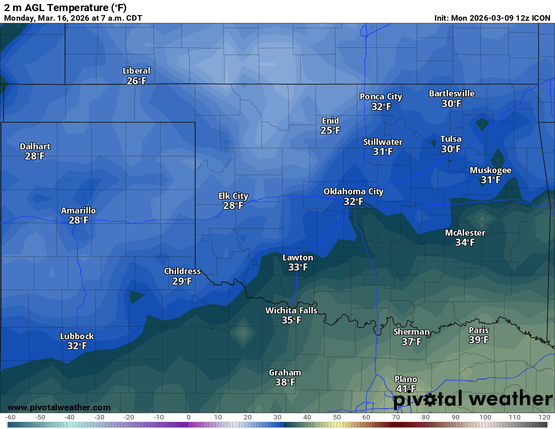
Some will experience a freeze on Thursday morning and again with a strong cold front on Sunday, dropping temperatures down the following Monday morning. So protect any tender vegetation.

Be sure to mention Aaron Tuttle when you call (405) 820-1193!
The OKC temperature trend has some warm days in it. We are in our full transition zone of Spring! -AT