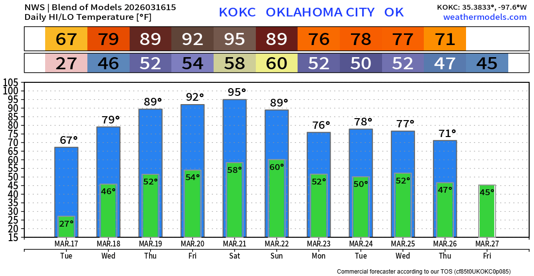
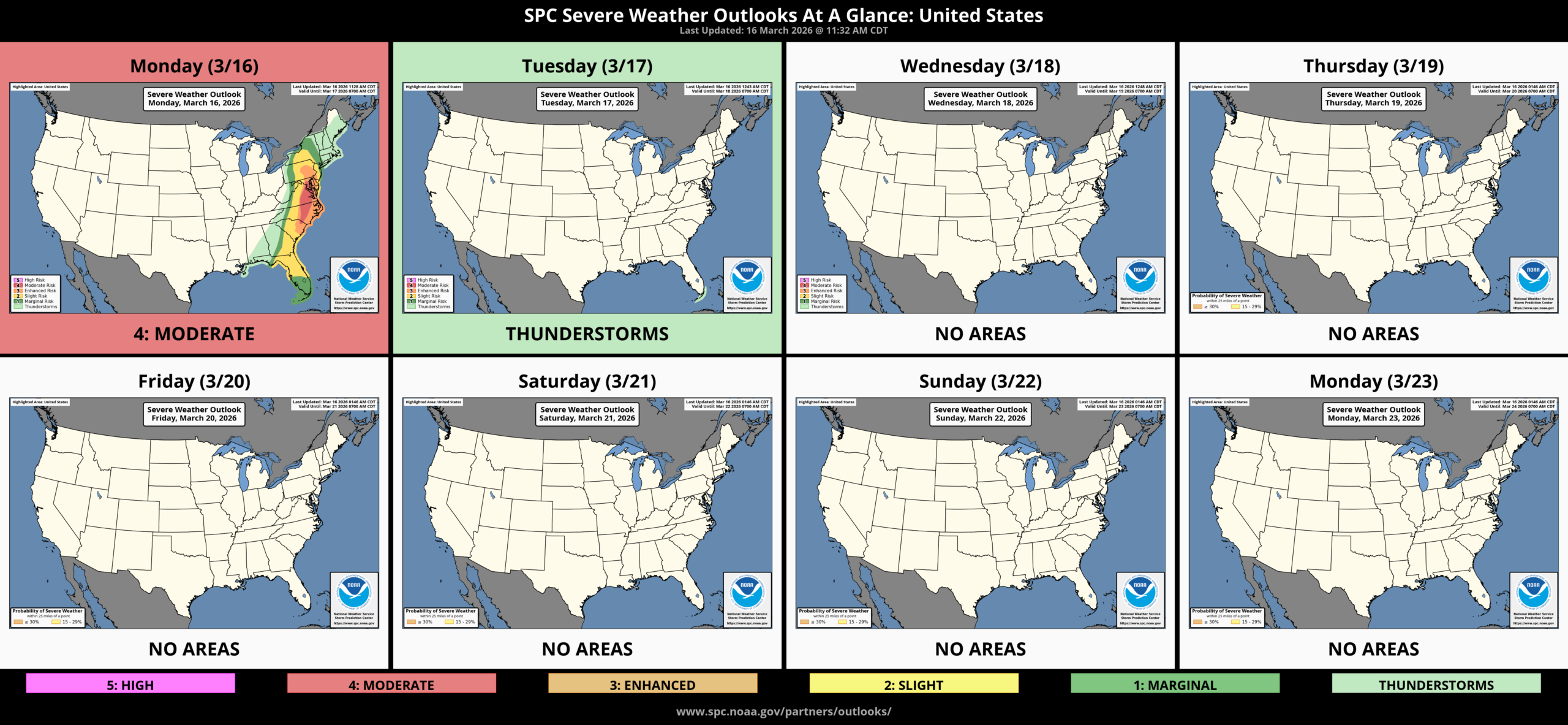
From Winter to Summer in 5 Days
Wow, what a shock to the system. Sunday was a day filled with wind damage, wildfires, evacuations, and even some snow! Hopefully, you took my advice and protected any outdoor plants as morning lows were downright frigid! And our cold shot is going to turn into a heat wave come Saturday!
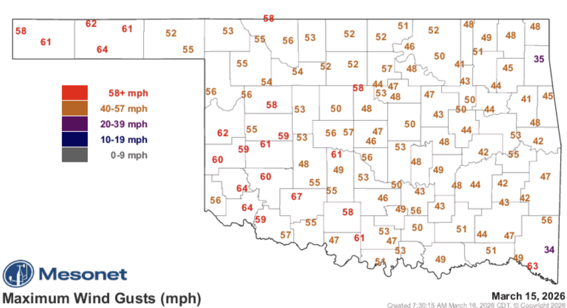
Wind gusts on Sunday afternoon.
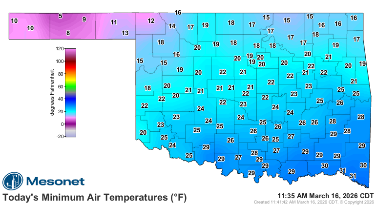
Morning lows bottomed out from the single digits in the panhandle to teens and 20s elsewhere.
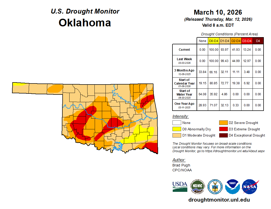
The dry conditions persist, and the fire danger continues to increase on any windy days, especially on Tuesday. Drought breeds drought, and it is expanding.
The Jetstream pattern shows a very strong upper ridge developing across the desert southwest. This will be like a block for storm systems and allow the heat to build with downslope air coming off the mountains. It also forces all the cold air back to the NE. Watch the animation below to see it take over.
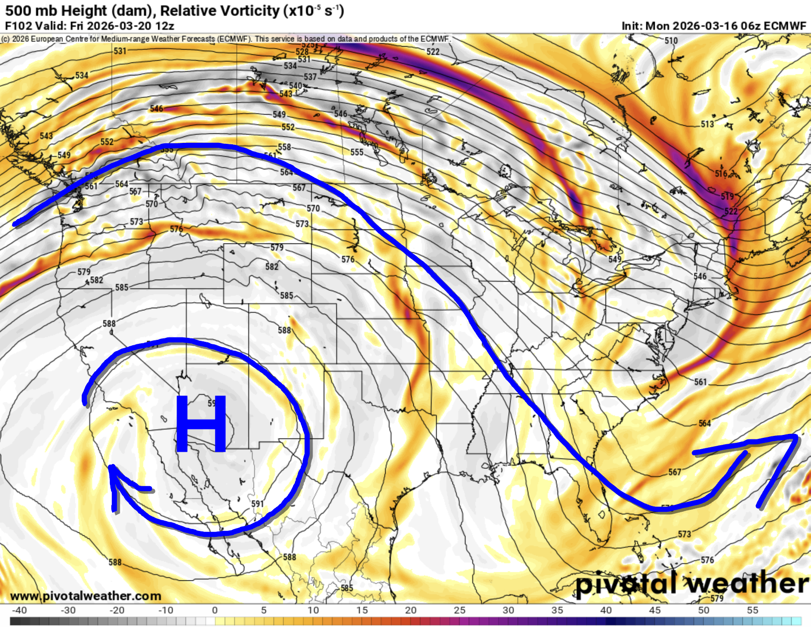
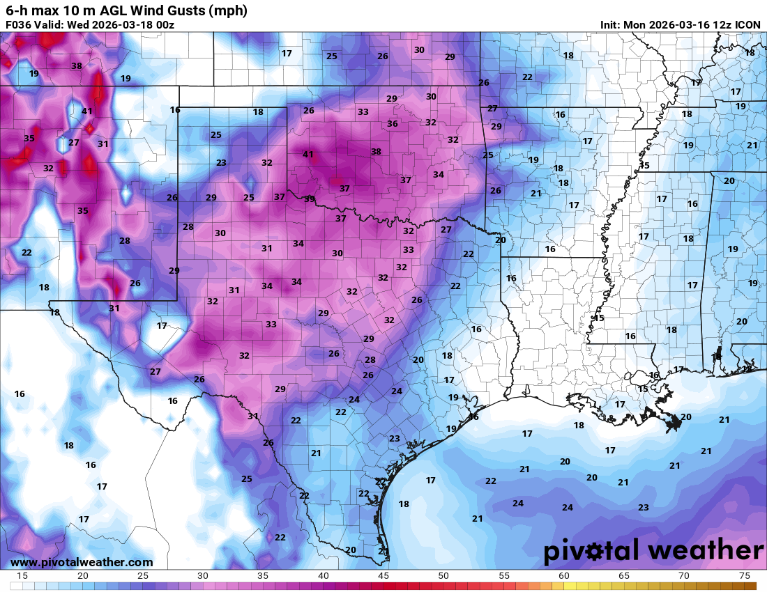
Long-term for the rest of March indicates another ridge developing across S TX, once again keeping us on the dry side. This means a lack of severe weather for the rest of the month. One can hope, but we need the rain!
 Restoration and Disaster Cleanup Service
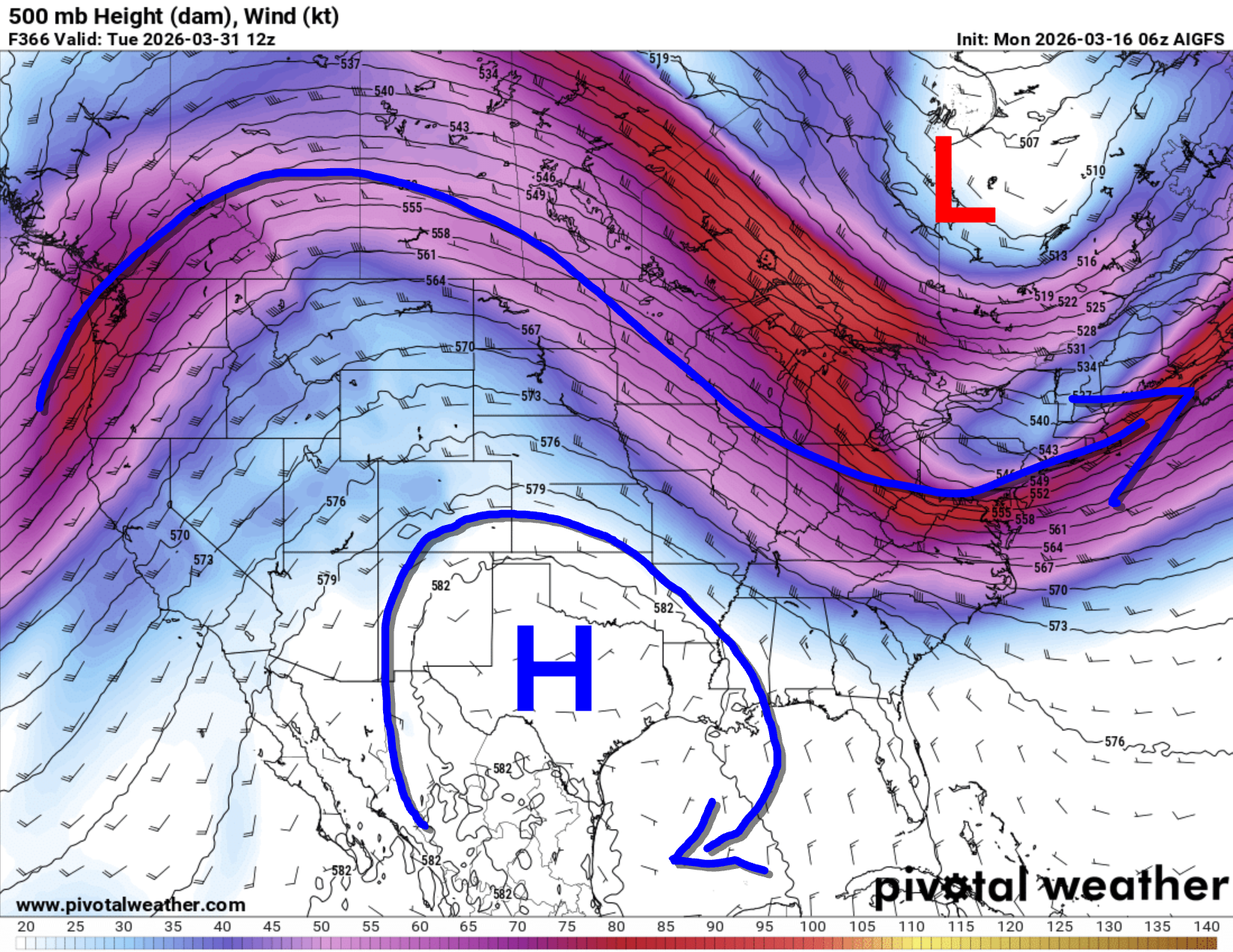
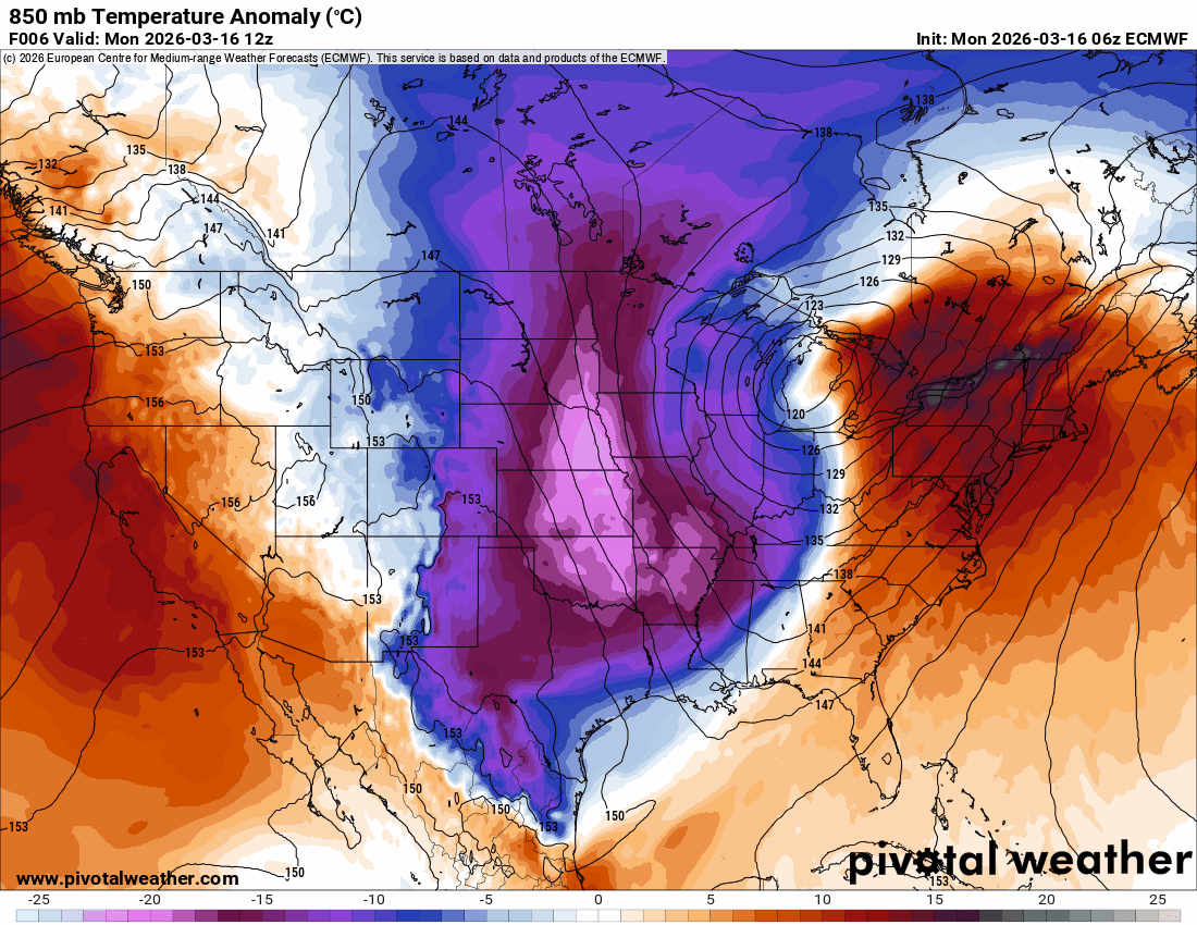
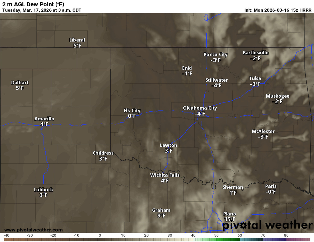
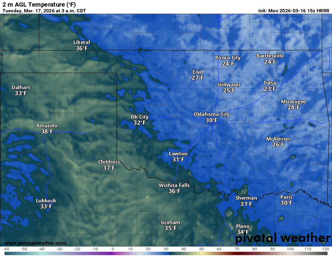
We do have another cold night ahead. Dewpoint values are extremely low. Some high clouds are working through the state, and that will help keep our temperatures from bottoming out, but don’t be surprised if we get colder than the map shown below. We’ll likely see a lot more 20s and a few teens.
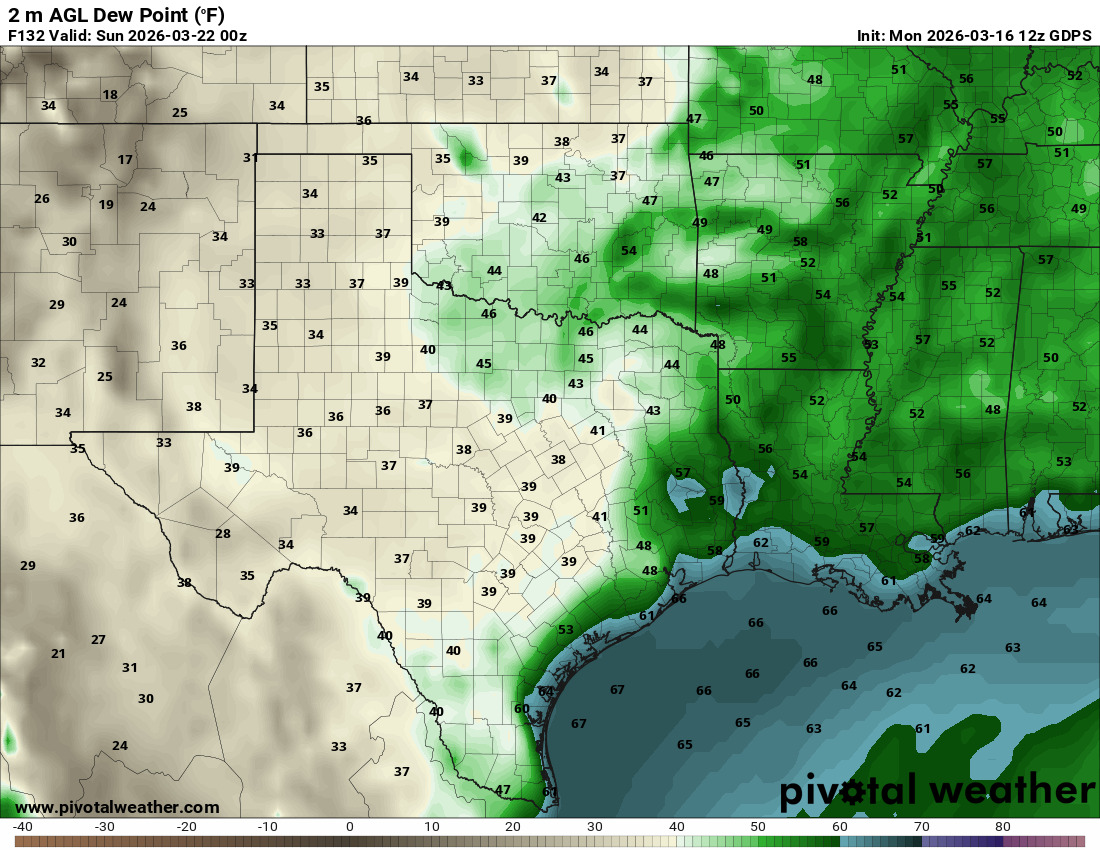
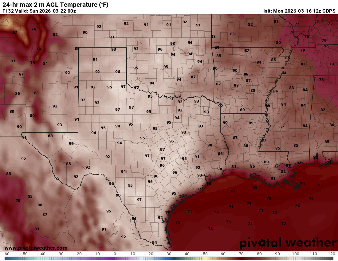
Then we focus on the heat. Once again, dewpoint values are extremely low, and that dry air heats up a lot faster. Consider it a dry heat Friday and Saturday as they experience out west. Thankfully, another cold front will knock that nonsense down a bit.
The OKC temperature trend echoes the large pattern change. Wardrobe insanity this week!