Forecast including Memorial Day Weekend

A stormy weekend prevented me from getting the blog out earlier. As it looks now, most of the severe weather is behind us. We do have a few opportunities for rain/storms this coming weekend, as we usually do over this holiday time frame.
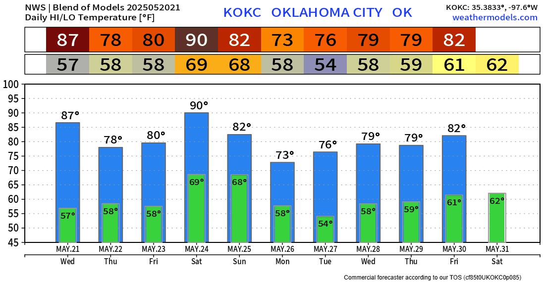
The Jestream shows we will be in a weak NW flow aloft, transitioning back to a SW flow by the weekend. This will allow temperatures to heat up by Saturday, and until then, weak disturbances will bring occasional rainfall.
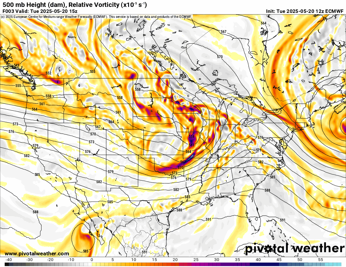
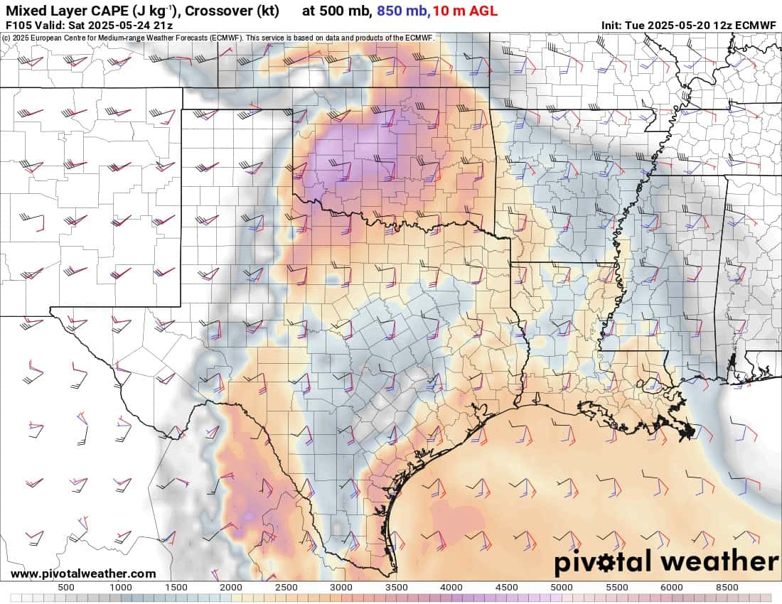
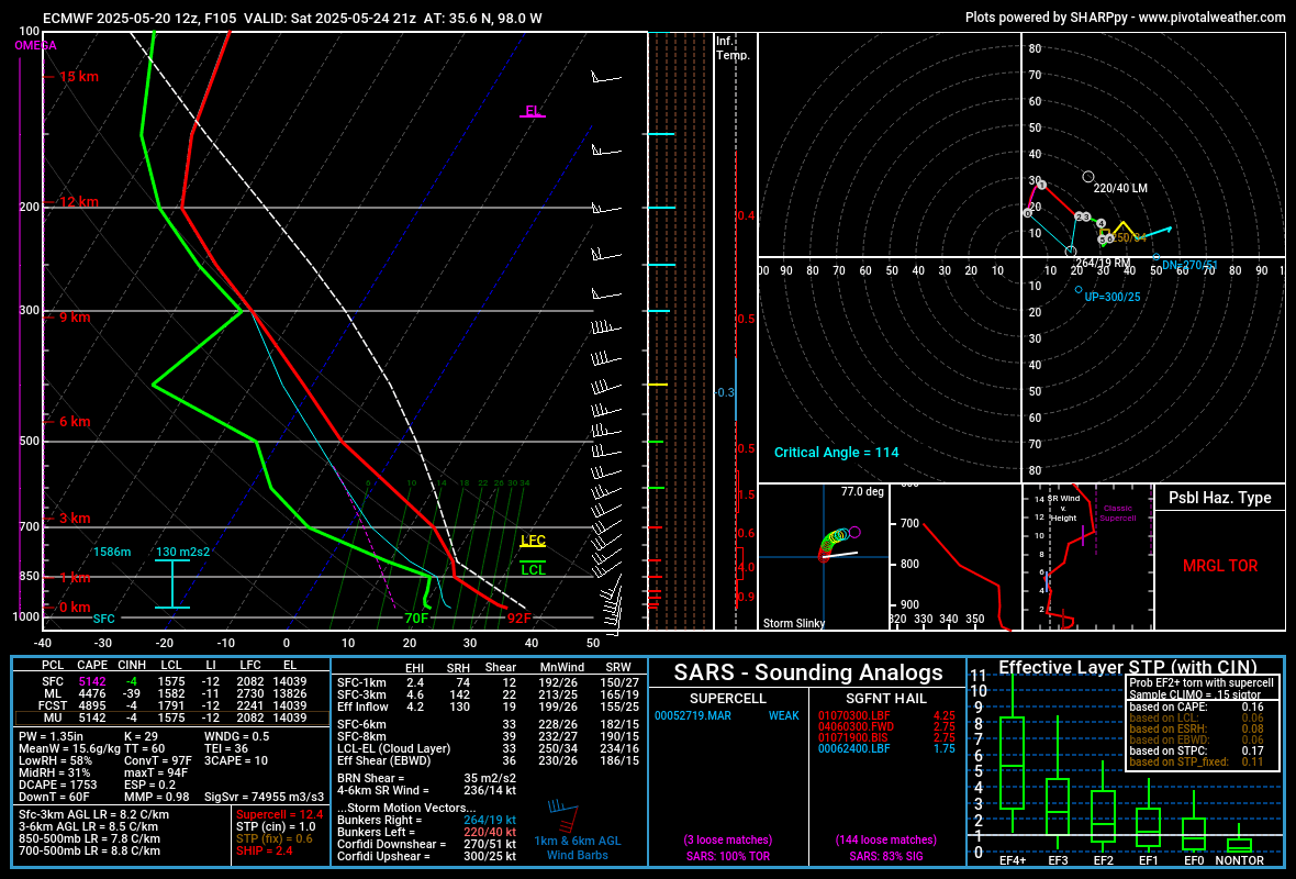
Saturday appears to have the best instability across the state, but also a mega CAP with a convective temperature of 100 degrees. The European fires storms, but that’s suspect at this point. So the only severe storms we may see will be with the cold frontal passage on Sunday. Look for elevated wind and hail if that’s the case.
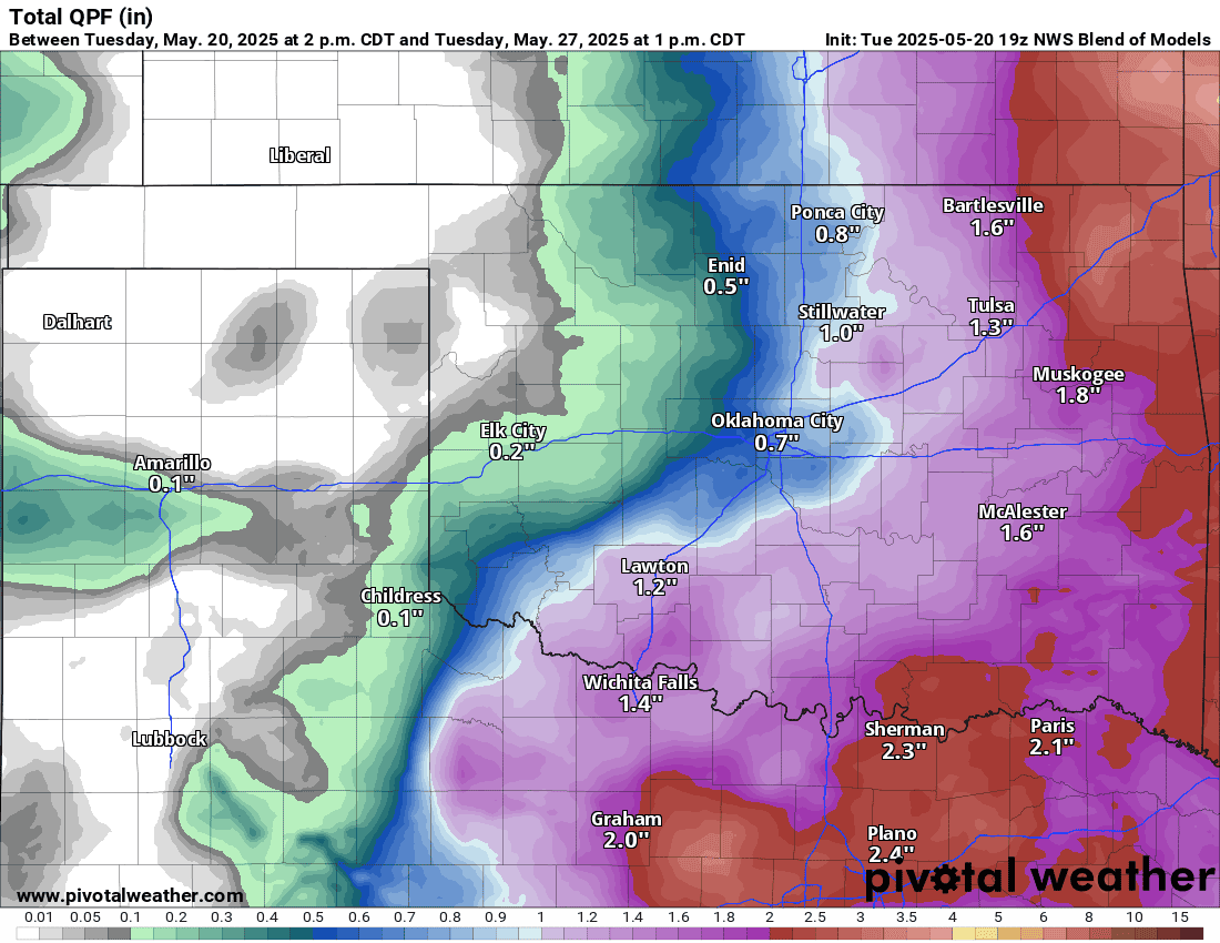
We have a few opportunities for rainfall starting Wednesday in NE OK. Then, early Thursday morning, across C OK traveling east, and again on Friday in the morning and evening.

Ferguson Roof Systems is offering an AT's Weather special!

Clouds may be slow to clear out on Monday morning, but should be better by the afternoon. Temperatures will be cooler after the frontal passage for your holiday.
Unless something dramatic changes in the data, it may not be that bad of a holiday weekend. I’ll keep an eye on things. -AT
Ferguson Roof Systems is offering an AT's Weather special!