Winter Storm, Below Zero Temperatures, and AT’s Weather Closing
There’s a lot to discuss in this week’s forecast blog. We have another winter storm that will hit Oklahoma and surrounding states on Tuesday, then the coldest temperatures we’ve seen since 2021 will arrive with below-zero readings, and finally, what you need to do to continue receiving accurate forecasts like this along with live discussions and severe weather coverage.
If you’ve missed my prior blogs or social media posts, I’m closing down the free content and moving AT’s Weather to a subscription-only format. I am entering a symbiotic and mutually respectful relationship with you moving forward. We all work hard to earn a living and provide for our loved ones. We also realize time is always in short supply. I want you to value me, my time, and my services as I value you and yours. For over 15 years I gave and gave and gave, asking nothing in return. While my energy center could handle that initially, as I moved into a new state of mind and wellbeing I realized this needed to change for me to survive. People who give selflessly to others their entire lives reach this point where the mind and body cry out, needing their energy centers to be refilled. It is called “compassion fatigue”. This may sound familiar to some of you, especially if you work in caregiving roles, like healthcare workers, social workers, and therapists.
 Restoration and Disaster Cleanup Service
I realize that not everyone can join me on this journey, and that’s okay, I did what I did and I would do it again. So if you don’t join me moving forward, thank you for today, yesterday, and the past 15 years. This wouldn’t have been possible without you. I was the first independent meteorologist to utilize social media for weather content starting back in 2010 after leaving television news in 2007. From there, I released a free weather app and built a TV studio in my home office to provide live weather forecasts and severe weather coverage in 2014. Now, I’m doing something first as well, moving my entire weather content to a private membership. I’m looking forward to shrinking down to a smaller and very supportive community with a more intimate feel. I am here for you and if you would like to be there for me, please pick a platform to join by the first of March. Once storm season hits, I won’t be able to keep up with member requests to join, so I don’t know how long you will have to wait before I can let you into the group. You can find out more at my recent blog here: Subscription Options for AT’s Weather Thank you!!!
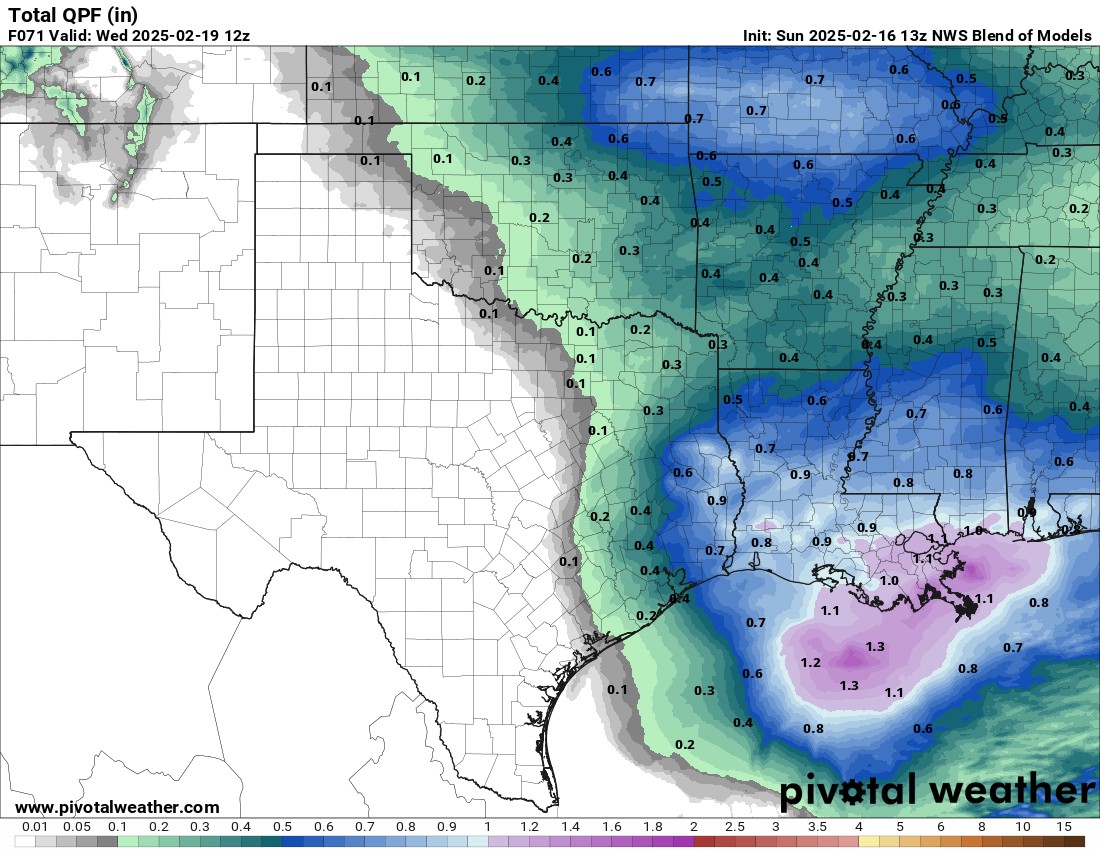
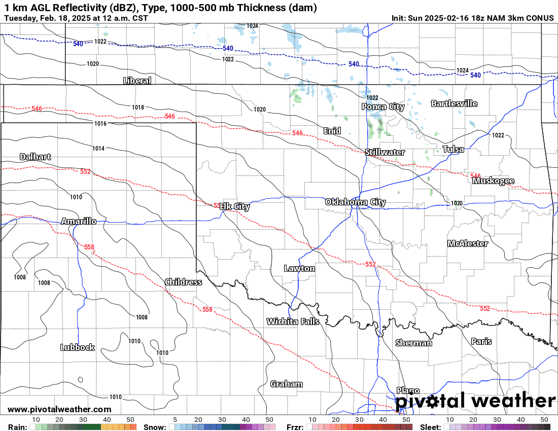
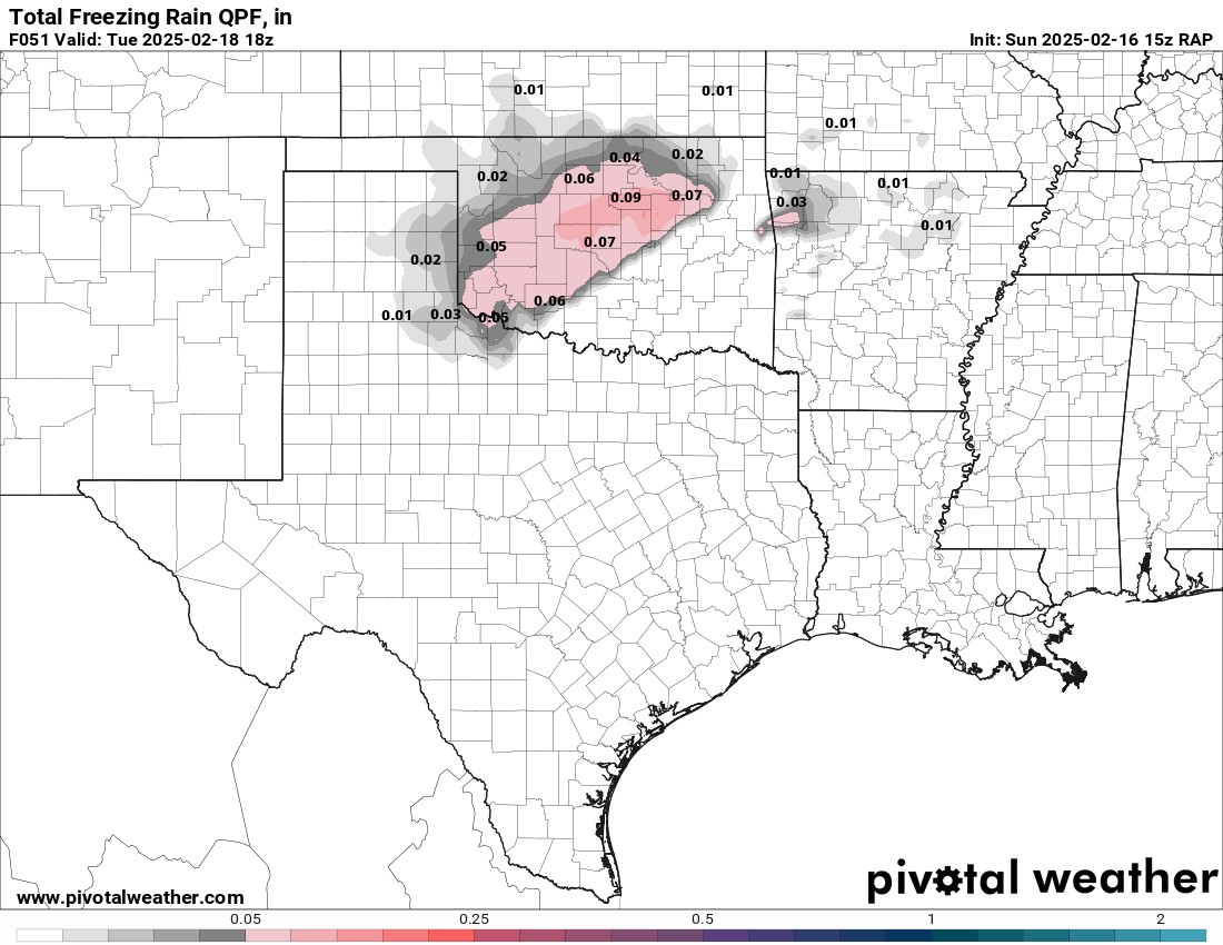
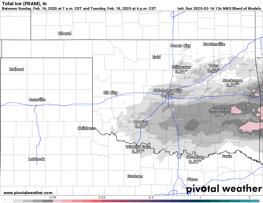
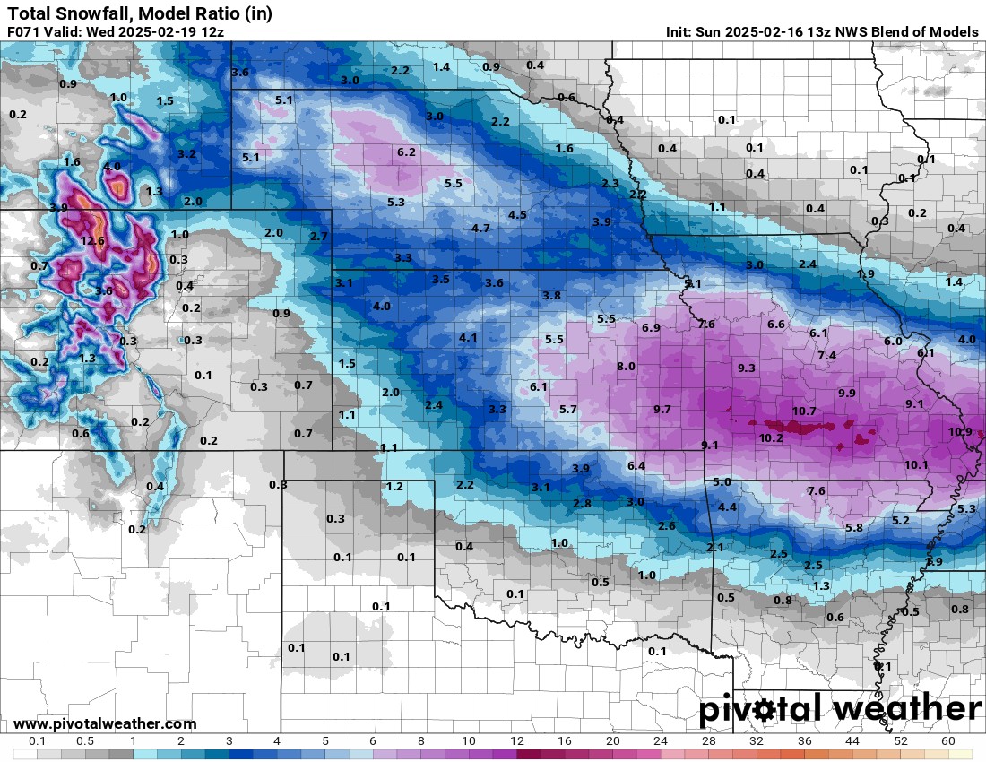
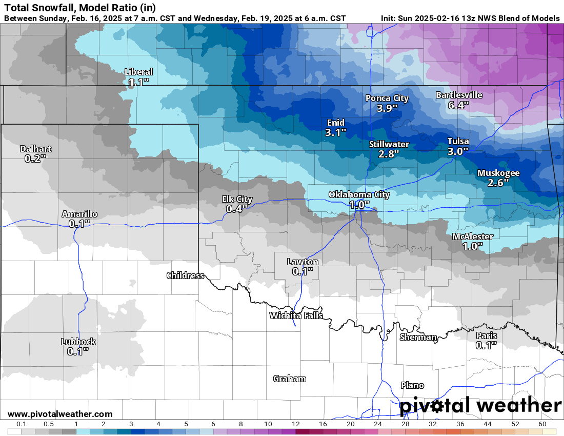
Now regarding the next winter storm. It appears this one will be moisture-starved for a large area of Oklahoma. The far northern and NE counties will see the best snow. The rest of the state gets more of that light pesky icy mix. The main reason for the lighter amounts is the dry slot in the mid-levels. Unless this changes significantly in the data, don’t expect much on the precipitation front. The first two maps below are the moisture and the precipitation totals. That’s not much to convert to ice or snow. Which is a good thing really.

Be sure to mention Aaron Tuttle when you call (405) 820-1193!
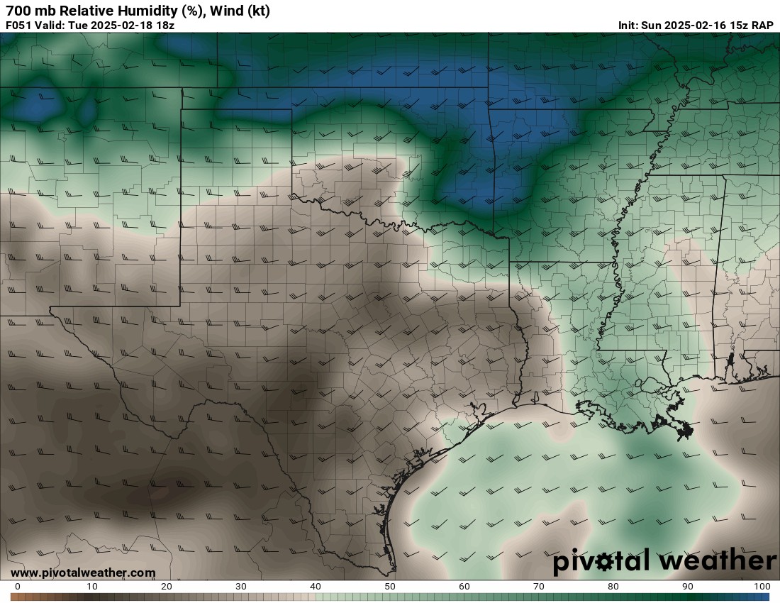
So basically the next cold air push comes into the state Monday night and approaches the I-44 corridor by 6am. Any precipitation that falls shortly behind this boundary will be frozen. This looks to include Tulsa and OKC by this time. The amounts will be very light, in the form of freezing drizzle, light freezing raindrops, and sleet. This mix will continue throughout the morning across that frontal zone and stretch into the northern counties. At some point during the morning, some light snow will mix into this, especially across the northern counties. Otherwise from noon onward it should be all snow across N/NE OK and into KS and MO. It will stay a cold rain across SE OK until late day. The entire system moves out overnight. It does appear to be a roadway shutdown system for Tuesday morning along about the same southern area as this past system (Just South of Tulsa to near Norman to Chickasha to Lawton). Take that into account for your morning appointments. Western AR will also see about 0.10-0.20″ of ice Tuesday evening/night.
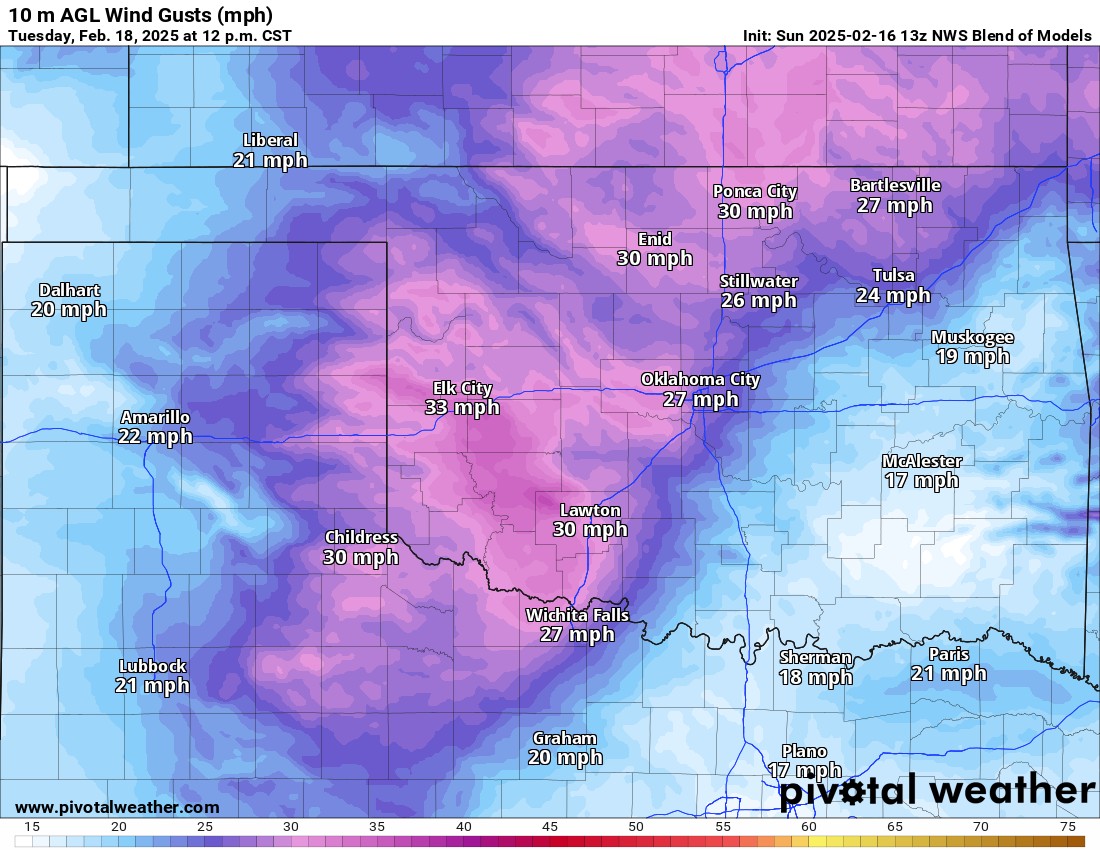
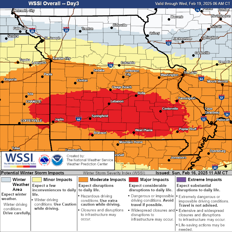
Snowfall amounts will be significant across Kansas and Missouri. With 30 mph winds, blowing snow will also be a factor in reducing visibility at times adding to the Major Impact category. Due to the drier air and lack of significant lift across much of Oklahoma, I do not expect significant snows over the body of the state, just to the north and northeast.
Be sure to mention Aaron Tuttle when you call (405) 820-1193!
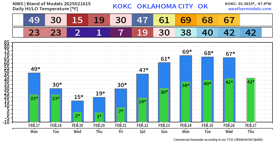
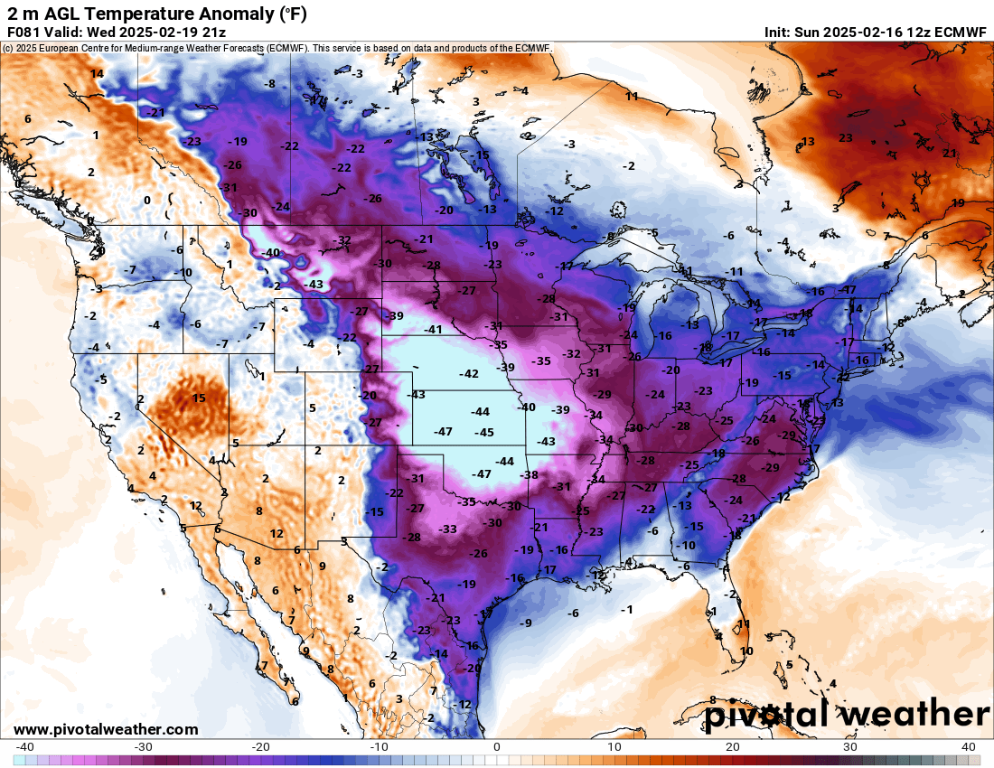
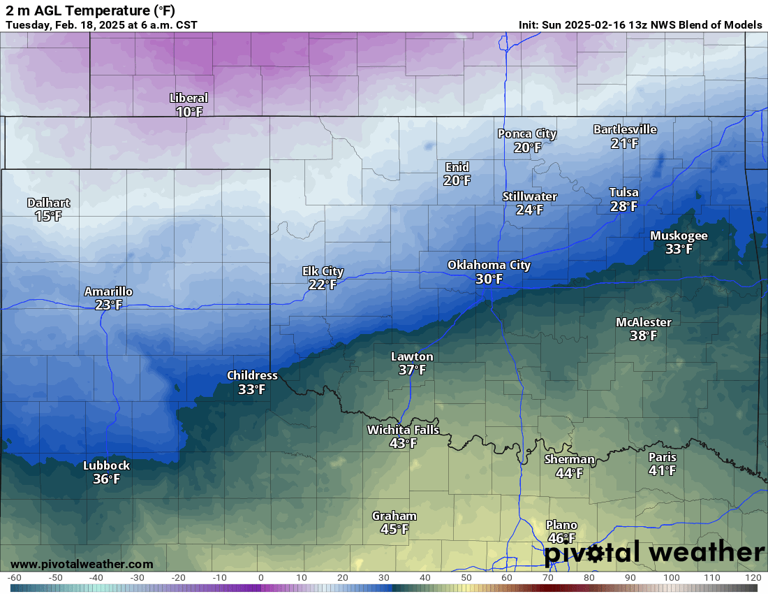
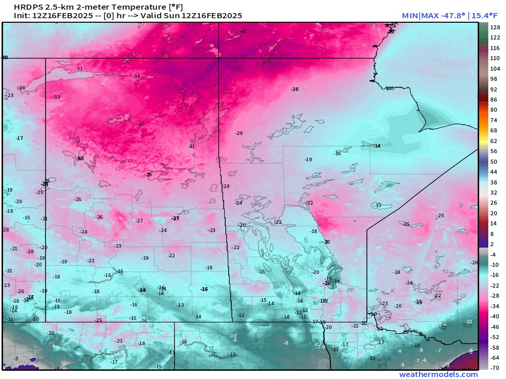
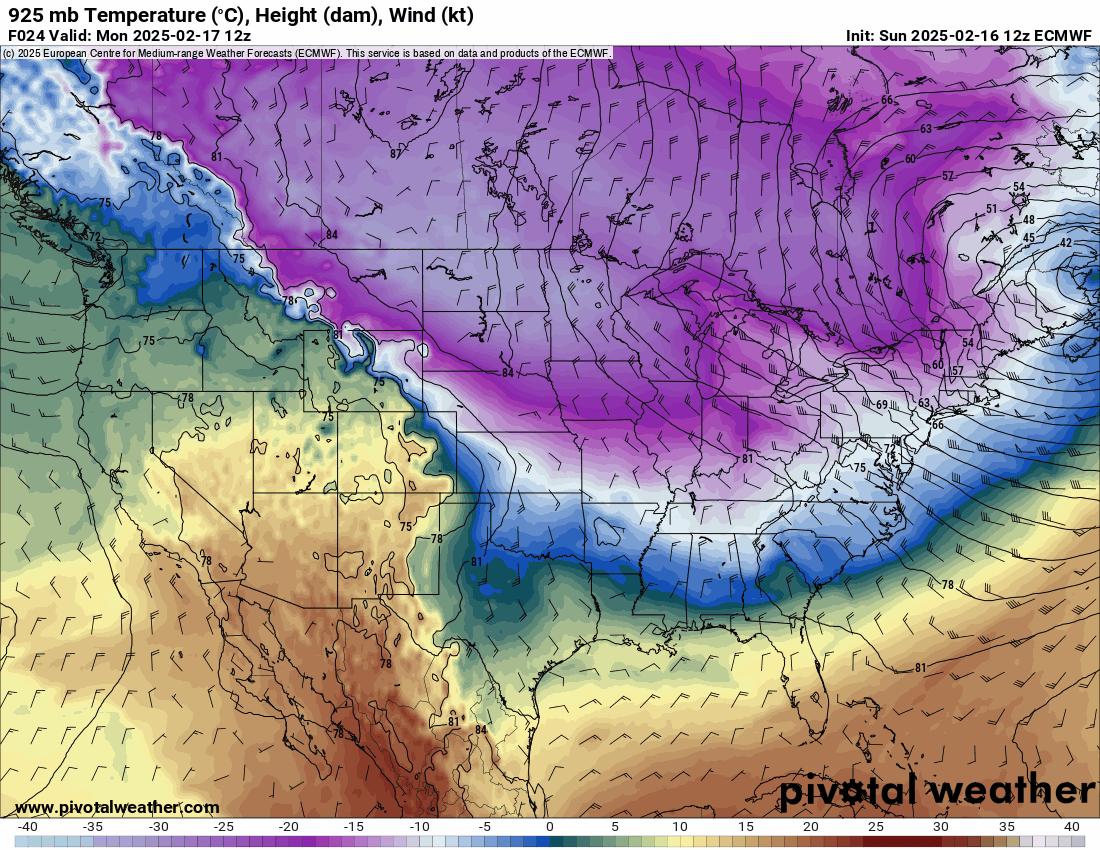
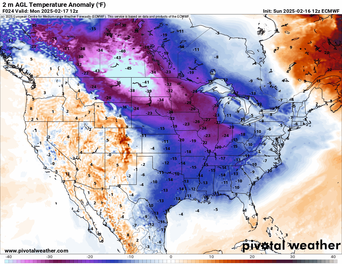
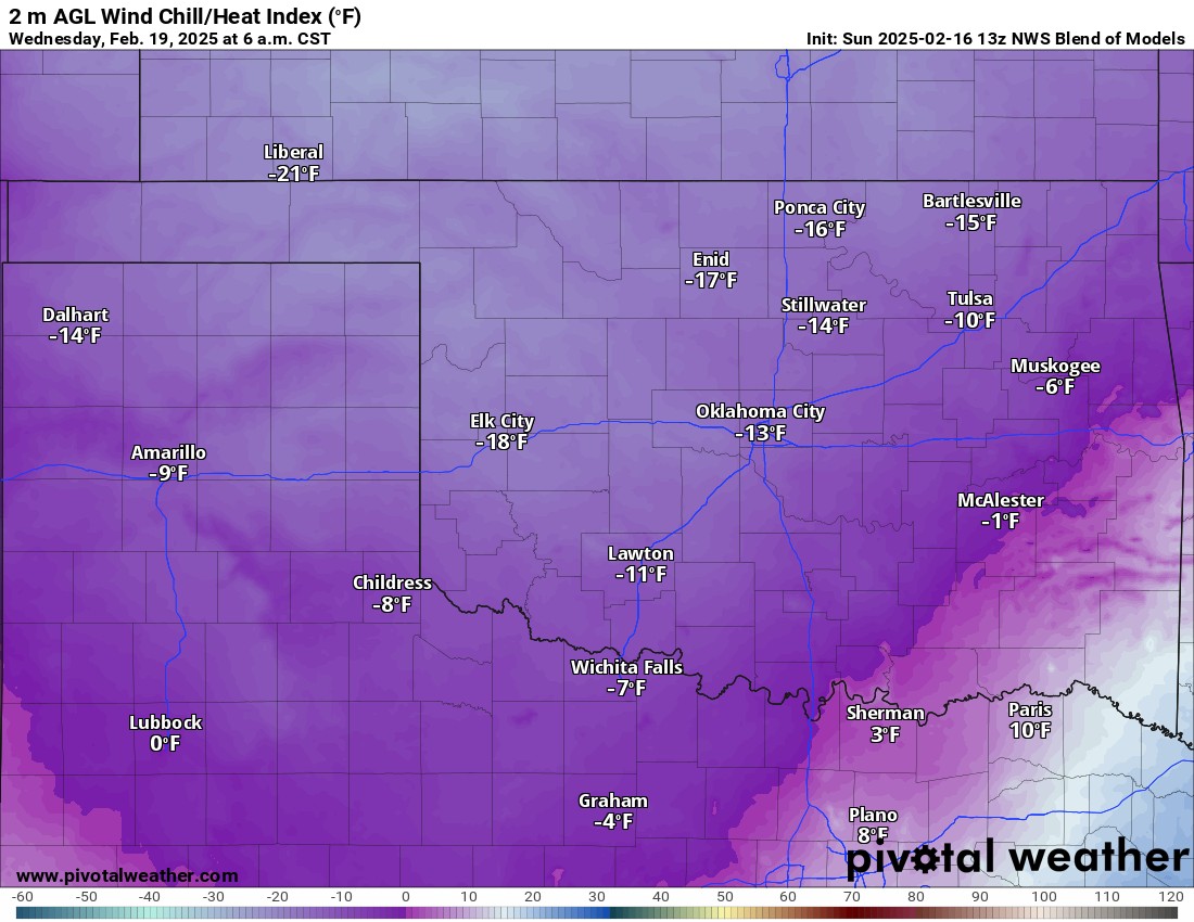
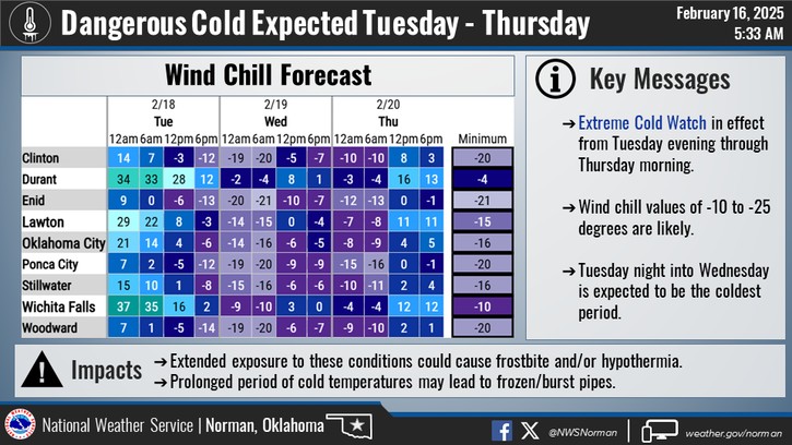
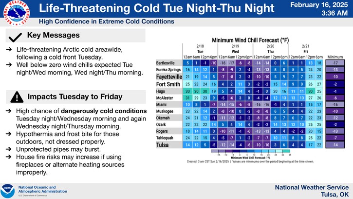
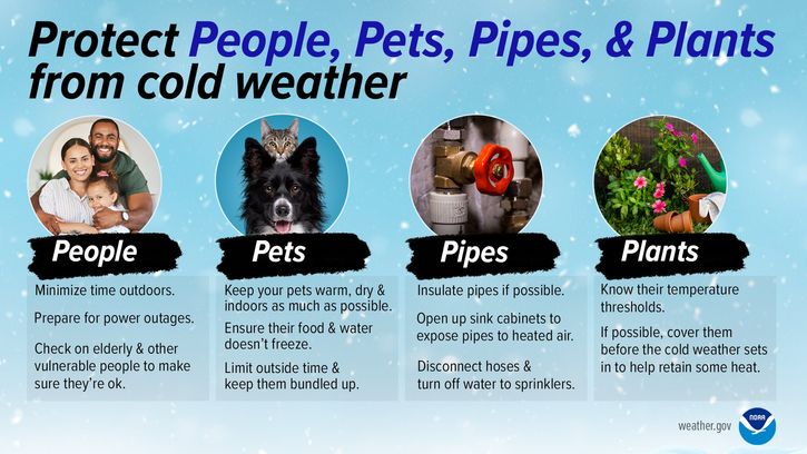
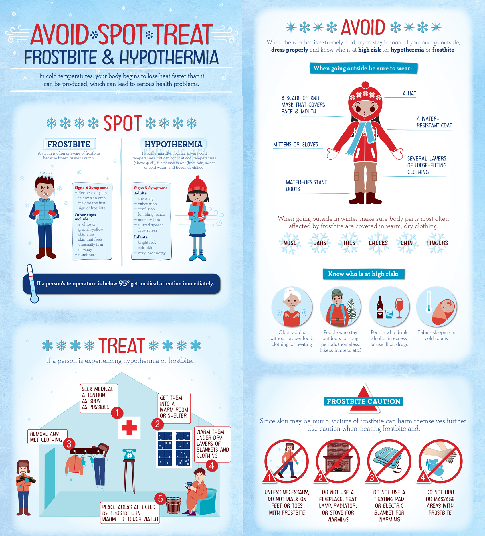
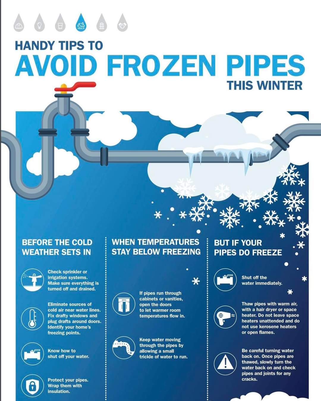
The big story may end up being the frigid temperatures once again. The arctic air currently sitting across the border in Canada will spill southward quickly bringing us below-zero temperatures and wind chills. Watch the two animations of the arctic front covering the United States and then the “departure from normal” map, down to -47 degrees below normal in OKC!!!! Wednesday and Thursday morning will be our coldest. Due to the prolonged 72 or more hours below freezing with readings near zero, there will be a significant water line break threat. So plan accordingly. I’ve included a few graphics below to help be aware and for safety purposes. Frostbite will occur in less than 30 minutes to exposed skin, so don’t mess around this week!
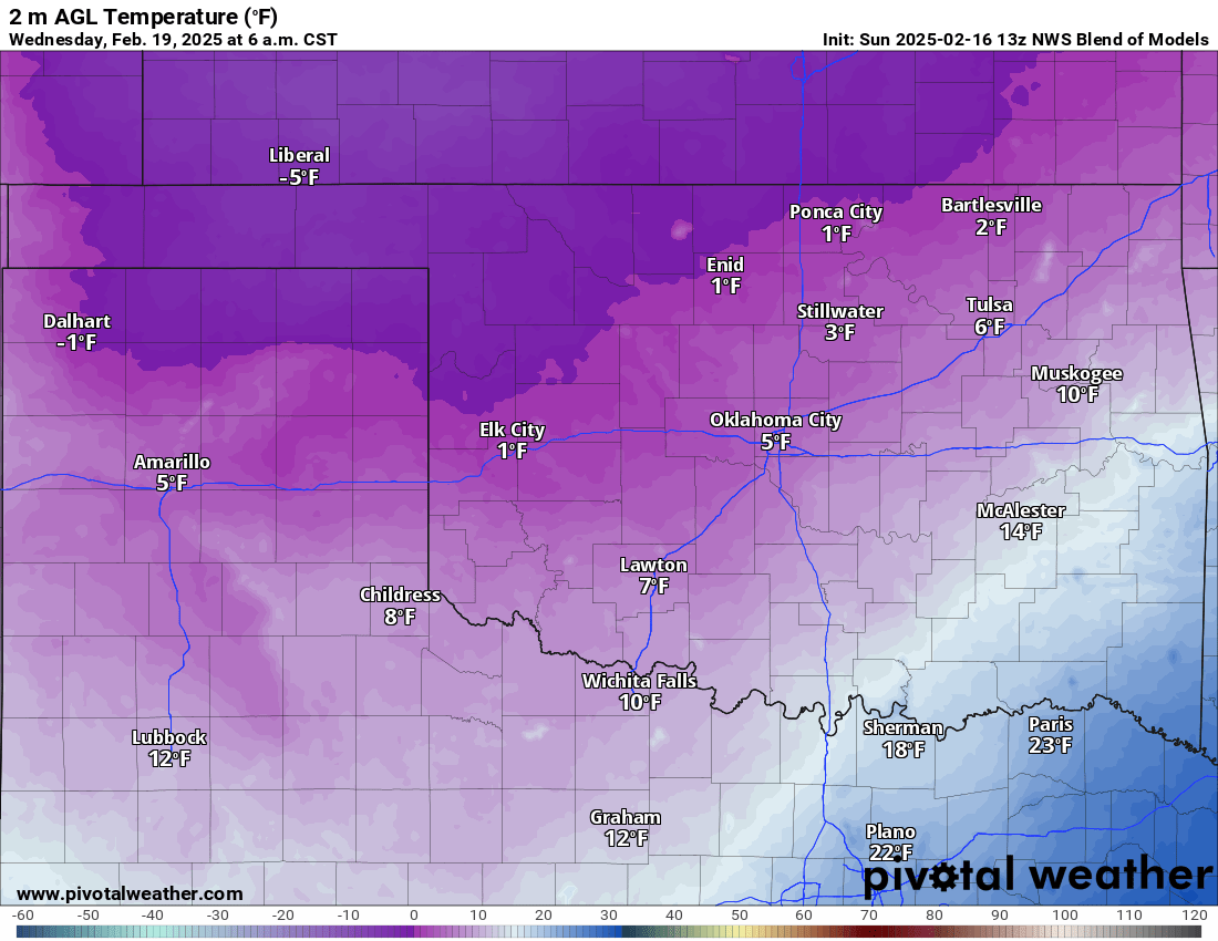
The frigid temperatures will be slow to recover. I’m hopeful we can briefly hit above-freezing Friday, otherwise, we’ll have to wait until next weekend for the big thaw! Bundle up and stay safe out there! Join me live for updates on this storm and the cold temperatures and I would love for you to join me as a subscriber. See you soon! -AT