Another Week of Heavy Rainfall and Severe Storms

Thanks for your patience while I was out of pocket last week. My forecast for the entire week was mostly okay. We ended up receiving more rainfall than was expected, so flash flooding was a problem for a few areas. The tornado potential for Saturday ended up materializing, and I was back in town in just enough time to cover them live. This week, we’ll have several days of rainfall across the region, and there will be a few severe storm opportunities.
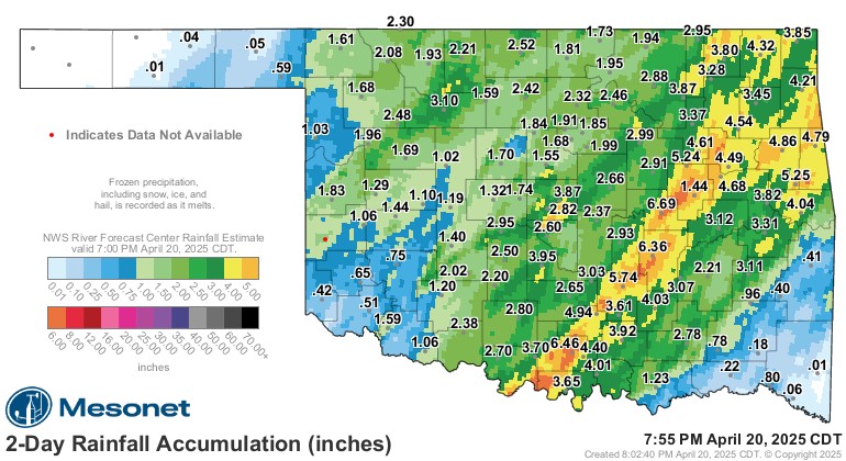
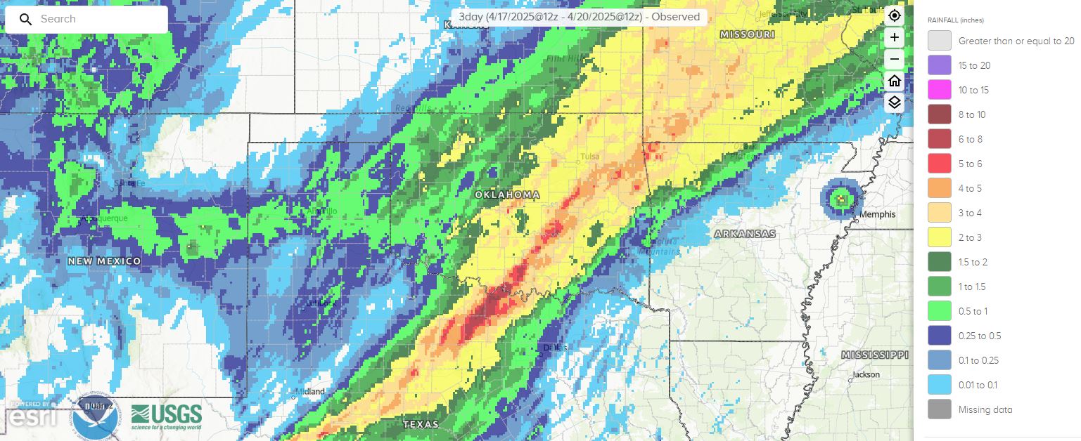
To recap the rainfall, my goodness! We always need rain this time of year, but having it all at once can be problematic sometimes. Flash flooding appears to have caused the loss of life in the metro as well. Always take flooding seriously and don’t try to cross flooded roadways.
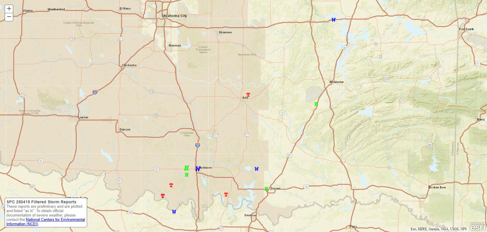
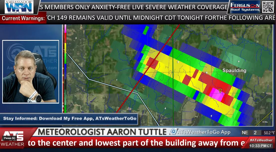
Regarding tornadoes, there were officially 5 reported Saturday evening at the time of this blog, all were weak at an EF0-1 strength. Sadly, one person lost their life in Spaulding, in Hughes County, as their manufactured home took a direct hit from the tornado. Never ride out a tornado in a mobile or manufactured home. They are not built to withstand the shear and high winds. Check out the tornado shelter link on my website if you are in this position: Tornado Shelters
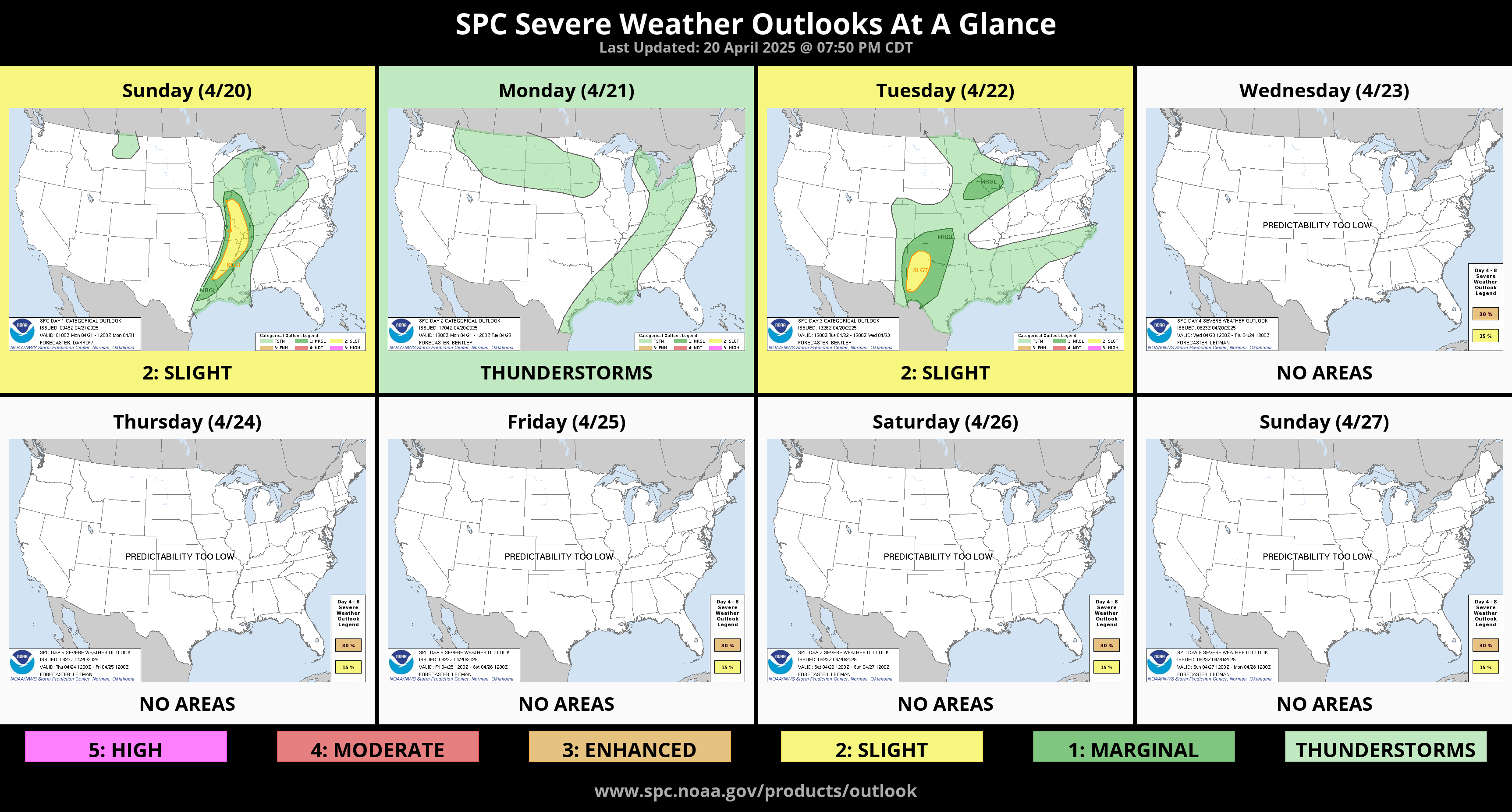
The Storm Prediction Center’s outlook for severe weather for the week is lackluster. They’ll have to modify this as new data helps to fine-tune areas and timing.

Ferguson Roof Systems is offering an AT's Weather special!
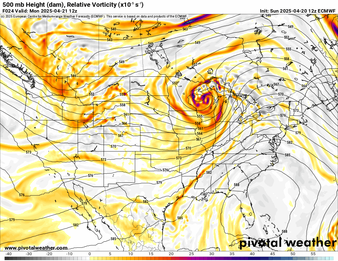
For this forecast period, take a look at the Jetstream animation. Notice the blobs of brighter colors are running along in a SW flow aloft across the area during the week. These disturbances will trigger several rounds of rainfall and storms. So keep my app handy to track the radar each day to help you plan your outdoor activities. You can download it from the Apple and Google app stores. ATsWeatherToGo.

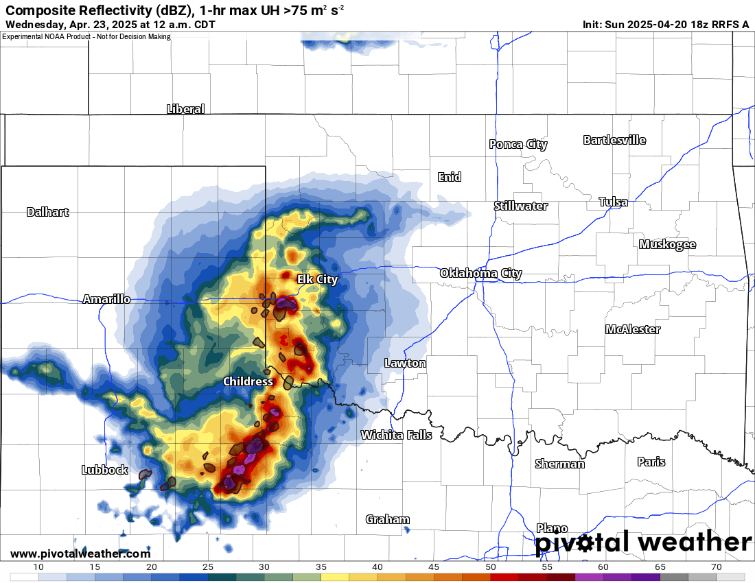
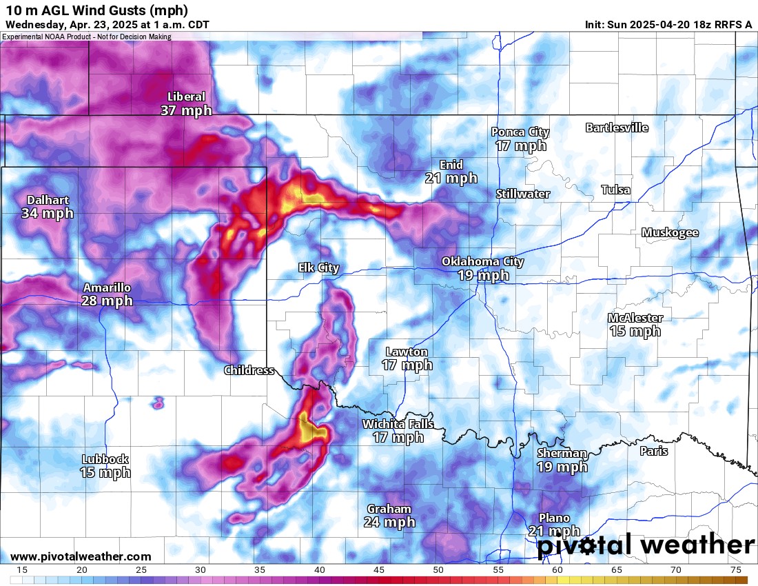
Regarding how things may play out on Tuesday, while tornadoes aren’t expected, damaging winds may be an issue for late evening storms that come out of the Texas Panhandle. Those storms will move slowly eastward overnight and linger into our Wednesday morning.
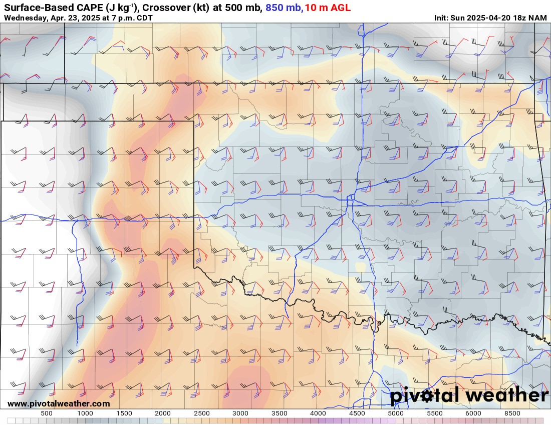
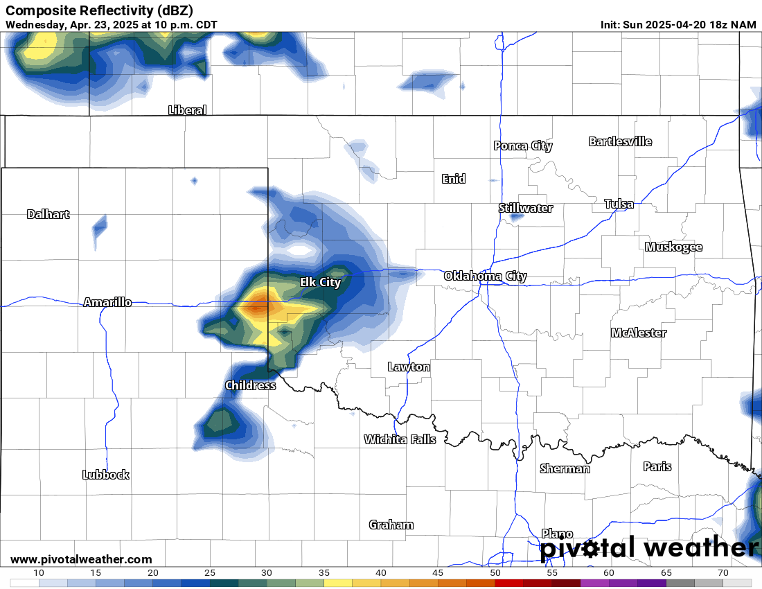
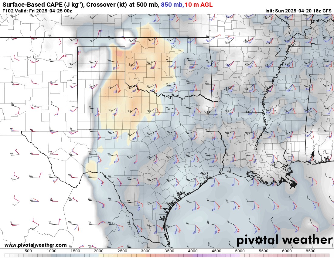
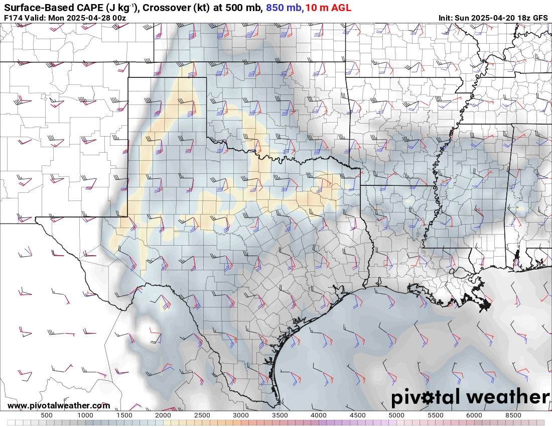
As far as what may be the best conditions for severe storms that might produce tornadoes, I highlighted the days with Shear and CAPE values, which represent instability and the ability for the storms to rotate. Wednesday is a wildcard as I’m not sold yet, but if it were to pan out could have tornadic storms in SW OK by evening, and those may hold together into C OK as they travel E/NE. The other potential days would be Thursday afternoon/evening and Sunday afternoon/evening. Too many things can change to neutralize a tornado threat, so I typically limit that type of discussion until 48 hours out. So expect a few updates this week with live broadcasts.
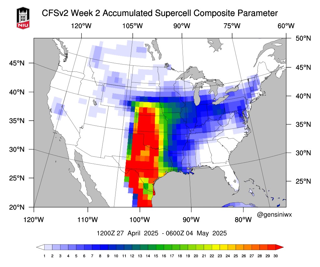
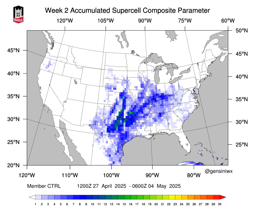
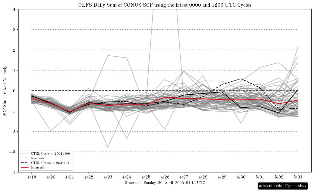
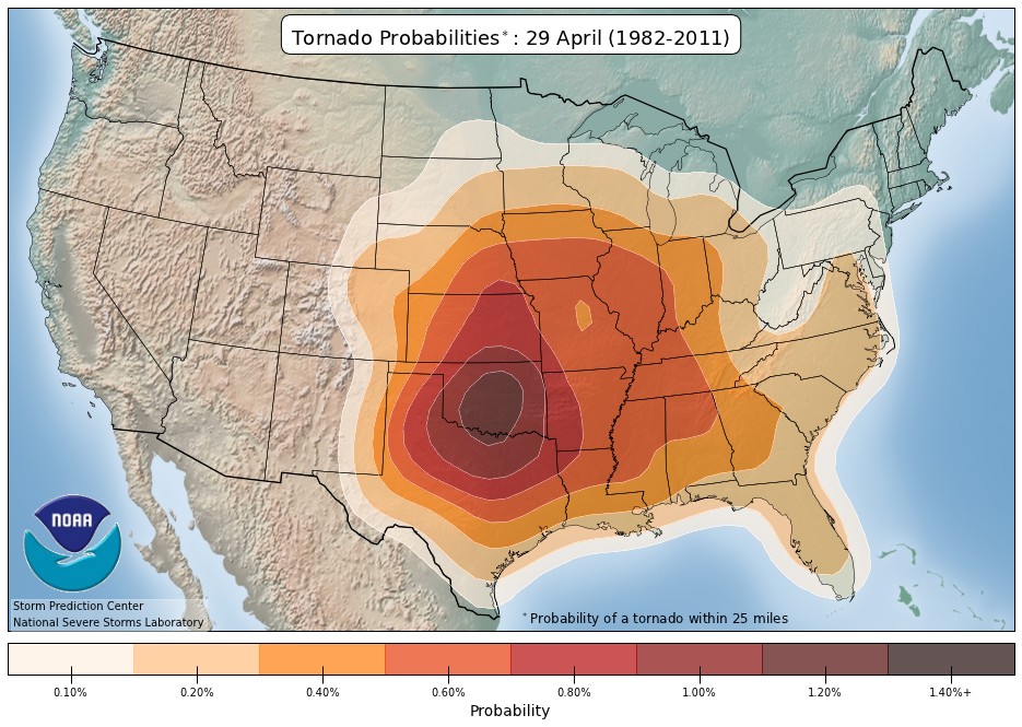
This brings me to those ridiculous CFSv2 Supercell Composite Parameter scary red blob maps that are all the rage these days. Be sure to read my blog from last week for a deep dive into those. I did want to compare them in another way this week. Let’s look at the GEFS and the CFS output of that same parameter. The difference? GEFS is a short to medium-range forecasting system, typically used for weather forecasts up to 16 days, while CFSv2 is a climate forecasting system designed for seasonal to inter-annual climate prediction. Note the output below. The GEFS, which is much more reliable and accurate with better skill scores, shows that our standard severe weather setup for the last week in April is a little lower than what we would expect for this time of year when you look at the standardized anomaly. Notice how the red line (the mean of all the 30 model members) is running negative. That’s bad news for the gloom and doomers out there! Also, notice climatology-wise, how Oklahoma is in the center of tornado activity late April, with about a 1.5% probability of seeing a tornado within 25 miles of a point. This continues up through mid-May, so the atmospheric conditions that can support tornadoes are nothing new.
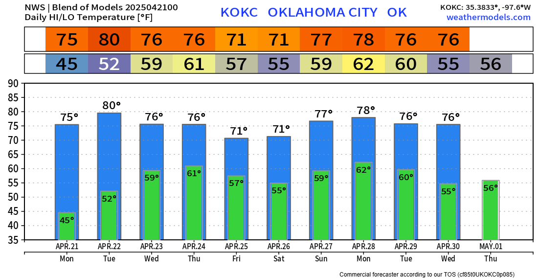
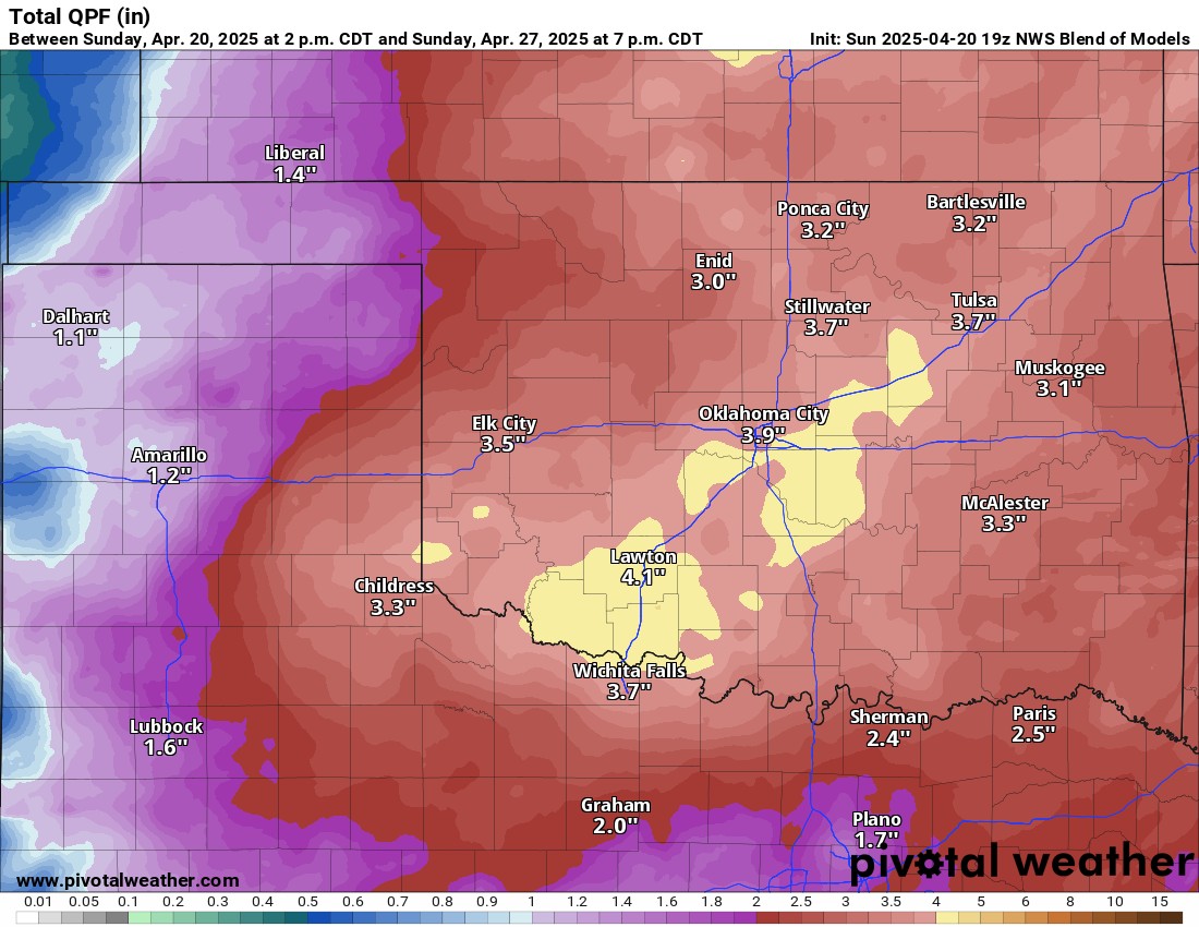
Rainfall amounts will be impressive once more. As usual, this time of year, severe storms can produce quite a bit more than the model blended average. So always keep that in mind if you live in a flood-prone area.
As far as temperatures are concerned, it will be typical stuff for late April. Stay weather aware this week. -AT