Fire and Heat to Start, Severe Storms to Finish
This week will actually be mostly uneventful with just a couple of days that have some interest. Sunday will be very hot with a threat of wildfires and next Saturday *might* have severe storms. On a side note, I’ll be out of pocket this week at a mental health retreat where you detach from this matrix and return to source. I’m in this for the long haul to serve you, so need to take care of myself first to make sure that can happen. I will be back late Saturday, so if storms are ongoing, I should be able to cover them. (That’s why you are getting my blog today)
The reason why things are quiet for now is there is a ridge in the Jetstream flow that will transition to a SW flow by the weekend. This will allow a couple of nice cold fronts to move in.
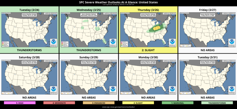
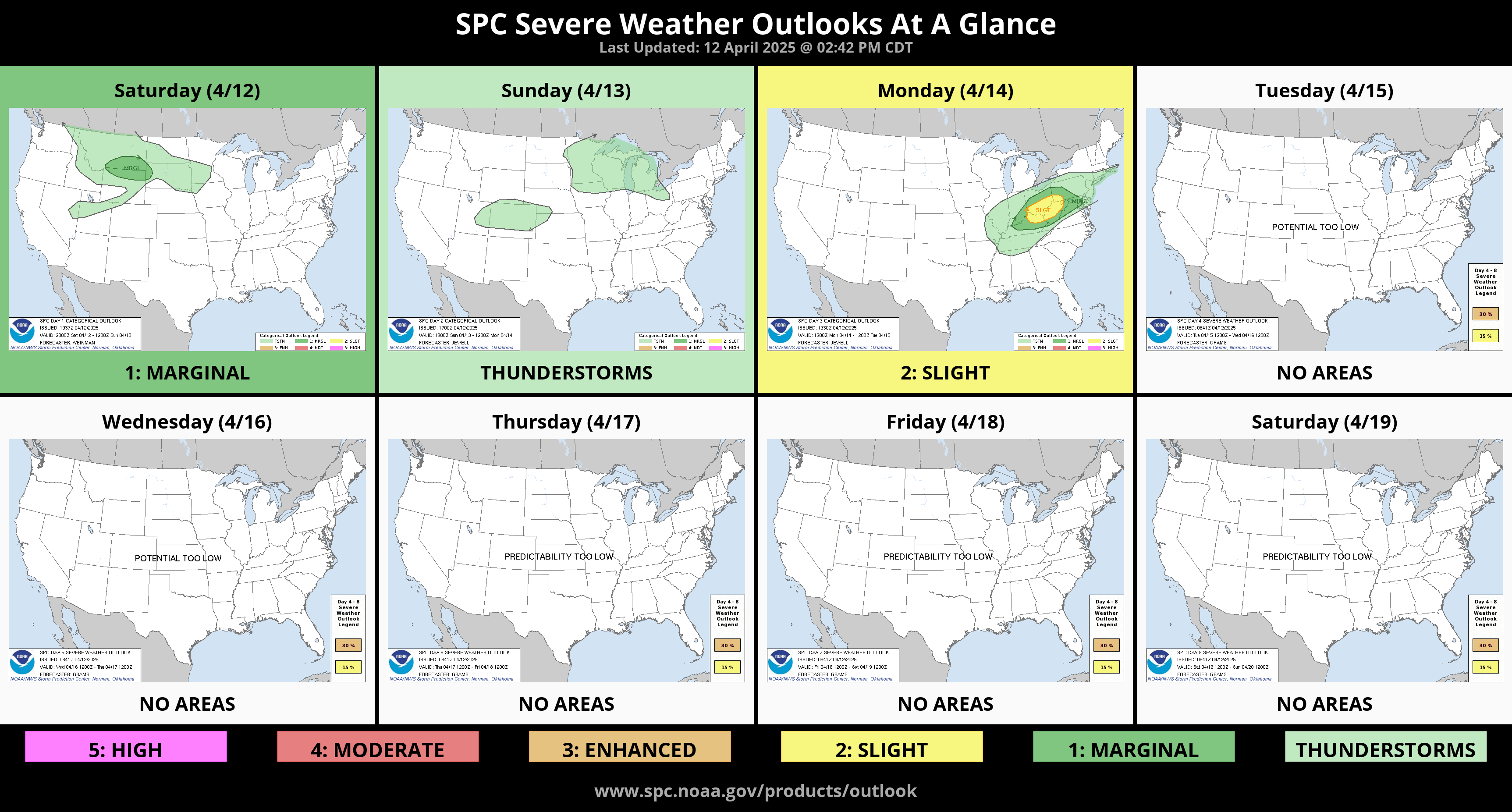
This keeps us mostly quiet for severe storms. The SPC Outlook is uneventful, to say the least.
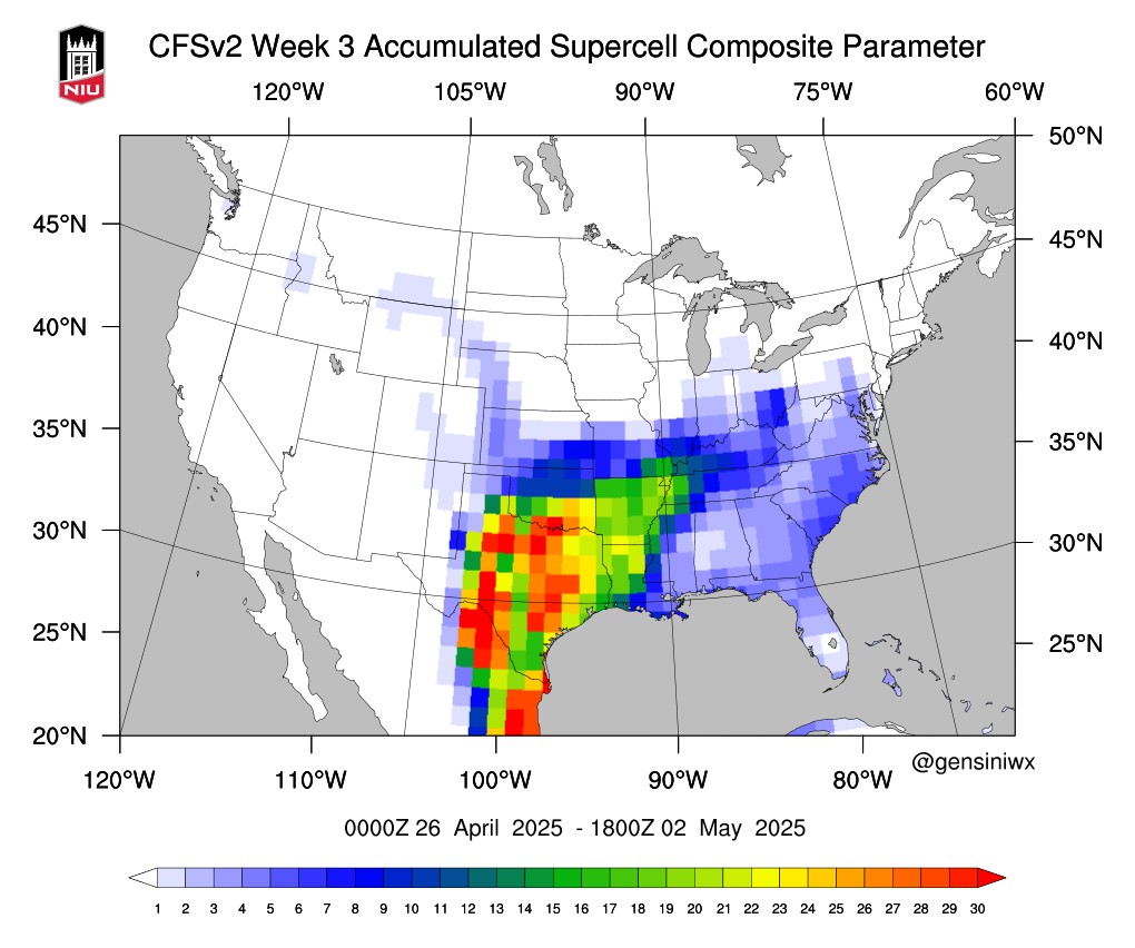
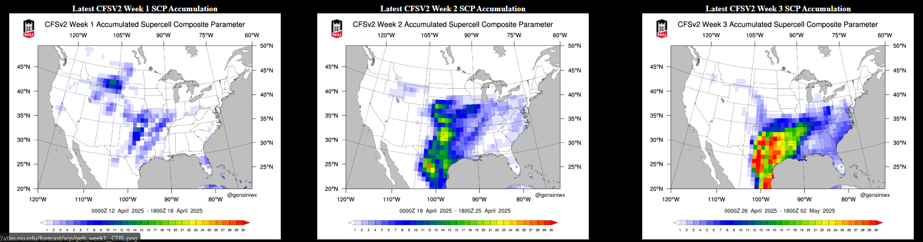
However, you’ve seen those CFSv2 Supercell Composite Parameters floating around. You know the ones posted from all the severe weather wishcasters that love a good gloom and doom porn fest. They get you all worked up, show these red maps, and say WATCH OUT!!! The rest of April and May are so scary!!! Do you want reality? Take a look at that same composite from today below. How much red do you see? Hardly any. It literally changes every day and these clowns for ratings and clicks will never show you this output. So do yourself a favor and stop following idiots who pray on your fears and anxieties, Also keep in mind, just because the parameters say there are some good ingredients for severe storms, it doesn’t mean they will actually happen. Besides, in late April and May of every year we have good parameters for severe storms. So we expect them anyway without the hype.

Ferguson Roof Systems is offering an AT's Weather special!
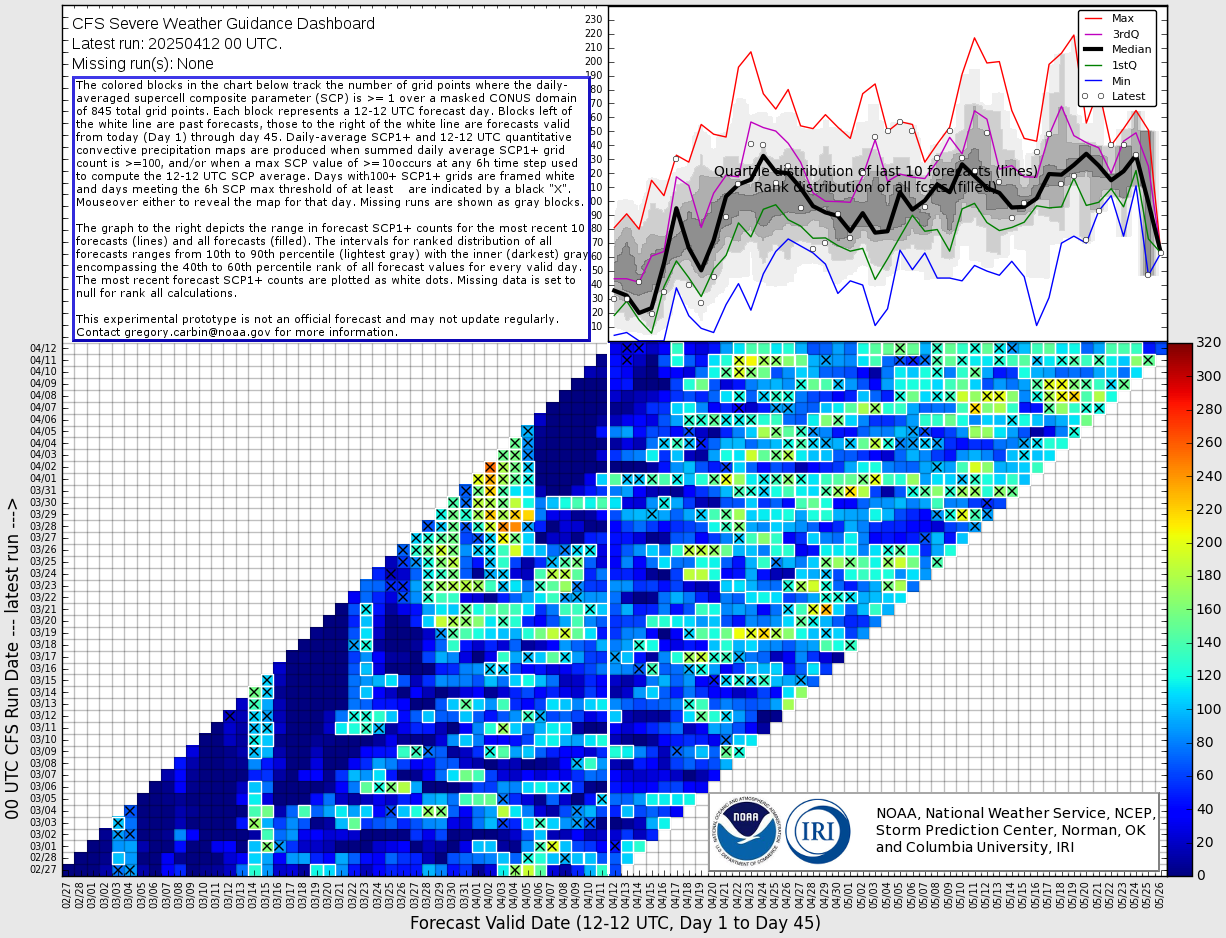
The part of that 3-panel image is the story behind it. Take a look at all of the model runs each day in the form of colored blocks. It will take a minute to understand this graphic. To make it easy, the bottom line, the lower right panel has colored blocks with X’s in them. You want to look at the days of the month and then view vertically to see how many lines contain a brighter color. Blue means uneventful. Yellow is about average severe parameters, and red is let’s talk business. What do you see? No red, and not a lot of continuity. There are a few weak signals around April 20th and a few in early May. Nothing consistent. That’s a lot of uncertainty. So when you see the cherry-picked standalone images of all red, keep in mind the details behind the maps aren’t all that impressive. Will we get a few days of severe storms between now and mid-May? Of course, we do every year.
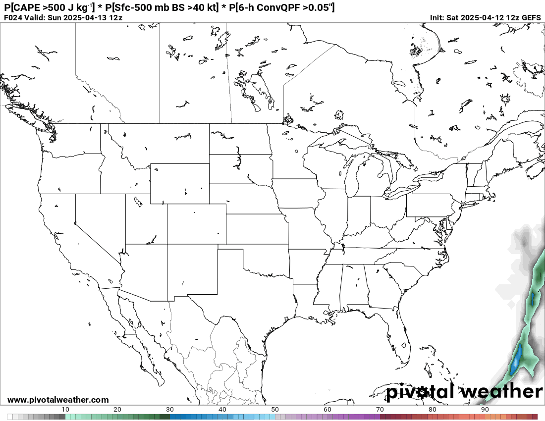
One more thing we can look at long-term is the global ensemble run of that same period. The map animation below shows a probability of the SCP broken down into adequate shear, instability, and actual precipitation. Meaning the CAP didn’t prevent storm formation. In other words, the likelihood of severe storms actually occurring. I want you to notice, that outside of basically one day in green, the other days are in grey, also known as about a 5% probability or less. Not impressive eh? Keep this in mind with those red maps you see posted on the internet and laugh in their face instead of getting anxious.
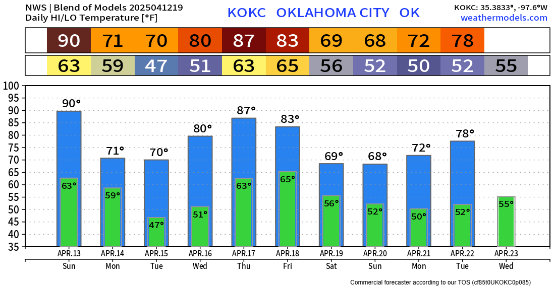
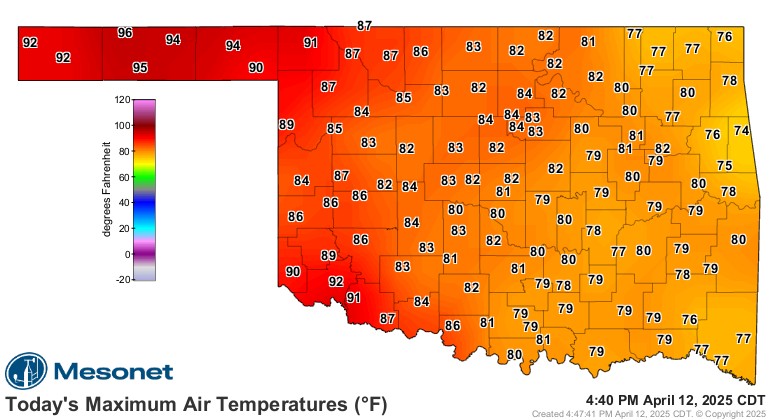
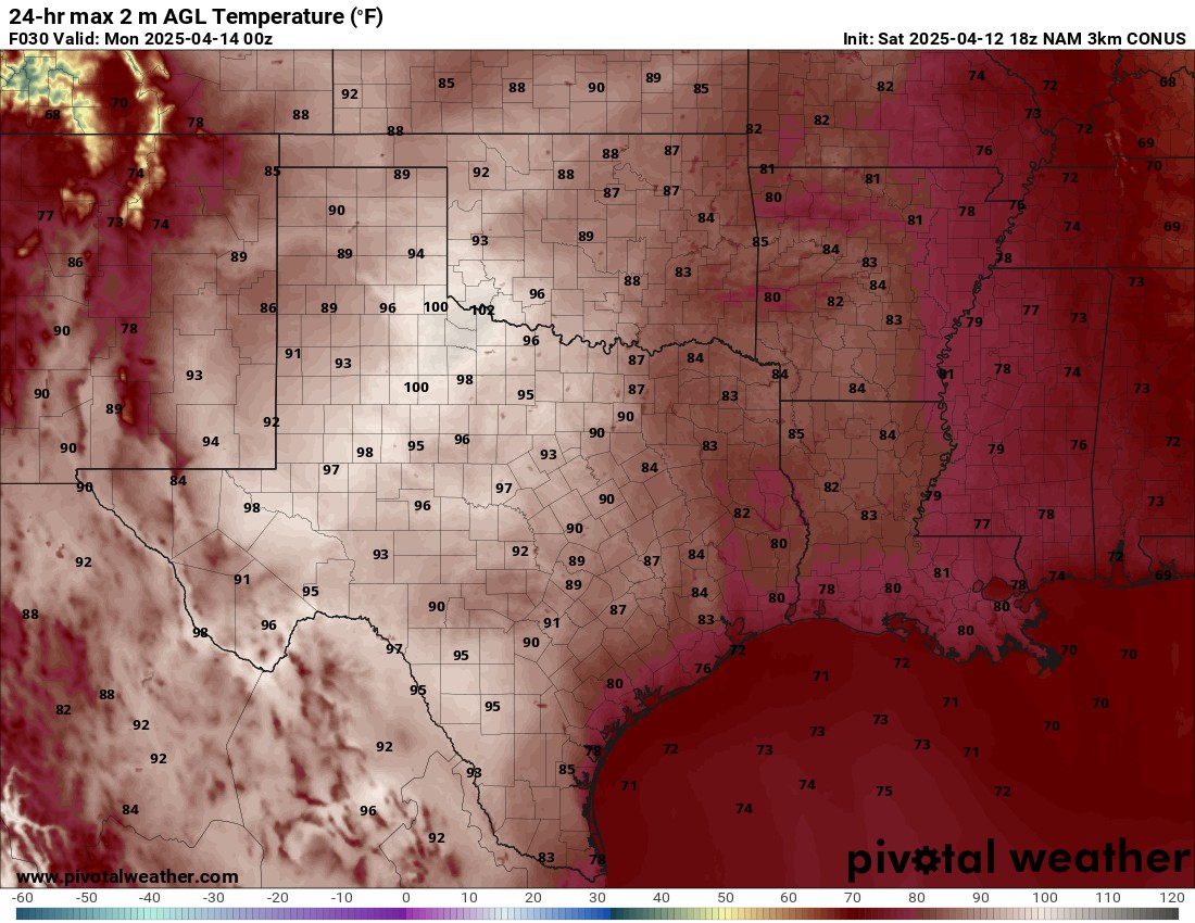
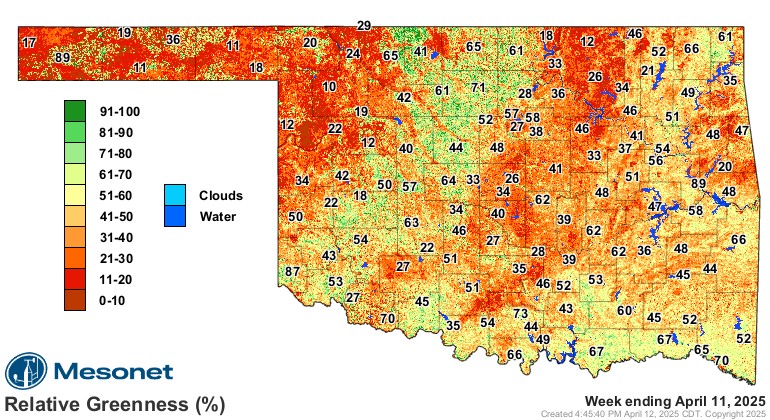
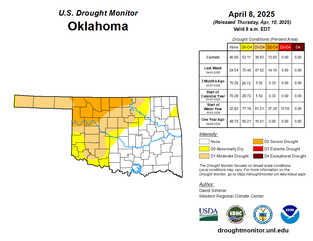
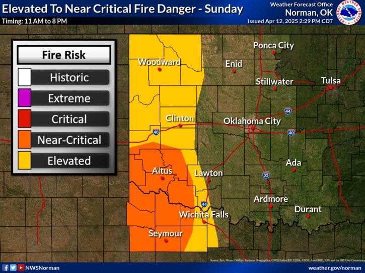
Regarding the forecast, the heat will be excessive on Sunday. Saturday was already pretty hot across the panhandle and SW OK. So even more so to round out our weekend. Part of the reason for this is the greenness factor of vegetation and the status of the drought. We definitely need more rain out west and we’ll get it Friday night through Sunday. The fire danger will be elevated on Sunday as well.
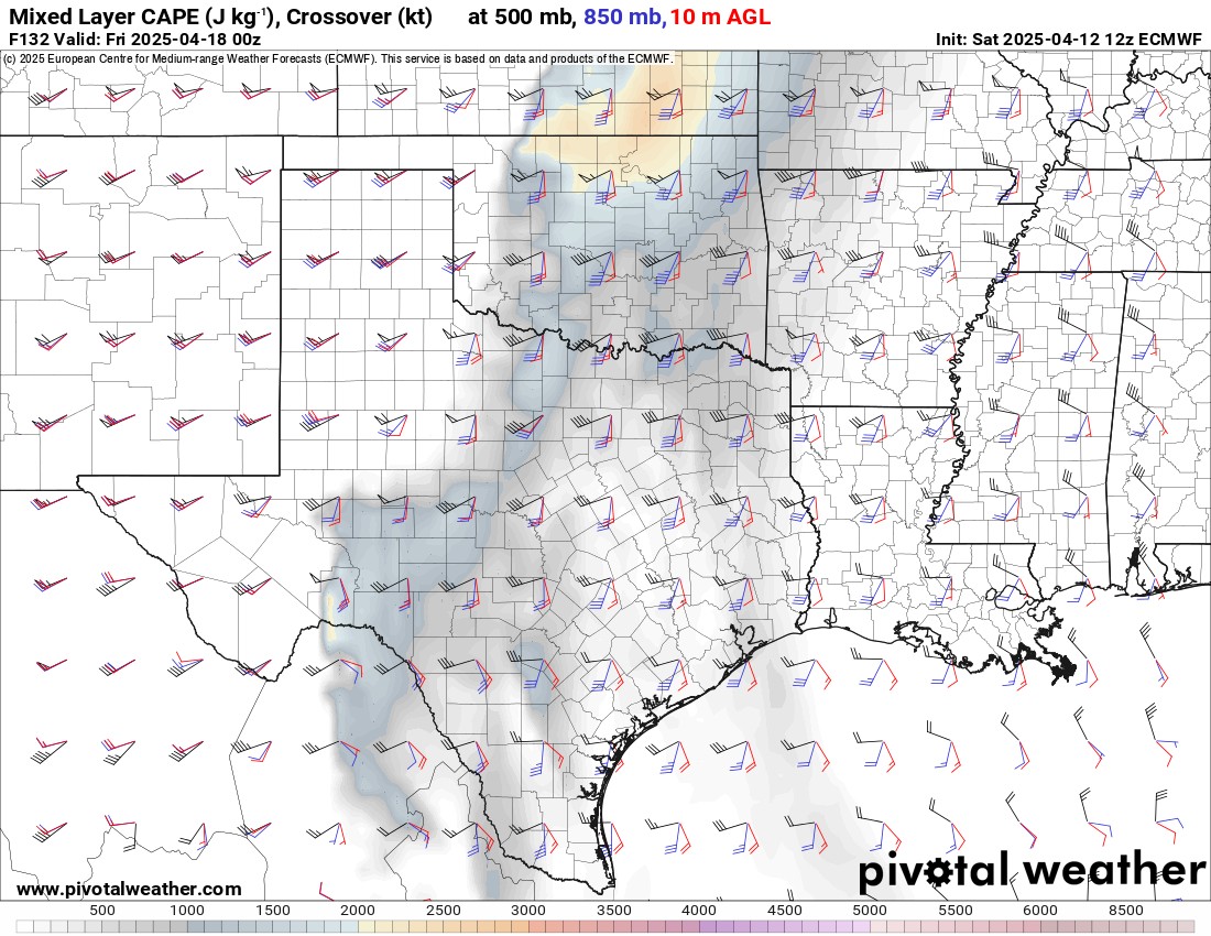
Let’s focus on severe storm potential. Thursday we will have a return to CAPE and shear to the state. However when you look at the atmosphere vertically, we’re very dry and there is a massive CAP in place, so I don’t expect any storms to develop as a result.
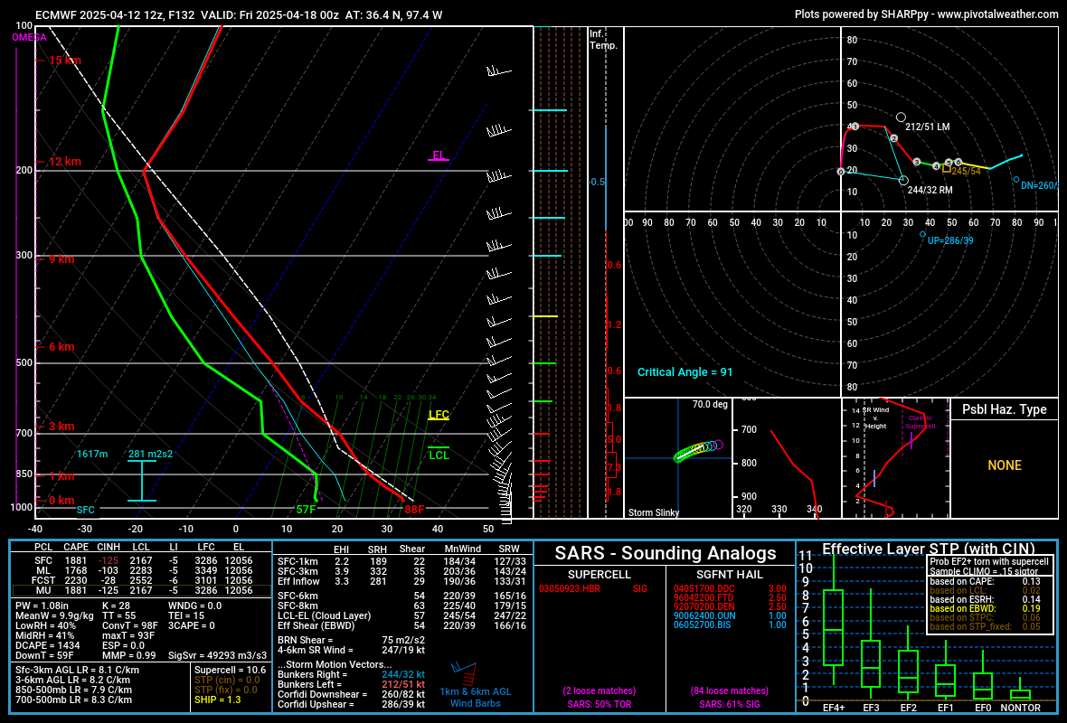
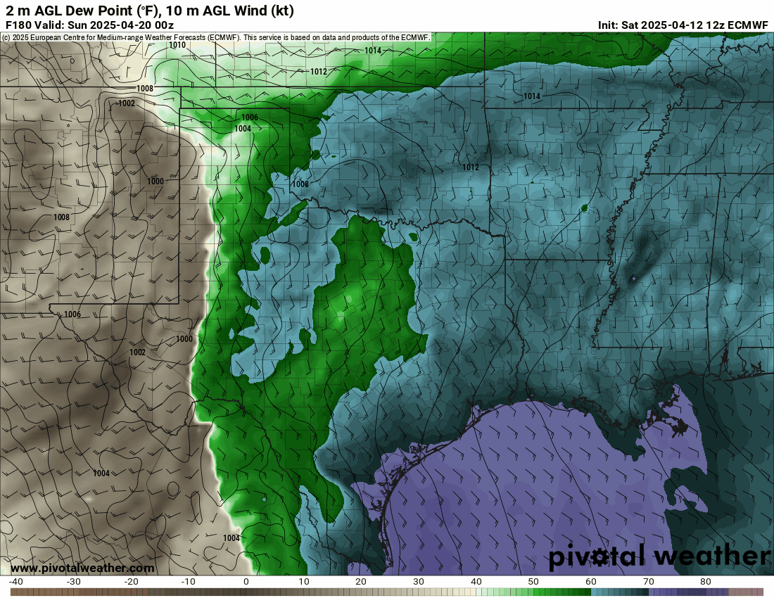
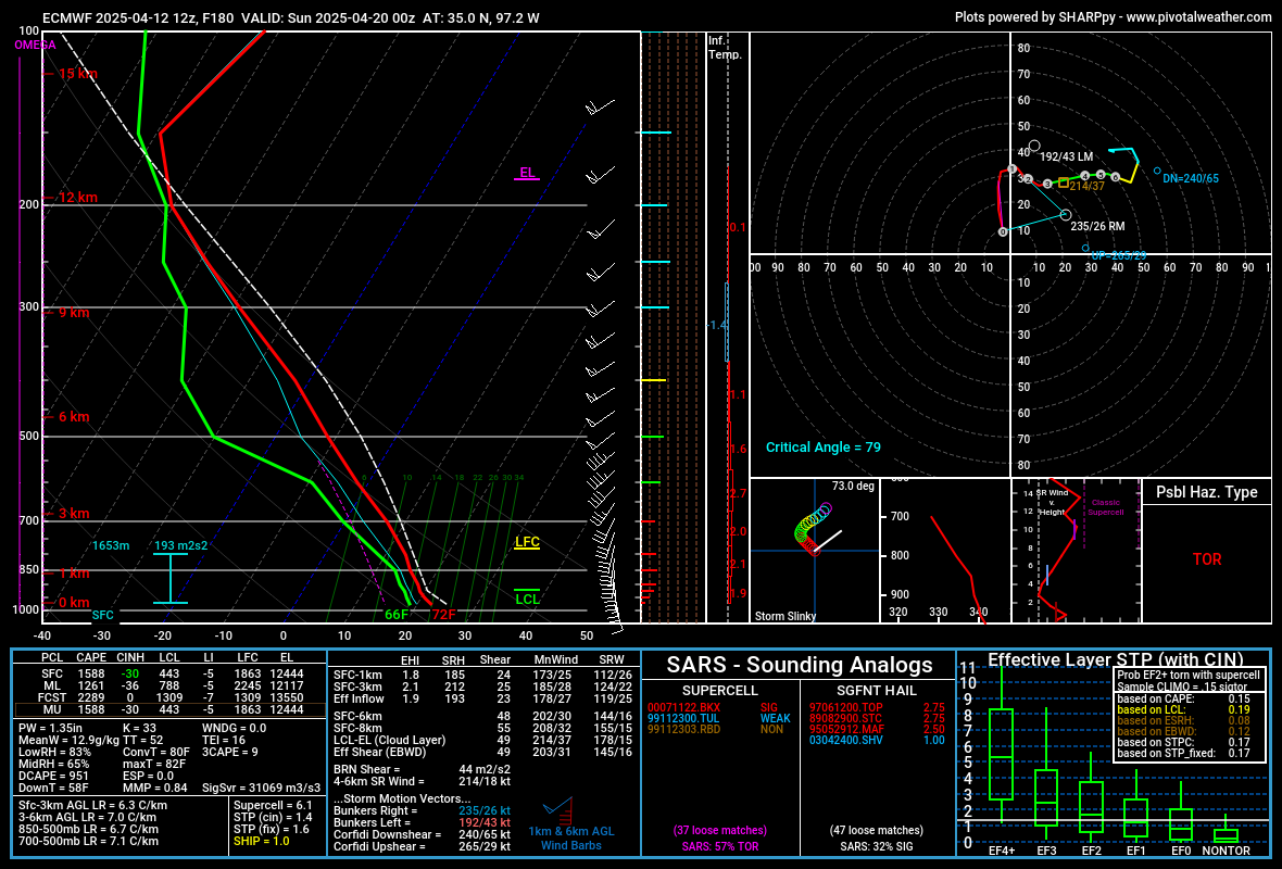
Then Saturday, we do have some indications that severe weather will be possible. There is a cold front that models are trying to retreat northward. It’s 2 against 2. The Euro and GFS bring it back to at least I-40 corridor. The Canadian and German models keep it south. You can see the uncertainty in the dewpoint map animation among models. If you want severe storms, you want the warm front to come this way. If we assume the pro-storm models are correct, we might be dealing with a tornadic environment of adequate wind shear. That surface configuration will allow for an East wind which helps in the low-level rotation of storm structure. Of course, if those winds are only 5 to 10 mph, that’s a limiting factor for tornadogenesis. To form, they prefer surface winds closer to 20 mph or greater. The other thing is how worked over the atmosphere may be from prior overnight and morning convection to help stabilize things. So there are a lot of details and uncertainties to work out as I peek into my crystal ball 7 days out.

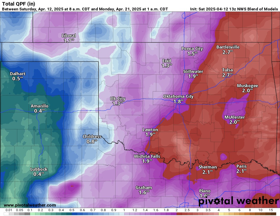
Outside of any severe threat, we are looking at more beneficial rainfall. Totals from the model blend look impressive!

Temperatures will fluctuate quite a bit this week. We’re in that transition period of Spring. -AT