A Beautiful Week Ahead!
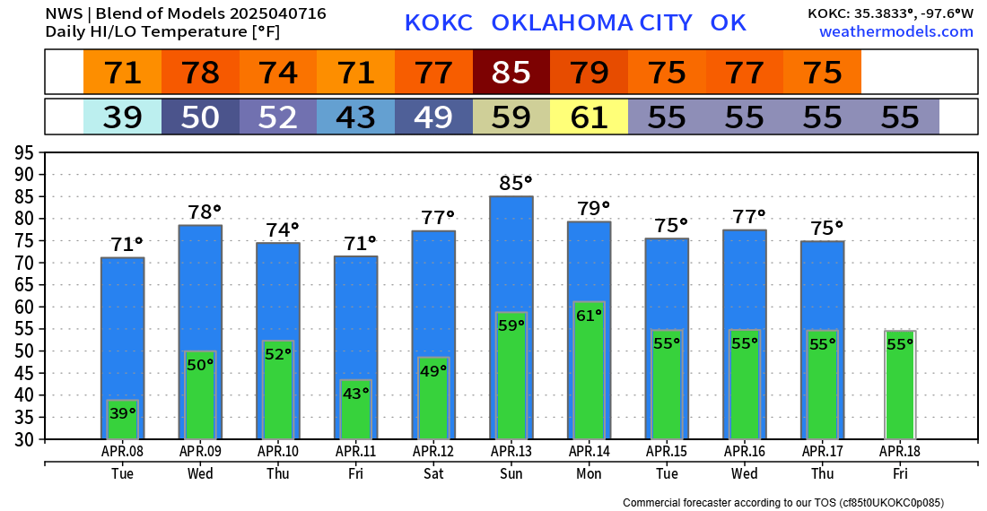
It’s not often we get a long, nice stretch of perfect weather in April, so we’ll take it when we can. After some much-needed rainfall, we’ll get a chance to let the vegetation blossom. There are no threats of severe storms this week, either.
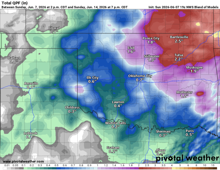
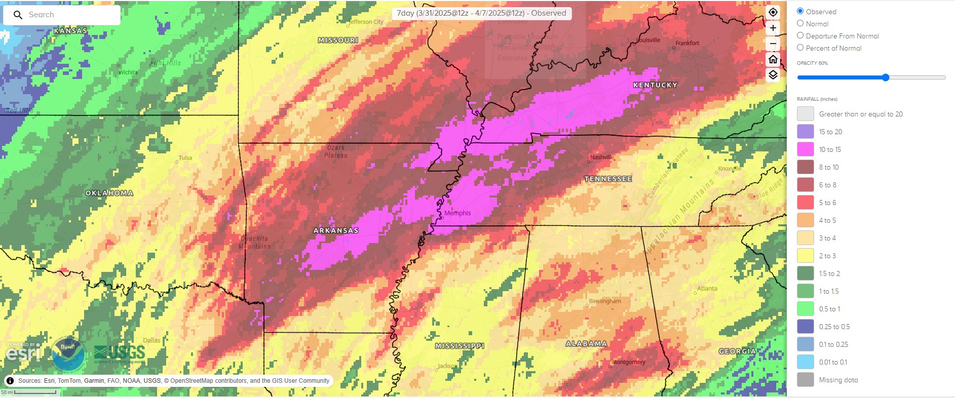
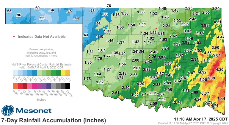
Seven days of rainfall brought flooding to parts of SE OK and Arkansas. As much as a foot or more fell in the areas in pink out east.

Be sure to mention Aaron Tuttle when you call (405) 820-1193!
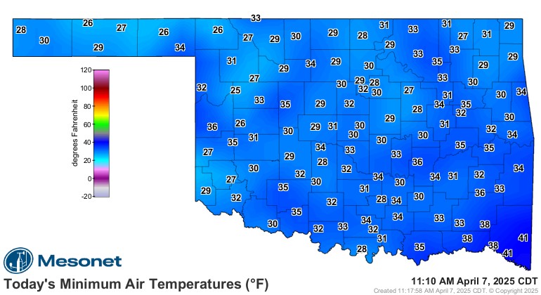
We also had a fun burst of rain and snow Saturday night. This led to two cold mornings with a decent freeze as a result across a large area of the state. Hope you protected those plants!
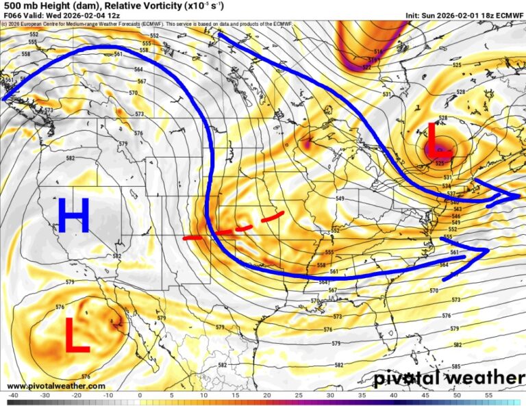
The Jetstream keeps us in a NW flow aloft with a transition to some weak overhead ridging. This keeps the weather quiet.
 Restoration and Disaster Cleanup Service
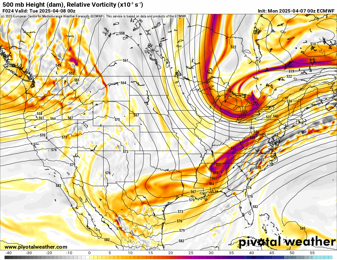
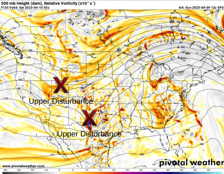
You can see how the instability and shear have been shut down across most of the region. The animation shows no large brightly colored blobs roaming around.
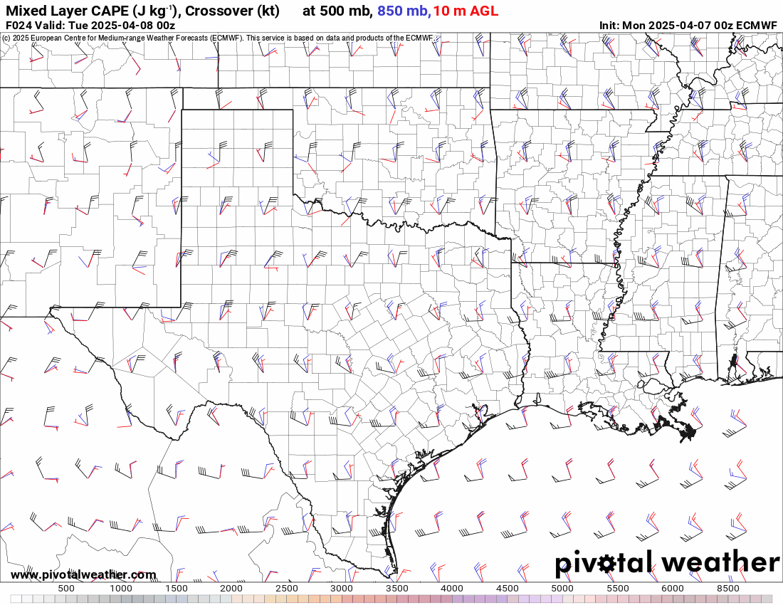
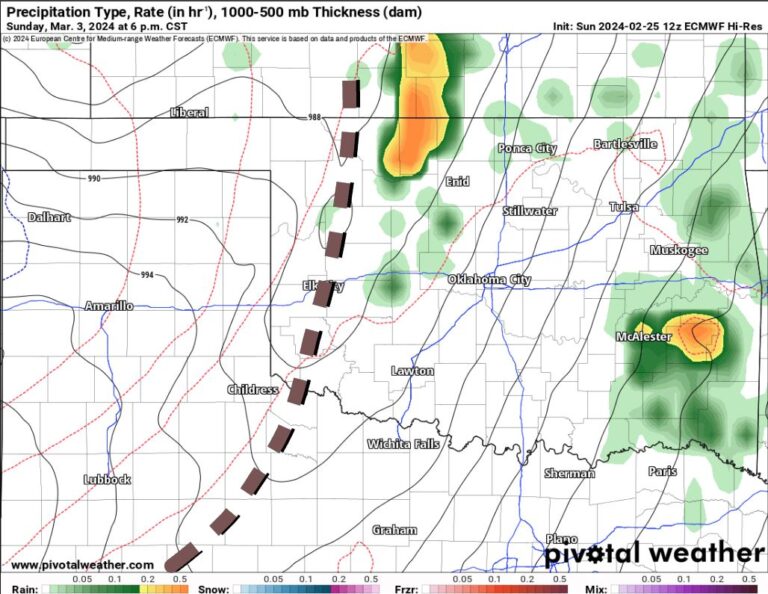
A system will move through the nation’s midsection on Sunday, but our atmosphere looks to be capped. Despite a weak cold front and dryline in place, hot downslope winds at 850 MB will dry out the mid-levels and create an environment where we would have to hit 100 degrees to get storms.

Ferguson Roof Systems is offering an AT's Weather special!

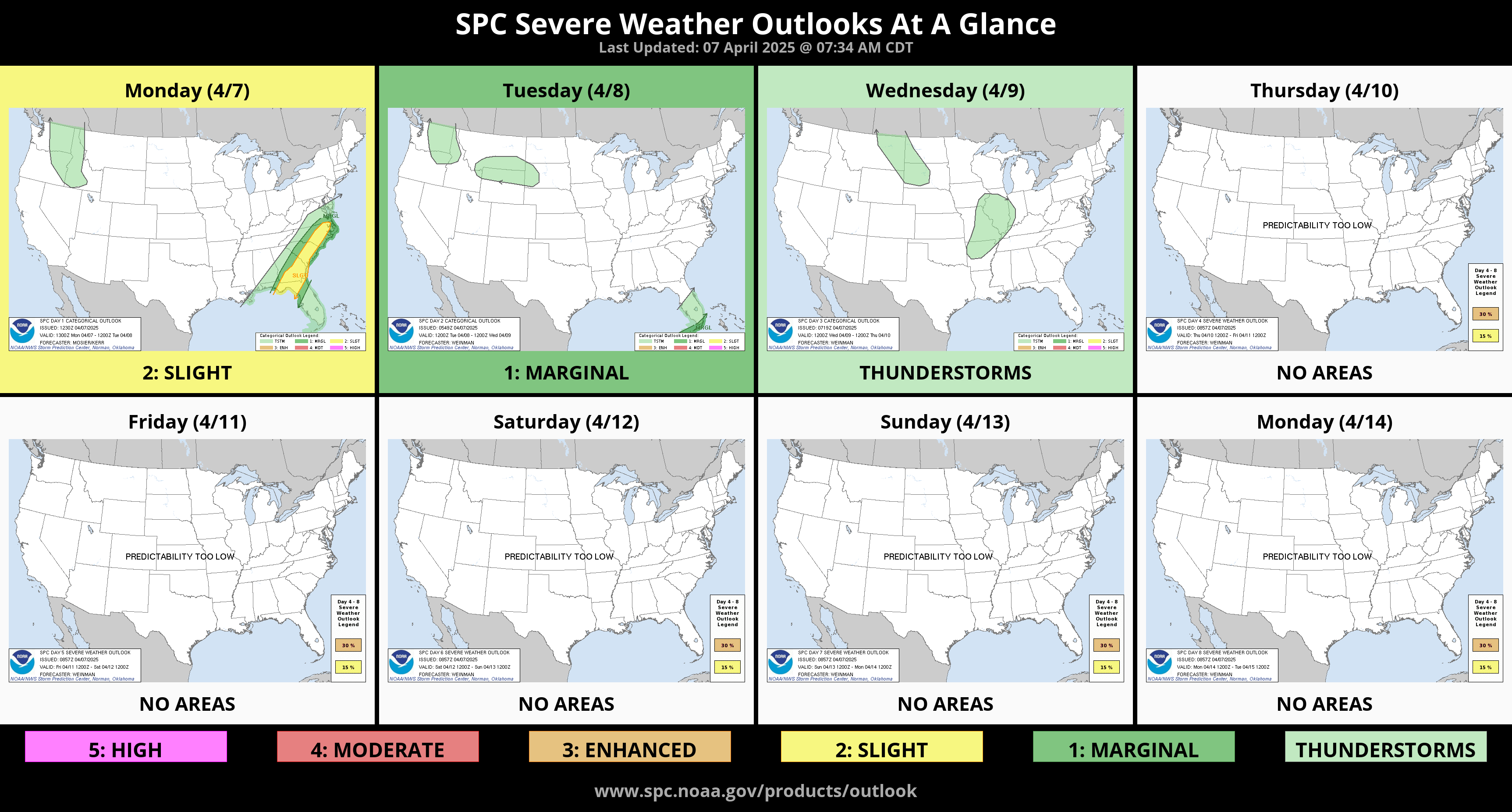
The following week of the 14th also looks mostly quiet. There are indications we may get two storm systems, coming across at the off hours of the day and with a more uniform shear profile out of the south. This limits the rotational component of the atmosphere and lessons the severe magnitude. I’m hoping those two events will be a bust because I will be at a mental health retreat that week. They didn’t ask me when to schedule the event, haha, but it is what it is. I’ll be off the grid, so if we do get any storms the week of the 14th, you’ll need to rely on my free weather app, ATsWeatherToGo.
Temperatures will be amazing. Enjoy the weather this week! -AT