Summer Heat Builds but Rain Isn’t Far Away

Our wet pattern over the past few days gave many much needed rainfall. There will be a few dry days ahead, and temperatures will heat up, but good news isn’t far away.
First off, I don’t know who build a dome across the greater OKC metro area, but that wasn’t cool. It appears the rain fell all around us. While this meant the weekend behaved better for outdoor activities, it cost us some much needed rainfall. Some areas experienced flash flooding and there were even a few tornado warnings in western Arkansas on Saturday with damage to trees and a barn roof.
 Restoration and Disaster Cleanup Service
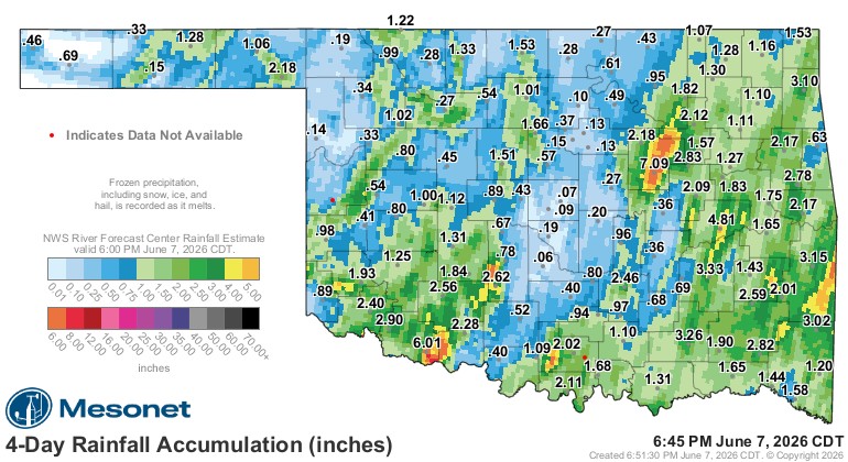
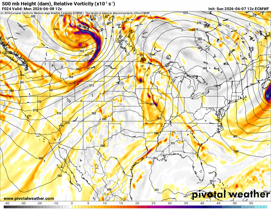
The Jetstream pattern shows weak ridging aloft, but otherwise a mostly zonal flow. This will allow a weak cold front to arrive Thursday and another Sunday. So that along with upper disturbances in the flow will provide at least some rain across the state from Thursday through Sunday. The pattern stays a little unsettled beyond this week as well.
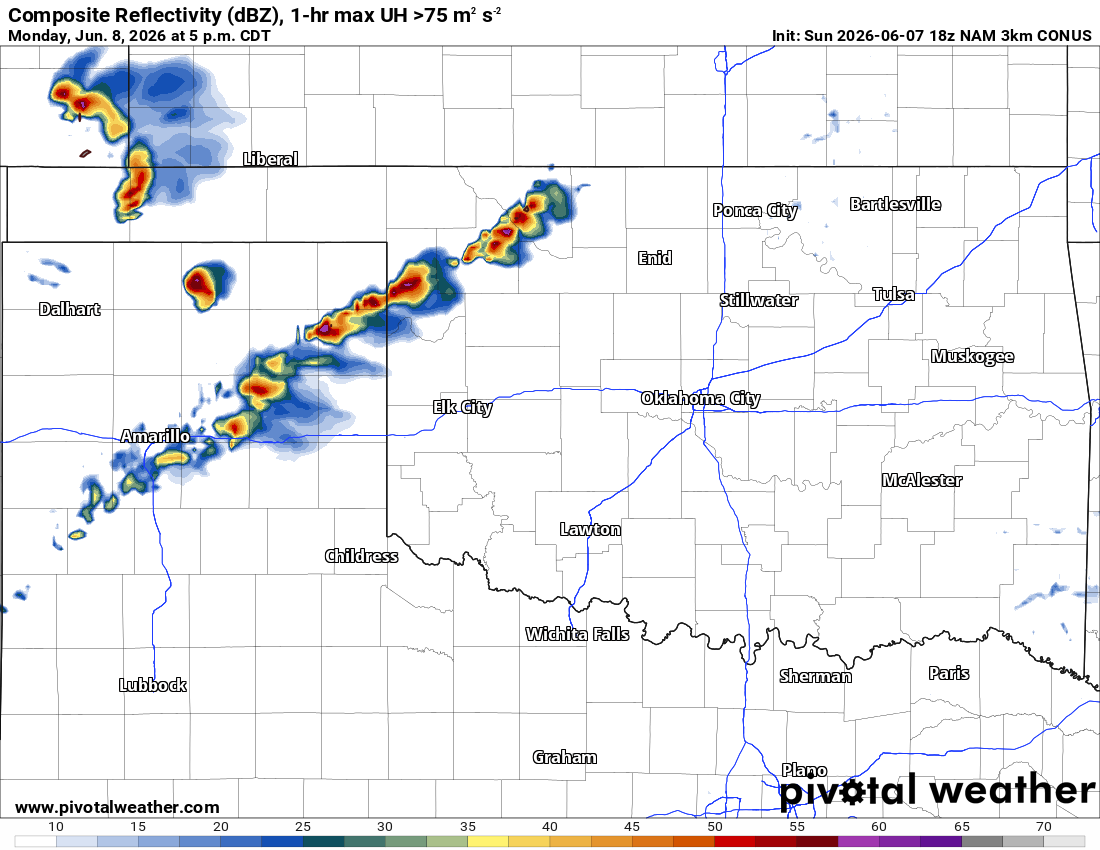
Other than a few storms overnight across parts of N/NE OK, additional activity should develop across NW OK Monday afternoon/evening. After that, the front will trigger some storm activity on Thursday off/on through Sunday. Sunday may end up being the best day for rainfall across the state. Not everyone will get wet and not everyone will see decent amounts either.

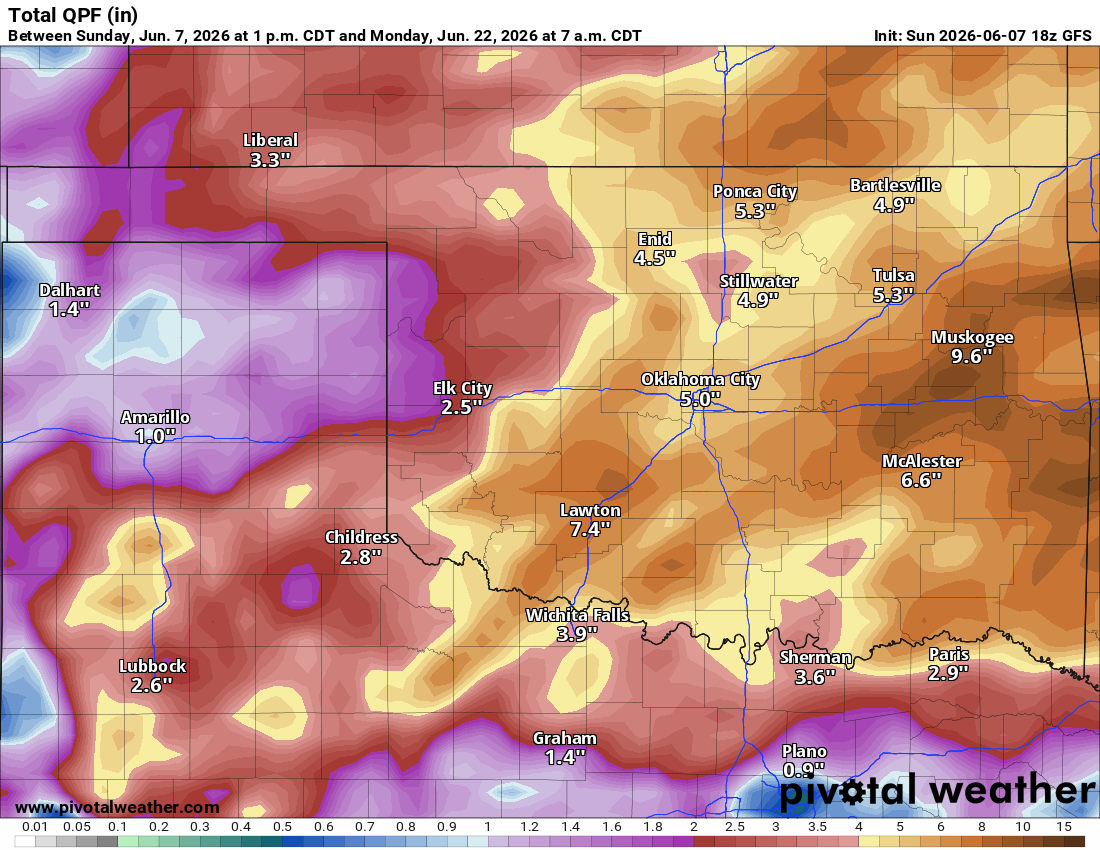
Speaking of amounts, the conservative model blends paints the highest totals across NE OK through Sunday. For the following week, models are much wetter and cooler as well.
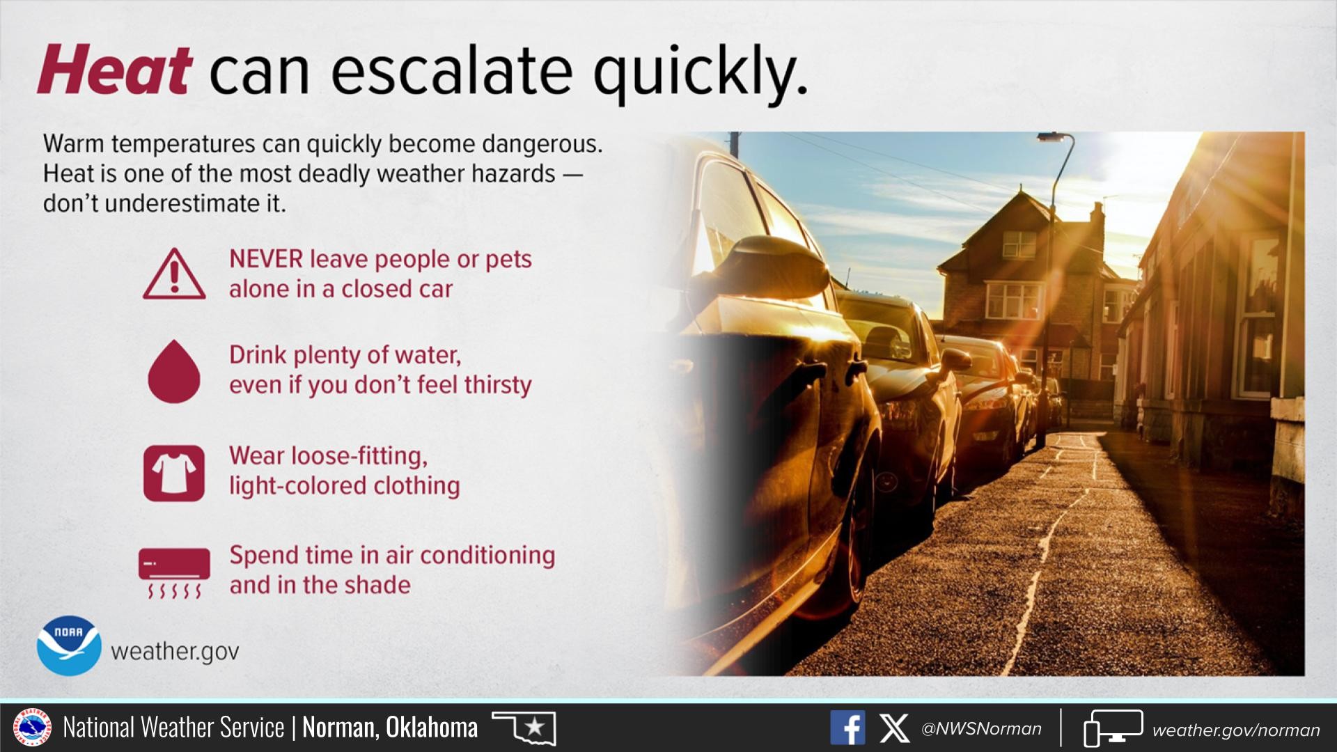
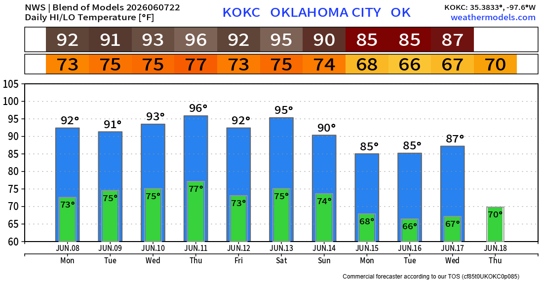
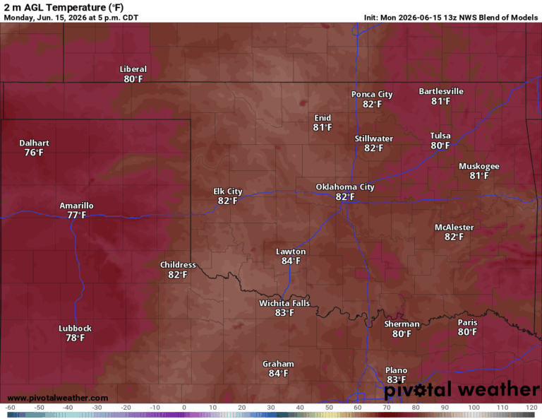
Speaking of cooler, we’ll get there, but not before a brief round of heat. Make sure to be aware of heat safety in the short-term.

Be sure to mention Aaron Tuttle when you call (405) 820-1193!