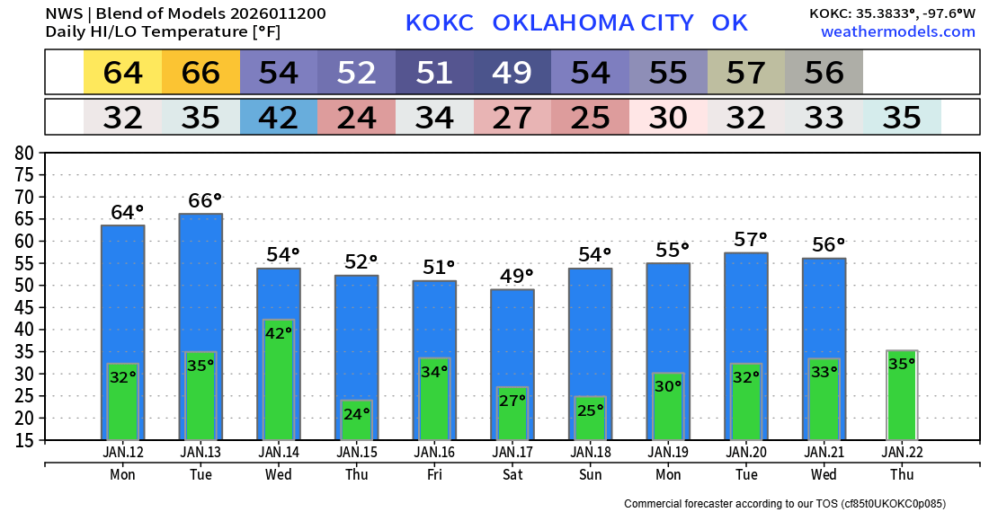
Seasonably Colder Conditions Return
We’ve been spoiled with above normal temperatures for December and even into January. The pattern is shifting for the 2nd half of January. Not that we won’t see a mild day or two, but overall much colder. May see a few sprinkles on Wednesday with a cold front, but otherwise no significant precipitation is expected.
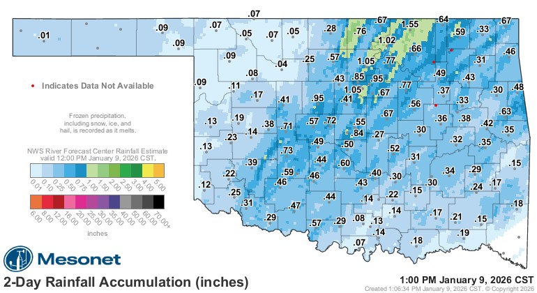
Before I get into the forecast, we did experience a few tornadoes around the 7 am time period on Wednesday. EF0-EF1’s were recorded. The NWS says an outbuilding was damaged around Lexington and a roof torn off on a dwelling, but it was vague and cryptic, so I don’t know what caused what they later claimed was EF2 damage. Regardless, it just goes to show you that tornadoes can happen any time of year in Oklahoma. Outside of the severe weather, we did receive some beneficial rain across the region.
 Restoration and Disaster Cleanup Service
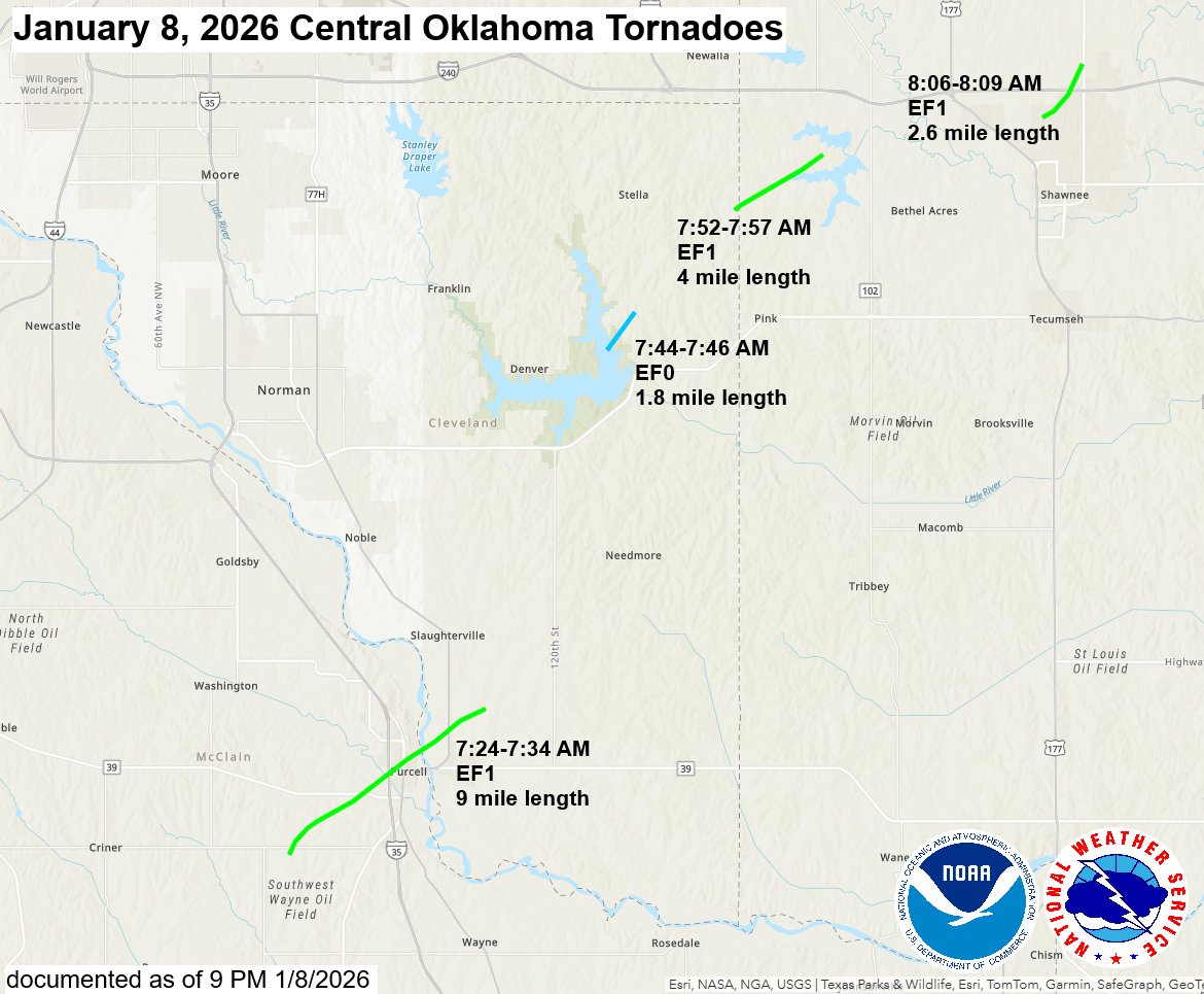
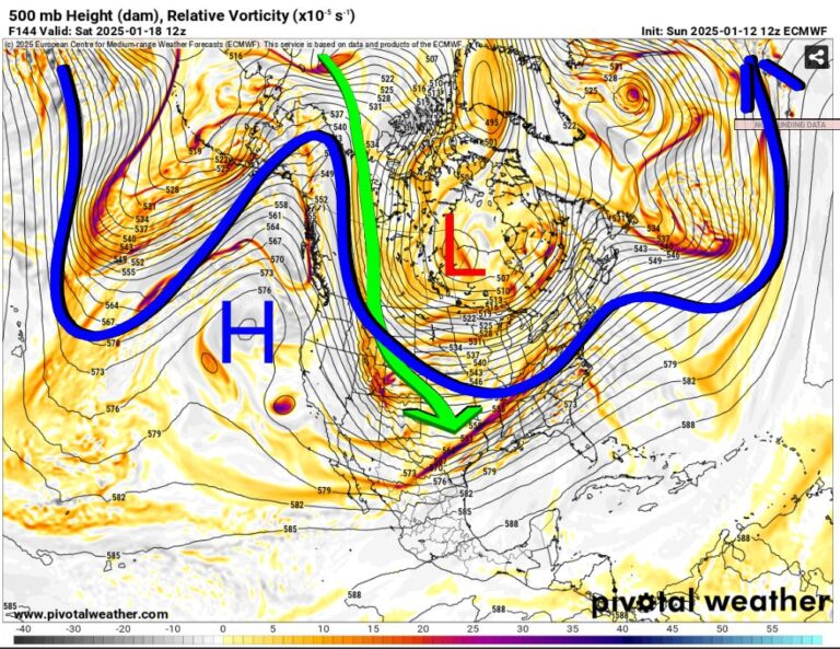
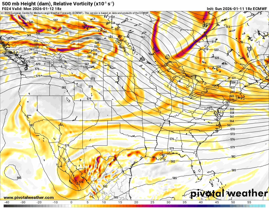
The Jetstream shows how we’ll transition into a strong North to South flow in the animation below. This is a dry and colder pattern for Oklahoma.
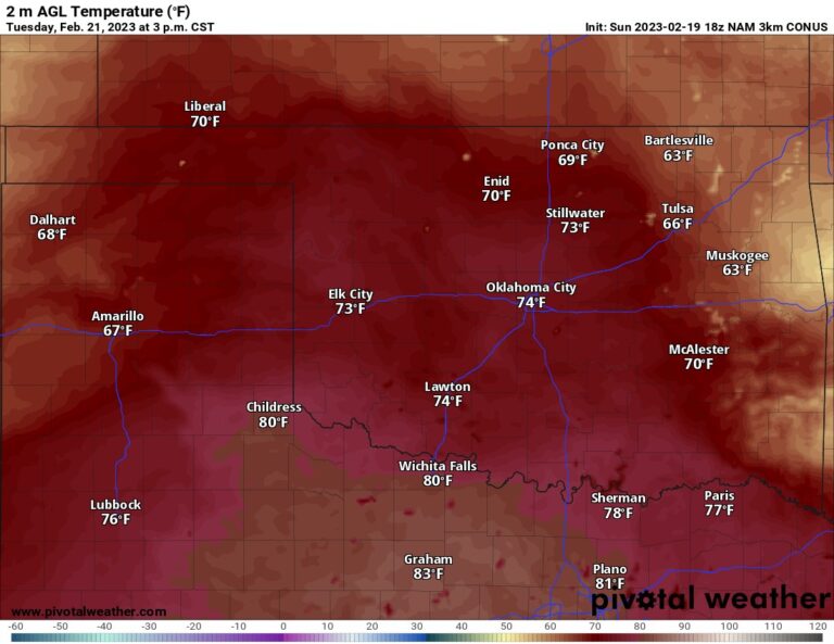
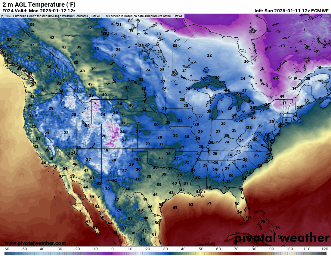
The temperature animation shows how the cold stuff affects mostly the NE 1/3 of the country, with Oklahoma getting a glancing blow here and there.
Restoration and Disaster Cleanup ServiceHere is your OKC Temperature trend. Enjoy! -AT