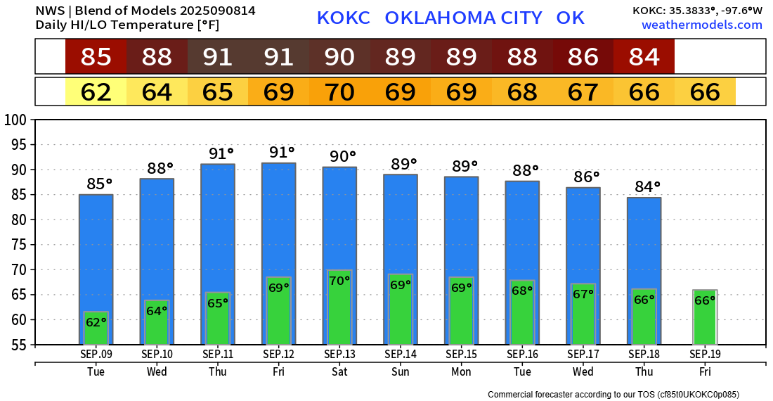
Drying Out and Warming Up

Our false Fall is replaced with a last-ditch Summer this week as the rain is sparse and the heat builds.
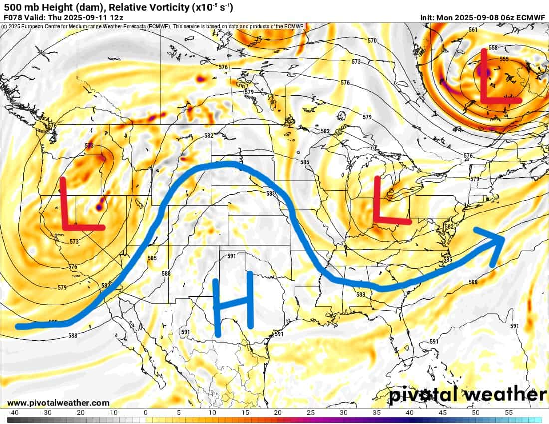
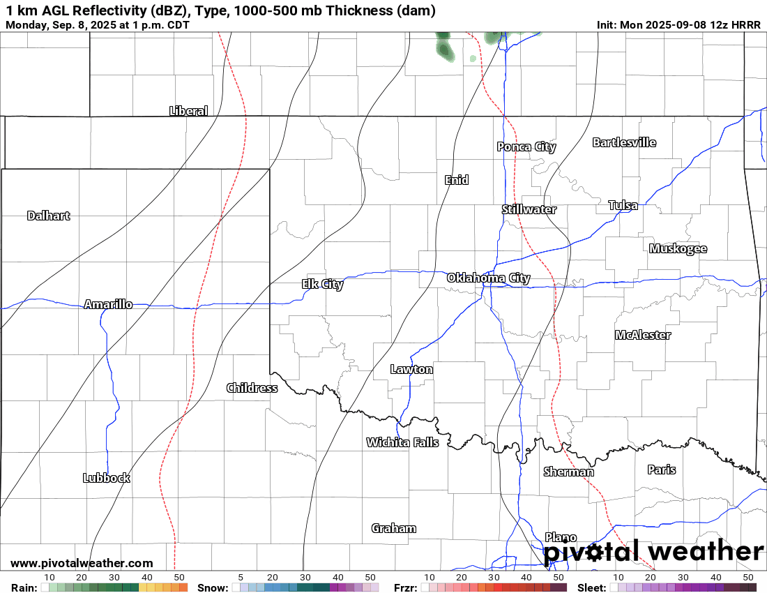
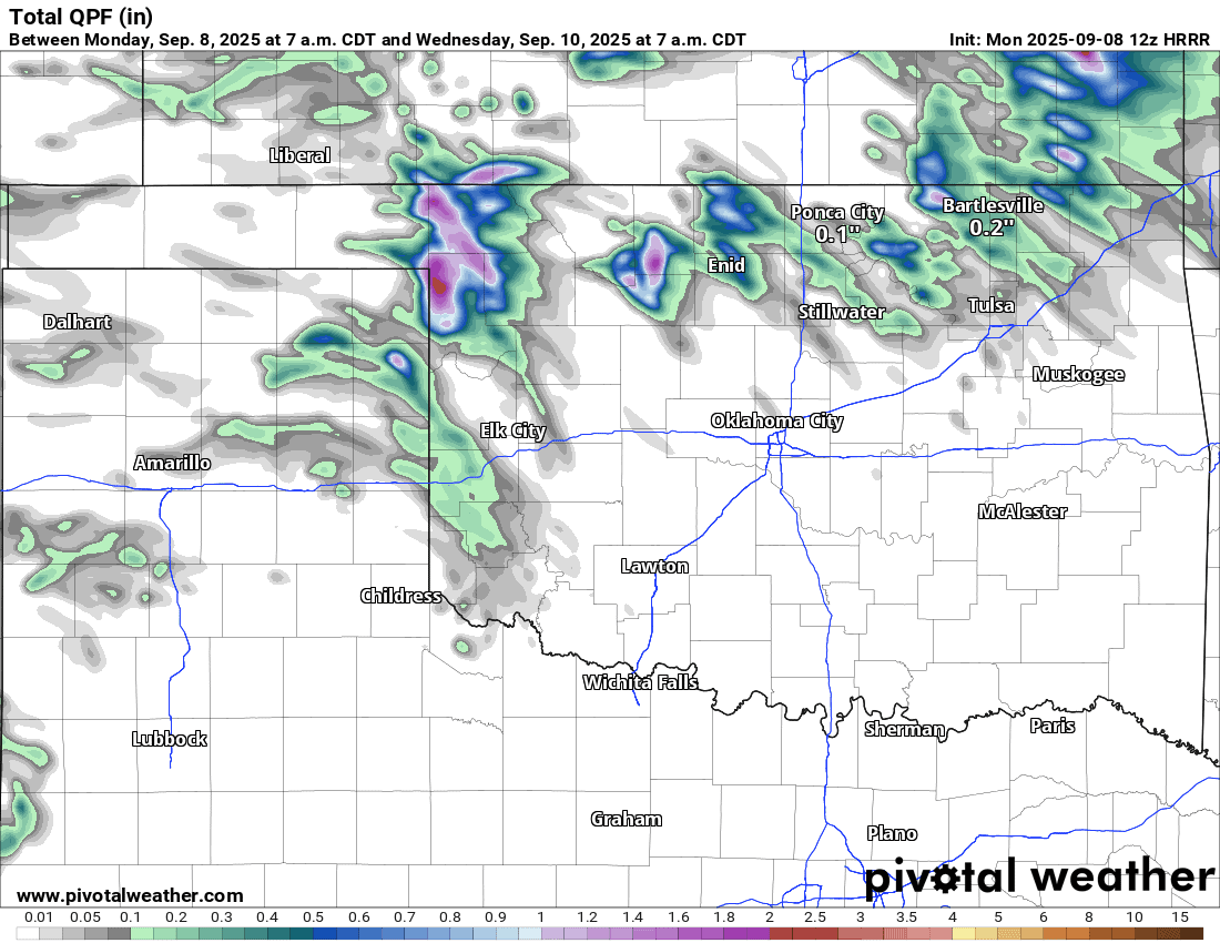
The Jetstream is going to transition to an upper ridge across Texas and Oklahoma. This will cause temperatures to rise and the rain to end. During this transition, there will be a few showers across far N/NW OK, but few and far between. By this Sunday, that large upper low out west will move through the central part of the country and could bring a few showers Sunday afternoon across W/C OK.

Ferguson Roof Systems is offering an AT's Weather special!
As we move through this transition, you can watch how the precipitable water anomaly animation brings in drier air from the east into Oklahoma. This is why any rain will be confined to the N/NW, as that’s where the moisture moves to.
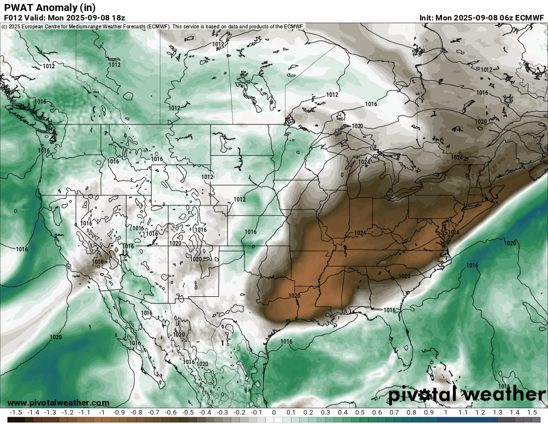
The short-term model tries to bring it south into C OK for Tuesday, but looks like it will fall apart in the drier air. Rainfall totals can still be impressive for just a few folks.

Be sure to mention Aaron Tuttle when you call (405) 820-1193!
Temperatures will heat up across the nation’s midsection with cooler weather under each upper trough.
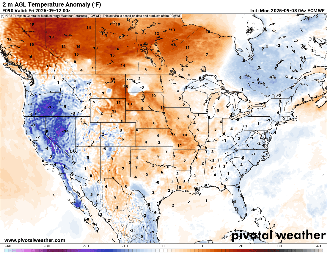
The trend in OKC will be a warm one, so if you were sad to see summer go, here’s your chance to enjoy it once more! -AT
Be sure to mention Aaron Tuttle when you call (405) 820-1193!