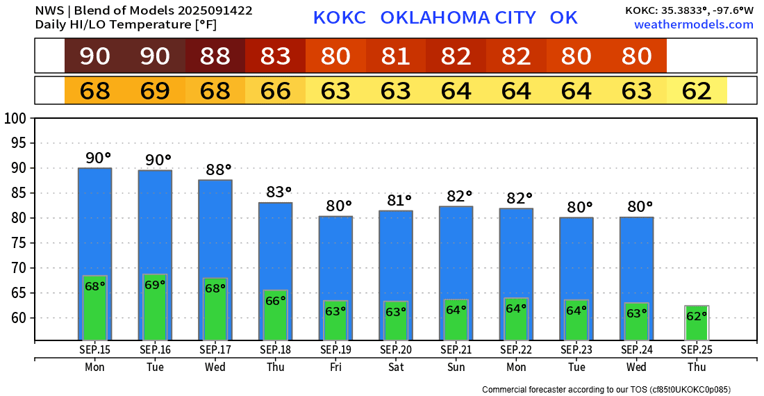
Pattern Change and Rain is Back

I hope you enjoyed that last taste of Summer this past week, as we’ll cool down a bit and bring back the rain for the week ahead.
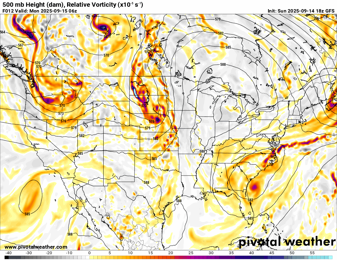
The Jetstream animation shows a lot of spinning across the nation’s midsection. These colors you see (red/yellow) indicate lift in the atmosphere with upper perturbations. As you can tell, Oklahoma is in the path of this disturbed atmosphere, so that means more rain for us most days this week.

Ferguson Roof Systems is offering an AT's Weather special!
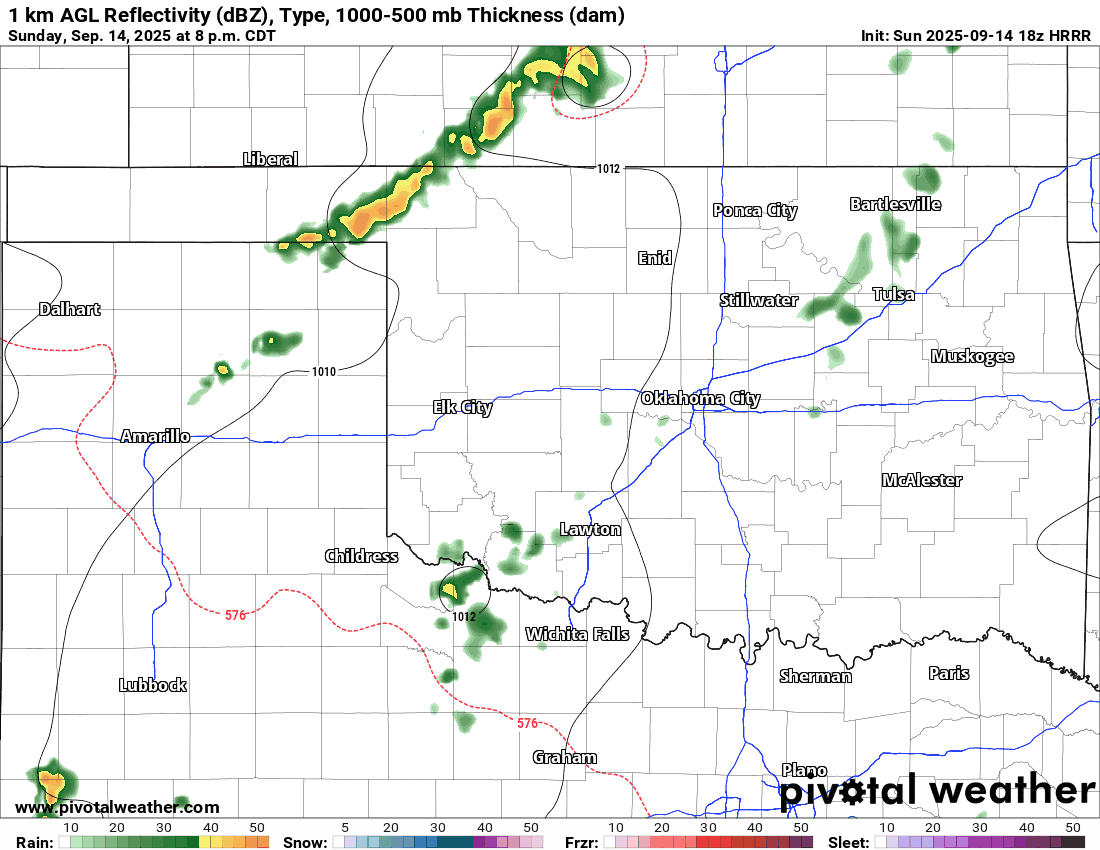
In the short term, storms will move through NW OK Sunday night and then additional activity across C OK Monday afternoon. Only isolated activity across the western half of the state on Tuesday, then a good line of storms should move through Wednesday and Thursday. There might be a brief break on Friday, before Saturday and Sunday morning bring the next rounds.

Rainfall amounts will be decent in an accumulative fashion.
 Restoration and Disaster Cleanup Service
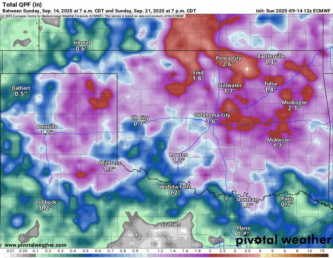
Temperatures will decrease once we enter the pattern change. There are signs that an upper ridge may build briefly overhead again after 10 days. If that occurs, we may taste the 90s again.