Fall Severe Weather Season has Arrived

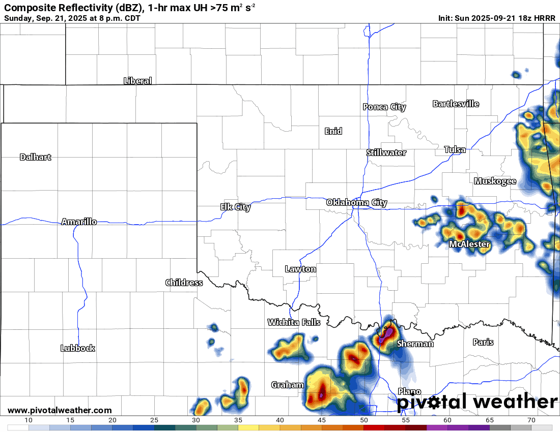
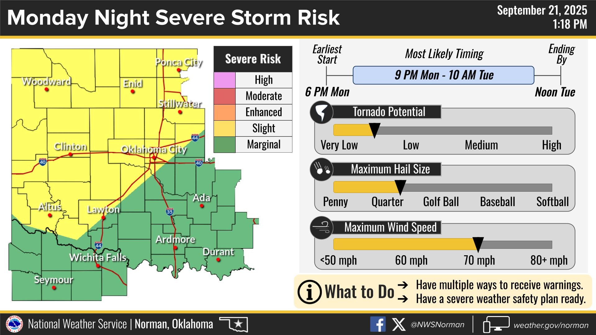
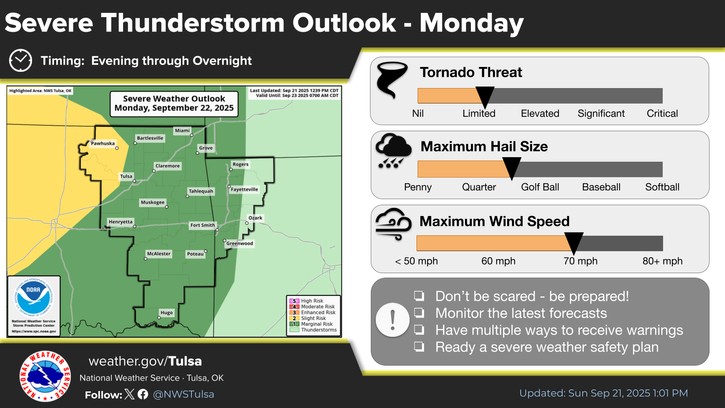
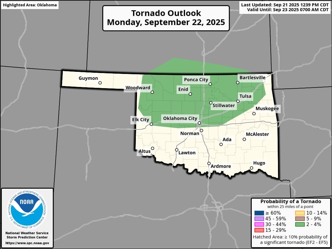
Over the last few days, there has been an uptick in severe thunderstorms across the state. The trend will continue Monday and Tuesday of this week. This mini-season will last through about the first week of November. We do get tornadoes this time of year, so I’ll be on the lookout.
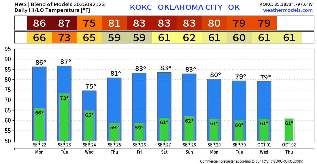
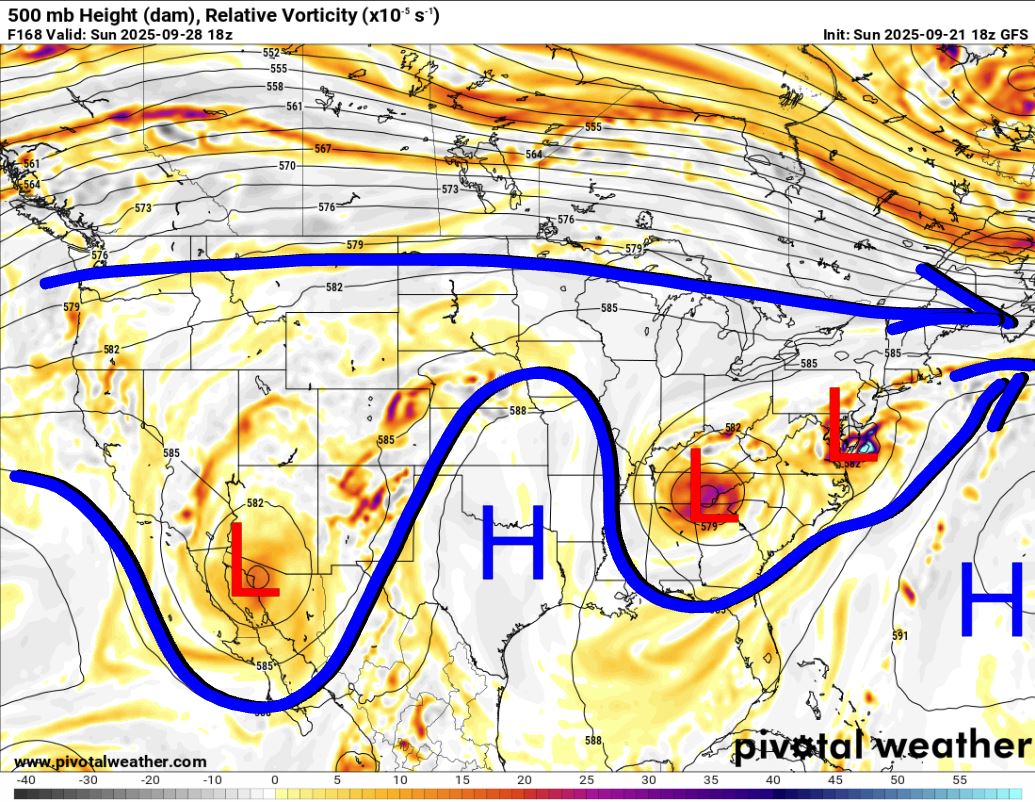
The Jetstream shows an upper low coming down from the Rockies into the central plains through Wednesday. After that passes by, dry weather will return as an upper ridge builds in. You’ll notice more pleasant temperatures as humidities drop later this week.

Be sure to mention Aaron Tuttle when you call (405) 820-1193!
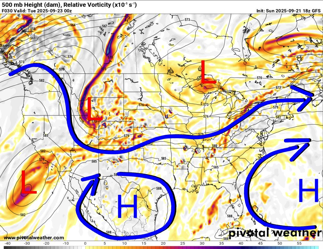
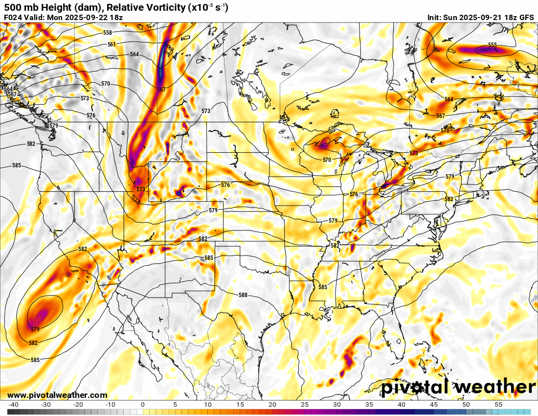
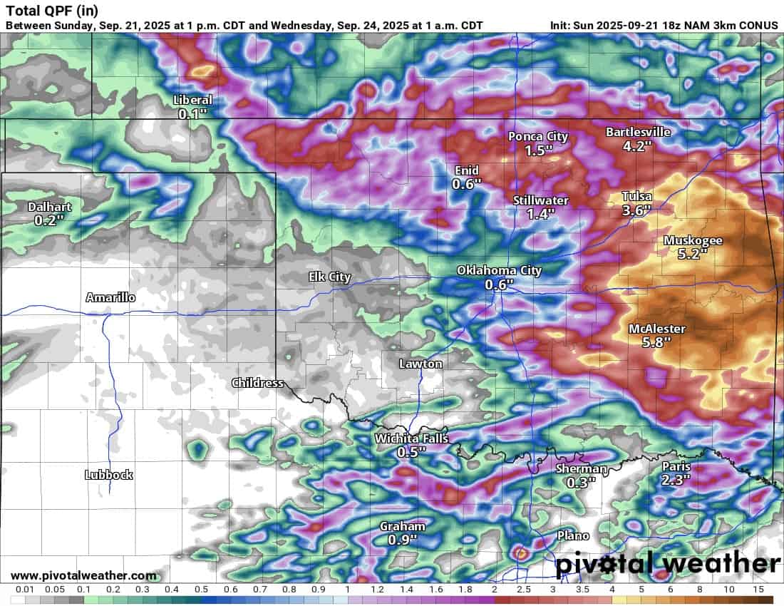
The short-term model shows a few areas of storms Sunday night through Tuesday afternoon. The majority of the severe weather will be confined to mostly north of the I-40 corridor Monday/Monday night and then in eastern Oklahoma Tuesday afternoon. Long-term shows additional showers on Wednesday with cooler temperatures as a front clears things out.

Rainfall amounts will be substantial across many areas, especially the east, through this period, so watch out for flash flooding.
Be sure to mention Aaron Tuttle when you call (405) 820-1193!
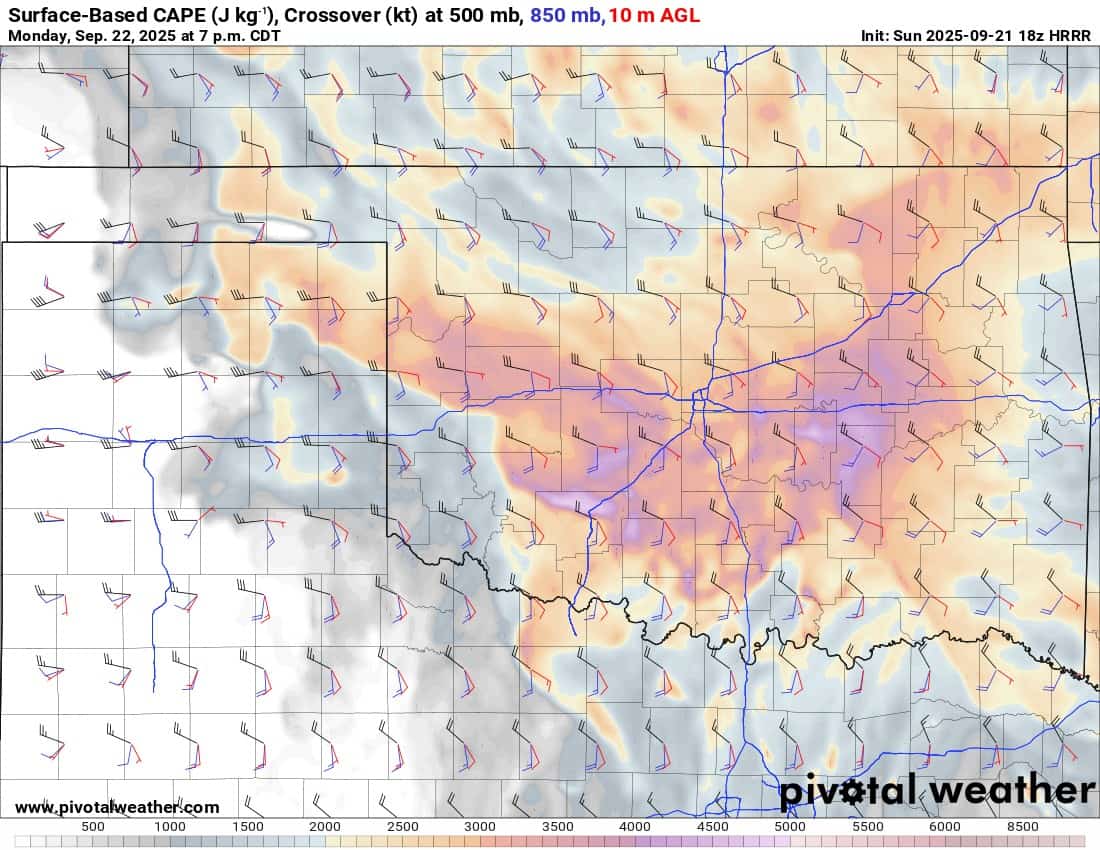
Regarding severe weather, most storms should be elevated in nature due to a weak capping inversion, but if a couple manage to get rooted down into the boundary layer, there is enough shear to produce a tornado or two Monday afternoon/evening and possibly again Tuesday afternoon/evening.
The temperature outlook looks typical for late September. Enjoy the transition! -AT