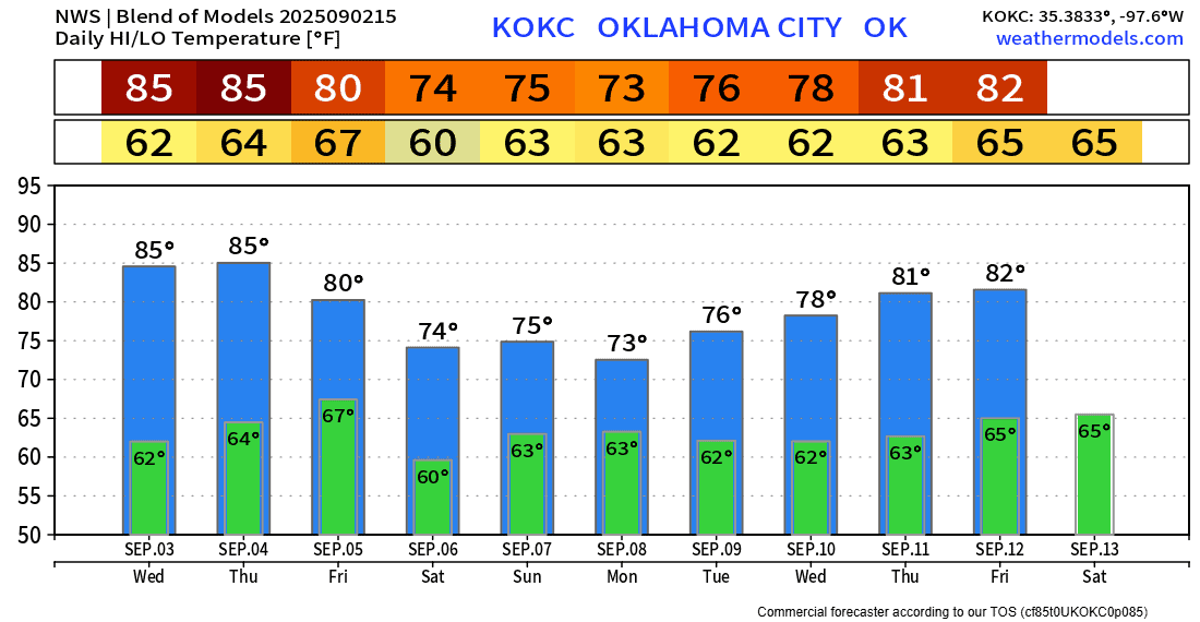
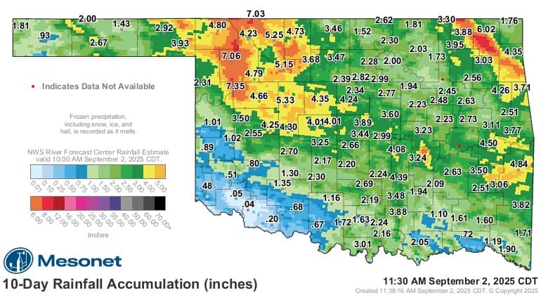
September Continues the Rainy Pattern

There’s something to be said for a planned long and hot dry period. It’s good for business for many and gives you some predictability with outdoor projects. This has not been one of those years! Now that we’re transitioning from Summer to Fall, the unsettled pattern continues.
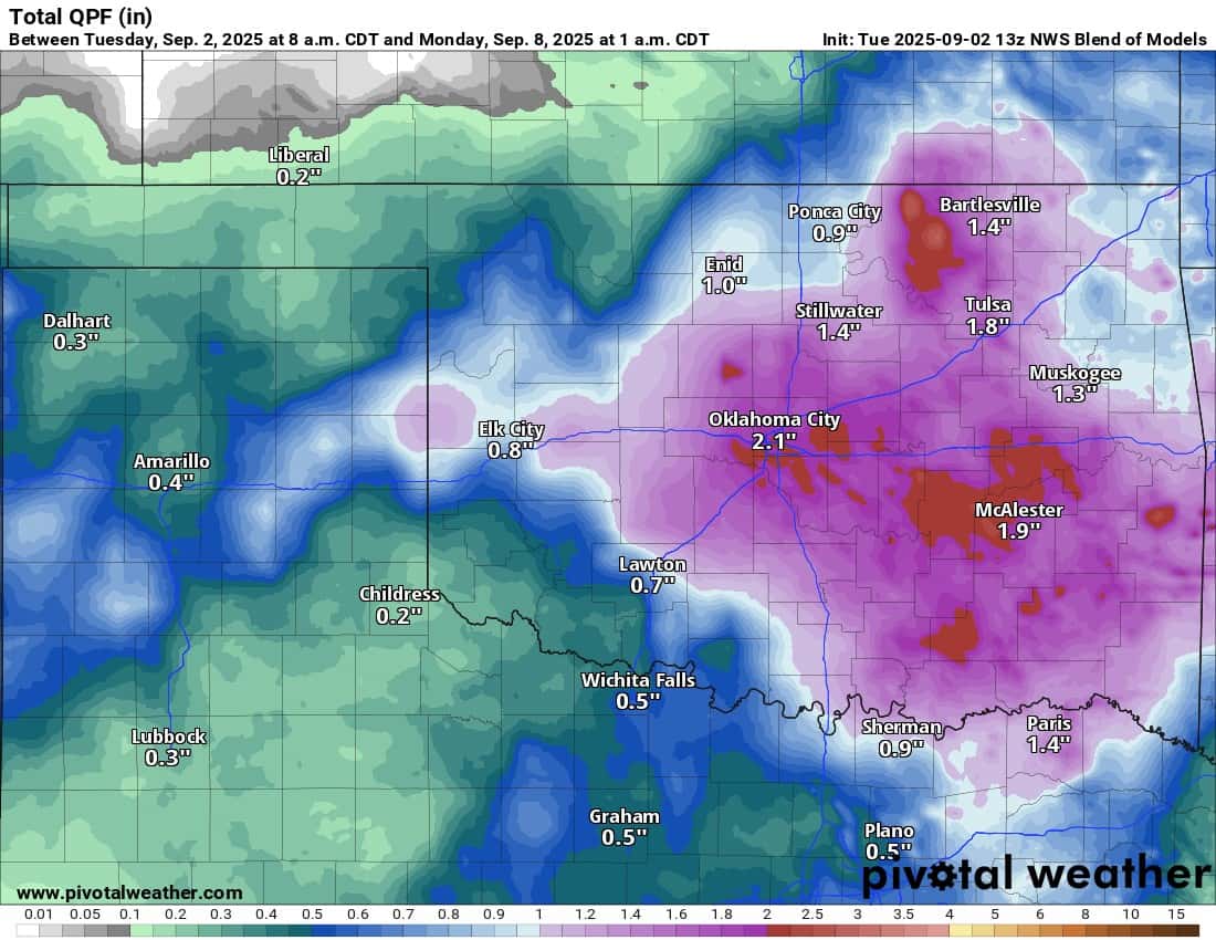
Over the last week of August and the Labor Day weekend, we racked up some ridiculous rainfall totals.

Be sure to mention Aaron Tuttle when you call (405) 820-1193!
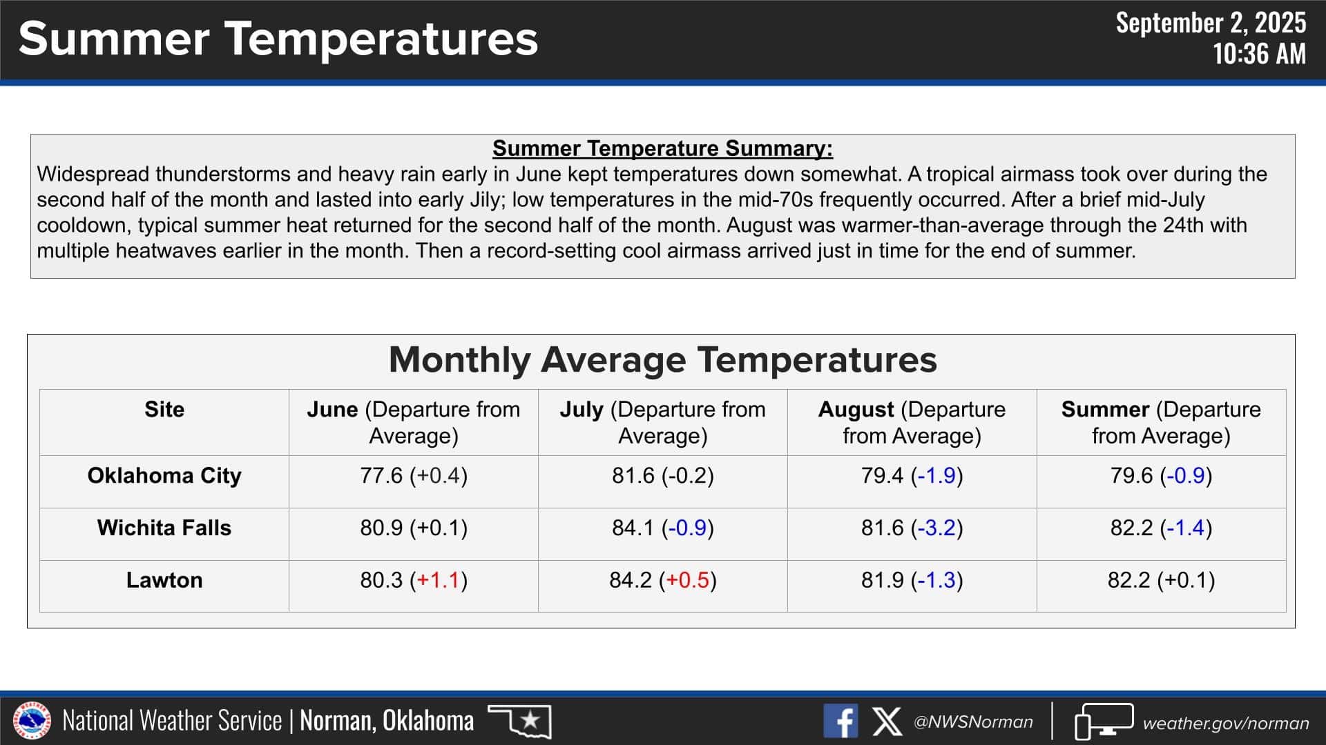
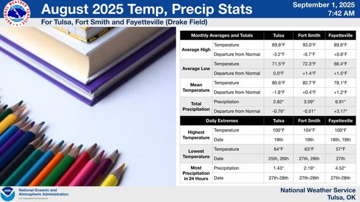
The Summer itself was a little below normal temperature-wise and above normal precipitation-wise for OKC and Tulsa.
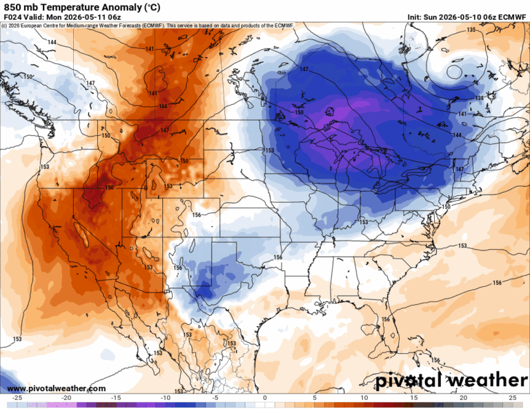
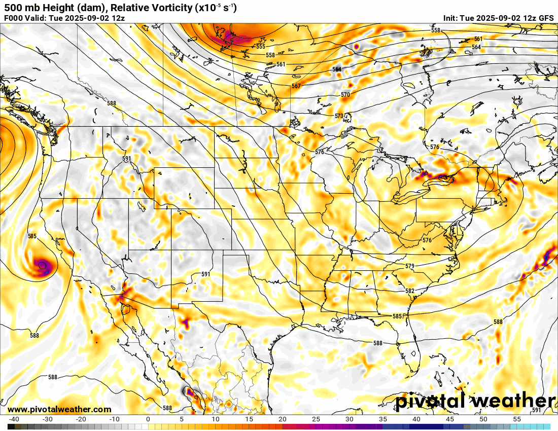
The Jetstream animation is going to showcase a couple of things (brighter colors = upper lift). One, the remnants of current tropical storm Lorena, will move across the Mexican mountains and into Oklahoma and Texas this weekend. The second thing of importance is the large trough in the NE, which keeps that N to NW flow continuing across the midsection of the country. This brings in that cooler Canadian air.
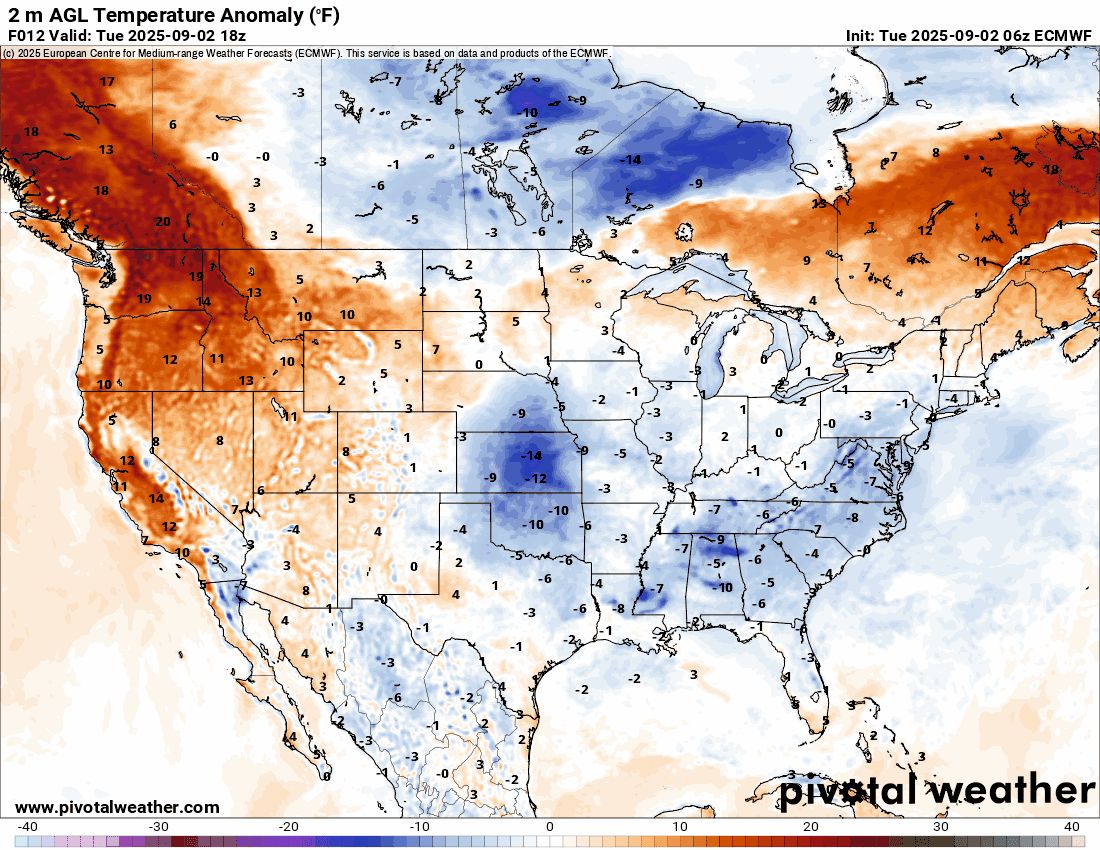
The temperature animation of departure from normal shows a lot of blue across our area and to the northeastern US.
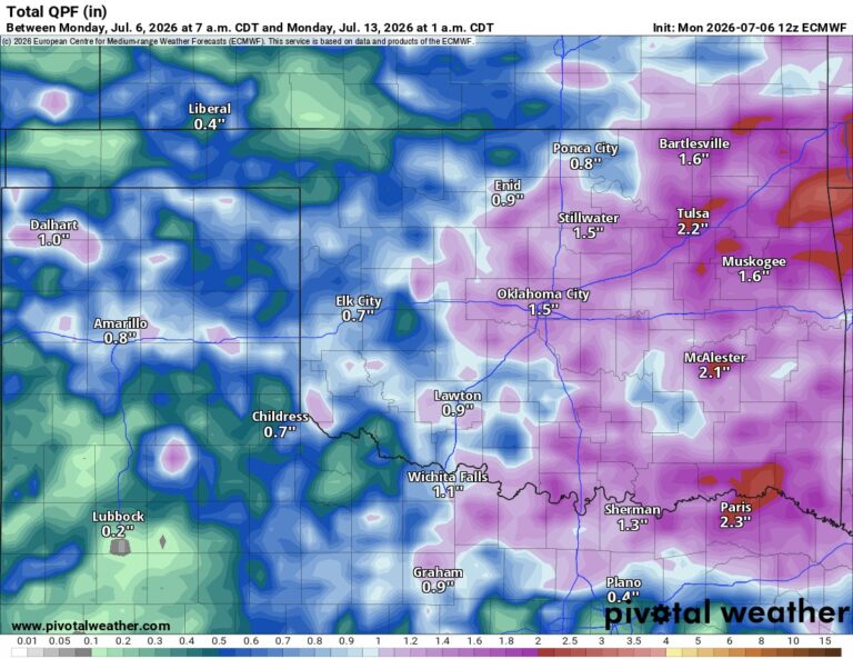
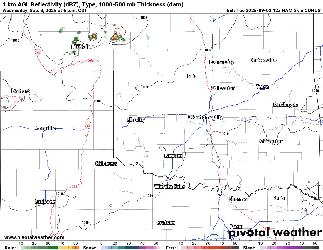
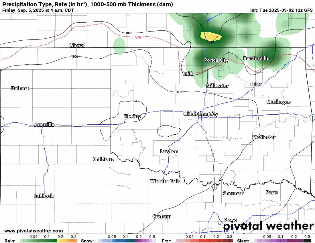
As far as rain goes, we have a weak system that will generate a few showers and storms on Wednesday evening across Kansas. That activity will travel southward. The next opportunity for rain should return Friday morning and continue through the weekend. The coverage should be more sparse on Friday and Saturday and then widespread on Sunday. So if you have any outdoor activity, don’t put it off for the latter part of the weekend. Rainfall totals could be significant as well.
Be sure to mention Aaron Tuttle when you call (405) 820-1193!
The temperature trend is going to the cooler side again, so enjoy the brief warmth today and tomorrow! -AT