Ridiculous Ending to Summer

I told Jodi to look around our yard and notice how everything is still green and alive! It’s very rare that I can get through an entire summer without watering the grass and still have it green all the way to the curb. What an amazing summer it’s been! This week, we’re going to end our meteorological (Labor Day) summer with ridiculous rainfall and cool temperatures.
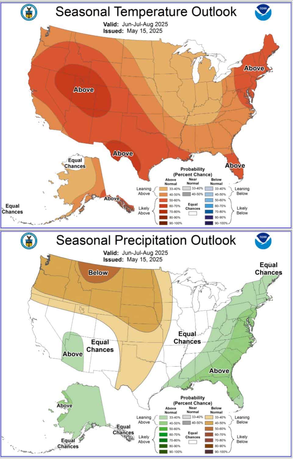
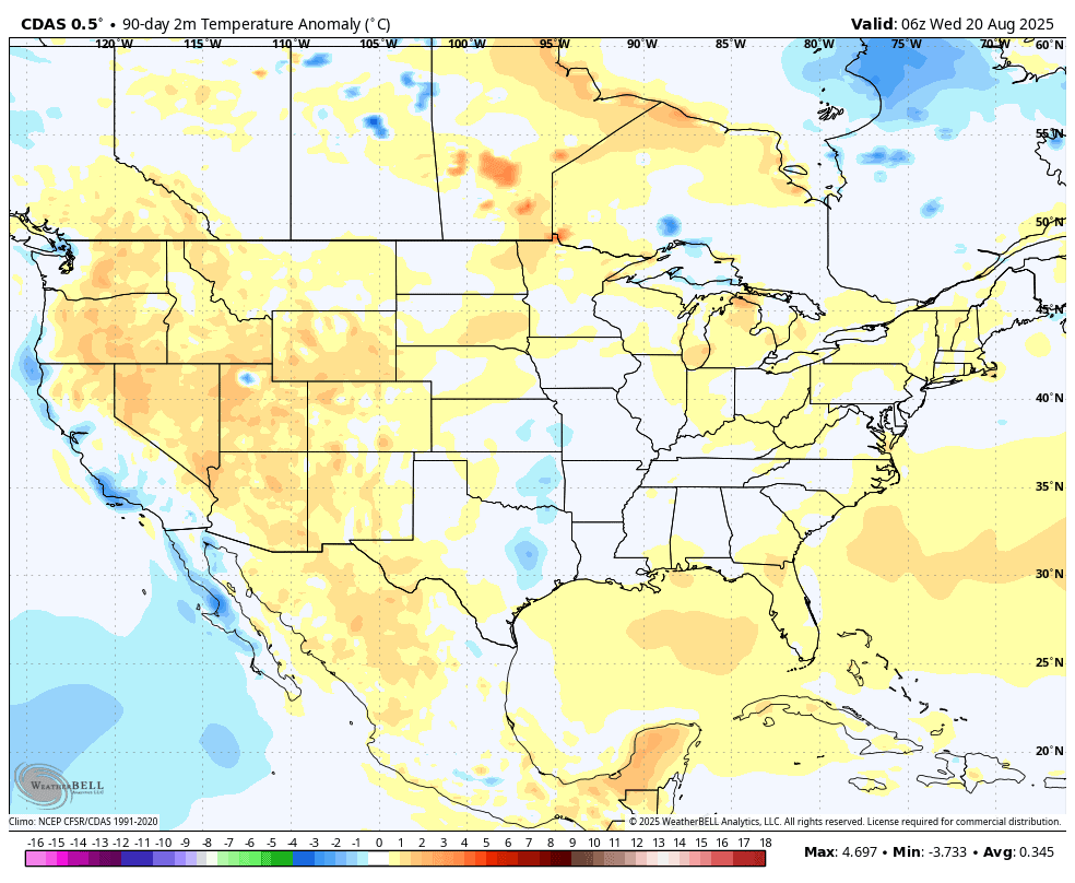
Before I get into the forecast, you’ve heard me mention not to pay too much attention to long-range outlooks. They hold very little skill but are used by clickbait artists to sucker you into discussions and sharing to build their social presence. Case in point, I compared the summer outlook for precipitation and temperatures with what actually happened. You tell me how worthwhile these forecasts are. Keep this in mind anytime you see these maps shared. Maybe AI will eventually provide some value, but not in 2025.

Ferguson Roof Systems is offering an AT's Weather special!
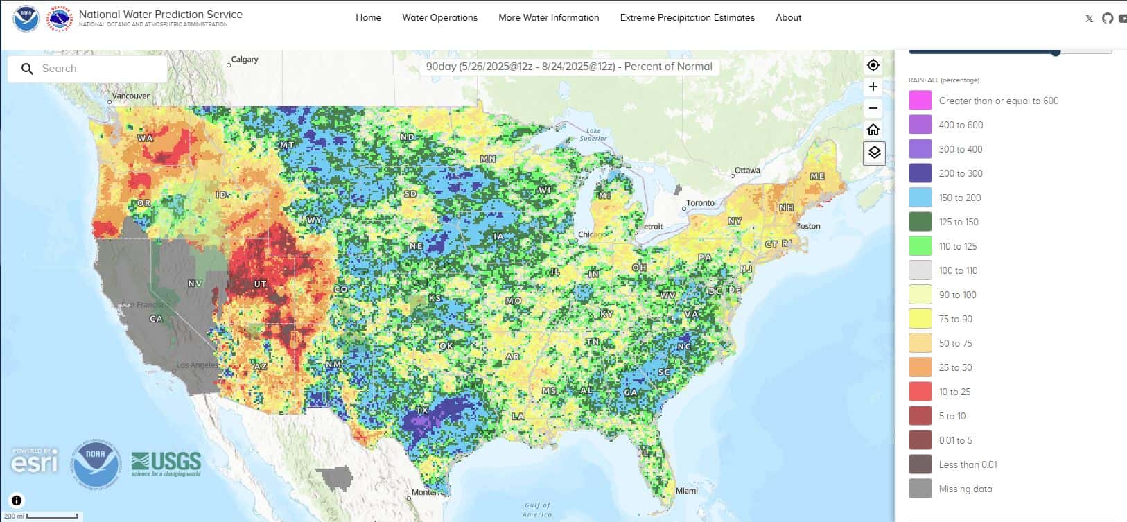
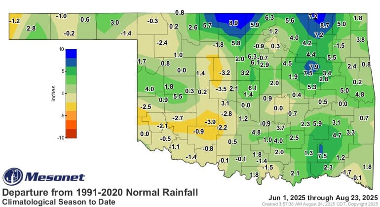
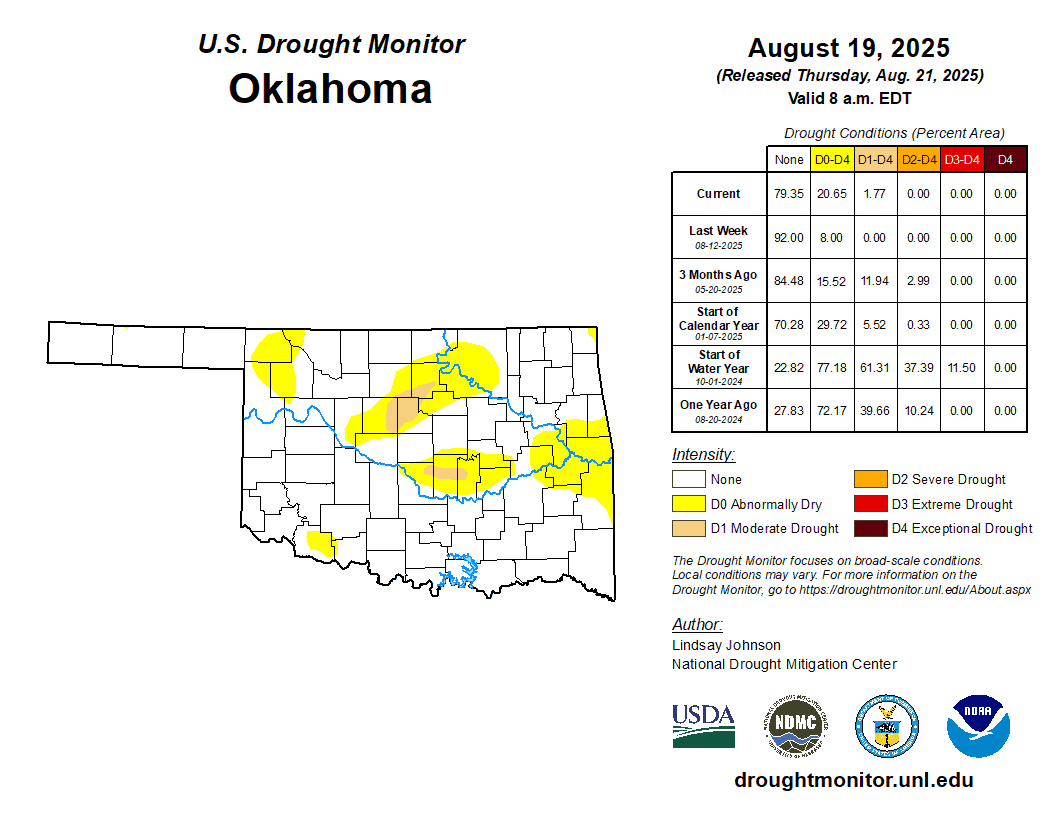
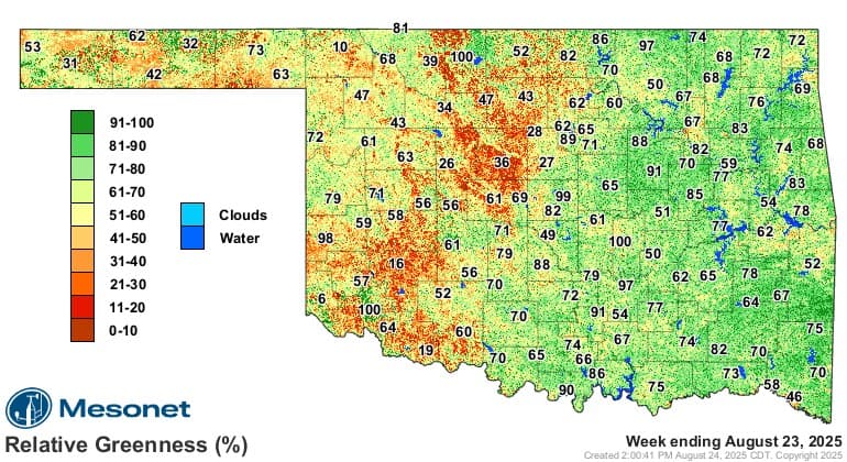
With the rainy summer, it has kept our drought from soaring back. We typically have a significant one by late August. So this has been another area of welcomed relief. The greenness map indicates how much of the state still has a lot of green vegetation.
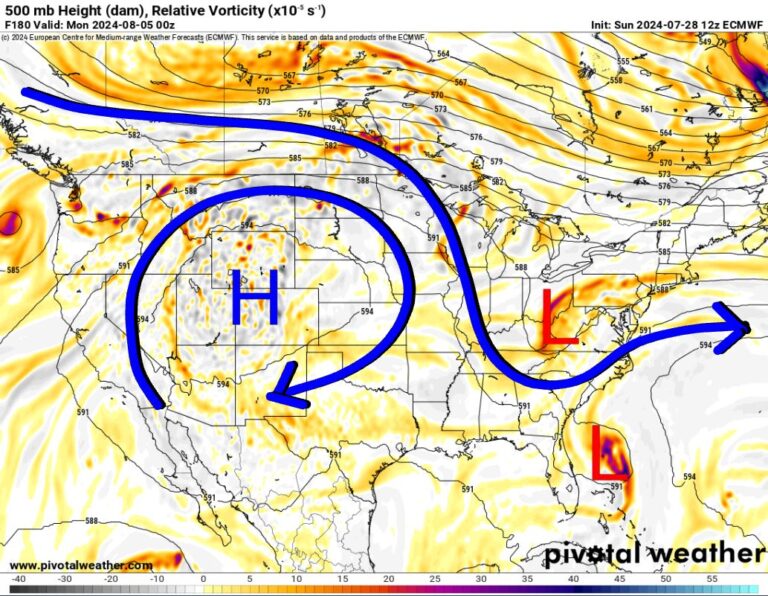
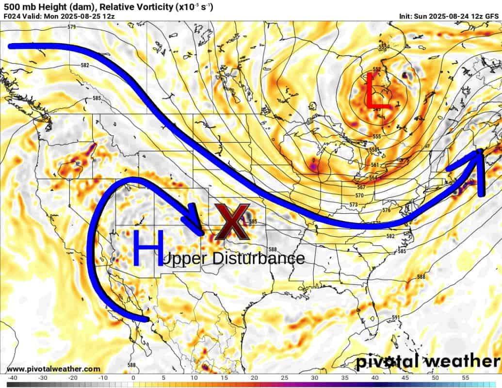
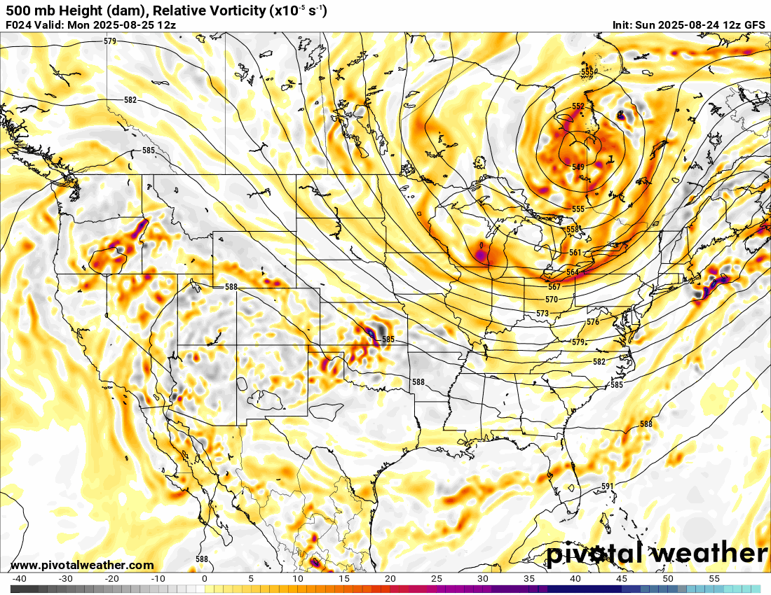
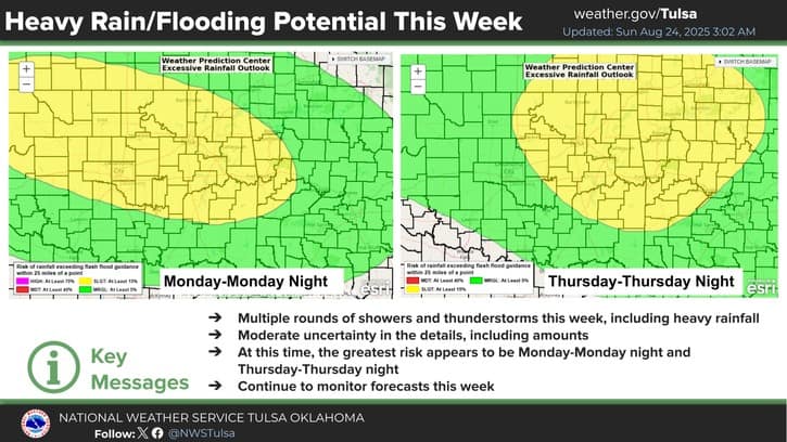
So let’s switch gears to how August is going to end. The Jetstream shows that we will be in a NW flow aloft all week long. This allows upper-level disturbances (perturbations in the flow) to trigger rounds of showers and storms. You can time the lift by tracking the areas of red blobs that move across the state in the animation. The first strong one arrives Sunday night/Monday morning.
Ferguson Roof Systems is offering an AT's Weather special!
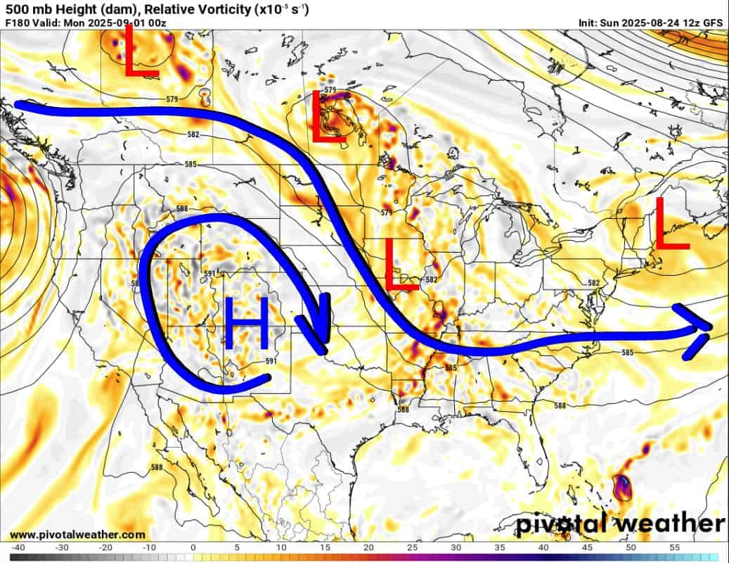
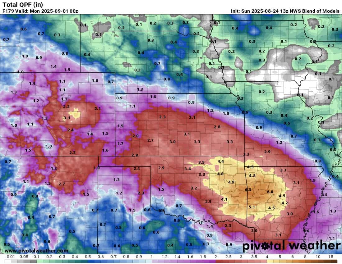
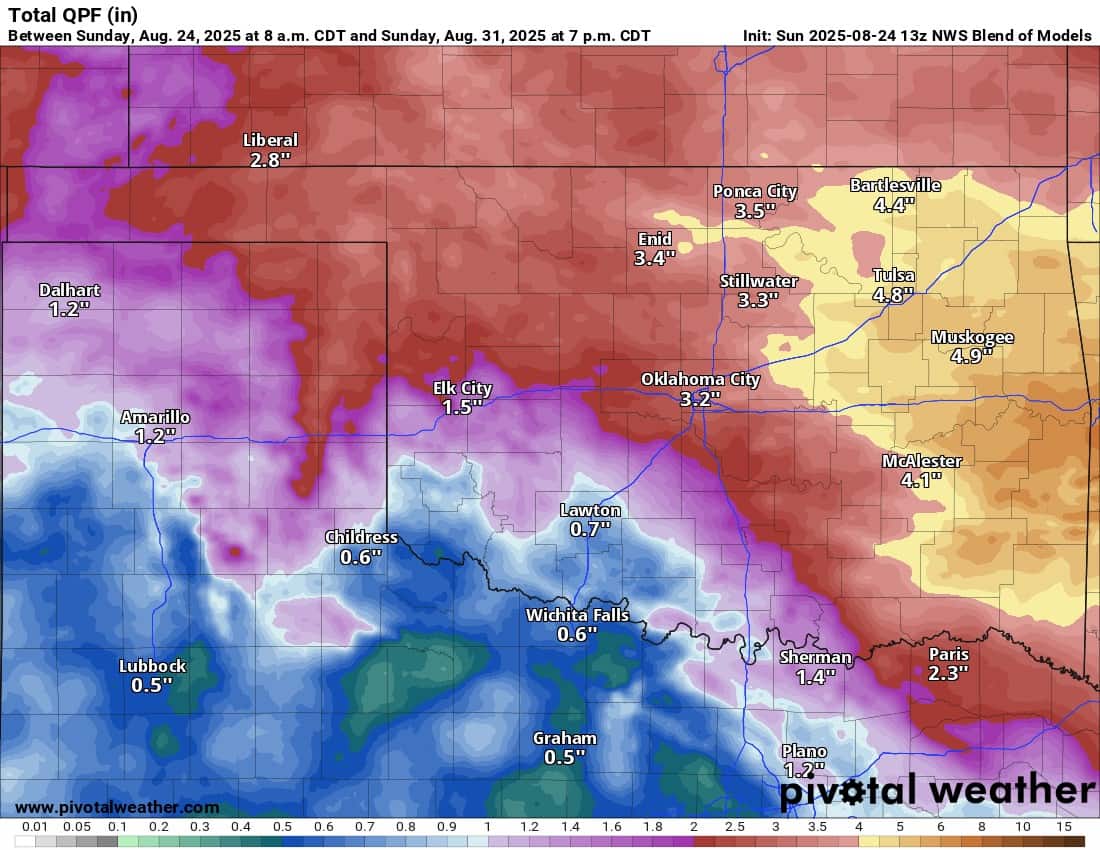
This pattern is going to provide rain just about every day somewhere across the state. You won’t see rain every day in your backyard, but when you do, it will be significant. The animation gives you an idea. Rainfall totals will be excessive, which may lead to flash flooding in some areas. As usual, the model blend does a fairly decent job at highlighting the areas with conservative amounts, but there will always be isolated spots that get much more.

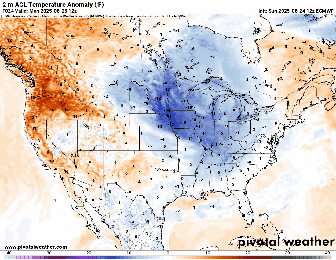
The rain indicates a lot of cloud cover as well, which will help to keep temperatures down. As a matter of fact, this pattern is going to usher in cooler weather in large areas of the country with temperatures significantly below normal. Watch the temperature anomaly animation below.
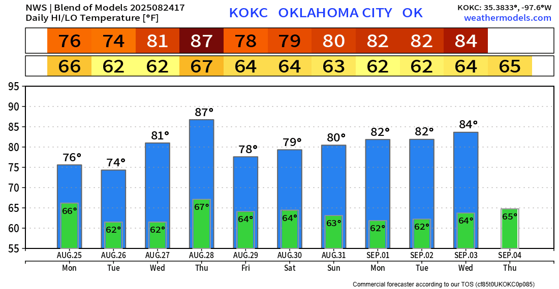
Here’s an example of what that should look like in the OKC metro area. My free weather app, ATsWeatherToGo, will provide you with your backyard temperatures anytime you want to check. Enjoy the change and make backup plans for your Labor Day holiday weekend. It won’t be a washout, but there will be showers and storms around! -AT