More Rain This Week, Drought Update, and Mother’s Day
What an absolutely amazing weekend we just experienced! Wouldn’t it be nice if all weekends in May were like that? I hope you got a chance to enjoy it. The highlights for this week are more rainfall and a lack of severe weather, which is unheard of this time of year.
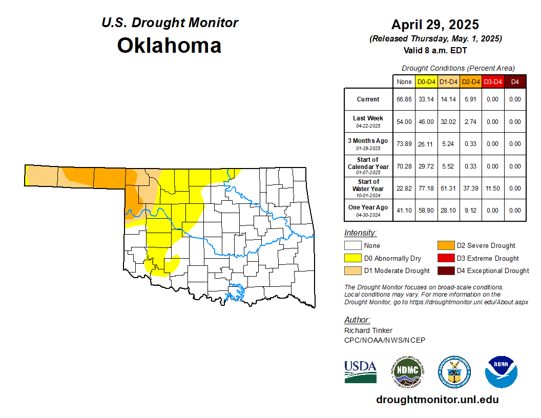
The recent drought outlook was last updated on April 29th, so it didn’t capture last week’s rainfall, but regardless, it’s pretty much absent. That’s great news for our spring season!

Ferguson Roof Systems is offering an AT's Weather special!
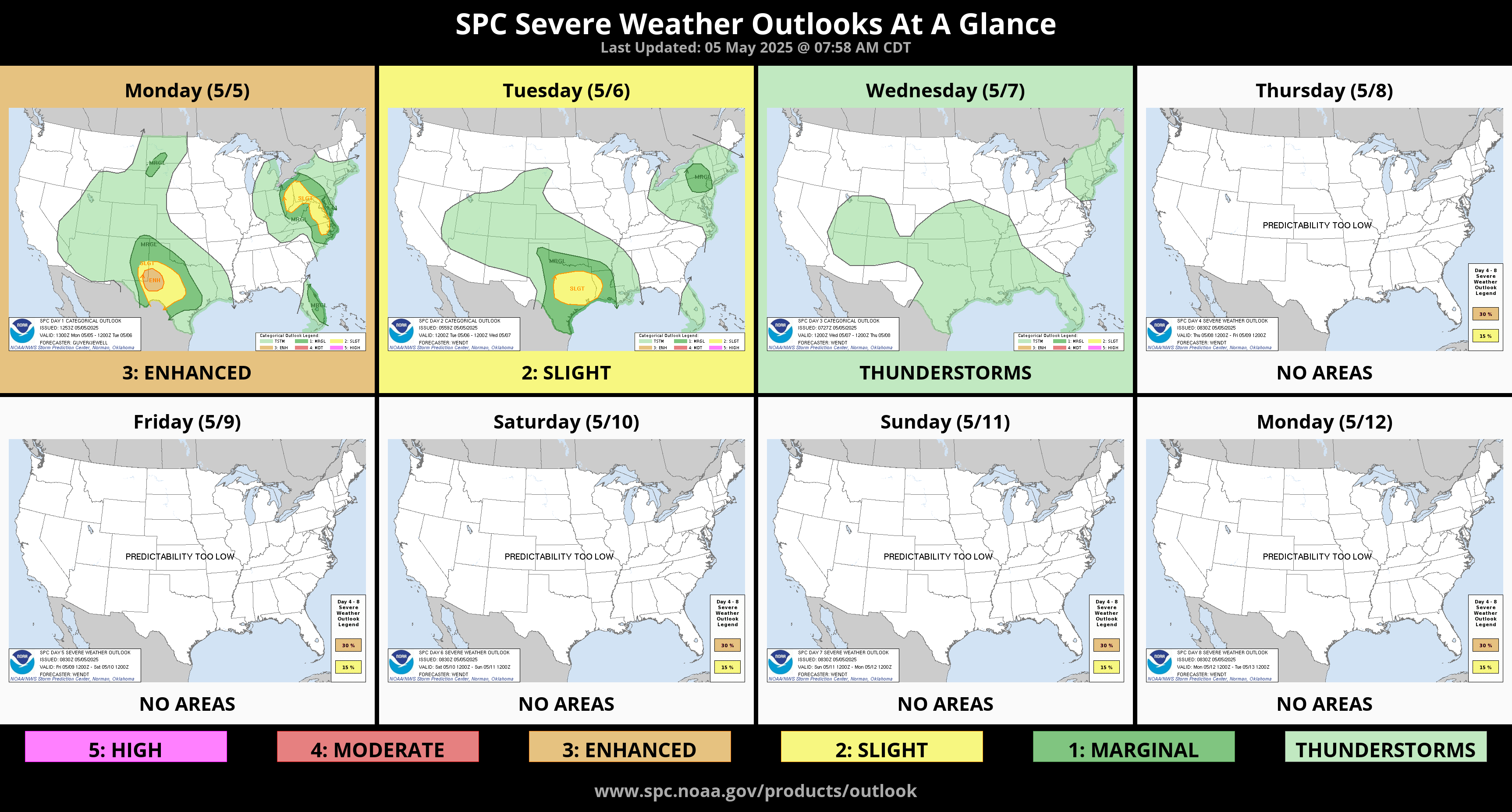
The long-range outlook from the Storm Prediction Center doesn’t have Oklahoma in any severe weather. This doesn’t include any brief flash flooding risk, by the way. You don’t typically see early Mays like this.
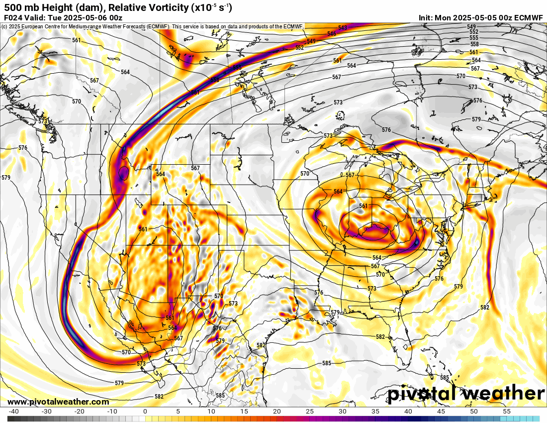
The Jetstream pattern shows the slow-moving upper low moving into our region. It will be the source for clouds and rainfall. Its biggest punch will be the first wave on Tuesday, and then it will weaken considerably afterwards. We also transition to a brief ridge by the end of the week, so next Mother’s Day weekend looks great too! Whoohoo!
Ferguson Roof Systems is offering an AT's Weather special!
Timing on the precipitation is already underway in SW OK. As it moves NE, it will fall apart into the dry air for our Monday, but start to saturate overnight. After the heavy round on Tuesday morning, improving conditions return for the afternoon, but additional scattered activity will be around through Wednesday. A few showers remain on Thursday, mostly across the north and eastern areas of the state. So there will be several dry hours during this event. Use my weather app, ATsWeatherToGo, to track radar while you are outdoors.

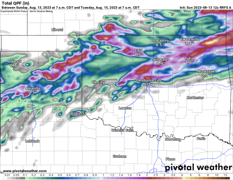
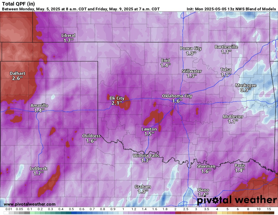
Regarding rainfall, the conservative model blend has a widespread 1-2″ zone. As always, where you can get some training of thunderstorms (cells moving along the same track), you can pick up a little more, which may lead to brief flash flooding. Most of this accumulation is on Tuesday.
 Restoration and Disaster Cleanup Service
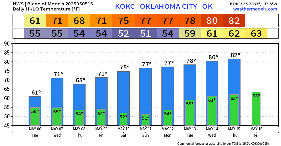
Temperatures look incredible this week. I hope you take advantage of it and squeeze in some outdoor gardening! Mother’s Day will be partly cloudy, with light easterly winds, and mid-70s statewide! -AT