Severe Storms and Flash Flooding
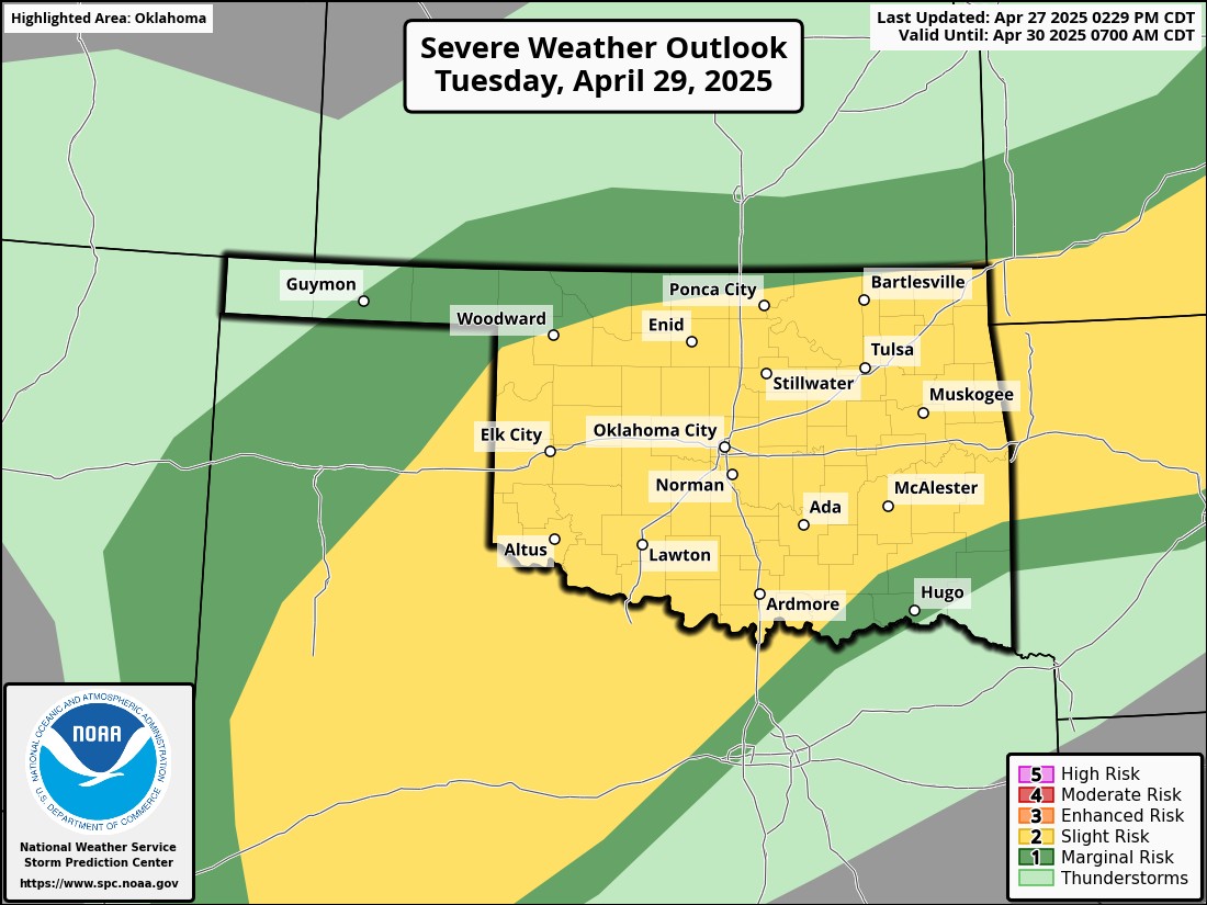
If last week wasn’t wet enough for you, we have another extended period of heavy rainfall. Another cold front will move into the state Tuesday and stall through Thursday morning. This will allow excessive rainfall to develop, causing flash flooding in many areas. Outside of that, we will see our typical severe weather this time of year.
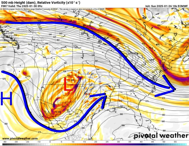
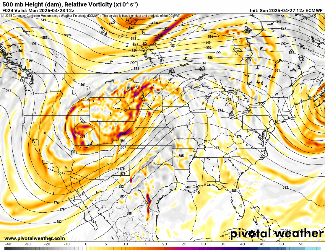
The Jetstream shows a slow-moving upper storm system approaching from the SW US. After it clears later this week, another will take its place Sunday/Monday.
I’m not going to get into a lot of detail regarding the severe aspect, only to say I’ll be updating with live broadcasts and live coverage should tornadoes develop. Here’s a quick look at the Severe Weather Outlook from the SPC and one of the AI models for tornadoes on Monday.
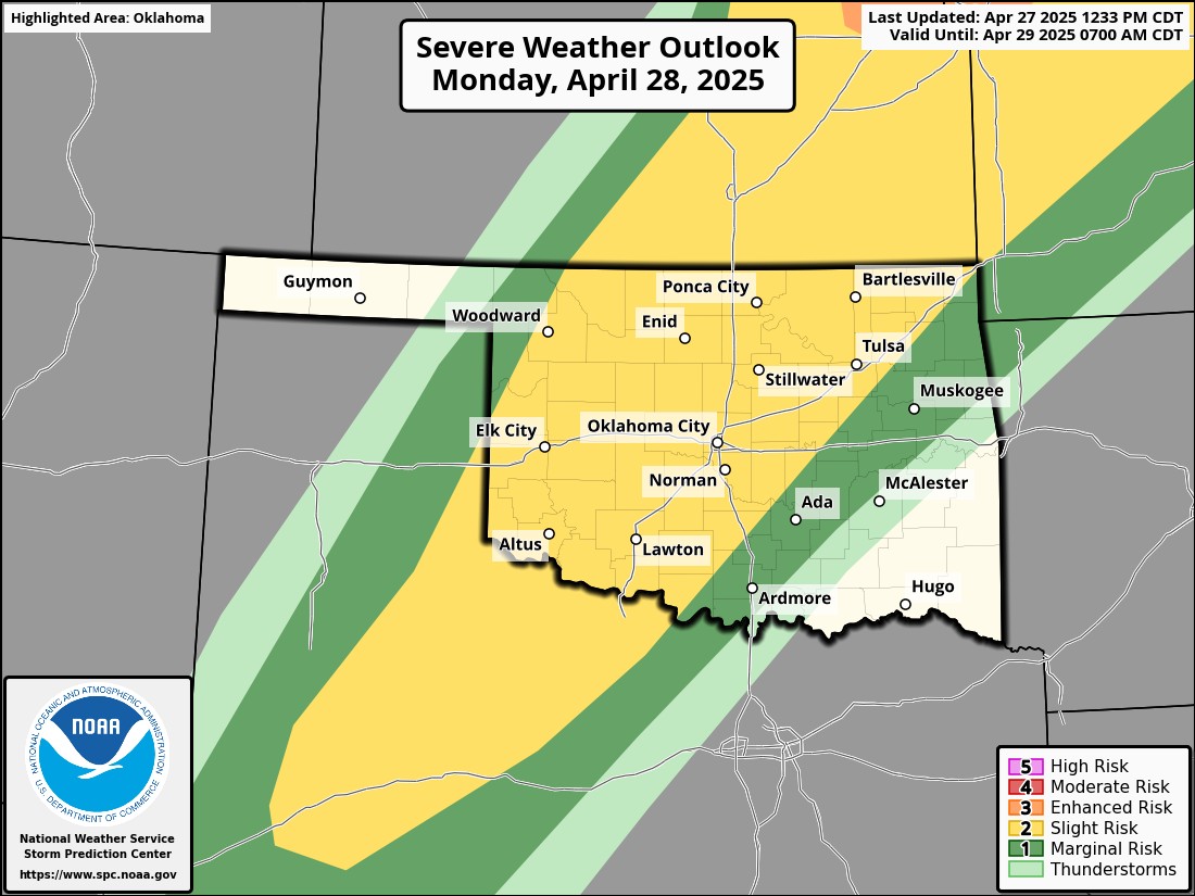
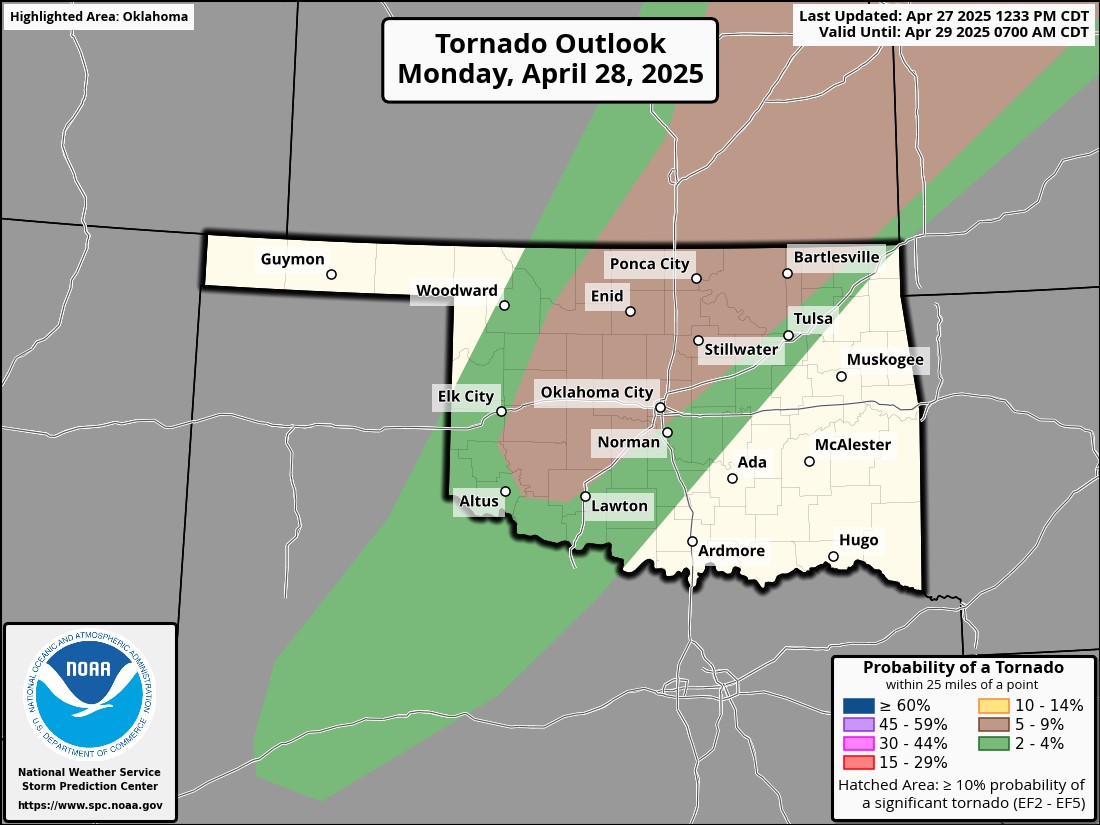
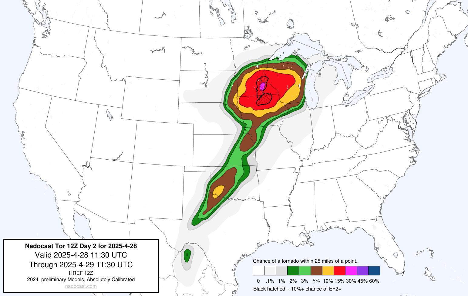
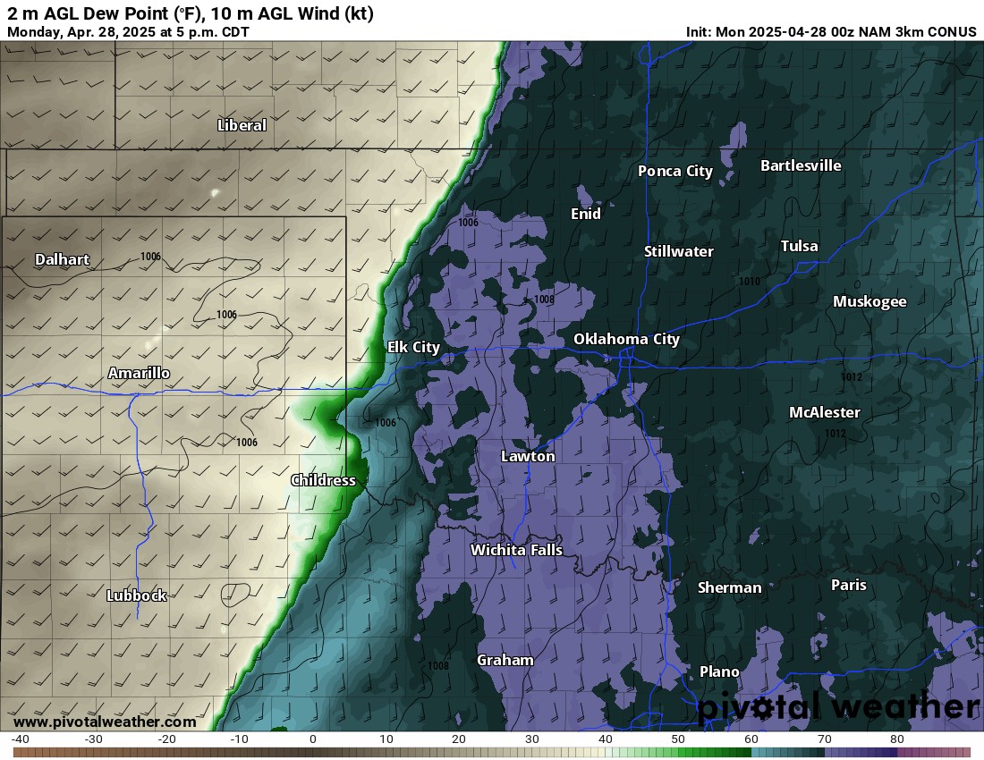
The cause of Monday’s event is a dryline setting up across W OK. There are some issues that may help to limit severe storms. The SW winds west of the dryline are weak, therefore, convergence is not strong. The CAP will break if we can get into the lower 80s. We may fall short by a degree or two. That would prevent surface-based supercells. One of the things models are struggling with, is will the CAP break, and can the storms get rooted in the boundary layer to survive and pose a tornado threat. As of this blog, it’s a 50/50 chance for a small area for a storm or two out west. I posted an animated .gif of all the models to show how many are dry between 5-7 pm. This means they think the CAP holds. However, IF a supercell can develop, it will likely be isolated and move eastward towards the greater OKC metro early evening. If it can get rooted and produce tornadoes before the CAP builds back in, it may pose a continued threat up through 9 pm. Regardless of any surface-based storm activity, we will see elevated storms develop mid to late evening and overnight. Those would pose a wind and hail threat.
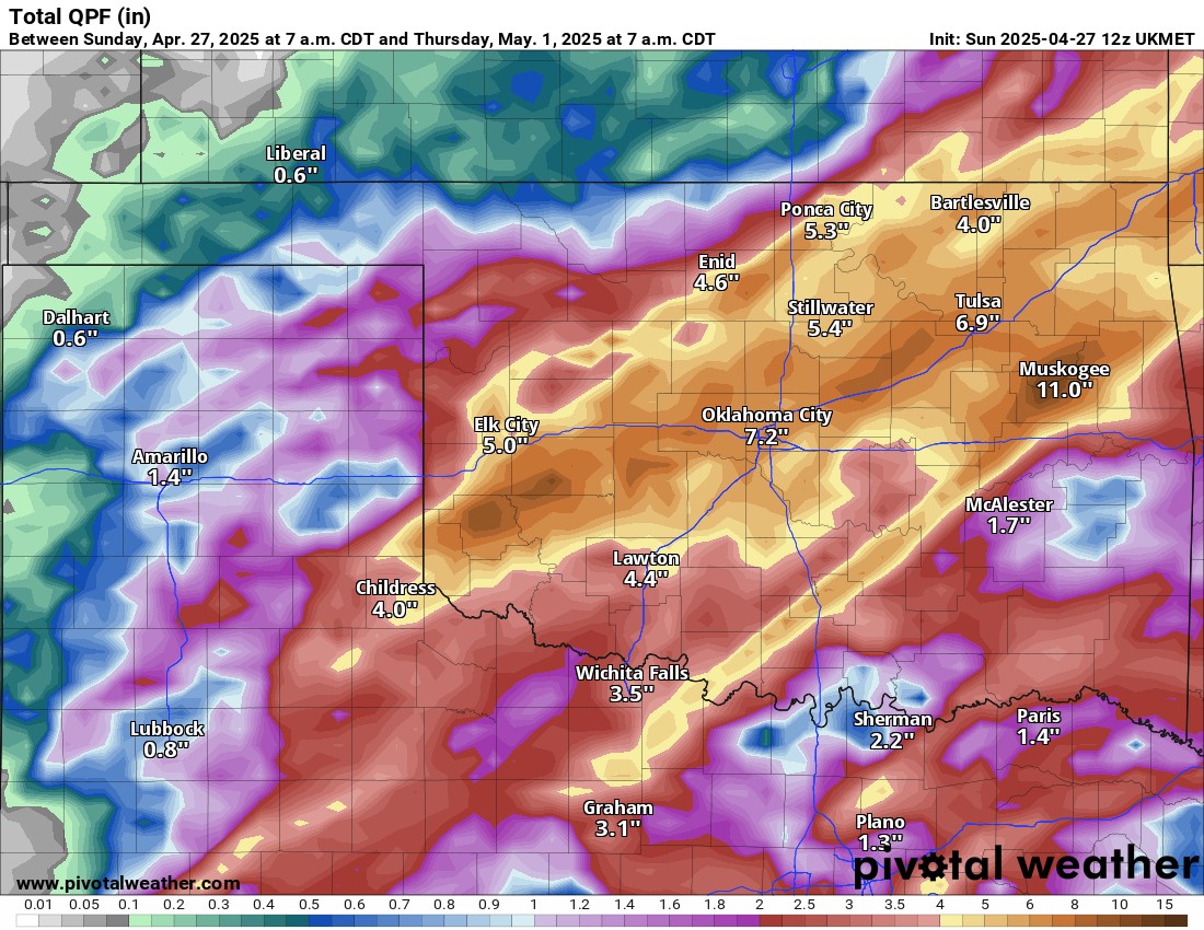
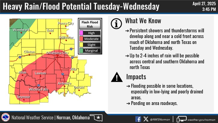
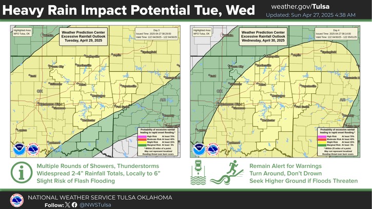
The big topic this week is going to be flash flooding. Look for a washout Tuesday-Wednesday night. We may see up to a foot of rain over parts of Oklahoma. Peppered within this system will be wind and hail as well.

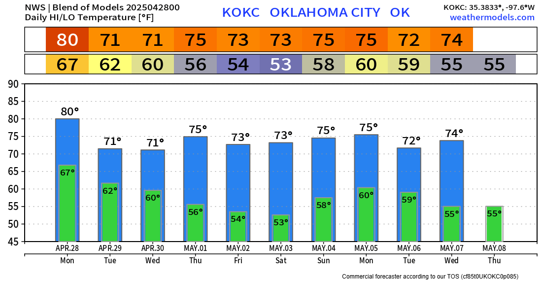
Temperatures will be fairly steady this week. Be sure to use my free weather app, ATsWeatherToGo. It will warn you of developing tornadoes ahead of time. Also, look for my live broadcasts on the platform you subscribed to. I’ll go live around noon and in the evening. If tornadoes develop, I’ll be live as well.

Be sure to mention Aaron Tuttle when you call (405) 820-1193!