A Chilly Rain with a Mini-Winter Thaw
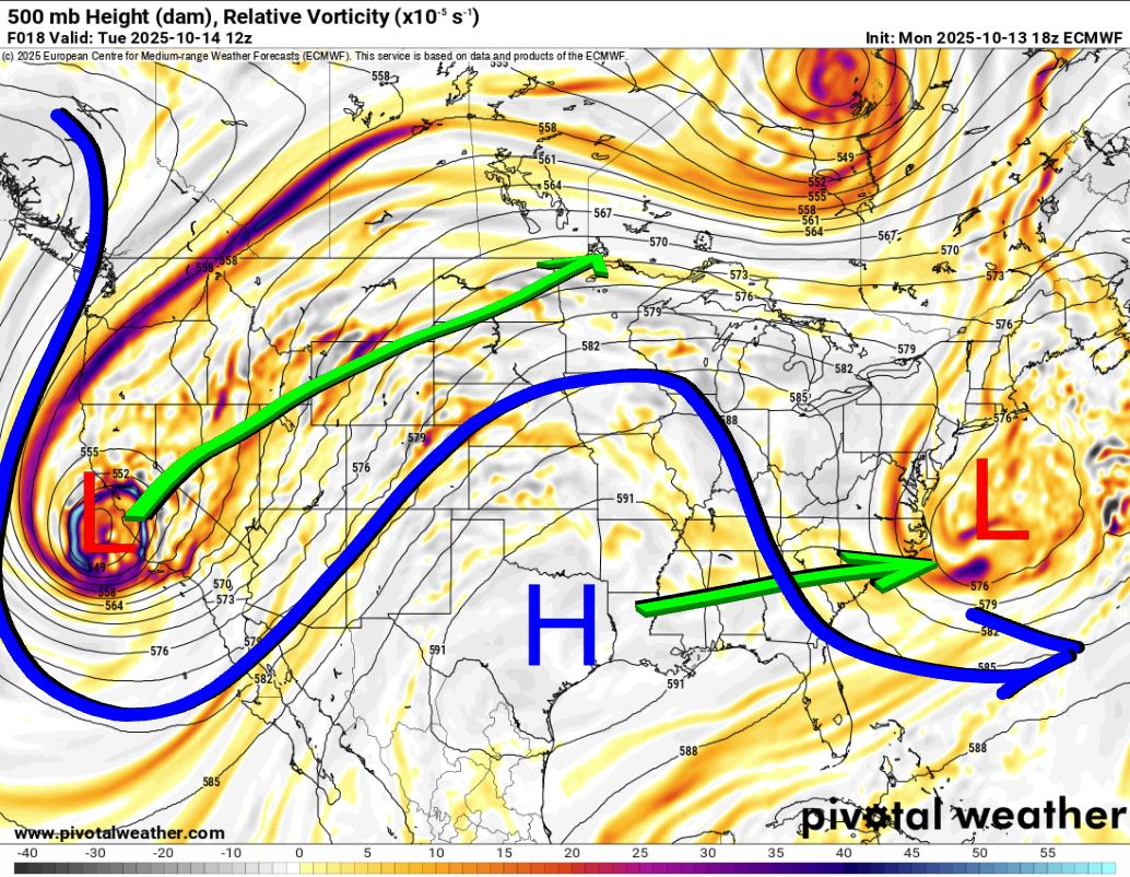
The Jetstream pattern this week is one I mentioned in last week’s blog. A strong storm system will eject across the Southern Plains and generate quite a bit of precipitation. The wild card was going to be if there was enough cold air nearby to work in from a glancing blow. The good news is that it’s been pushed off to the northeast, so instead of ice, it’ll just be a chilly rain.
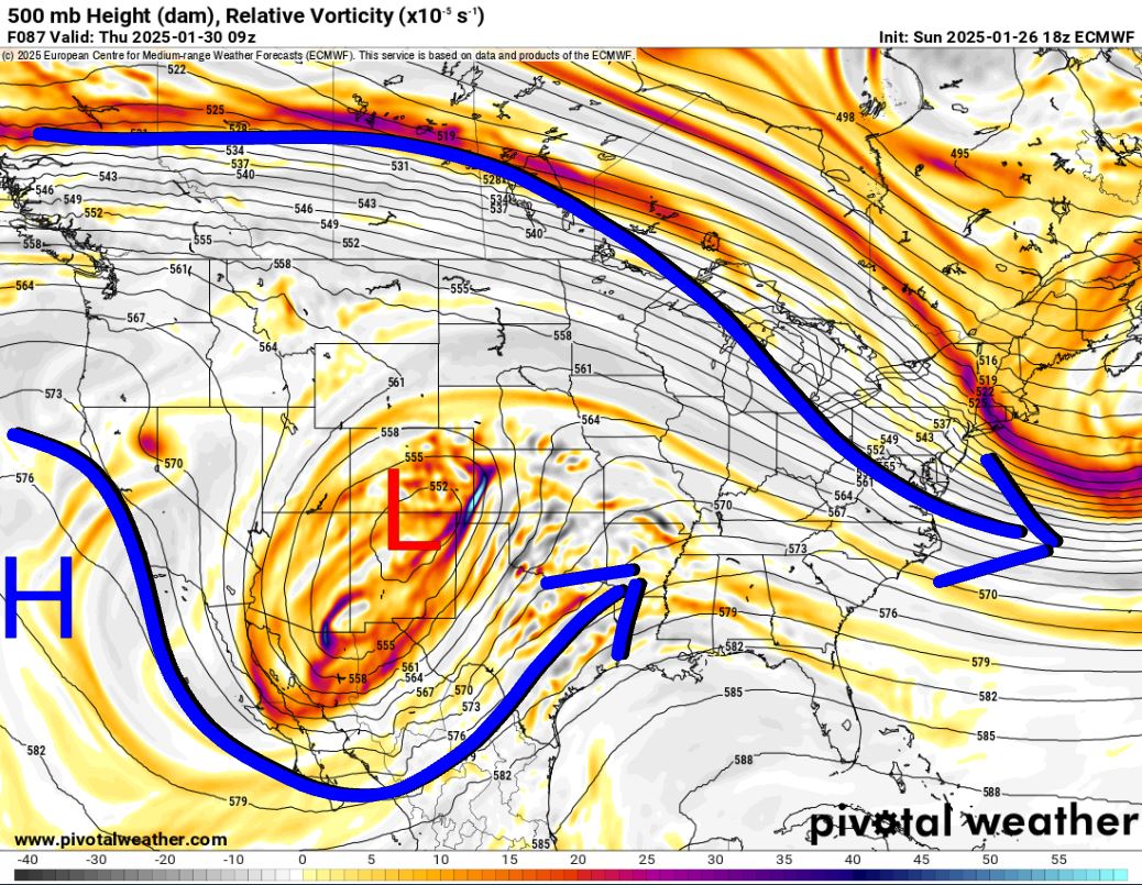
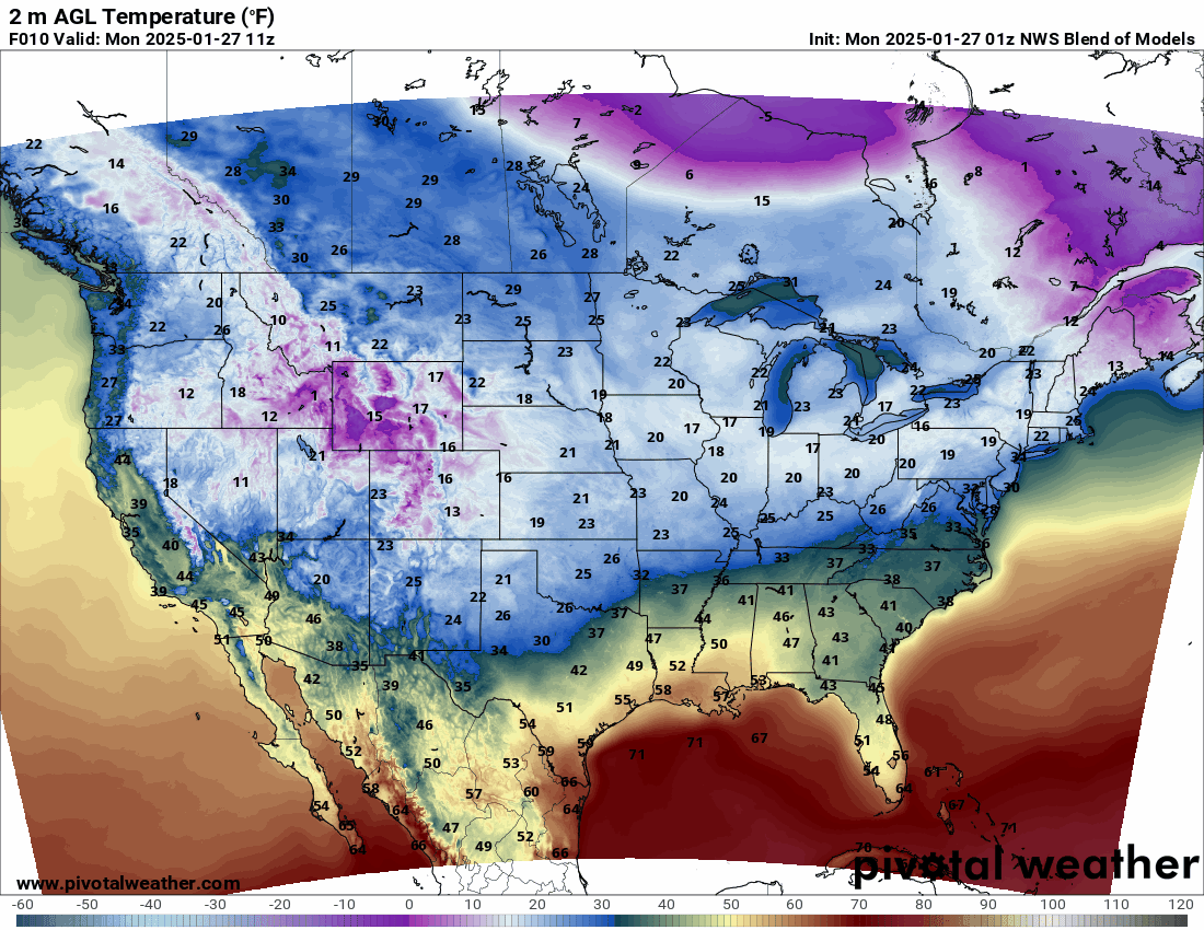
The pattern this week shows the upper-level low moving in mid-week. The colors indicate lift in the atmosphere and a lot of it! The National map shows where the freezing line will be (in blue), so we’re in the clear.

Ferguson Roof Systems is offering an AT's Weather special!
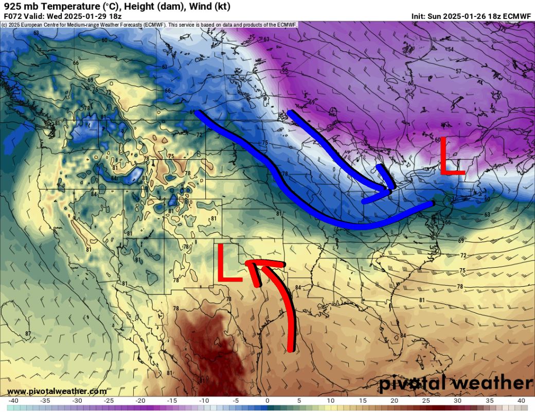
As a matter of fact, this week most of the country will start a moderating trend as the cold stuff stays trapped in Canada.
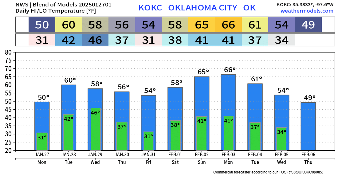
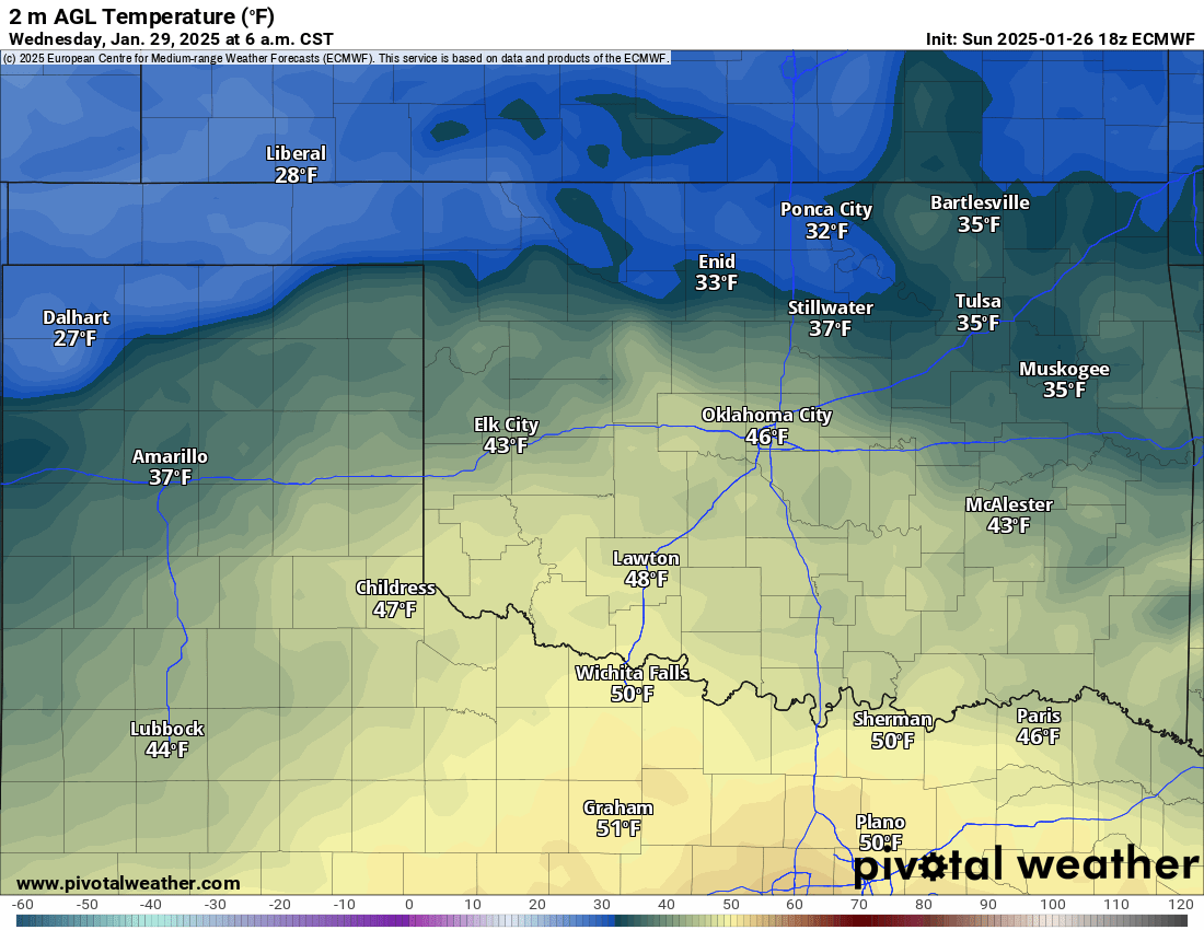
When the precipitation starts Wednesday morning, temperatures will be close to freezing across the north and into the panhandle. I expect them to warm before raindrops hit the ground in N and NE OK, but there may be a touch of ice for the panhandle region. The rainfall lasts through Friday morning.

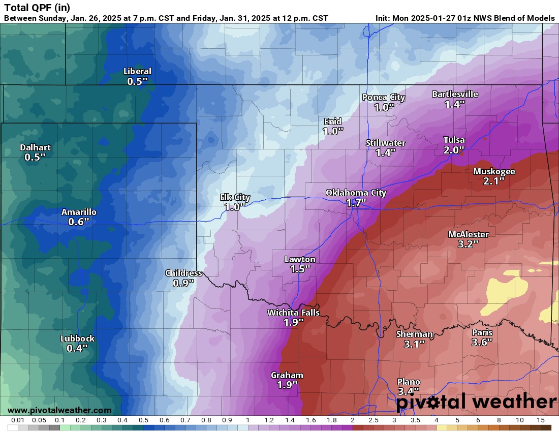
A conservative model blend estimate of rainfall is quite impressive!
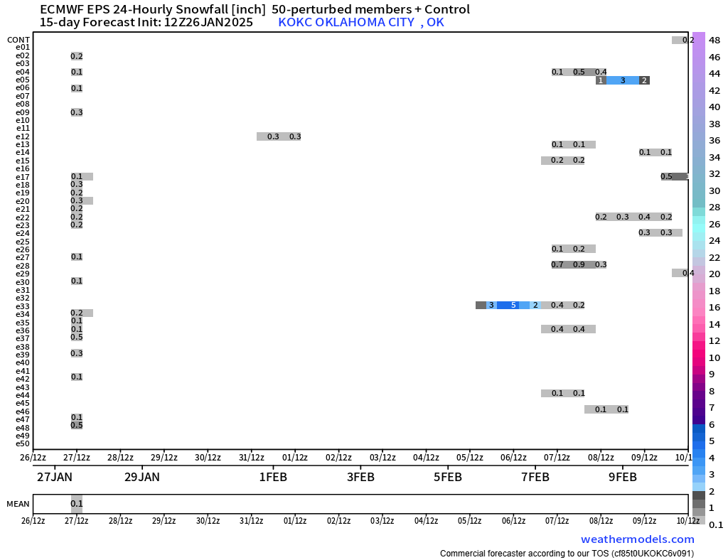
When will the next round of snow or ice occur? There is a signal beyond this week around the middle of next week to the 7th, so stay tuned!

Be sure to mention Aaron Tuttle when you call (405) 820-1193!
In the meantime, enjoy the slight warmup as we move through our week. Might be a good time to sneak in some outdoor work while it’s not so cold! -AT