Record Heat Followed by Winter Storm
It’s that time of year with wild temperature swings! This week will leave you confused as to which season we’re in. Expect 70s and 80s for Monday, but the bottom drops out a couple of times this week as cold fronts sneak in. The pattern then tries to give us a winter storm just beyond the 7-day outlook.
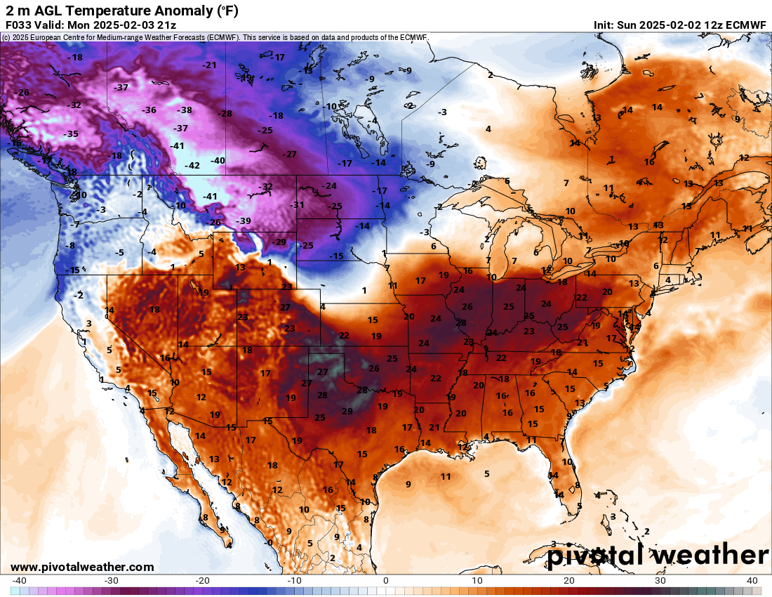
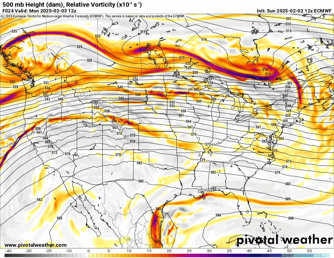
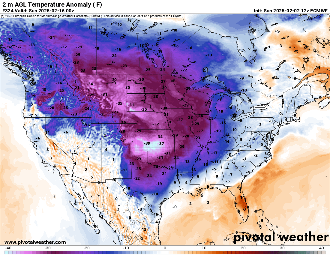
The Jetstream is in a mostly zonal flow for the week. This allows those temperatures to go either way. Typically this allows those sneaky back-door cold fronts to come through and stall out. Wait until you see what happens with the one Monday night and Tuesday. The temperatures above normal that we’ll experience also turn into -40 below by the time we reach the middle of the month. So don’t get used to the warm air!

Ferguson Roof Systems is offering an AT's Weather special!
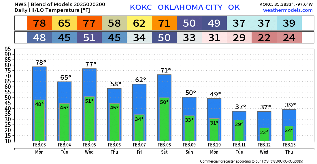
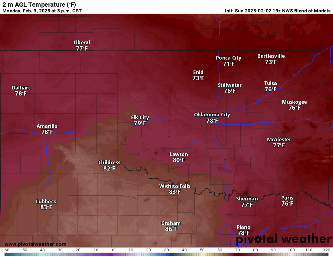
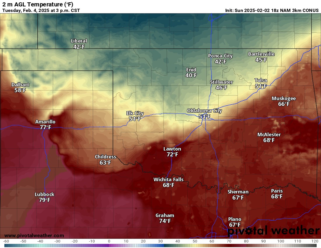
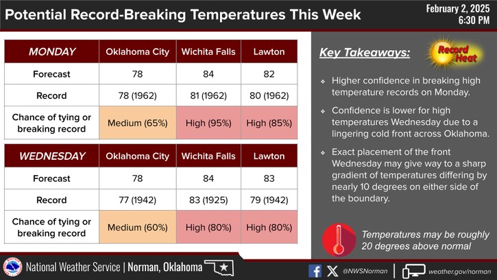
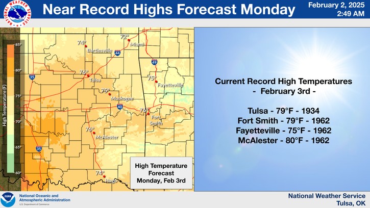
Here is a look at Monday and Tuesday’s high temperatures. Quite the shock! We’ll be approaching some records too.
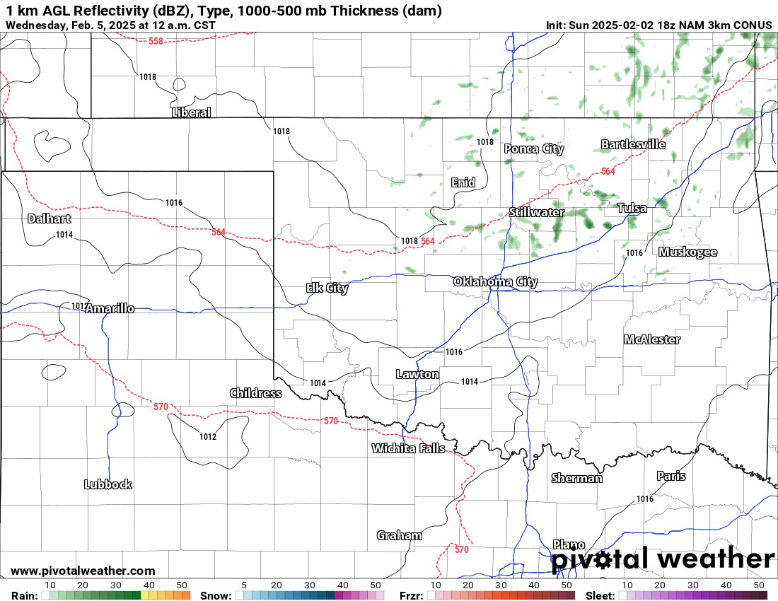
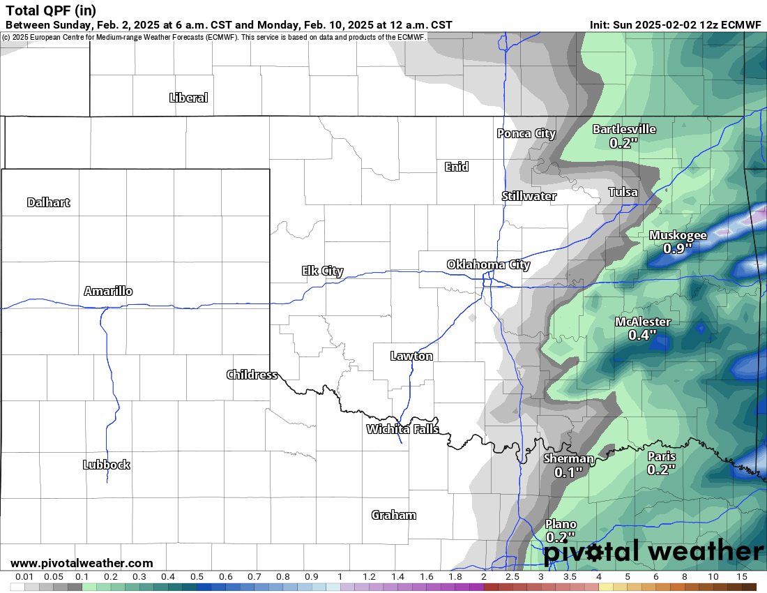
A little bit of light rain or drizzle late Tuesday evening and overnight. Otherwise, more significant rain will occur Saturday night across the east as the next stronger cold front moves through.
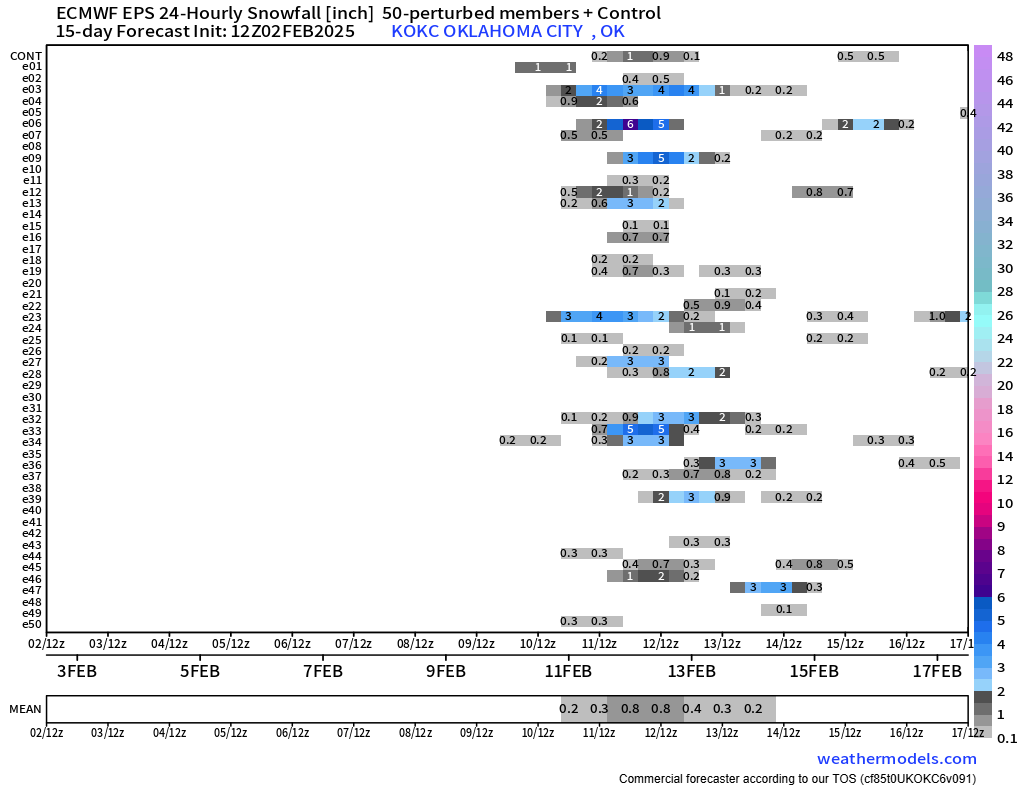
Beyond this week a winter storm is showing up in the model data for Tuesday and possibly again Thursday. We’ll have plenty of time to work out the details, but the signal is there.

Until then, here is the OKC temperature trend for the week. There are some wildcards, however. Sometimes these warm days don’t pan out if that sneaky front slips through. So keep that in mind. Use my free weather app, ATsWeatherToGo, to get those daily temperatures and how to dress in the morning! -AT

Be sure to mention Aaron Tuttle when you call (405) 820-1193!