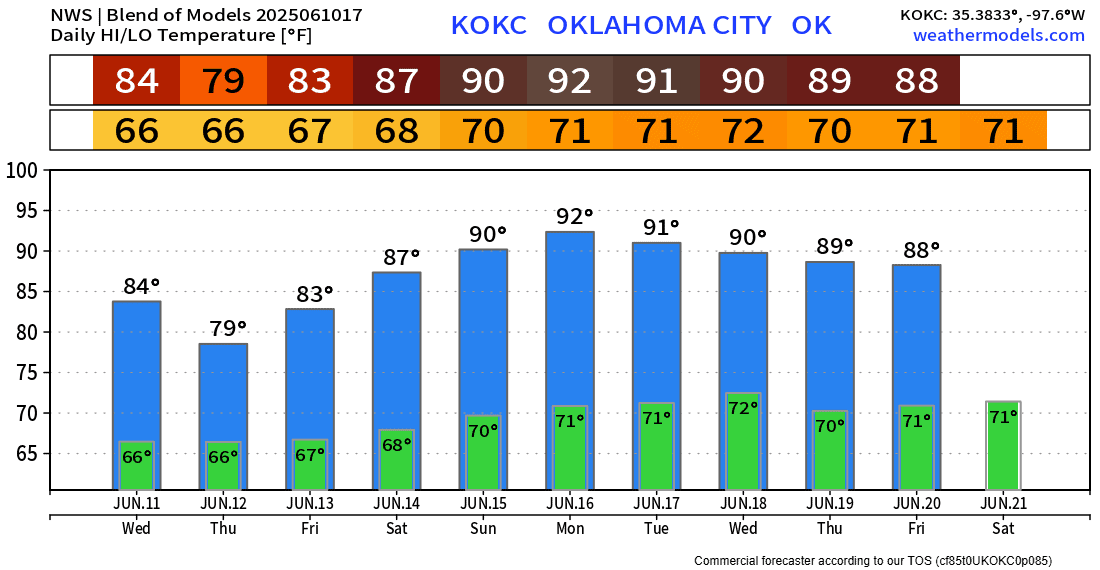
Additional Rain then a Decent Weekend

Another storm system in the form of a slow-moving upper low will move across Oklahoma Wednesday and Thursday, generating scattered showers and weak thunderstorms. Then we transition into a mostly dry weekend.
You can track the upper low in the Jetstream animation, and after that, a ridge builds across New Mexico, placing us in a NNW flow aloft. We can get weak disturbances to rotate down from the north in that pattern, but the signals are extremely weak at this point, so it looks like a mostly dry weekend with only an isolated shower or storm possible Saturday and Sunday.
 Restoration and Disaster Cleanup Service
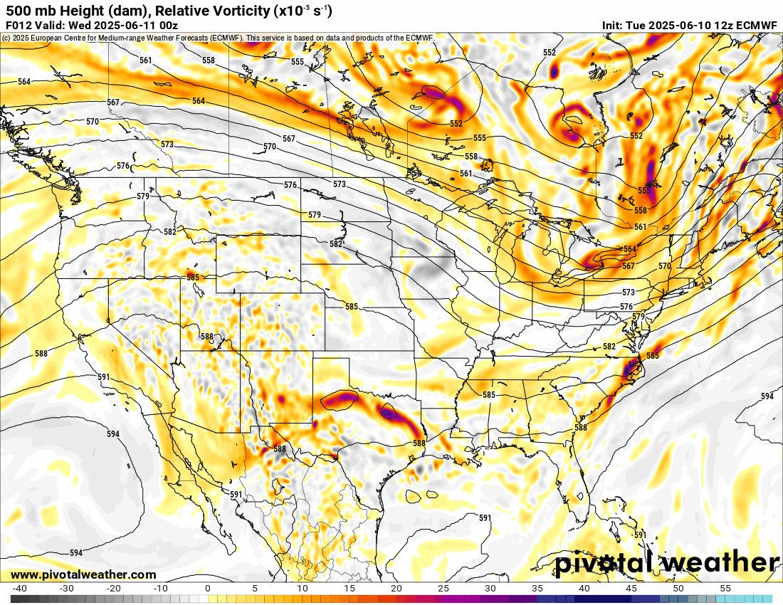
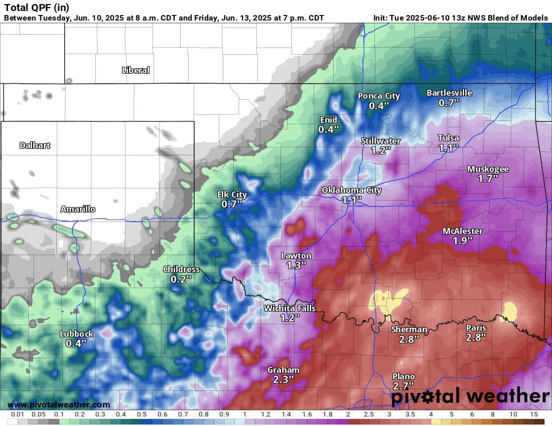
This next system will bring widespread rainfall across the SE 1/2 of the state. It won’t be a washout, but expect to dodge raindrops for a bit. As the low departs, we’ll get an early Friday morning round across SW OK that may drift into C OK before falling apart. At this time, severe weather is not expected.

Temperatures will be quite comfortable through Friday before heating up for the weekend with low 90s returning, especially across W OK.

Be sure to mention Aaron Tuttle when you call (405) 820-1193!